Here are another 30+ images from the last three days we recently spent in Snowdonia. Click on any image for a slideshow.
On Tuesday (original report here) we took a short drive to Tomen y Mur - just as well it was short, as on arrival at the car park we realised a need to return immediately to Porthmadog - for a 9km circuit described in Walk 3 of Alex Kendall's 'Snowdonia South' book.
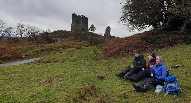
The cloud was down at our 300 metre starting point at the historical site of a Roman fort upon which the Normans built their motte etc.
There are several information boards; the one pictured above is next to the small car park and imagines the view shown below in the era of a Roman amphitheatre that occupied this spot.
The site has a mixture of Roman and later remains and must be a special place for archaeologists.
Beyond the historical site, a sunken lane led out of the mist towards the main A470 road.
Near the road, we crossed over the remains of a railway line, before taking a farm track past a mountain of beet being used as sheep fodder, and passing back under an old railway bridge.
Once past the farm, tracks and paths guided us along the anti-clockwise route suggested by Alex. Navigation was very easy despite the limited visibility.
After passing a small operational slate quarry we reached Llyn yr Oerfel, from where our misty car park was just a few minute' stroll.
Here's the route (overlaid with Alex's .gpx file) - 9km with 200 metres ascent. It took us a little over 2 hours, but there wasn't much call for pausing to admire views, and we decided that a 'car lunch' was preferable to one exposed to the elements; we didn't want our crisps to blow away!
Wednesday (
original report here) brought a change in the weather for a visit to the welcoming village of Trefriw, where we paused for lattes in a friendly cafe before setting off to Fairy Falls, opposite the Fairy Falls pub. This is Walk 5 in Alex's 'Snowdonia North' book.
There's a high footbridge from which to view the falls, but the view from the bench (above) gets my vote.
Forest tracks rise above Trefriw and continue towards the Grey Mare's Tail waterfall, which is accessed via the steep descent of a 'there and back' path. It was well worth the visit.
Continuing along the forest tracks, we admired the views back to Trefriw, and across the valley to Llanrwst.
We passed a car park that marks the start of some mouth watering mountain bike routes - the
Gwydir Mawr and Bach Trails.
A navigational error (we missed a left turn downhill) resulted in our arrival at a flat pice of ground that turned out to be the site of a 400 year old bowling green.
After retracing our steps, we tottered on to a great lunch bench next to the River Conwy near Llanrwst.
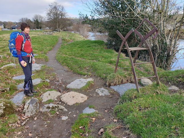
The remainder of our walk was beside the river, passing an ornate but somewhat redundant metal stile.
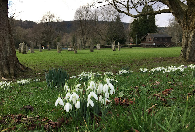
Snowdrops provided a foreground for pictures of Llanrwst's iconic Pont Fawr bridge, and the stone circle built in 1951 to celebrate the town's Eisteddfod.
Beside the bridge are tea rooms and a gallery, shrouded in vegetation and sadly not open today. We paused here for a long chat with a man who said he had lived here all his life, desite his Liverpudlian accent!
Our walk finished in sunshine along an embankment similar to that beside the River Mersey in South Manchester, for which flood warnings are in place as I compose this entry.
Here's the anticlockwise route - 11km with 300 metres ascent, taking us 3.5 hours.
On
Thursday we had to get home for a folk concert in Sale, so we took the opportunity to park in a lay-by on our road home and stumble along the route of Walk 19 in Alex's 'Snowdonia South' book. The contemporaneous posting is
here.
Easy paths and a short stretch of road walking led us to a rising track from which we could look back to the controversial reservoir, Llyn Celyn, whose creation drowned a village in order to provide Liverpool with a water supply.
Looking ahead, Arenig Fawr ('great high ground') soon came into view. It could be easily ascended from this route, via Llyn Arenig Fawr, given a bit more time than we had today.
Llyn Arenig Fawr, the objective of this walk, eventually came into view, offering views of Arenig Fawr from a comfy memorial bench, and shelter for three people, if necessary, in a small bothy below the dam.
From here, the path became rougher and less distinct as it made its way down to cross a river at Fridd y Fawnog by one of a choice of two bridges.
Eventually a grassy track was reached, and this took us down to a farm by Llyn Celyn and the course of the old railway line between Bala and Trawsfynydd.
A pleasant spot on a log beside the track of the railway, which operated for passengers and freight between 1882 and the 1960s, served as a venue for lunch before a hailstorm arrived to hasten us back to the car.
Here's the route we took, anticlockwise - about 11 km with 200 metres ascent, taking less than 3 hours.