The main purpose of this blog is to keep in touch with friends and family, and maybe entertain others with common interests, particularly in relation to the outdoors. We hope you enjoy it, and your comments are valued....
Sue and Martin in Mallorca 2019
On the Archduke's Path in Mallorca
Saturday, 20 November 2010
Saturday 20 November 2010 - A Great British Ridge Walk - Number 8 - The Nantlle Ridge - from Garnedd-Goch to Y Garn
Elevenses were late today - enjoyed after a 400 metre ascent, in the shelter of a wall by the summit of Garnedd-Goch, with fine views over the Lleyn Peninsula. Our own route ahead was obscured by nearby Craig Cwm Silyn, the highest point on the ridge. Snowdon, now free of snow but with an intermittent cap of cloud, shone brightly to the east.
Our traverse of the 6 km ridge commenced with an easy stroll over broken rock to Craig Cwm Silyn, where a bank of cloud provided much entertainment, with Glories and Brocken Spectres in abundance - see previous posting and the comments (thanks Gibson and Paul) - it'll be interesting to see how the 'proper' photos turn out.
The ridge slowly yielded to our slow but pleasurable progress along it. I am prohibited 'on pain of death' from revealing the principal culprit, but until that person mentioned it I wasn't really aware of a laggard other than myself. Anyway, all six of us managed to negotiate the greasy rocks and vertiginous knife-edged ridges with no more damage than brown bummed Rohans.
The whole 11 km episode included around 900 metres of ascent and took us just under 6.5 hours. We finished at 4.40, just as darkness was falling. We had seen about 20 others on the ridge today, all revelling in the excellent conditions.
Anne, Sue and Jenny then enjoyed refreshments at the highly recommended (by that trio) Cwellyn Inn, whilst the rest of us retrieved the cars.
By some miracle we all finished up back in Porthmadog with sufficient groceries and 'medical supplies' to last us the evening. The latter were much needed by a faction intent on monitoring a former politician's progress through an early evening offering from the BBC.
Hic....!
Sent using BlackBerry® from Orange
Brocken Spectre or Glory
... On the Nantlle Ridge this morning.
Sent using BlackBerry® from Orange
Friday, 19 November 2010
Friday 19 November 2010 - Carn Fadryn & Garn Bach
Lingering cloud and the prospect of a persistent cold wind on the Ridge drew us to the Peninsula, but it was a close call. Ken, Anne, Sue and I enjoyed a short walk to Carn Fadryn, whose 371 metre summit sports a conspicuous yellow trig point, a recent addition to the Iron Age walled hillfort containing stone huts, and a small fort reputedly built by Roderic and Maelgwyn, the sons of Owain Gwynedd in 12thC.
Low cloud over the Peninsula inhibited the views, but the sun shone and K & A, fresh from sunny Portugal, were able to top up their tans.
A peregrine, and then a buzzard joined the ravens in following our progress to the lesser summit of Garn Bach. That proved to be another excellent viewpoint (pictured, with Sue looking to the east).
From here we headed north to a small crag that offered superb lunchtime views, before aiming for a boggy path next to a finely preserved stone wall to the north of Coed Garn Fadryn. This led conveniently to a green lane and back to the car. Just 7 km and 350 metres ascent, taking all of three and a half hours.
We've noticed that whilst most trees in the area have now lost their leaves, a few (not just the firs!) remain virtually untouched by the ravages of autumn. Similarly, most flowering plants have had their day for 2010, but a few - for example, herb robert, red campion, several thistles, gorse and clovers - soldier on, showing a healthy disregard of the season.
We had plenty of time to revisit Plas Glyn-y-Weddw tea room and gallery (see Wednesday's posting), but not before a short stroll along Llanbedrog's sandy beach, where we encountered numerous scallops and an octopus on the tide line, lots of oyster catchers and black-headed gulls, dog walkers and a man with a metal detector who was digging furiously in the soggy sand.
Then it was back to more à la carte cookery in the nearly overflowing cottage in Porthmadog, where R + J arrived later, as planned.
Sent using BlackBerry® from Orange
Thursday, 18 November 2010
Thursday 18 November 2010 - Portmeirion
It was Sue's first visit.
Better late than never!
[Mark, and others, I'm glad you are enjoying this series of postings. Sorry to be so brief today. We have now been joined by A and K, and with J and R due to arrive tomorrow I'm afraid that postcards from this small cottage will be brief for the rest of our stay, with further observations and an annotated slide show next week to fill in the gaps.]
Sent using BlackBerry® from Orange
Wednesday, 17 November 2010
Wednesday 17 November 2010 - Mynydd Tir-y-Cwmwd, and the Iron Man
However, by lunch time the sun was shining again, so we ventured once more to the Lleyn Peninsula, which according to the map houses lots of excellent short walks.
It was sunny at Llanbedrog, between Pwllheli and Abersoch, and from there we could see that the 'mainland' was engulfed in dark cloud, so heading west was a good call today.
From the beach we headed south east along the shore to reach a steep path leading up a cliff. A barrier blocked our way. The path was shut due to a landslip. We looked around; the place was deserted. So we ignored the sign and climbed easily and safely up the steps to the top of the cliff, where we negotiated another barrier to escape from the closed path, and admired the Iron Man, a sculpture that looks out over a dangerously exposed (but freely available to the public) precipice.
The wrought iron man was a millennium project to replace a Tin Man that had looked out over Cardigan Bay to Barmouth and the Rhinogs since the 1980s.
Continuing along the path and around the headland into a blinding sun, the holiday town of Abersoch and its long sweeping beach came into view. Neither of us had seen Abersoch before. From this angle we didn't feel we had missed very much.
Gradually we progressed around the headland to a position where the low sun was behind us.
This was the signal to turn right and ascend gently to the trig point and cairn that mark the summit of Mynydd Tir-y-Cwmwd, a mere 133 metres in height but commanding views in all directions - west to Abersoch; east to Pwllheli and the mountains extending south from Snowdon along the periphery of Cardigan Bay; north to the Rivals (Yr Eifl and its outliers).
Three people followed us up - we didn't surprise them Mark, unlike the middle-aged couple who we startled the other day whilst they were engrossed in their lunch.
We lingered at this summit (pictured) admiring a Toposcope that confirmed that on a clear day much of Snowdonia is visible from here.
A short descent back to Llanbedrog took us past St Pedrog's Church Hall, home of St Pedrog's Knitting & Sewing Guild, then past the church itself to Plas Glyn-y-Weddw, a dower house built in 1856 by Lady Love Jones Parry. The Gothic mansion became an art gallery and ballroom in 1896 and was served by a horse-tramway from the railway terminus at Pwllheli until 1927. It remains a vibrant gallery, and is one of nine locations that houses the Celtic Neighbours partnership, a group of visual artists from native Celtic communities.
Their art, unlike their tea and cake, was sadly not to our conservative taste.
Sent using BlackBerry® from Orange
Tuesday, 16 November 2010
Tuesday 16 November 2010 - A Great British Ridge Walk - Number 6 - Cnicht and Moelwyn Mawr, The Cwm Horseshoe
But there were vocal residents in the form of flitting sparrows, chirpy robins and tweeting tits.
The route up Cnicht (pictured) from here requires no description. From this direction the 689 metre summit justifies its 'Matterhorn of Snowdonia' tag. It's a straightforward hour and a half's stroll, with ever more expansive views and some very easy scrambling up the final slopes to the airy summit.
The sun was bright; as we strolled along the easy ridge, with improving views across to snow-capped Snowdon, we pondered today's breakfast TV's 'happiness' survey. 5.3 out of 10 was (I think) the average, but hey - it was carried out before 8am - it must be skewed...
Our average was 8.5, marked down as a result of cloud on Snowdon's summit, and problems with our shadows invading our nicely framed images.
Half an hour beyond the summit, a cairn alerted us to a thin path to the east that snaked its way for fifty minutes or so over occasionally boggy ground to the abandoned quarry of Rhosydd. This occupies a huge area and has one wondering about what the place must have been like in its heyday.
I felt a 'Jim Perrin Moment' coming on, and scratched fervently in my notebook (edited out of this report!) during our lunch break at the top of the tramway incline behind the quarry buildings.
The route up Moelwyn Mawr is simple from here. There are no technical difficulties and the walker is afforded many excuses to pause whilst the whole of Snowdonia gradually appears on the wide horizon, with Cnicht now in Snowdon's foreground.
A thin veneer of ice below the 770 metre summit required care, and served as a reminder to stash my Yaktrax crampons in my day sack as a precautionary measure over the winter months.
We lingered on the summit, spotting seven walkers on Cnicht's fine ridge, the only people seen all day. From here, an easy knife edge then grassy slopes lead down the WSW ridge of Moelwyn Mawr, along Braich-y-parc, to join the road to Tan-y-Bwlch near a gate on the edge of Croesor.
The 12km walk with 930 metres ascent took us just over five hours.
It was a lovely little excursion in great weather.
Sent using BlackBerry® from Orange
Monday, 15 November 2010
Yr Eifl and Tre'r Ceiri
At 564 metres, Yr Eifl is the highest point on the Lleyn Peninsula. It's a short excursion, suitable for a winter's day with a late start.
We parked in the spacious car park at SH 353 440, virtually empty today but perhaps busy in summer.
A stony track led easily towards the top of Bwlch yr Eifl, before which we headed up by a wall to some disused buildings (where we surprised a couple) and on up steps to a transmitter mast. Turning left at the perimeter fence, we soon found an excellent path carved out of the rocky crest of the hill. This brought us up to a cairn at 444 metres that commanded a fine view over the Peninsula, across to Anglesey, and inland to snow-capped Snowdonia, where the mountains sat below a deep blue sky.
Our own local weather was more problematical. After lunching in a disused building carpeted with sheep poo, we set off into the cloud that had been skirmishing with Yr Eifl all day. A storm arrived to test our newly proofed waterproofs. The sleety rain was thick and cold. Even the crows were cowed into silence. But not the aircraft of the RAF, training for missions in far off lands.
On the summit we found a chap with a camera, looking for a café. He headed down. The cloud had cleared just as we arrived, giving us more fine views. A stroll over rocky terrain led us to the magnificent Tre'r Ceiri (Town of the Giants). This is an Iron Age hill fort built on a long, narrow summit at around 485 metres. It covers 2.5 hectares (big) and is encircled by a massive dry stone wall rampart that's about 3 metres high. The fort houses about 150 round stone huts. It pre-dates the Roman invasion of Wales in AD 78 and it was used throughout the Roman occupation, eventually being abandoned in C4 AD.
There was sunshine and shade up there today, and with more showers approaching it was hard to get a good picture. Today's image was taken from the fort, but however closely I look at it I can't see the huge waterspout that was featured on today's local news, and was pictured within a very similar view.
A pleasant heathery path took us over the rocky outcrop of Caergribin (more fine views) and back to the car after 8 km, 500 metres of ascent, and 3 hours of exertion.
In the car park, our friend with the camera confirmed that he had found the café. I wonder whether he saw the waterspout.
Sent using BlackBerry® from Orange
A Room With a View
Maps and currency have been purchased and coffee and CCS has been savoured at leisure. It has been a lazy morning, but boots are now being donned for a short venture into Showell Styles country.
Sent using BlackBerry® from Orange
Saturday, 13 November 2010
Wednesday 10 November 2010 – Darwen Tower and White Nancy
Last Wednesday JJ’s finely honed team of runners dragged me up Darwen Tower on a 14km recce for a fell running trip over Darwen Moor for which they are laying the trail next Saturday.
It was a lovely day. We climbed to the top of the tower.
I don’t think they’ll be doing that on the fell run, not least because the top of the tower blew away on Thursday!
We had a bit of trouble with rickety stiles and barbed wire fences – great care was needed, Steve and JJ will bring wire cutters, hammer and nails when they lay the trail for the runners.
It was wonderfully clear, with the peaks of Snowdonia standing clear some 80 miles to the south west, and the snow laden summits of the Lake District looking much closer than 50 miles distant to the north.
There’s a slide show (31 images) here.
And the route (roughly) is shown below:
It took us over four and a half hours for the 14km. Perhaps the runners will go faster!
As for White Nancy – Sue and I were joined by JJ and another John at the Vale Inn in Bollington. Richard E also turned up – it was good to see him after a long hiatus. He’s been working hard – with one press of a button his new car’s boot flew open and the door handles all lit up – amazing…
It was dark by the time we set off, on a lovely clear evening, to negotiate a 7km circuit with fine views over Greater Manchester.
Oh, and we found White Nancy, pictured here in the background.
Friday, 12 November 2010
Tuesday 9 November – South African Memories
On 28 April, Sue and I enjoyed giving a little slide show to the Stockport Walking Group. It covered trips to the Drakensberg and the Cape regions of South Africa.
Tonight we were booked for a second delivery of the same slide show, with Sue in charge and me as projectionist. This time the willing victims were Tim and Kate Wood’s local church group in Southport.
A more welcoming group could not be imagined. We enjoyed giving the approx 45 minute show to about 15 folk, some of whom had been to places that were in the show. Happy memories all round.
Tim and Kate are TGO Challengers. Their hospitality is second to none, and we were treated to a superb dinner before the meeting. Their house is full of cards – Tim’s 75th birthday, 54th wedding anniversary cards, and get well cards for Kate. We do hope that she can overcome her health problems, and that we’ll be seeing the familiar profiles of ‘Little and Large’ on next year’s TGO Challenge.
The photo (I’ve not really mastered the art of scanning slides, I’m afraid) shows Sue above a cloud inversion in the Winelands, with the flat summit of Table Mountain visible in the far distance.
Tuesday 9 November 2010 - An Important Announcement and an Expectant Grandad
Here they are on 24 July 2009.
Since then, Simon and Kate have been busy.
A sproglet is due to arrive on 17 May 2011.
Congratulations
I’ll have to hurry back from Montrose on 27 May after the TGO Challenge. I won’t be needed before then. Given that Kate’s mum and I both re-married some time ago, the little blighter darling will have three sets of attentive Grandparents.
That could be confusing.
Apart from some minor dietary quirks, Kate’s condition doesn’t seem to have caused her any inconvenience so far. Long may that continue.
So there’s a fair chance that during next year this blog will wander off into ‘Mark Alvarez territory’. Mark’s is still a walking blog, but these days it is also a fanzine for ‘Sweet B’. I’ll enjoy re-reading it, Mark, you’ll be an ideal role model!
Thursday, 11 November 2010
Sunday 7 November 2010 – Elite Karting
My son in law, Simon (more about him in the next posting) kindly organised a trip to Elite Karting in Wigan.
It took me over an hour to complete the 30 minute journey to this venue, and my performance in the kart mirrored that effort. I never did work out the racing line, and when I got close to it someone always seemed to bash me out of the way!
There were 33 of us in the Grand Prix, including rather too many testosterone/adrenaline fuelled men with Alonso/Webber/Vettel masks.
Mere mortals stood no chance, so having made it into the last eighteen, together with Bernie (Simon’s dad), Simon and I thought we’d done quite well. The top two from each semi progressed to the final (pictured). Simon (especially) and I were therefore gutted to be thumped by illegal manoeuvres into third place in our respective semis, but at least he managed one of the fastest laps.
A very small (4 images) album is here.
Next time Simon will be inviting a party of schoolchildren. That may allow us a better chance of success!
PS Should anyone else who attended this event read this, I do apologise for the smidging of poetic licence employed within this report. A special apology goes to the young lad who suffered at least twice as a result of the violent and uncontrollable antics of my kart.
Saturday 6 November 2010 – A Sunny Saturday Morning at Dunham Massey
It’s a bit like April weather just now in the Timperley area. Sunshine and showers.
On Saturday Sue and I enjoyed a short visit to Dunham Massey. The low sun illuminated the house, gardens and park beautifully.
I took just a handful of snaps, in my effort to get a few more images of leafy trees before the frost and wind finally release the remaining foliage to the ravages of gravity.
I wonder whether the gardening staff will continue to wash the trunks of these birch trees during the winter months. I expect they will…
The short slide show from today is here.
All my Dunham Massey postings can be seen here.
Wednesday, 10 November 2010
Friday 5 November 2010 – The Bridgewater Way
I frequently stroll down the section of the canal that runs between Timperley and Sale. Today, a gang of Polish workmen was installing numerous signposts and this information board. As you can see below, the towpath at this point has been restored to a pristine condition. Unfortunately, beyond Marsland Bridge – seen here in the distance – the section of the towpath from Brooklands, through Timperley and Altrincham to Lymm, is in places a quagmire at this time of year.
It’s a shame that the funding for the elaborate signposts doesn’t extend to a bit of hard core (even as a temporary measure) on the towpath, which is on the whole in good condition.
There’s lots more about the Bridgewater Canal and the Bridgewater Way here.
Maybe I shouldn’t be too harsh. This press release indicates that the whole of the 40 mile Bridgewater Way project may take some time. We can perhaps expect some local towpath closures.
It does seem crazy though that there don’t seem to be plans to improve the narrow section of towpath between Stretford and Deansgate (Manchester City Centre). That would encourage more people to cycle to work in preference to crowding onto the inadequate rush hour trams.
Tuesday, 9 November 2010
Thursday 4 November 2010 - Shutlingsloe
Is it really January since I was last up here?
Today I revisited that walk in the snow with JJ and Graham Brookes, this time on my own, with the object of further walking-in my new winter boots. They had been comfy on the flat; how would they fare on some steepish slopes?
The route is shown below and is also described in my reports on previous visits here and here, though on those occasions we went clockwise around the reservoir at the end of the walk.
All recent visits to Shutlingsloe are described here – it’s a regular venue.
Rain was forecast – that’s becoming a habit – but it never appeared despite the low cloud and general dampness.
I was on my own today; the only others out walking were a few dog walkers and two noisy men (I’ve no idea why they were exchanging uncouth shouts) who reached the top of Shutlingsloe whilst I was enjoying my elevenses below the hill’s steep eastern flanks. I was glad they returned the way they’d come.
The ground soon levels out below those eastern flanks and reaches a tarmac lane that leads down to the Crag Inn. The brilliant chef of bygone years has long since departed, but this hostelry remains welcoming and friendly, with good pub food.
Beyond The Crag, field paths lead to another tarmac lane that is accessed via an ancient stile that the farmer seems paranoid about walkers not using. Why anyone should wish to climb a high stone wall in preference to using this fine old stile is beyond me, but the farmer is certainly concerned (click link to slide show below for more).
The lane is soon left to climb steeply, whilst we take a gentle and well marked path from the valley floor to Oakenclough, near where a youth allowed his young labrador to bathe in the stream and then ‘mug’ me.
Hey, it was no laughing matter!
This is a lovely route. Shutlingsloe slowly reveals itself behind you, whilst the flatlands of Greater Manchester and the Cheshire plain are suddenly revealed at the top of the sunken lane that runs down to The Hanging Gate.
That path can be boggy, so a pause to regain breath and drain the flask is always welcome before the ascent. A visit to the pub is optional, it’s not off route as the path runs through its garden before dropping down to join the Gritstone Trail, which is followed most of the way back to Ridgegate Reservoir.
Today’s route left the ‘G’ Trail in favour of a narrow path to the right, in and out of a small valley, leading to the main ‘drive’ around the reservoir, across which the yellow leaves on the trees certainly brightened the otherwise dull day.
And that was it – this time Naismith would have taken 3 hours 10 minutes, a time that I was happy to better by some 20 minutes. The new boots had remained comfortable throughout; my fears about having to spend some time breaking them in appear to be unfounded.
That left me plenty of time to get to Macclesfield, where coffee and cake and a good old chinwag with Geoffrey and Nick was the highlight of the day. Geoffrey (hello, sorry this has taken so long to write) is one of very few friends from my former life (ie w**k) who despite his love of trail biking follows this blog; and I still harbour happy memories of weeks of ‘study’ on Donald Rich’s residential courses held in Andover, when Nick and I took our evening medicine in warm surroundings by a pool (table) whilst others remained frozen (literally) to their study manuals except when Bohemian Rhapsody was playing on TOTP.
It was great to see you both.
As promised, today’s route (enjoy – it’s a good one) is shown below, and there’s a slide show here.
Monday, 8 November 2010
Tuesday 2 November 2010 – The Trans Pennine Trail and the Bridgewater Canal
We woke early, due to a loud bang in nearby Irlam. A row of houses, wrecked by a gas explosion. Not good.
Rain was forecast, so it seemed unnecessary to drive anywhere when the main point of getting out was to try to break in some new heavy duty boots.
Setting off at 9.50, I wandered through Newton Park, crossed Washway Road and explored De Quincey Park. I’d not ventured into it before. It comes to a dead end, so whilst useful for pushchairs and dog walkers it was pretty useless for someone in search of a through route. So it was back to Washway Road and across Siddall’s Bridge – not an obvious landmark, but it does date from 1765 – and into Woodheys Park.
Past allotments and beside Sinderland Brook, I headed towards Carrington Moss. I met a chap assiduously taking photos of the brook and muttering about the inadequacies of the National Trust, who appear to have taken over certain custodial/maintenance functions from the Environment Agency. He explained that the brook used to run straight through this area, but following the development of a housing estate on National Trust land to the south of the brook, kinks and shrubs have been introduced. Unfortunately these have resulted in blockages, and the houses to the north of the brook are now in fear of flooding. This concerns me; a branch of the brook runs past the end of our own road, though I’ve not noticed any problem there.
Anyway, I left this concerned resident and the ugly new houses on the Stamford Brook estate and entered the wastes of Carrington Moss.
Altrincham’s ‘Household Waste Recycling Centre’ was my next landmark, beyond which I was pleased to turn right onto the Trans Pennine Trail (TPT). There are lots of stables, and a donkey sanctuary, around here. The quiet path leads north into the Moss. I was alone with magpies, wood pigeons, carrion crows, chaffinches and moorhens. Elevenses were taken near Ash Farm, by a bent TPT sign, with some spots of the overdue rain, and cyclists and walkers making use of the track.
From here, the TPT skirts through mixed woodland, neatly planted in rows in the not too distant past, certainly not sufficiently recent for the Ordnance Survey to have noticed them.
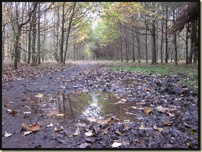
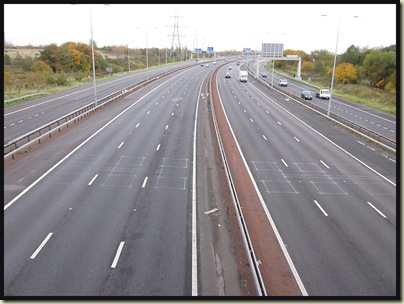
It was extremely gloomy, but somehow the rain held off as I strolled along, separated by a tall hedge from the A6144 ‘Carrington Spur’. A small footbridge over the River Mersey, home on this occasion to mallards and grebes, led to a short section along that river’s high retaining banks, before the TPT drifted down a surprisingly pleasant path by Kickety Brook that culminates in this fine new footbridge over the ring road.
An expensive alternative to a pedestrian crossing?
The berries by the bridge looked very juicy. No doubt the small birds that were harvesting these berries looked equally tasty to the kestrels that hovered overhead.
Luckily, the busy A56 road is negotiated via an underpass, after some more surprisingly pleasant woodland on the edge of Stretford. Barges on the Bridgewater Canal were soon in view, but my route didn’t join the canal just yet. The TPT heads under the canal, past an immense cemetery, and back to the banks of the Mersey.
Soon after that, I left the TPT, where it went off beside Chorlton Brook whilst I continued along the river bank, past a splendidly decorated brick building that houses the flood gate controls.
The TPT rejoins the river bank near Jackson’s Bridge, but I left it for good here, by crossing the bridge and returning from Lancashire back into Cheshire.
There has been a bridge here since 1816. At that time there was a halfpenny toll to cross it. The bridge was built to replace a local farmer (Jackson) and his boat who had provided a ferry service across the river. The boat was hauled from bank to bank by a chain fastened to posts on either side.
The bridge has recently acquired a two tone appearance, and lunchtime aromas nearly drew me into the old pub. This picture shows the view south into Cheshire, so it's a surprise to discover that the ancient Jackson's Boat pub is in Lancashire, apparently due to changes in the course of the river over the centuries!
From here, a pleasant path leads to Sale Water Park’s Visitor Centre, where I paused for lunch on a bench. Drizzle that accompanied me for the rest of the walk commenced here.
Rats, jays, blackbirds and thrushes were all to quick for me in the dim light as I approached reed beds at the end of the man-made lake. It was a gravel pit until its conversion in the 1970s. Today there’s a heronry in the Ees beyond the lake, and cormorants stand on the ski jump, drying their wings.
The ‘beach’ is populated by bickering Canadian geese and black-headed gulls, whilst young mallards frolic in the shallows.
Another splendid footbridge leads back across the ring road and into Priory Gardens, where today I disturbed a kestrel with its prey. A right turn up Dane Road leads to the canal bridge, where there’s access by The Bridge (a pub) to the familiar towpath of the Bridgewater Canal and an easy walk home in thickening rain.
Mr Naismith would have taken 4 hours 10 minutes over this little jaunt; it took me just 10 minutes longer than that for the 21 km circuit. But I’d had lots of photo stops despite the gloom, and hadn’t really hurried due to the heavy new boots, which luckily remained as comfy as when I’d set out.
The route is shown in blue below, and for anyone who may be interested, the full slide show is here.
TGO Challenge 2011
A satisfyingly weighty ‘plop’ through the letter box this morning brought the excellent news that Mike and I have been accepted for the 2011 TGO Challenge backpack across Scotland.
I can’t really believe our luck, this being my fifth Challenge entry and the fifth time I have ‘made the cut’. This year there were 440 applicants for 330 places. I was disappointed not to find friend and neighbour JJ #3 on the list, nor Mick and Gayle #4, or even the irreverent Reverend (aka David) #1. Hopefully they are high on the list of reserves.
A number of other bloggers appear to have been successful, so come next May armchair enthusiasts may be able to tune in to Tony, James, Louise, Geoff, Andy, Phil, Laura, Martin, Shirley or even Alan to gauge how well a random selection of participants are managing to potter across Scotland. Not all of them will have the energy to make postings as they go across – some prefer to write up their experiences later, at leisure, but I know that readers of these particular pages prefer the ‘what’s going to happen next’ uncertainty of daily postings from such trips, so this blog will be posted ‘from the coalface’ so to speak. It could be interesting as Mike has only backpacked properly for two days in the past 40 years #2.
The picture above was taken on the morning of Day 2 of the 2009 Challenge that I completed with Sue. We had camped comfortably at NG 871 001, below Luinne Bheinn at the head of Coire Odhar, a much more sheltered spot than Mam Barrisdale, near where Robert Slade had finished up bivvying due to problems getting his Akto tent up in the wind and rain. He was not too cheerful when we saw him later on Day 2; he was wet. We had warm, dry feet. It’s on occasions like this that the decision to wear waterproof boots rather than lighter trail shoes seems to be a ‘no-brainer’!
#1 – reserve number 23, that’s good news, he’ll make it in.
#2 – so his Black’s Good Companion tent, even older than my Phreerunner, may need to be replaced!
#3 – great news – JJ is reserve number 11. He will be there.
#4 – more good news - M+G are also high on the reserve list.
Friday, 5 November 2010
A Christmas Walk, and other stuff
Those of you using Google Reader to view this blog may have noticed that I accidentally posted a round robin message, which you may also have received by email. Luckily, it wasn’t a serious faux pas (except in that it omitted to incorporate an image!), and on reflection I’m reiterating the text of the message below. If any readers would like to be added to (or indeed deleted from) our email circular list, or join us on any of these jaunts, do let us know.
The snapshot was taken from Thor’s Cave on 6 October. The view will have taken on a different hue by 12 December!
“Hello All
Christmas Walk
We think we have a nice route for a Xmas walk on Sunday 12 December, starting from Wettonmill.
Details are here. Please let us know, by 30 November at the latest, if you plan to come, as we'll need to pre-order the food. We'll let you have the menu closer to the time.
Evening Walks
We have had to change the dates of the last two evening walks of the year, to 10 November (next Wednesday) and 20 December. Details for that small minority of you who may like to turn up are here.
Day Walks
These days our day walks tend to be at fairly short notice, geared to the best of the weather. Do let us know if you would like to be kept informed of short notice mid-week walks.
We'll be in Wales the week after next, and are happy to set provisional dates for any of the 'Great British Ridge Walks' mentioned here. So let us know if you'd like to join us on any of those routes, on any particular day. We are unlikely to be doing them all - it'll depend on the weather.
That's all for now.
We hope you are well, and enjoying life.
All best wishes
Sue and Martin”
Wednesday, 3 November 2010
Summer
It’s on dull, overcast, somewhat drizzly days like this that it’s nice to revisit images from earlier in the year, and re-live those lovely high Alpine days when Sue and I were enjoying unusual warmth up at 2500 metres whilst the rest of Europe was sweating it out below.
Here, on a day walk from the campsite in Trafoi, Sue is looking towards Rifugio Borletti (dead centre), where we had earlier enjoyed refreshments, beyond which the unmistakable hairpins of the Stelvio Pass wind inexorably up to its 2800 metre summit.
My posting made at the time is here.
I’ve still not really touched the pictures from that trip. I suppose that’s what I should be doing on days like this. That and finishing my TGO Challenge slideshow. Oh dear, there’s some new gear to write about as well. And yesterday’s walk. The distraction of unboxing and sorting a lorry load of possessions at Mike’s house doesn’t help, of course. There are rooms over there to decorate as well, once the contents of 20 or so huge boxes have been stashed in his loft in more manageable bags. Then, what to do with those contents…
So, now you know why postings are currently a little sparse. “House Admin.”
How did I ever find time to go to work?
Tuesday, 2 November 2010
Sunday 31 October 2010 – Autumn Leaves – A Circuit from Cressbrook
An email from Sue and David drew us this morning to a 9.30am rendezvous, after a suitable lie-in due to the clocks going back, at Owl Cottage in Cressbrook.
Gaynor was also staying there, as were Nicky and Jenny. Andrew (Notchy) turned up as well, so after a lengthy coffee break we ambled down the hill past the Millennium Stone and the Millennium Tree, to admire the views from Cressbrook weir.
As you can see, it was heavily overcast. But the rain kept off and we enjoyed the gentle strolling, catching up with Sue and David’s activities over the past year, and with Notchy’s recent adventures in Bhutan.
Luckily the water level was low, so we could enjoy the valley route up Miller’s Dale, where three female goosanders floated gracefully past, whilst coots squabbled, dabchicks dived and dippers toured the briskly flowing river.
We soon reached Litton Mill. Sue and I had passed by the derelict mill many times in the 1990s, wondering whether the planned redevelopment would ever transpire. Whatever the downsides of the refurbishment (I’m sure there must be some) the appearance of the old building has been transformed and it would appear that some attractive apartments have been created.
Beyond the mill, a footbridge across the River Wye leads to a pretty woodland approach (pictured above) to the disused railway line that used to link Derby with Manchester.
The line was opened in 1863, when some people saw it in the same light as many of us now view wind farms. For example, Ruskin wrote about it: 'There was a rocky valley between Buxton and Bakewell, once upon a time, divine as the Vale of Tempe... You Enterprised a Railroad through the valley - you blasted its rocks away, heaped thousands of tons of shale into its lovely stream. The valley is gone, and the Gods with it; and now, every fool in Buxton can be in Bakewell in half an hour, and every fool in Bakewell at Buxton; which you think a lucrative process of exchange – you Fools everywhere'.
Our stroll continued through the Litton Mill Railway Cutting - now a SSSI (Site of Special Scientific Interest), and past Miller's Dale Quarry, with a supporting embankment currently under restoration.
At Miller's Dale a second viaduct was added in 1905 to house the line going north towards Buxton and Manchester. Dr Beeching was responsible for the closure of the line in 1967.
We stopped here for elevenses – tea and plentiful CCS – and for this self-timed group photo before Nicky and Jenny took an easier alternative route.
It appears that the tunnels on this line may be reopened in 2011. They were certainly navigable for years after the line closed in 1967 and were presumably blocked for safety reasons. If the rumour is true, it’ll be great to be able to walk through them again in the future.
After crossing the older viaduct we turned right along a minor road and descended to Miller’s Dale from the first corner. Missing a left turn up Monk’s Dale, we reached the church in Miller’s Dale. So it was back up the path to the left of the church and straight on after a gate where the main path heads left. The stony path leads into Monk’s Dale.
If you haven’t been to Monk’s Dale you haven’t lived. At first sight these stepping stones may lead up the dale. Take care, they are slippery, as these three falling souls demonstrate.
The stepping stones lead out of the dale, so we retraced our steps to regain the valley path.
The dale drips with mosses and lichens. Each step requires care. There’s a choice of foot placement: slithery rock or gooey mud being the usual options, the sticks and branches being best avoided. New Zealand ex-pats pining for the rain forests of home could do worse than visit this dale.
Eventually, and it did take some time, we emerged at the minor road that marks the start of Peter Dale, which is a little shorter and easier. A grassy knoll provided an excellent spot for lunch, during which we were mugged by a muddy spaniel.
Moving on, Dale Head provided our escape onto easy paths for the rest of the walk. First along a metaled lane to Wheston, from where ‘white roads’ took us to the north of a trig point at 381 metres and down to the quiet village of Tideswell, looking very out of season in the murk.
Continuing to Litton, the wide grass lined boulevard that runs through that village showed more signs of life, even a pub and a tea shop. But we hastened onwards towards our destination.
There were quite a few other folk in Tansley and Cressbrook dales. We let them pass whilst draining the last dregs from our flasks, before continuing on a fairly direct route back through golden woodland towards Owl Cottage…
…where tea and cakes were enjoyed at leisure.
This was an excellent day out in fine company. Thanks for the invitation, Sue and David. Here’s the 17km route with 750 metres of ascent. It took us a fairly leisurely 6 hours.
There’s a 40 image slide show here.