The main purpose of this blog is to keep in touch with friends and family, and maybe entertain others with common interests, particularly in relation to the outdoors. We hope you enjoy it, and your comments are valued....
Sue and Martin in Mallorca 2019
On the Archduke's Path in Mallorca
Saturday, 9 June 2012
Pitlochry
Tonight the picnic tables were out, alfresco dining was de rigeur for the early diners.
It was 11C when we left Timperley; it was 20C when we arrived here. A good call!
Before dinner we visited the salmon ladder, which enables around 5,400 salmon and sea trout every year to make it up past the 17 metre dam to spawn beyond Loch Faskally. There are 34 stages to the ladder, with a couple of larger resting pools en route.
Our evening was spent at the 300 year old Moulin Hotel, next door to the brewery that produces thirst quenching Braveheart Ale. Here 15 out of the 18 victims carefully selected by Graham and Tove for this week's activities, endured a softening up session, courtesy of the hotel's mouth watering menu.
The downside was a ten minute walk back to Pitlochry in pouring rain. Shame we left our waterproofs in the car....
Sent using BlackBerry® from Orange
Thursday 7 June 2012 - Bleaklow
First of all, I’ve been informed by Heather T-S that Grant Cunliffe’s body was found on 7 June in the Braeriach area, as the snow line finally recedes in the Cairngorms. You may recall a posting in January that I made at Heather’s request. It’s very sad news, but at least his family can now grieve properly. Our thoughts are with them, and with all his friends.
Now then, Gareth and Andy had been camping out on Bleaklow. Despite a rather dire weather forecast I popped out to meet them, as Obi 1P (last seen on a November backpacking trip with Mick and Gayle), who I wanted to borrow again, was languishing in Andy’s car.
I left Polly at 7.30 on the top of the Snake Pass, where the Pennine Way takes on a rather strange look.
Turning the other way, I wondered briefly as to my sanity, but the flowers were nice, and the plovers certainly noticed me.
‘Welcome to the High Peak’ muttered a runner as he breezed past. (Or was I imagining that?)
The runner was one of only five people I saw on the hill today. Two of the others were Andy and Gareth, who took some tracking down.
I was at Bleaklow Head by 8.30. It’s a bleak sort of place and I didn’t feel like a long wait. I knew that they were camping at Grinah Stones, some way off, thanks to Gareth’s ‘buddy beacon’.
So, with the unexpected benefit of a phone signal, we arranged to meet at Bleaklow Stones. We arrived there within a few minutes of each other, but Andy and Gareth didn’t think these were Bleaklow Stones, so they moved off to an obscure map reference just before I arrived and taunted me from there.
It didn’t help that I’ve still not learnt how to use the Satmap GPS, so I bumbled around, already having inadvertently turned 180 degrees on the path from Bleaklow Head to Bleaklow Stones. It was that sort of day, I think Andy and Gareth did something similar.
Anyway, I zigzagged my way to their obscure location, half expecting to find an envelope with directions to my next ‘clue’. But there they were, a jolly pair of backpackers in the rain, which was the dominant feature of the day’s weather.
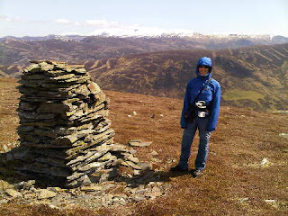
After making our way back to Bleaklow Head, the navigation became very easy for the rest of the walk. We simply headed back down the Pennine Way, turning left down Hern Clough to Grains in the Water, near where the dynamic duo are pictured in the top image. Beyond there, Alport Dale narrows and the path moves high above the left bank. It’s a beautiful dale, even in the rain.
Andy found a little difficulty in staying upright, banging his head and his knee at one point. So G brewed up for him and all was well again.
Andy’s spring had been re-wound, and off he went again as we contoured gently past Over Wood Moss and along the delightful contouring path across Alport Moor.
Opposite Grindlesgrain Tor, our route switched to the heights of Westend Moor, climbing steeply but briefly beside Glethering Clough.
Andy was suffering…
Soon we were up at the trig point on Westend Moor.
By now we were rather damp. It really was raining quite hard. Perhaps a little harder than on the first Sunday of the TGO Challenge. It was certainly more wetting, perhaps because I’d deployed an old set of waterproofs for this day walk.
Cameras were stashed before they drowned, and we made our way along to Alport Castles where a left turn took us down the excellent path to reach Andy’s car at the hairpin bend near Fox’s Piece.
The Ladybower Inn then provided real ale and a large plate of chips, which went down very well. In the next alcove a group of farmers had assembled to listen to a fascinating presentation on management of the Peak District moorland. It seems that much good is being done, with new techniques revitalising the land. We left feeling that there is much hope for the future wellbeing of the magnificent landscape and the flora and fauna, not to mention the crops and livestock, that are being helped to flourish in their moorland habitat. One slide showed an area where there had previously been hardly any skylarks changing to the extent that their numbers are now uncountable!
Thanks for your company, and to Andy for the lift back up to Polly, and Gareth for the loan of Obi 1P, and if you want a bit of a laugh you can chuckle at my wanderings, as recorded by the Garmin gadget:
Tuesday, 5 June 2012
SWCP 2012 - Durlstone Head to South Haven Point, Poole (Monday 4 June - The End of a Long Walk)
Numbers increased again today, with Colin, the original organiser of these trips, arriving with Simon at Primrose Cottage. Meanwhile, Sue, Andrew and I picked up Gaynor and Jacqui from Ammonite B+B. G and A then strolled into Swanage whilst Sue and I provided Jacqui with a tour of the Bee Orchid beds that she'd missed yesterday.
Somehow the whole group eventually managed to coagulate - for the record:
Organiser Sue and David
Stalwarts Betty and David
Sisters Jacqui and Gill
Gaynor and Hilde
Liz and Rachel
Martin, Sue and Andrew from 'up north'
Nelia and Jonathan
Colin and Simon
The very scenic stroll around Durlston Head got the three of us off to a great start, though I think others may have short-cut this section. After admiring the orchids and the sea birds - mainly guillemots and gulls, plus a few scavenging jackdaws - we found ourselves back at the car park 50 minutes after setting off. A fine walk to Peveril Point (pictured - top) and its National Coastwatch Institution lookout point maintained the quality of today's outing. Then it was a stroll along the sea front to Swanage and a morning coffee.
The rest of the party had long since moved on from here, so we continued as a threesome out of the seaside town, past beach huts whose occupants were sporting Royal Family masks. It's QE11's diamond jubilee weekend.
The rocky spikes of Old Harry soon beckoned, beyond a golden buttercup meadow (pictured - middle) and by the time we reached the headland (pictured - bottom) known as Handfast Point we had caught up with half of the rest of our party. Lunch was taken here, in a zone of wide tracks, vertiginous cliffs and whizzing mountain bikes, whilst the vanguard had moved on towards Studland for lunch on the beach.
Wonderful wild flower meadows on the stroll to Studland sported a variety of species, including broomrapes and lilies - providing Sue and me with a foretaste of our forthcoming Alpine adventures.
From Studland the SWCP ends in style, with a stroll along the beach all the way to its conclusion at South Haven Point, where one sign indicates the start of the classic trail and another sign alerts one to the fact that it's 650 miles of coastal walking to reach Minehead.
Today we traversed the beach soon after high tide, so the sand was firm enough to grant us an easy passage. There's a nudist zone where today a lone elderly man played (frisby) with himself in a rather ostentatious manner. Not a pretty sight!
We all finally met up at the end of a walk that only two of our party, Sue and David E, had actually completed in full. Congratulations were in order. And self-timed photos. Then a tanned gent turned up and watched as many of us fumbled to find our old age bus passes.
"I started from Minehead on 26 April" he observed "it has taken me six weeks. And you?"
"We started in May 1997" chimed Sue E, proudly demonstrating her mathematical expertise by adding "it has taken us fifteen years..."
A number 50 bus curtailed that conversation and whisked us back to Swanage, where a street party was in full flow. We adjourned for tea and cake/biscuits at our various lodgings before reconvening at Primrose Cottage for a barbecue and beer celebration. Sue and Colin both received presentations in recognition of their organisational efforts and I think I spotted the odd bottle of champagne being quaffed.
The evening climaxed after dark, when most of us (Sue, me, S+D, B+D, J+G, Andrew, Liz, Simon + Jonathan) took a stroll under a full moon up Knowle Hill to admire a selection of firework displays and try to spot some of Dorset's many jubilee beacons. It was a perfect activity with which to round off the mini era of our SWCP travels.
What next for this group? Who knows?
Sent using BlackBerry® from Orange
Sunday, 3 June 2012
SWCP 2012 - Gaulter Gap to Durlstone Head (Sunday 3 June - a Bee Orchid Day)
Gaynor, perhaps distracted by yesterday's memory of prostrating herself in front of a pirate, missed the crocodile and headed off in the wrong direction, but by the time of our CCS stop below Eldon Seat she had caught up and could enjoy the goodies.
Today's weather forecast foretold of steady rain all day. Luckily for us the legendary pessimism of the BBC's forecasters proved to be the case. Not a drop of rain fell on this pleasantly temperate day.
It was a classic 18km section of coastline. A few ups and downs put paid to some of the less fit members, and Liz, Betty and Jonathan soon headed off to a strategically placed car in Kingston.
The rest of us continued on past some warblers - whitethroats I think - to a sheltered spot for lunch in a field to the south of well named Emmett's Hill.
Shortly afterwards, National Coastwatch Institution volunteers provided more tea and cake in return for a small donation, though I suspect that we and they do not approve of the government cuts - minuscule in general terms - which are forcing coastguard operations to rely on charity.
Nearby was a field of poppies and St Aldhelm's Chapel, a unique and fascinating place dating from before the 12th century.
The walk to Dancing Ledge was easy and uneventful apart from a short appearance of the sun. Numerous climbers were enjoying the warm rock on the cliffs above the crashing waves.
As we progressed towards Anvil Point, Sue spotted some Bee Orchids, the first time she has seen them in the UK. Quite a find, although my reference book describes their occurrence as 'frequent, locally common". One of them is pictured above, underneath some cliff scenery typical of today's walk.
Tea and cake at Primrose Cottage was followed by another meal at the New Inn with coffee and chocs back at PC before the long drive home to Norden House.
Sent using BlackBerry® from Orange
Saturday, 2 June 2012
SWCP 2012 - East Chaldon to Gaulter Gap (13 go for a roller-coaster ride)
There were some steep undulations - totalling around 1000 metres for the day, hence the 'roller-coaster' analogy. Some found these enjoyable - one of the Davids romped on ahead so far that he missed his lunch. Others suffered, particularly Liz, who claimed not to have been for a walk since last year's portion of this coast path. So she and Rachel baled out at Arish Mell and strolled up to the pub in East Lulworth for a taxi back to Church Knowle, where this year's SWCP HQ is situated in Primrose Cottage, next door to the New Inn.
The pub is so close that they offered to serve dinner to the 13 of us either in a private room, or a Very Private Room - Primrose Cottage's garden. That would have been good if today's hot, humid, mainly overcast weather hadn't deteriorated to the extent that waterproofs would have been needed for the 'garden' option.
Sadly the dull weather precluded stunning images from our amateur photographic skills - there were however a plethora of stunning white cliffs (pictured above), and Durdle Door (the lower picture) is a coastal rock feature that probably looks good in any weather.
From time to time one of the Sues slewed to a halt and brought out a gas stove. This allowed everyone to catch up and rest for a while. Andrew's crappy (sic) legs were consequently able to last until the very last stile before cramping up. It took him several minutes to hobble across the car park, before being whisked with the rest of us back to Primrose Cottage for tea and cake.
Earlier, the other Sue, a staunch Royalist, had produced a huge slab of CCS (chocolate caramel shortbread) emblazoned with a Union Jack that she claimed was food colouring. But why had my box of Humbrol enamel paints been left on the kitchen table?
Anyway, now there's only half a Union Jack.
The walk didn't have the sublime scenery of the Cornish sections of this trail, but it was enlivened by rugged coastal features and by the colourful flora - particularly dominant amongst which was Viper's Bugloss, Thrift, Herb Robert, Kidney Vetch, Bird's Foot Trefoil, Spurges, Red Valerian, Dog Rose, Speedwells and many more.
Today's route was highly populated between Durdle Door and Lulworth Cove. I have a clear memory of a visit to Lulworth Cove a few years ago. I'd spent a while compiling a report to the DPP (now known as the Crown Prosecution Service) on someone I considered to be a bit of a rogue. To my surprise, the case was taken up, and allocated to an enthusiastic novice in the police force. It eventually came to court in Dorchester. I was called as an 'expert witness' (I wasn't, but that meant there would be some nominal payment for my time - the police knew that there had been no payment up to that point). I waited in Dorchester for three days whilst the defence interrogated a series of bankers, and on one of those evenings I took the opportunity to visit Lulworth. Next day I was summoned and underwent extreme interrogation on the precise detail and timing of events several years in the past. I learnt a lot. Memorising my contemporaneous detailed notes during my days of waiting certainly helped. Being asked to describe 'fraudulent trading' in layman's terms to the jury was an ordeal. Fraudulent trading cases are not usually understood by juries, they are notoriously difficult to win. My evidence ended at lunchtime on the second day. I drove back to my office in Manchester without stopping. A message awaited me from the policeman who I'd been helping on the case. 'Plea changed. Guilty. Five years for Richard Lee.' The defence's abortive efforts to discredit my evidence had been their 'last throw'. So, Lulworth Cove brings memories.
Apologies for that interlude in this rather disjointed posting... Today we passed numerous burnt out tanks, and for part of our walk we were directed between a narrow band of yellow posts. The left hand posts warned of unexploded shells should we venture beyond them. The right hand posts warned of eroding cliffs that would deposit us into the surf far below should we stray beyond their bounds.
Single file seemed appropriate.
Tonight we enjoyed our private alcove and our meals at the New Inn. Especially Betty, who took great delight in slowly consuming her lonely dessert in front of twelve slavering spectators.
That's - sleep is taking over, but first - congratulations to the 'pixies', Andrew and Kate, on getting up Skiddaw, and thanks to Andy for all your comments - I was quite excited when I turned the phone on and found so many comments....
Goodnight.
Sent using BlackBerry® from Orange
Friday, 1 June 2012
South West Coast Path (SWCP) 2012 - Norden House
I still didn't manage to process all the TGOC photos though. One day...
But our bathroom leak has been fixed. Thanks again JJ.
Norden House, pictured, should prove to be an excellent base for our final assault on the SWCP - the section from East Chaldon to Poole will complete (apart from some missing links that vary from person to person) the route from Minehead that we've been following for the past dozen or so years.
There's a campsite here that would have been fine, but Andrew appears to have booked us into a luxurious guest house. Not that we are complaining, we trained hard for such indulgences on our TGO Challenge route.
There are up to 14 of us doing this section of the SWCP. We should meet up in the morning. Perhaps...
Sent using BlackBerry® from Orange
Thursday, 31 May 2012
‘Postcard’ reveals New Blogger from Timperley
Wednesday, 30 May 2012
Loch Arkaig
In between ‘processing’ my TGO Challenge photos (now down to just 800) I’ve popped into Google Reader for a moment and found Andrew Walker’s rather explicit account of his party’s adventures by Loch Arkaig during this year’s event.
I notice he has borrowed some rather poor images from the web, so I thought I’d just upload a couple to demonstrate what it was really like.
On 11 May 2009, that is.
A beautiful spot.
Our own story of that day, somewhat in contrast to Andy’s experience, is here. For what it’s worth.
Happy Days!
Better luck next time, Andy… glad you survived!
Monday, 28 May 2012
Jacob Visits Walton Park
Saturday, 26 May 2012
A Postcard From Timperley!
Well, I’m busy slaving over nearly 1000 photos taken during the past two weeks, whilst Sue trundles around the garden in the sun.
We hope you enjoyed the TGO Challenge postings – someone was obviously looking at them as visitors to the blog increased in number during the walk.
Thank you to all those who provided accommodation, including Alison R, Ali-J, Bill and Alison, and all the bunkhouses B&B’s, Guest Houses and small hotels who so efficiently accommodated us during the two weeks.
A slide show will follow in due course.
Enjoy the continuing sunshine!
PS – just missed a PB in today’s 5km Parkrun. Tired Legs!!
Thursday, 24 May 2012
Thursday 24 May 2012 - TGO Challenge Day 14 - Drumoak to Nigg Bay (Aberdeen) - A Sunny Stroll with Janette
.See http://www.topwalks.com/tgoc2012.html Day 14 for map
Distance: 25.5km (Cum 426)
Ascent: 300 metres (Cum 10,100)
Time taken: 6hrs including stops
Weather: another hot sunny day
Challengers encountered: none on the walk; none on the train; many in Montrose.
Others encountered: we had the pleasure of Janette's company for today's walk.
Flora and Fauna: coastal sea birds and flowers including thrift in fine fettle, swifts as we entered Aberdeen, a sparrowhawk on the path in front of us, lots of bluebells, red campion, daffodils, etc lining the path.
Janette joined us for a 7.30 start from Drumoak, along the pleasant Deeside Way trail all the way to its terminus at Duthie Park. This was almost all 'off road' and far preferable to our more customary road walk to the east coast.
We reached Duthie in time for elevenses at a café, before muscling our way across town for lunch at Baron's Cairn, at 83 metres the final summit of our trip.
It should have been an easy half hour's stroll down to Nigg Bay, but a landfill had encroached to the extent that we thought our planned route across the railway would be blocked (it wasn't - just seriously diverted). So we went the other way around the landfill and soon found ourselves on a lovely coastal path and heading inexorably towards Nigg Bay and the end of this most satisfying journey.
At the very end of the journey was the ruin of a church - the final subject of this series of postings' historical references. First established in 1242, the kirk was Catholic up to the Reformation then Episcopalian until 1716. It was abandoned in 1829, following the opening of the New Church of the parish of Nigg, though the graveyard continued to be used up to the twentieth century. Due to its remote location the kirk was a target for body snatchers in the early nineteenth century and was consequently equipped with a watch-house, the ruins of which can still be seen today, along with the main church building.
Bill and Alison turned up at Nigg Bay but failed to persuade Sue to skinny dip. Perhaps due to the fact that it was cooler here (14C) due to the remnants of some coastal fog, or perhaps due to the smelly effluent from a sewage works that drains into the bay. There was just one fat lady swimming.
After celebratory hugs and photos we were glad of a lift into Aberdeen to collect the 14.39 train to Montrose.
That's where we are now, hoping soon to be reunited with some of our Challenger friends, having seen no other Challengers since before Dinnet on Tuesday.
That's all for now. Montrose will no doubt be fun.
Sent using BlackBerry® from Orange
Nigg Bay - 1.30pm Thursday 24 May2012 - the end of Another Great Challenge
Party time now...
Sent using BlackBerry® from Orange
Wednesday 23 May 2012 - TGO Challenge Day 13 – Potarch to Drumoak - Sunstroke on Scolty?
See http://www.topwalks.com/tgoc2012.html Day 13 for map
Distance: 29km (Cum 400.5)
Ascent: 500 metres (Cum 9800)
Time taken: 8.3hrs including stops
Weather: drenched with sweat
Challengers encountered: none
Others encountered: mainly Bill and Alison, who walked with us from Potarch to their house in Drumoak.
Flora and Fauna: Bill was given a lesson on hedgerow flowers; lots of birds and deer already recorded.
Greater spotted woodpecker and collared doves in B + A's garden.
This was a lovely day's walk, with virtually no tarmac, under a clear blue sky, with flowers, birdsong and Bill and Alison to cheer us along the way.
Bill and Alison arrived on the 9am bus, just as we were settling our modest hotel bill. The Deeside Way is not yet waymarked hereabouts, but the paths have been built and they coincide with the route I'd plotted.
Sue is pictured with B+A on one of the forestry paths featured early on the day's stroll.
After an hour or two we diverted slightly from the route of the Deeside Way to ascend Scolty (299 metres), our 'Hill of the Day' (had you noticed that policy?). It's a lovely little hill with a tower on the top (pictured). Last week Bill had to wear gloves and spend the rest of the day thawing out after visiting this spot. Today he lagged behind; on arrival at the top collapsing like a jelly in front of a friendly sunbathing George Formby fan. We thought he had sunstroke, and despite witnessing his skill in dodging a banana skin flung towards him from the top of the tower, we think we may have been correct.
The tower commemorates William Burnett (1762-1839), who was a son of Sir Thomas, the refurbisher of Crathes Castle and its famous gardens. On retirement from the army, William acquired and enlarged Banchory Lodge Estate, of which Scolty Hill was then a part.
Bill's temporary revival allowed us to descend gently to the pleasant town of Banchory, where in his sun-stricken state he demanded ice creams with menaces. Local entrepreneur farmer, Maitland Mackie was up to the challenge and one of his minions sold us some 'Mackies', a miracle ice cream cure for sunstroke.
Suitably refreshed, we made our way a few hundred metres to the Banchory Lodge Hotel, where further remedial medicine was provided by way of a large pot of tea in the garden, where Bill lay under the shade of a tree, Alison and I sat in the sun, and Sue went for a swim (well, this poetic licence has gone quite far enough - a paddle) in the river.
We returned to the official, waymarked Deeside Way until Crathes, passing on the way a short section of reclaimed railway line and its associated paraphernalia.
Then we could have continued along the old railway track, but instead we chose a slightly longer route along paths actually beside the river. This was a delightful way to finish the day, and thanks go to B + A for pointing out this route, which eventually regained the Deeside Way a few metres before reaching their house in Drumoak.
Drumoak (Scottish Gaelic: Druim M'Aodhaig, the ridge of St Aodhag) is a village situated next to the River Dee, with Park Bridge, named after the local Park Estate, being a local crossing; Park Estate was formerly owned by the railway engineer Sir Robert Williams; Sir Robert is interred at Drumoak. There is a church, small shop, bowling green and the Irvine Arms restaurant (after the family that owned 13th century Drum Castle). Drum Castle is run by the National Trust and is open to visitors. Relics and portraits of the Irvine family are kept here, and it was conferred by Robert the Bruce onto William de Irvine. The Dee River gravels also attract gravel extraction on both sides of the river. Drumoak Manse in 1638 was the birthplace of James Gregory (astronomer and mathematician), discoverer of diffraction gratings a year after Newton's prism experiments, and inventor of the Gregorian telescope design in 1663. The design is still used today in telescopes such as the Arecibo Radio Telescope, upgraded to a Gregorian design in 1997 giving Arecibo a flexibility it had not previously possessed.
Tonight the champagne and wine flowed and I'm not really in a state to compose this entry.
So before closing I'll simply thank Ali-J for her comment, congratulate Mick and Gayle on their successful crossing, wish everyone well for tomorrow and Friday, confirm that I'll pass on Martin R's best wishes to his 'Chally' friends, and say "Goodnight".
Sent using BlackBerry® from Orange
Wednesday, 23 May 2012
Tuesday 22 May 2012 - TGO Challenge Day 12 - Ballater to Potarch - Blue Skies and Good Company
See http://www.topwalks.com/tgoc2012.html Day 12 for map
Distance: 34.5km (Cum 361.5)
Ascent: 500 metres (Cum 9300)
Time taken: 9.9hrs including stops
Weather: t-shirt and shorts, blue skies and light winds
Challengers encountered: Emma in the bunkhouse, Tony near Dinnet.
Others encountered: Bill, Alison, Humphrey and Peter joined us from Aboyne, then Katie came - and went with Humphrey. Jon, Margriet, Ian and Janette (as well as the above) joined us for dinner at the Potarch Hotel.
Flora and Fauna: roe + sitka deer 'everywhere'.
An early start saw us leave the bunkhouse at 7.15am, when only Emma was up. Craigendarroch was lovely in the early morning and the views from the summit down to Deeside were excellent, with Lochnagar glittering in the background. Sue is pictured on the summit looking towards Lochnagar.
The coffee house was open when we got back down, so we breakfasted there, before setting off down the disused railway line that now houses the Deeside Way, towards Aboyne.
The Deeside Railway was a line that travelled from Aberdeen to Ballater as a stretch of the Great North of Scotland Railway. Its tracks have been removed in their entirety and the path opened as a track to the public. However, there are breaks in the route from Aberdeen in places where access has not yet been agreed, and the Royal Deeside Railway Preservation Society are reclaiming part of the line to build a heritage railway from Banchory to Milton of Crathes. The pathway is shared by walkers, cyclists and horse riders alike.
Our route vetter, Alan Hardy, had pointed out that soon after leaving Ballater we would pass the historic site of Tullich, the first church at which spot was founded in the 7th Century AD by St Nathalan, one of the great Scottish saints. He cultivated the land by the church and distributed the produce generously to local people. After his death in 678AD his relics were held at the church until the Reformation in 1560. Tullich was the most important village in the area and in the 13th Century much of the land was owned by the Knights Templars. In the late 18th Century the nearby wells at Pannanich were developed as a Spa and then the new town of Ballater was developed to cater for the large number of visitors. The importance of Tullich rapidly declined and the church fell into disuse after the new church of Glenmuick, which combined the parishes of Tullich, Glen Muick and Glen Gairn, was built in 1798.
Tullich Kirkyard is notable for its circular boundary wall, so built to deny the devil a hiding place, and the stones with Pictish inscriptions (testifying to the great age of this kirkyard). Tullich is commemorated in dance. The Tullich Reel was said to have been created by parishioners waiting for a minister who was very late for a service. The minister finding the congregation dancing was very angry and cursed them!
Thanks for that little burst of history, Alan, it planted the idea of including a little such history in each day's posting, perhaps to the chagrin of some readers...
We inadvertently walked past the church, but we did shortly after that divert from the old railway line to visit the needle monument erected in memory of the founder of Ballater, William Farquharson, laird of Monaltrie, who inherited the land in 1791 from his uncle Francis who had just started to develop the village when he died. William continued to create Ballater. The needle monument is to William, who died at Vevay in Switzerland in 1828. His wife Margaret chose this hillock with its stunning views of Lochnagar, to erect the monument in 1836. It's a shame that his descendants and their unpopular Abergeldie Estate Factor are currently engaged in the blocking of old paths, such as the one up Creag nam Ban, which affected our planned route yesterday.
We had a cuppa at the needle, removed some clothing, then toddled off in lovely summery weather, passing Tony - togged up as if on a winter mountain traverse - before we reached Dinnet. After another cuppa there, we timed our stroll into Aboyne with precision, spotting Bill and Alison alighting from the bus just as we emerged from a sunken pathway.
Aboyne is a quiet village, except in summer, when tourists visit and the number of people increases dramatically. The Highland Games on The Village Green is a notable feature in August, when the population of the village doubles. Aboyne is unusual in having this Green on which events are held, as the village was modelled by one of the first Marquesses of Huntly (inhabitants of Aboyne Castle) on a traditional English village with a green at the centre. Few Scottish towns have such an asset.
We enjoyed lunch in the café of the shop that used to be the Co-op, then wandered outside to meet Peter and Humphrey off the next bus from Banchory.
The Deeside Way between Aboyne and Potarch is not complete, so who better to guide us through the best route than Peter, who has worked tirelessly with local landowners in an effort to secure permissions for a sensible route, and Bill, who had recced an off-road option over free access land.
They had both seen Challengers from the bus window, walking along the busy and dangerous main road. Peter's efforts to secure permissions for Deeside Way access had been foiled to some extent by adverse reactions from landowners to planning refusals for such things as a minor hydro scheme. An alternative, less satisfactory, route for the Way is now in gestation.
Anyway, with the benefit of our expert guides we found a good route (on which Peter, Humphrey and Bill are pictured above) before rejoining the official Deeside Way after passing through 'Kinker' - Kincardine O'Neil and Alison's old house.
Today the Deeside Way was in good form, with its verges lined by bright yellow broom and gorse, backed in many places by avenues of silver birch. Bluebells, pansies and many other flowers added to the colourful scene.
Arriving shortly after 5pm at Potarch, a small hamlet with a fine bridge across the River Dee, we headed straight for the old fishermans' hotel (http://www.potarchhotel.co.uk/) and lounged outside for some time with suitable refreshments.
Katie turned up to take Humphrey (an 11 year old beagle) home for a long sleep; Sue and I enjoyed a refreshing bath; and various above-mentioned stalwart members of Aberdeen's XXL (ex Exel) Hillwalking Club joined us for a tasty dinner and a most enjoyable evening.
It was strange to be at this late stage of a TGO Challenge without a Challenger in sight, but that is the nature of our route this year, and it's great to have the opportunity to catch up with some of our rarely seen friends from Aberdeen.
Alan R - yes, we are very much 'On Holiday', as you suggest.
Sent using BlackBerry® from Orange
Tuesday, 22 May 2012
Monday 21 May 2012 - TGO Challenge Day 11 - Braemar to Ballater - Hot Forest Tracks and a Small Hill
See http://www.topwalks.com/tgoc2012.html Day 11 for map
Distance: 33km (Cum 327)
Ascent: 500 metres (Cum 8800)
Time taken: 9.6hrs including some long stops
Weather: t-shirt
(Sue's reply to Alan R's fingers comment: "Why didn't you cross your legs as well?!")
Challengers encountered: numerous
Flora and Fauna: red squirrels and roe deer in Braemar, and lots more
Brief entries from now on, you'll be pleased to hear, due to a hectic schedule. Thanks for your comment Alistair - we heard about your walk with Isabel and we look forward to seeing you in Montrose.
We slept in, so started later than planned. Further delays arose due to meeting Geoff + Co, the kilted Doug Bruce and his wife, then Emma.
Lingered on Creag Choinnich summit in perfect weather, with fine views to Braemar and Balmoral.
Easy walking to Invercauld Bridge, built in 1752 to carry the Military Road that leads north to Corgarff Castle and Ruthven Barracks in Strathspey, encountering Valerie Hamilton, a first timer. Sue was the first lady Challenger she had seen!.
Hot woodland tracks led pleasantly to Balmoral Castle, which is in fact a large estate house. Balmoral has been one of the residences of the British Royal Family since 1852, when it was purchased by Queen Victoria and her consort, Prince Albert. It remains the private property of the monarch, and is not part of the Crown Estate. Soon after the estate was purchased the existing house was found to be too small. It was demolished, and the current Balmoral Castle was completed in 1856. The castle is an example of Scots Baronial architecture.
The Balmoral Estate has been added to by successive members of the Royal Family, and now covers an area of about 20,000 hectares (49,000 acres). It is a working estate, including grouse moors, forestry and farmland, as well as managed herds of deer, Highland cattle and ponies. King Robert II of Scotland (1316–1390) had a hunting lodge in the area. Queen Victoria and Prince Albert first visited Scotland in 1842, five years after her accession and two years after their marriage. They stayed at Edinburgh, and at Taymouth Castle in Perthshire, the home of the Marquess of Breadalbane. They returned in 1844 to stay at Blair Castle, and in 1847 when they rented Ardverikie by Loch Laggan. The latter trip was extremely rainy, which led Sir James Clark, the Queen's physician, to recommend Deeside for its more healthy climate. Sir Robert Gordon died in 1847, and the lease on Balmoral reverted to Lord Aberdeen. In February 1848 it was decided that Prince Albert would acquire the remaining part of the lease on Balmoral, together with its furniture and staff, and the couple arrived for their first visit on 8 September 1848. Victoria found the house "small but pretty", and recorded in her diary that: "All seemed to breathe freedom and peace, and to make one forget the world and its sad turmoils". The house was quickly found to be too small, and John and William Smith were commissioned in 1848 to design new offices, cottages and other ancillary buildings.
Improvements to the woodlands, gardens and estate buildings were also being made. After seeing a corrugated iron cottage at the Great Exhibition of 1851, Prince Albert ordered a pre-fabricated iron building for Balmoral, to serve as a temporary ballroom and dining room. It was in use by 1 October 1851, and served as a ballroom until completion of the new ballroom in 1856. Major additions to the old house were considered in 1849, but by then negotiations were underway to purchase the estate from the trustees of the deceased Earl Fife. The sale was completed in November 1851, the price being £32,000, and Prince Albert formally took possession the following autumn.
After taking the Deeside path around Balmoral, we diverted to Crathie for tea with Laura (who as reported yesterday has dropped out of the Challenge) and her husband John. We were there for an hour and a half. Thanks, Laura.
A short road walk by-passed Creag nam Ban, which hill we failed to traverse due to access problems. A lovely green lane (pictured) followed by some deep heather took us to the south of Creag Ghiubhaig and back to the quiet road.
Then it was another lovely woodland track, partly beside the Dee (pictured) most of the way to Ballater. We saw kilted Doug Bruce and Richard Baker on the north bank of the Dee. We'd seen them earlier on the trail and apart from Valerie they were the only other Challengers we saw walking today.
Ballater is a centre for hikers and known for its spring water. The medieval pattern of development along this reach of the River Dee was influenced by the ancient trackways across the Grampian Mounth, which determined strategic locations of castles and other Deeside settlements of the Middle Ages. In the early 14th century, the area was part of the estates of the Knights of St John, but the settlement did not develop until around 1770; first as a spa resort to accommodate visitors to the Pananich Mineral Well, then later upon the arrival of the railway in 1866 (since closed). Ballater railway station was closed in 1966. Many buildings date from the Victorian era and the centre of the village is a conservation area.
The Habitat Bunkhouse supplied us with an excellent en-suite twin room, and the Alexandria sorted all our food and social requirements, including encounters with JJ and with Colin Tock, who told of a grand tour of the Highlands on this year's Challenge in order to keep his feet dry.
Sent using BlackBerry® from Orange
Monday, 21 May 2012
Sunday 20 May 2012 - TGO Challenge Day 10 – Mar Lodge to Braemar - Summer arrives in Braemar
See http://www.topwalks.com/tgoc2012.html Day 10 for map
Distance: 16km (Cum 294)
Ascent: 700 metres (Cum 8300)
Time taken: 6hrs including lots of stops
Weather: warm and sunny, with a light SE breeze
Other Challengers encountered: 'Big John' Hutchinson on the trail, and numerous others in Braemar.
Others encountered: just a few day walkers.
Flora and Fauna: rabbits in Simon's garden and hares on the hill, golden eagle floating over Inverey.
Mar Lodge's cooked breakfast was limited to a bacon roll, but the bacon chef was on form and the cold plates contained an excellent repast. So much so that to our table's bemusement Freddy pottered in, rucksack loaded and ready for the hill, and scoffed a selection of items from the other table before wandering off again.
By the time we left at nearly 10am the campers had all gone and the ballroom had been emptied and cleaned. We had also discovered that our next destination used to be owned by Jane Torrance's family before being sold to our friend Simon. It's a small world!
Big John came storming up the driveway in search of tea and cake. He got shortbread. With a broken walking pole and half his specs missing he looked a bit battered. He related tales of seven major river crossings in one day - this Challenge seems to have been quite an adventure for many of the participants.
Mar Lodge (pictured) looked splendid in the morning sunshine as we strolled down the drive.
Our walk up to Carn Mor was blessed by sunshine and monitored by hares. It was a pleasure to be out on such a lovely day. A phone signal, the first since Blair Atholl had us pausing at each message's bleep, then tea was taken at the summit whilst we assimilated the news. Thanks everyone for your comments and text messages and we are pleased to hear that you are enjoying this series of posts.
Well done also to my son Mike who did the Manchester 10K this morning in a creditable (for a non runner) 57 minutes, and thank you to all who sponsored him.
There were great views of the Cairngorm summits stretched out before us. Then when we reached Carn na Drochaide (pictured) even more views were open to us, with the Lochnagar massif looking enticing to the east. But the snow could be deep and soft in this summery weather.
Easy ground soon led to the track to the 859metre summit of Morrone, where we spent a pleasant 45 minutes with Big John.
This summit, though the highest of the day, was the least pleasing of the three as it's festooned with radio masts, and a car was parked on the summit - there's a service road. One of the buildings is the Brian M Goring Radio Relay Hut, erected by Braemar Mountain Rescue Association with funds donated in memory of Brian M Goring, who died of exposure in the Cairngorms in April 1967.
David? arrived, totally free of any pack on his day walk from Braemar, to chaperone the lumbering and half blind giant masquerading as 'BJ' down the mountain.
Meanwhile we romped into Braemar to find Alan Sloman and Andy Walker just about to leave the Fife Arms to join Lynsey Pooler's birthday party at Lochcallater Lodge. "Where's 'Very Poor David?" I enquired. "Broken" they reluctantly admitted, explaining that they had left the third member of their team in a ditch near Spean Bridge after about three days, with only a bottle of red wine for company! "'Poor Michael' sends his regards", I chirped, having received that message from my erstwhile companion (who I am pleased to say I didn't break) a couple of hours earlier.
Red wine was also being tippled by Laura and Louise, who we joined for a couple of hours in the pub, where it was great to find Stefan in good form and going well, and David (whose exploits in the Pyrenees we had followed) and his girlfriend Tanya, who was clearly enjoying the Challenge experience.
Unfortunately Laura has had to give up due to storm inflicted problems, and that may work to our advantage tomorrow - but ... bad luck Laura.
We also received news from Markus, the Austrian Challenger, who had embarked on a Fort William to Cape Wrath walk. Unfortunately he has given up and gone home, after some scary adventures with water. It seems he omitted, perhaps with wildly misguided optimism, to pack his waterproof trousers, and suffered a rucksack failure as well. His detailed account should be interesting.
A call to TGO Control later revealed that despite record numbers of drop outs, the octogenarian La Borwit and Fowkes teams are continuing to romp inexorably through the Scottish glens towards Montrose.
Around 6pm we located a large key that had spent the Challenge as ballast in my first aid kit. It was now brought into use and magically gained entry to Thornbank Cottage, to where we adjourned for a pizza supper, courtesy of Simon and Kat's freezer. We also found a convenient machine with which to remedy the problem of our smelly clothes, so spent the evening in front of the fire in dressing gowns that would have looked a bit odd in the Fife Arms!
And finally, here's a bit for the connoisseurs, this time on the subject of today's destination.
"Braemar, or Braigh Mharr in Gaelic (which finally died out locally as a spoken language about 1900), is not only redolent with Scottish history, but is a land of superlatives. It is the highest and most mountainous parish in the UK, with each of its 182,000 acres being more than 1000ft above sea level (the Post office, in the village centre, is at 1110ft).
The area contains within its borders some 24 Munros, and for the visitor interested in wildlife, Braemar has long held great attractions. There must be few villages where one can take an early morning walk along the village main street and have a good chance of meeting, one after the other, a magnificent 13 pointer stag, a shy roe deer, red squirrels stealing nuts put out for the birds, a cock pheasant strutting in all his finery, and a big brown hare timidly exploring the possibility of access to some of the gardens, while overhead golden eagles and buzzards sail silent, missing nothing.
Devotees of Highland Games can, in September, accompany Her Majesty Queen Elizabeth to the great Braemar Gathering, reputedly founded in the 11th Century by Malcolm Canmore, used as a front in 1715 by the Earl of Mar to plan the first Jacobite Uprising, and which has been run in its present form since 1832 by Braemar Royal Highland Society, the oldest surviving Friendly Society in Scotland."
Just thought you might like to know...
Sent using BlackBerry® from Orange
Sunday, 20 May 2012
Saturday 19 May 2012 - TGO Challenge Day 9 – Blair Atholl to Mar Lodge - A Stunning Glen to a Fine Mansion
See http://www.topwalks.com/tgoc2012.html Day 9 for map of planned route
Distance: 41km (Cum 278)
Ascent: 900 metres (Cum 7600)
Time taken: 9.5hrs including stops
Weather: fine, with early sunshine soon gone, cool NE breeze, temp rising from 5C at 7am to 9C at 4pm
Challengers encountered: none until after crossing the Geldie, then John Hesp and Chris Peart having a brew sheltered by White Bridge's parapet. Around 20 Challengers at Mar Lodge, including Nik (who was pressing on to Braemar) Heather, Sue and David, Freddy Campbell, Di Gerrard, some Hungarians and sundry others
Others encountered: mainly Ali Ogden, and Jane Torrance's excellent team at Mar Lodge
Flora and Fauna: red squirrel, ring ousel
After an early breakfast, we started at 7.15am on a sunny but cool day. The sun was soon lost, and cool it remained, failing to get above 9C all day. That didn't detract from our day's stroll up the wonderful Tilt glen. Apart from the cute red squirrel and the shy ring ouzel we encountered a few humanoids, varying from laden backpackers to a man in flipflops returning with his fishermen friends to a house party at Forest lodge.
Glen Tilt is watered throughout by the River Tilt, which enters the River Garry after a course of 14 miles, and receives on its right the Tarf, which forms some beautiful falls (pictured) just above the confluence, and on the left the Fender, which also has some fine falls.
The attempt of George Murray, 6th Duke of Atholl to close the glen to the public was successfully contested by the Scottish Rights of Way Society.
The massive mountain of Beinn a' Ghlò and its three Munros Càrn nan Gabhar (1129 m), Bràigh Coire Chruinn-bhalgain (1070 m) and Càrn Liath (975m) dominate the glen's eastern lower half.
Marble of good quality is occasionally quarried in the glen, hence the presence of Marble Lodge, now a self catering holiday let, where the river rushes past over polished marble slabs. The rock formation of the glen has long attracted the attention of geologists. One of the earliest was James Hutton, who visited the glen in 1785 and found boulders with granite penetrating metamorphic schists in a way which indicated that the granite had been molten at the time. This showed to him that granite formed from cooling of molten rock, contradicting the ideas of Neptunism of that time that theorised that rocks were formed by precipitation out of water. Hutton concluded that the granite must be younger than the schists. This was one of the findings that led him to develop his theory of Plutonism and the concept of an immensely long geologic time scale with "no vestige of a beginning, no prospect of an end."
At the confluence with the Tarf, we admired the falls, enjoyed our lunch, and thanked the builders of the fine suspension bridge that obviates the need for a difficult river crossing. A plaque reminded us that 'The bridge was erected in 1886 with funds contributed by his friends and others and by the Scottish Rights of Way Society Ltd to commemorate the death of Francis John Bedford aged 18 who was drowned near here on 25th August 1879'.
There are lots of great wild camping spots beside the Tilt, all the way up to the watershed, which is much less boggy than many of the highland watersheds we encounter. An excellent path runs for 8km from where the Land Rover track (LRT) ends near Tarf Falls all the way to the Geldie river crossing beyond the dilapidated ruins of Bynack Lodge.
We delighted in this stroll across the watershed at around 500 metres, with the snow clad peaks of the Cairngorms in view just below the cloud base. It was cool where we were - up on the tops it must have been 'full winter' conditions, albeit with soft snow.
Bynack Burn was crossed easily just below the lodge, and the Geldie was a straightforward knee deep wade. The water was a little numbing, so we paused to enjoy the last of our tea before replacing our boots and moving on, joining the crocodile of Challengers arriving from the west via Glen Feshie.
At White Bridge, john and Chris were in classic Challenger repose, lingering in a sheltered spot over a long brew. We chatted, but sadly I missed the classic photo opportunity.
A large gaggle of Challengers was nearly caught at the Linn of Dee, but Sue and I fell back as we diverted to admire the bridge and the falls. Then an easy road walk took us to the entrance of Mar Lodge, which I can recall being a difficult place for walkers to negotiate, even in the not too distant past. The present owners take a different view, welcoming the public, in particular at this time of year, TGO Challengers, for whom greeting notices are placed in an effort to draw the walkers in as they approach the Linn of Dee.
This year a big birthday function has relegated us to the tea room, and there is no accommodation for Challengers other than for their tents on the lawn, or their thermarests in the splendid ballroom (pictured). Sue and I had been promised mattresses in the ballroom, but Jane T kindly showed us up to 'Twin 3', a rather comfortable bedroom. Luxurious, Gibson? I guess so.
Despite the high mileage, the day's walk from Blair Atholl hadn't been particularly taxing, and we savoured Mar Lodge's mushroom soup and venison casserole with relish with old friends and new. Heather, Sue and David had planned a tough 'high' crossing ('High = 12 or more Munros and Corbetts) but had been seriously affected by bad weather and are having to pull the stops out to achieve that objective.
We also heard that there has been the heaviest 'casualty' rate ever, with Sue's mate Denis P being the 50th person to drop out of this year's event. Once again, we have chosen a route unaffected by any particular drama, so we have to make do with second hand reports such as Nik's 'stuck on an island' drama, and Heather + Co's graphic description of floods at Cougie.
I'm finishing with a bit of 'Wiki' on Mar Lodge for those who may be interested.
"Mar Lodge is a sporting lodge built for the use of the Duke and Duchess of Fife. It is accessed from the Linn of Dee road, over the Victoria Bridge, a lattice girder structure built across the River Dee in 1905.
The first Mar Lodge was built in the 18th century by Lord Braco, on the site of the present Lodge. It was Lord Braco who initiated the construction of the mansion house at Dalmore, known from the 1760s as Mar Lodge, a predecessor of the present, much altered, late-19th century house.
Sometime between 1730 and 1737, the property was acquired by the Duffs—this family's first foothold on Deeside—and by the end of the century they had purchased the neighbouring Farquharson lands of Alanaquoich, Auchindryne and Inverey.
Originally known as Dalmore House, the Lodge was damaged in the 'Muckle Spate' ('large flood') of 1829 and later demolished.
The 2nd Mar Lodge, colloquially known as Corriemulzie Cottage or 'New' Mar Lodge, was built near Linn of Corriemulzie at the top of Mar Lodge Brae. It was a very 'Victorian' building with architectural detailing such as prominent use of lattice work (still visible on the 'Stag Ballroom') and tree-trunk supports (visible in the veranda of the old bar at the rear of Mar Lodge) being reused in the construction of the next Mar Lodge. It was destroyed by fire on the 14th of June 1895.
The 3rd Mar Lodge was built between 1895 and 1898 for the Alexander Duff, 1st Duke of Fife and his wife Princess Louise, Princess Royal and Duchess of Fife. The foundation stone was laid by the Duchess' grandmother, Queen Victoria on 15 October 1895. The architect was Alexander Marshall Mackenzie of Aberdeen (1848-1933) who, at the express request of the Duchess—H.R.H. Princess Louise, used the Elizabethan style of architecture.
The 3rd Mar Lodge was destroyed by a fire while being renovated in 1991.
The 4th Mar Lodge is the result of rebuilding the lodge soon thereafter to a similar design. It has recently been converted into holiday flats and retains many of the grand features of its heyday as a hunting lodge. The ballroom has a spectacular 2,435 red deer stags heads lining the walls and ceiling.
Mar Lodge Estate became a National Trust for Scotland property in 1995.
The Stag Ballroom was constructed for estate staff balls, required by the need for segregation between master and servant which dominated the period. Built near to the second Mar Lodge at Corriemulzie, it was moved to the present site in 1898. A large timber building in the estate red, it has distinctive lattice trellising, an original Victorian ventilation system and unusual cast iron bracers on stone plinths supporting the walls. Internally the building remains virtually in its original state and contains over 2,435 stag's skulls." It is currently (as I write) occupied by about a dozen TGO Challengers on thermarests.
Sent using BlackBerry® from Orange
Friday, 18 May 2012
Friday 18 May 2012 - TGO Challenge Day 8 – Loch Tummel to Blair Atholl - Jungle foils Summit Attempt
See http://www.topwalks.com/tgoc2012.html Day 8 for map
Distance: 21.4km (Cum 237)
Ascent: 600 metres (Cum 6700)
Time taken: 6hrs including stops
Weather: light rain
Challengers encountered: none after leaving Loch Tummel Inn; in the Atholl Bothy Bar - Bill A, Graham W, Bernhard Koeglmeier, Phil E, Geoff G + entourage
Others encountered: nobody of significance other than Kirsty and Geoff at The Firs Guesthouse
Flora and Fauna: buzzard mobbing, pied wagtail, swallows and martins, oyster catchers, long-tailed tits, greylag geese, wood sorrel
Your comments:
Paul - thanks, we hope you're right about the weather
G - thanks, those dog walkers were actually quite knowledgeable and were interested to learn about the Challenge
Alan - I think you first visited the Loch Tummel Inn following our recommendation!
Gibson - thanks for your comments, I decided not to include a more detailed Munro story as some of my readers won't know that a Munro is a Scottish mountain over 3000 feet high. If they read your comment they'll now be puzzled as to what makes a 'Top'! Ronnie Burn must have been a very focused individual!
'Luxurious' - yes Gibson, we know how to live!
Martin R - we had to go up, as Sue thought there might be a spectacular cloud inversion!
We started today by once again by donning our waterproofs and setting off up the hill towards Blair Atholl. There was a boggy bit of woodland with the added spice of some fallen trees for the second kilometre of the day, then we started our 'roundabout route' by heading easily past honking greylag geese and down to Calvine and its trio of bridges over the River Garry.
Tea was taken where our route crossed the indistinct remains of General Wade's Military Road, then we progressed easily, in varying strengths of rain, past a tasteful memorial to Mark John McGowan (1958-2007) to The Falls of Bruar. These tear through a deep cleft as the water (pictured) rushes towards the River Garry. A large group of brightly dressed, helmeted men were doing something adventurous on the opposite bank as we passed on our way to the top bridge.
The next section involved a very pleasant stretch of forest tracks, before we headed up towards today's summit, Fair Bhuidhe (462 metres). It wasn't a big hill. Less than half the size of yesterday's giant. We got to within two 10 metre contour lines, and within 200 metres as the crow flies, to be presented by dense impenetrable jungle. I prepared for the final assault.
"Why are we going to this summit?" enquired Sue (admittedly it was a little off route).
"For the view" was my unhesitating reply.
We gave up the attempt...
An easy stroll then took us to the tourist trap known as Blair Castle (poorly pictured).
The castle is Blair Atholl's most famous feature. It's one of Scotland's premier stately homes, and the last castle in the British Isles to be besieged, in 1746 during the last Jacobite Rebellion. The Castle was the traditional home of the Earls (later Marquises, now Dukes) of Atholl. The Duke of Atholl is the only person in the United Kingdom allowed to raise a private army. This army, known as the Atholl Highlanders, conducts largely social and ceremonial activities, and primarily consists of workers on the extensive Atholl Estates. The Castle no longer belongs directly to the Duke of Atholl, as the 10th Duke, George Iain Murray (1931–96), left the Castle in trust upon his death for the benefit of the geriatric clients of The Wallace Arnold International Omnibus Company. His distant cousin, the 11th Duke, John Murray (born 1929), lives in South Africa, and returns annually to review the Atholl Highlanders. The oldest part of Blair Castle, known as Comyn's (or Cumming's) Tower, a small tower-house with immensely thick walls, is claimed (perhaps dubiously) to date from as early as the 13th century. The majority of the Castle is 16th century in date, though much altered. After the siege referred to above, the upper storey and battlements of the ancient Castle were removed to render it indefensible. A medieval appearance becoming fashionable once more during the 19th century, the Castle, which had become known as Atholl House, was raised in height and adorned with battlements once more. The many alterations in the fabric are largely concealed by the white harling (roughcast) on the walls. The collections of furniture, paintings, historical relics, weapons, embroidery, china, Highland artefacts and hunting trophies preserved in the Castle are among the finest in Scotland, as is the plasterwork and other décor of the principal rooms. Thirty-two rooms are open to the public, more than in any comparable stately home.
From the castle, a fine avenue of trees leads past the camp site where the unmistakeable red Akto tent broadcast Graham Weaver's presence, and into the village, where we were soon able to stock up with supplies and find our way to The Firs Guesthouse (http://www.firs-blairatholl.co.uk/), where Kirsty kindly saw to all our needs.
A peculiar quirk of Blair Atholl is ownership of the water supply. As a result of an unusual legal agreement made in 1911 for the benefit of steam trains, the responsibility for the public water supply to the people of Blair Atholl has been held by the railway companies who own the line through the town, currently Network Rail. In April 2006, it was announced that Network Rail would finance the cost of connecting Blair Atholl and Bridge of Tilt to Scottish Water's supply.
An evening in the Bothy Bar, in the dubious company of the above-named reprobates duly followed. Portion sizes are large in this establishment, and my seafood pasta came in a huge foil bag.
Tomorrow is a long day in a remote area with no phone signal, so the next transmission is likely to emanate from Braemar on Sunday.
Goodnight from two bloated Challengers.
Sent using BlackBerry® from Orange
Thursday 17 May 2012 - TGO Challenge Day 7 – Kinloch Rannoch to Loch Tummel - The Misty Mountain
See http://www.topwalks.com/tgoc2012.html Day 7 for map
Distance: 29.3km (Cum 215.6)
Ascent: 1300 metres (Cum 6100)
Time taken: 8.5hrs including stops
Weather: wet
Challengers encountered: none whilst walking; Phil, Dave and Conrad at the Loch Tummel inn, plus John Woolston and Bill Archibald, for whom there is 'no room at the inn'!
Others encountered: one day walker on Schiehallion and two sets of dog walkers
Flora and Fauna: curlew and lapwings, wayside broom, another yellow flower I can never seem to identify, lots of red deer
Ben and Rita are excellent hosts. We felt unable to rush off into our planned long day. Besides, it was raining. So it was 9.30 before we left to try our hand at Schiehallion, concerning which I've edited a Wiki extract below*.
The path to the small bothy built into the eastern hillside of Schiehallion at about 600 metres was delightful. A lovely old track with fine views which we lost beyond that point on account of the mist.
It was time for elevenses, which Sue savoured from the door of the bothy (pictured).
A steep haul up from there, with slippery rocks, a bit of scree, and some small crags to negotiate, saw us on the summit of this iconic hill (Sue is pictured there) at 12.15. It was misty and raining. Sue racked her brain and decided she hadn't ever gained a view from the summit.
We expected to see a few day walkers on the 'tourist path' but today only one of them had braved the conditions. Roger Boston (who was due there today) was nowhere to be seen. Later, some of the TGO Challenge road walking fraternity declared us insane. A text message received near the summit informed us that even the hardy trio of Heather, Sue and Dave were having a day off today!
The sleet eased after we had made our way slowly along the broad ridge strewn with slippery rocks. Then the descent down the JMT's fine new path brought us to a bench near the car park where we enjoyed lunch in the rain and a chat with some dog walkers.
Q: "Where are you going?"
A: "Aberdeen."
... always raises some interest.
Pressing on through bogs and across streams before heading up through deep heather, we eventually arrived, by a rather roundabout route, at the 416 metre summit of Creag Kynachan. It was low enough to offer wide ranging views, so far as was possible given that everything over 600 metres was enveloped in a thick blanket of cloud.
The view down Loch Tummel, about which there is more here#, was not quite at its best in today's rain.
The direct descent to reach the B846 road by the power station in Tummel Bridge was very rough and tiring, with a seemingly randomly placed deer fence to negotiate near the bottom.
After draining the flask from the comfort of another bench, we embarked on the uneventful final stage of today's journey, via Easter Bohespic and some lovely forest tracks. Footprints headed off towards Blair Atholl at the point where we went down to Loch Tummel.
Amanda provided her usual cheery welcome at the Inn (http://www.lochtummelinn.co.uk/) and we spent a pleasant evening in the company of the other Challengers mentioned above.
It was still raining when John and Bill stumbled out to pitch their tents and the rest of us took to our luxurious mattresses.
*Schiehallion has a rich botanical life, interesting archaeology, and a unique place in scientific history for an 18th-century experiment in 'weighing the world'. The mountain's popularity amongst walkers led to serious erosion on its footpath and extensive repairs were undertaken on the popular eastern flanks in 2001 following the area's acquisition by the John Muir Trust in 1999. The mountain (3547 ft/1083m) is isolated from other peaks and has an almost perfect conical shape from the west. The view of the broad eastern flank attracts many visitors to the shores of Loch Tummel. Schiehallion is sometimes described as the centre of Scotland. The justification is that the line of latitude midway between the most northerly and southerly points on the Scottish mainland, and the line of longitude midway between the most easterly and westerly points, intersect very near the summit of Schiehallion. By coincidence (perhaps) the summit marked the half way point in distance of our own walk across Scotland. The slopes of Schiehallion have been inhabited and cultivated since the first millennium BC until approximately two hundred years ago. Schiehallion has been used for grazing sheep and stalking red deer.
Schiehallion's isolated position and regular shape led it to be selected by Charles Mason for a ground-breaking experiment to estimate the mass of the Earth in 1774. The deflection of a pendulum by the mass of the mountain provided an estimate of the mean density of the Earth, from which its mass and a value for Newton's Gravitational constant G could be deduced. Mason turned down a commission to carry out the work and it was instead coordinated by Astronomer Royal, Nevil Maskelyne. He was assisted in the task by mathematician Charles Hutton, who devised a graphical system to represent large volumes of surveyed heights, later known as contour lines. The experiment was repeated in 2005 as an educational initiative.
#Loch Tummel is approximately 11 kilometres long from east to west, and is just under 1 kilometre wide. It became part of the Tummel Hydro-Electric Power Scheme when the Clunie Dam was constructed by Wimpey Construction at its eastern end in 1950, raising the water level by 4.5 metres. The loch is traversed by roads on both north and south banks, offering splendid views of the surrounding countryside. The best is probably the well-known 'Queen's View' from the north shore, which Queen Victoria made famous in 1866, offering a magnificent vista over the loch with Schiehallion in the background. It is also claimed that the view was originally named after Queen Isabel, wife of Robert the Bruce. Above the head of the loch, Tummel Bridge crossing the River Tummel actually has two bridges. The original bridge built by General Wade in 1730 has a modern replacement alongside carrying the traffic from Aberfeldy. The northern side of the loch has many duns, forts and cairn circles. At the eastern end, high in Glen Fincastle to the north, sits Fincastle House, a 17th-century seat of a branch of the Stewarts, with links to the 1745 rebellion. At the head of the glen are the standing stones of Clachan Aoraidh in the Allean Forest.
All good stuff! There's lots to explore around here, and all three of our lodgings over the past three nights have afforded great hospitality. Thank you to them all.
Sent using BlackBerry® from Orange