
After last week's sunshine, we arrived this week at the same car park, at Barnbridge Gates, in heavy rain. It eased a bit as we got ready for departure, and soon stopped, much to our relief.
Today's team included both Pauls and Graeme, Sue being absent at work. We saw virtually nobody else on the paths, just a few young cyclists pushing their bikes.
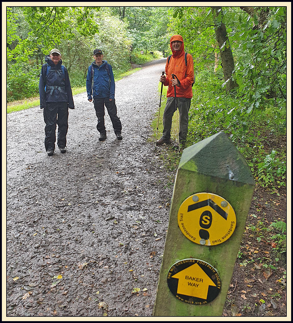
We set off south this time, pictured above, following the well signposted Sandstone Trail as far as Primrosehill Wood.
We soon came to a major junction - the panorama (try clicking on the image) shows a wide selection of tracks. Nearby, Martins were franticly hoovering all the insects they could find, in preparation for heading off to their 'winter' quarters in Africa. The Swifts went some time ago.

A little further on, a row of dead trees provided evidence of a disease of some sort.

After crossing the busy A54, we continued towards King's Gate and dropped through a deep valley to gain the perimeter of Michael Owen's stud farm.

The modern plantations in Delamere Forest are the current manifestation of a long history. I mentioned The New Pale in last week's 'report'. That deer enclosure dates from around 400 years ago, but 600 years before that the Normans created the Delamere area for the purpose of providing exclusive hunting grounds for the crown, which were preserved for over 700 years under strict forest laws. These laws protected game animals and the vegetation that gave them cover. The agricultural needs of the local populace therefore took second place, and those desperate enough to disobey were severely punished. This must have created terrible hardship for the villages that lay within the forest boundaries.

Over more recent centuries, the twin forests of Mara and Mondrem, which formed the Delamere area, slowly released much of their land to villages skirting the forest, culminating in an Act of Parliament in 1812 that removed the forest laws and created two new parishes, Delamere and Oakmere. The land that remained was retained by the crown and planted with conifers to form the modern plantations.
Whilst the local history goes back to Roman times, the above references explain the proliferation of names like 'King's Gate', where we left the forest (via stiles and kissing gates) to arrive in the outskirts of Kelsall, An elevenses break featured excellent home made flapjack from Paul S, before we headed on past a garden that instilled some amusement (click on the picture to see it properly).

Kelsall is a large village with good views down to the Cheshire plain. We found a way through, avoiding the centre and most of the roads.
Beyond Kelsall, we crossed the A54 again and progressed through fields that used to be a fruit growing area. Here, the tall trees that must have protected the fruit trees have been neatly trimmed up to a modest height.

We paused to admire good views over the Cheshire Plain.

The present crop appears to be … grass...(and trimmings?)

After continuing along the Eddisbury Way, a 16.5 mile walking route between Frodsham and Higher Burwardsley, for a while, a short stretch of tarmac in the vicinity of Brine's Brow led to a path under the Manchester to Chester railway. Here, we entered a sweetcorn growing area, with narrow paths between the tall crops.

Can you see Paul, just ahead, the crop towering over him.

Luckily, the foliage had dried out after the earlier rain, though we were pleased to be wearing long trousers this week, nettle stings having taken their toll in last week's 'shorts' conditions.

Eventually we emerged to a walled lane that led (this was a minor diversion) to the familiar sight of Stonehouse Farm B&B.
Bacon/sausage toasted sandwiches with coffee/tea provided us with an excellent value lunch before we headed back the way we'd come.

Then it was a case of following the Sandstone Trail for 3 km back to the car park along the same path as we'd enjoyed last week.
Here, I spotted Graeme studying the signpost and muttering under his breath - "I'm trying, honestly, I'm trying!"

I'm having mapping software problems and have 'lost' both the waypoint icons and the kilometre marker arrows (would anyone notice?), but this picture does accurately show the 14 km route which includes about 250 metres of ascent.

2 comments:
Looks a good walk even if it was wet Just being out in the country I love the photos
Looks amazing walking through the Corn
Thanks for forwarding it Maureen
It was only raining at the start, Maureen. We soon dried off...
And yes, it is fun walking through the corn.
Post a Comment