Sue and Martin in Mallorca 2019

Sue and Martin in Mallorca 2019
On the Archduke's Path in Mallorca

Tuesday, 23 September 2008

Tuesday 23 September 2008 - Lake District - a stroll from Mardale Head

2305aseat
By Adam Seat above Haweswater Reservoir

Today's excursion with Andrew (aka Notchy) comprised a high level round from Mardale Head, up beside Gatesgarth Beck, past Adam Seat to Harter Fell, then down to Nan Bield Pass before rising again to Mardale Ill Bell for lunch, then along the superbly renovated path to reach High Street at the Racecourse Hill cairn.

A short stroll north took us to The Knott, with great views across to the west, and north towards Ullswater.  Then it was across to Rampsgill Head, and on to our sixth and final Wainwright of the day, Kidsty Pike, before descending pleasantly over Kidsty Howe and down to the car park at the head of Haweswater Reservoir.

Here's the route - 14 km, with 950 metres ascent, taking from 10.30 to 3.45 including breaks of about an hour.2301route Here's the view back down Haweswater Reservoir, before setting off.2302mardale

2303sign


This rather complicated sign gave us three options.


We selected 'Gatesgarth Pass'.  The path is very nicely graded.  Here's Andrew on the ascent.2304gbeck
Up at  Harter Fell, we paused to admire the view along the Reservoir and beyond to the Pennines.2306harter Sunlit Lakeland summits lined up on the western horizon.2307view 
The Kentmere hills provided a fine foreground to the view across Morecambe Bay.2308mbay 
The path rose gently up to High Street.  It has recently been rebuilt and is in superb condition, as are many Lakeland paths these days.  It's just as well really, given the large number of people we saw in this comparatively obscure corner of the District.  We encountered 50-80 people on the hills today, probably as many as Sue and I were seeing each week in the Alps.2309aschs 
The Knott revealed sunny vistas to the north, with Ullswater just visible.  Ravens circled above.2310uls 
The picture below shows Andrew on the thin path up to Rampsgill Head, with The Knott behind him and Helvellyn and its neighbours behind that.2311knott 
These mountain bikers may have been enjoying a great 22 mile  route from Patterdale that passes this way.2312cycle 
We paused at Kidsty Pike to finish our provisions and admire three fine looking stags far below us in Riggindale.  A large female red deer studied us intently from a couple of hundred metres away.  We must have stood out very clearly on her horizon.  Sadly they were all far too distant to be captured on camera, and the kestrel that flew around well within range was just too quick!

And so we continued, on down the gently sloping ridge to the edge of the Reservoir and thence back to the car.2313hw

2314path


On the way we encountered a superb, ancient looking, path, with upright stones carefully positioned at regular intervals on either side.


2315sheep And this very clean (I believe it has rained here recently) sheep peered at us across a bed of tormentil.


Britain at its Best.  A fine walk in the best of company on a lovely late summer's day.  Thank you Andrew for suggesting this day out and acting as chauffeur.

Monday, 22 September 2008

Monday 22 September 2008 - A Brush with the C2C

As you may have gathered, I had the pleasure today of meeting up with Mick and Gayle who are walking Wainwright's Coast to Coast route.

Assisted by my faithful steed, I managed to join them at the excellent Pennine View camp site in Kirkby Stephen by 8.30, in plenty of time to set off with them at 9 o'clock on their comparatively short day to Keld, via Nine Standards Rigg.

I promised M&G that I would find out how the cairns got there. The above link to Wikipedia doesn't really help, but other explanations could be:

  • they were constructed by the Roman army to look like troops from a distance and were possibly marked on 18th century maps, or
  • they were built when the border reivers came south from the border country to help scare them off before they rustled all the local cattle, or
  • maybe they were put up by Victorian hoodwinkers.

Anyway, after admiring the small flock of parakeets that flew over the camp site, M&G were soon at the local Spar shop, stocking up their impressively small and light rucksacks (my day sac was nearly as heavy) and trying to spot the dog.2202spar Then it was up to the 4 metre high cairns of Nine Standards Rigg, which were just above the mist line.2203nsr Beyond here quite a few (over a dozen) C2C'ers were encountered as we negotiated the bogs, peat hags and holes in a bid to reach Whitsundale Beck (below), which provided a scenic lunch stop.2203zwb Then it was more peat and bog and holes - be very careful of the holes, Mick's freshly laundered trousers soon showed evidence of his inability to stay on his feet - to the haven of Ravenseat, which sported an enticing advertisement for teas. 2204cafe These were served by a sooty Amazon with a small baby.
Apparently she had just quelled a chimney fire.
Once we had escaped from a very local fly zone, it was very pleasant here in the sunshine. 2206tea But eventually we felt obliged to move on and we soon reached the road on the outskirts of Keld, whence M&G proceeded happily on their way and I returned to locate my car at Black Howe.

Nearly every field around here seems to have an old stone barn in it. They come in all shapes and sizes and states of dilapidation. Here is one of the more impressive ones.2207barn Here's the plan of our route - well, M&G went on to Keld, whilst I finished at Black Howe. It was about 21 km, 830 metres of ascent, and took 7 hours including a couple of hours' breaks.

Gayle, Mick, thank you for your excellent company today, it was really good to meet up for the day. Enjoy the rest of your trip, and hope to see you again soon.
2205map
Click here for Gayle's posting for today.

M&G GO FOR A WALK (2)

Here we are on the way to Keld, feeling sorry for all those people who are sitting behind their desks at work.

Not really gloating over them as I rather carelessly wrote in the original posting (was it Mick, or Gayle who dictated it? perhaps neither...)

It's a good way to spend a Monday.

As a bonus, the sun is shining.

(Edited following Alan's comment from behind his desk at work.)

Hmmm

M&G GO FOR A WALK (1)

Here they are, all fresh and ready to go after a good night's kip.

Their challenge for today is putting up with me, though I do have some goodies to reward them from time to time......

Sunday, 21 September 2008

An Italian Border Route incorporating part of the Grande Traversata delle Alpi (GTA)

headerpinterdrybrush

I have added daily photos and created an index for the postings from our recent two month trip to the Alps, should anyone wish to revisit those entries, or indeed visit them for the first time.

Click here to go to the Index.

Saturday, 20 September 2008

Saturday 20 September 2008 - Summer in Timperley

Wow! Summer has arrived!

Leave house. Walk through ginnel at end of road.

Look right:

2001canal1

Look left:

2002canal2

Wander down deserted path to the bridge, breathing fumes from the many BBQs:2003canal3

Friday, 19 September 2008

Friday 19 September 2008 - A Tale of Two Hostelries

No need to carry a case of beer with me today!1901baymalton

But further on...1902ropeanchor

'Ahoy there, me hearties', as BG would say following his brain transplant. This used to be a smart looking place. Perhaps some of us didn't stop there often enough. Curiously, it's a good half mile from the nearest water.

Thursday 18 September 2008 - Around Thelwall

Whilst Her Majesty is sunning herself in Sulawesi on the pretence of testing the waterproof cover for her Canon G9, I am left to stroll around in the Cheshire sunshine.  It's a pleasant diversion during one of those periods when illnesses and funerals of friends and relatives have been at the forefront of the mind.

This entry is a minor indulgence, so if you aren't interested in my rather mundane observations and very average images taken with the failing S70, you should skip this, though you will find a mouth watering kit summary somewhere below!

Let me take you on this short rural excursion:

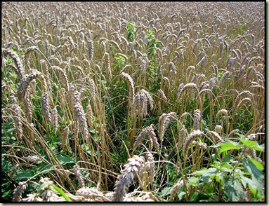
We start in Highfield Road, Lymm (SJ 673 868), a 20 minute drive from Timperley.  A snicket opposite the junction with Hardy Road leads immediately into lush Cheshire countryside and a field of wheat.
1803corn

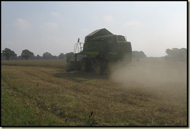
Well, it was a field of wheat!1804combine

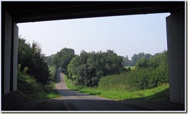
Reaching Booth's Lane we bear right to join Massey Brook Lane.  Heading left down here, we soon go under the M6.  The bridge frames the quiet Cheshire lane quite nicely.1805bridge
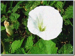
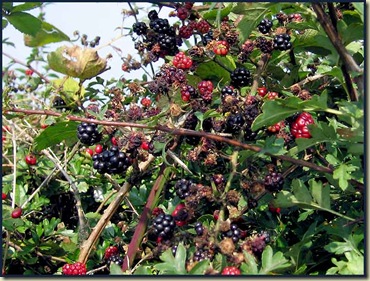
1806hbindweedPassing Massey Brook Farm and Thelwall Grange, we pause to admire the Hedge Bindweed (Calystegia sepium)  and the familiar fruit of the Bramble  with its succulent scientific name - Rubus fruticosus.
1807blackberry

Highfields Farm is by the junction of Massey Brook Lane, Halfacre Lane and Weaste Lane.  We turn left down an unnamed bridleway that those 'in the know' call Cinder Lane.
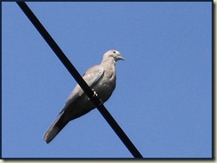
1808coldoveA young collared dove coos from its overhead perch, reluctant to move from this sunny spot.


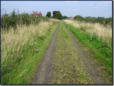
Cinder Lane is well named.1809cinderlane
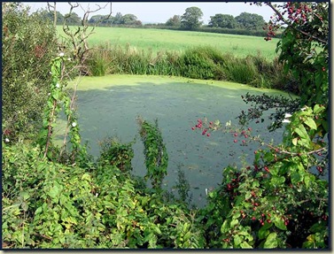
After a while the main A50 road is reached.  Turning right down the welcome footpath, the view of this pond is much better than that of the road.  We look for servicemen, and weird people testing stoves, but they have not reached these parts yet.1810pond
One Big Disappointment today:
No butterflies!

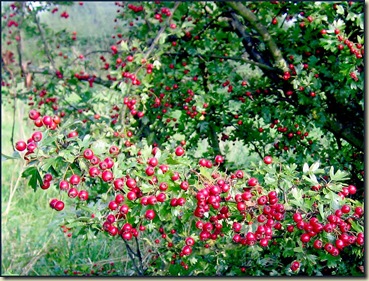
After 10 minutes, well past some noisy kennels, a broken footpath sign points us right, beside a pleasant hedgerow.  There's some fading Meadow Thistle here, and the hedge is positively dripping with the bright red berries of Hawthorn (Crataegus monogyna).1811hawthorn
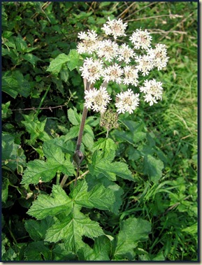
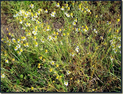
1812hogweedPassing through another snicket between houses, we reach Weaste Lane, where we turn right for a few yards before going left to cross a field.   Hogweed (Heracleum sphondylium) is still in full bloom here, as is White Dead-nettle and strongly scented Chamomile (Chamaemelum nobile).
 

1813chamomile

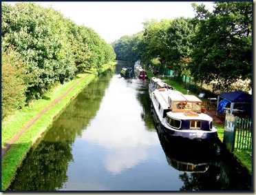
After a few minutes Pickering's Bridge, spanning the Bridgewater Canal (a historic waterway dating from 1759), is reached.  Here's the view from the bridge - quite a few barges are on manoeuvres.1814canal
We've been walking for nearly an hour now.  The sun has been beating down (doesn't it always?) and some refreshment is needed.  Time to settle down for lunch.  Here's the kit:1815gear
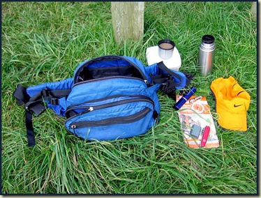
A gear review won't go amiss here.  The base weight of all this kit is 1400 grammes, which is just about manageable.  In addition we have the weight of the butties (but not for long - if we don't eat them, the mallards will make short work of them).  We could of (sic) brought one of our 57 varieties of cooking stove, but the flask is quick and reliable, and eminently suitable for a stroll of this arduosity.  In today's heat, though, the tea takes rather longer than we would of (sic) liked to cool down to a drinkable temperature.  Perhaps we should of (sic) brought a case of beer instead, but carrying that without a Slow Man to act as a porter can be oh so exhausting!

The map and compass are there to keep us on the straight and narrow, and the whistle is for seeking help when we stray from that course.  When things get really bad, we can of course use the penknife to construct a shelter whilst we ponder 'why didn't we ever get one of those wonderful 'Spot' gadgets?'

The specs come out after the shelter has been constructed and usually give rise to a completely different interpretation of the map. This can be useful.

Since we may be misplaced for some time, and want to record images of our surroundings, the spare camera battery is obviously essential, as is the sun/rain hat which quadruples as a full set of waterproofs and, if darkness were to fall, a tarp.

All this fits neatly into the old MEC bag.

Anyway, if you've followed these route instructions, you shouldn't be lost.  This walk is actually suitable for novice hillwalkers, and with its altitude gain and loss of 50 metres (mainly crossing bridges) it is suitable for those from the Flat Lands to the south and the east.  So don't be put off by the long list of gear - it's due to our 'double safety margin' approach.

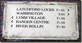
Replete from lunch (there is a bench about 200 metres down the canal to the west) we continue along the path after crossing the bridge, and after a few yards reach the Warrington-Altrincham rail link.  This dates from 1853 but now has no trains, so it is safe to turn right down the wheelchair ramp (yes, this walk is - mostly - suitable for wheelchair users) onto the path known as the Trans Pennine Trail that links Southport with Hornsea.1816railway 1817sign
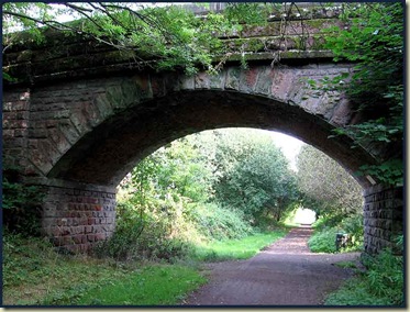
The trees today are laden with lush green leaves, so the path is dark under this late summer canopy.  Jays flutter in the branches, wood pigeons clatter around, and kestrels hover over nearby fields.  Huge wands of berry laden branches strive to get a view of the bright sunshine.1818berries
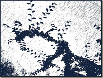
Others have given up that quest and are tinged with the first signs of autumn.1819bush

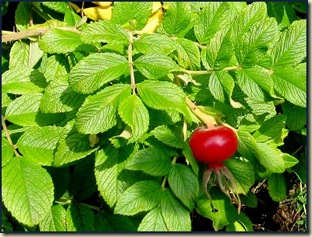
Red Clover lines the track, and the hedges are filled with dark red rose hips.  Here's a particularly succulent specimen.1820rose
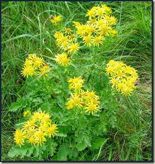
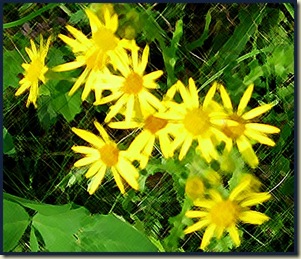
Common Ragwort (Senecio jacobaea) is abundant around here.1821comragwort 1823cragwort
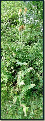
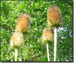
There's a huge thistle, over two metres high, perhaps a Globe Thistle (Echinops sphaerocephalus).1824thistle Correction: Teasel (Dipsacus fullonum) - thanks Mark.1825thistlehead
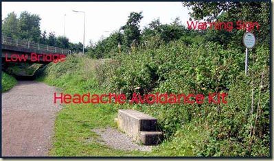
Most people who have listened to motorway traffic news will have heard of the dreaded 'Thelwall Viaduct' on the M6.  It's about 400 metres away at this point, but largely unseen and unheard.  A minor road does pass over our path though.  Local people hereabouts are quite 'horsey', and have wisely provided a headache avoidance kit.1826lowbridge
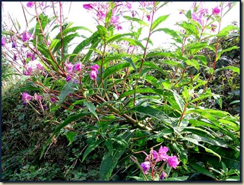
Whilst Hawkweed is also abundant beside the old railway, and Himalayan Balsam is rampant in the wet woodland below the embankments, Rosebay Willowherb (Epilobium angustifolium) reigns supreme today, with silky plumes attached to its seeds, ready to spread its influence far and wide.1827rbwh1
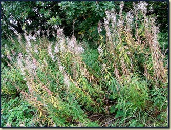
Some is still in flower.1828rbwh2

Having walked under the M6, we leave the quiet sanctity of the old railway at the first footbridge.  A left turn to a hostelry may be your choice at this point, but today we turn right over the bridge and take a last glance at the old trackless track - trying to conjure images of steamy, whistling engines from the past.1829railway
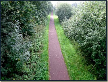
The path bends tightly in front of some pretty cottages before leading back to the canal, whence a right turn leads to a cobbled ramp up to the main A56 road.  Turn left, cross with care, and Highfield Road is the second turn on the right.  The car should have been safe up here, whilst we enjoyed the 7.5 km stroll, which has  taken us 1.5 to 2 hours. 

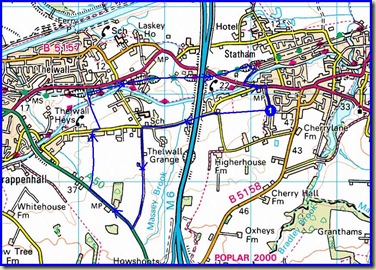
Here's the route, courtesy of Jen Darling's book, 'Walks in North Cheshire':1802map
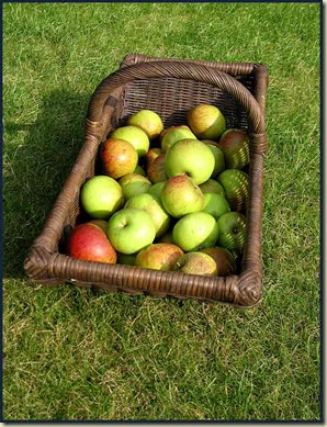
Then, back at home, it's time to raid the apple tree1830apples
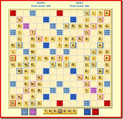
and thrash Helen...1899scrabble

Thursday, 18 September 2008

The Canon Powershot G10 Camera

1801g10
Hooray.

I've noticed that the G10 was announced yesterday. It should be available in the UK in November, though the staff in Wildings, Manchester, had not heard the news yesterday and told me that 'even if it is announced today' (it was) 'it will take until February or March to reach the UK'.

However, Park Cameras and Amazon both expect to have it, for £449, on 31 October, but note that the 'release date' is subject to change.

I would hope to get one from my local retailer, who is always on hand to provide help and advice, and offers prices that compete with the internet and include a 3 year guarantee.

I've been quoted nearly £90 for the repair to my old Powershot S70, so will probably soldier on with it in its broken condition (I have to hold the lens cover very firmly open to make the camera work, as the retaining spring has broken) unless I can get a cheap repair, until I can get my hands on a G10. I already have a brand new CCS protective case for it, thanks to Peewiglet's Plog, and RK Photographic.

I'm tempted to get a DSLR camera, but the bulk and weight - and the excellence of the Powershot range - leads me to favour the latter. The G10 will be more than adequate for my limited skills at taking snapshots. It's the journey I like; the photographic record is an incidental, albeit enjoyable, by-product - not an objective in its own right.

Update - 29 September 2008
I now notice that our local shop,
Kamera (Optical-Express) will be selling the G10 for £400, including 3 year warranty, 4 Gb SD card, tripod and case.

The cheapest I have found is £337 at Digitalrev (unknown provenance) - possibly around £400 when card and warranty, etc are added.

Update - 13 October 2008
It's landed - for £389.99 including 3-year warranty, tripod and 4Gb card.

Monday, 15 September 2008

Uploading Photos to Blogger (2)

This time I'm uploading directly to blogger.
Here is the original photo - it's a picture of Schlegeisspeicher in the Zillertal Alps, taken last year.

The original was 2.28 Mb, it took 1 minute 25 seconds to load, and blogger has reduced the size to 27 Kb.

Here is the same image as that loaded by Windows Live Writer in the previous blog. Live Writer loaded it in 10 seconds and reduced the size from 90 Kb to 59 Kb.


Curiously, blogger has converted this smaller image to 27 KB (actually 26,755 bytes) - exactly the same size as the conversion of the much larger original image. It took 3 seconds to load.

So assuming uploading results in no further changes, it seems that the image uploaded using Windows Live Writer (see below) is more than twice the size than the images loaded directly to Blogger. I wonder if there is any discernible difference in quality?

I suppose this also means the camera being used to produce images for blogging does not necessarily have to be very powerful, its shooting functions and flexibility (not to mention the skill of the operator - both with the camera and subsequently with any computer driven adjustments) being more important.

Uploading Photos to Blogger

Here's an image that was adjusted slightly and reduced to 90Kb before being loaded here.1502web
The following blog will explain more.