Sue and Martin in Mallorca 2019

Sue and Martin in Mallorca 2019
On the Archduke's Path in Mallorca

Sunday, 16 August 2015

Sunday 16 August 2015 – Bike Ride – Marple and Lyme Park

1602LymeHall2

The reason for all these bike rides will become apparent shortly. Today’s outing from Rose Hill in Marple was on yet another lovely sunny day, but thankfully lacking Pyrenean style heat, pressure sores and all that jazz.

I headed for over 6 km down the Middlewood Way, together with a large congregation of walkers, runners, horse riders and other cyclists. We did actually congregate for some time whilst a farmer moved his herd of Guernseys from a field on one side of the track to one on the other side.

Zooming past Higher Poynton Station, where previous rides have left the old railway line at Nelson Pit, I overshot the next exit and did a few ‘there and back’ kilometres before leaving the railway at a small car park after getting stuck for a while behind a fat, deaf man on a very slow bike, and heading down under the canal and up a hill. Doubling back to the left took me to the bottom of a hill, where a gate to the right (the West Gate) offered access to Lyme Park, and a steady pull up a rough track to another gate.

Beyond here, tarmac leads to the Hall, pictured above. This cycle route goes fast past the car park before doubling back to the right to face the hall as shown, looking back at the shocked faces of those who have just nearly been decimated by the silent but deadly Stumpjumper (my bike – the bell does work but people don’t seem to hear it).

Further up the hill the tarmac gave way to a stony path with views across Cheshire beyond the square hunting lodge on top of a hill that can be seen for miles around.

1603LymePark1

The track drops down to the East Gate, then a rough section goes down to the old bridge shown below. This bridge has recently been deemed unsafe for vehicular traffic by the Highways Agency. A footpath, on which my bike is positioned, has been constructed to by-pass the closed road. This is no good to horse riders, nor to the farmer who travels by Land Rover to shepherd his herd of sheep. So the fence erected to block the road is constantly being pulled down. Apparently some locals think it should have been demoted to bridleway status and not closed off, though that still wouldn’t be of much help to the farmer. The footpath proved too narrow for both me and my bike, resulting in a few skin rips from Stumpy’s sharper protuberances.

1607bridge1

A steep push from the bridge over slippery rocks led to roads (turn left at the first road, then right at the junction) that traversed high above New Mills and Furness Vale, dropping eventually towards Whaley Bridge.

There were fine views down to New Mills and across the valley to Kinder Scout.

1610kinder

A fairly obscure bridleway* took a left past a 4x4 that was virtually blocking the rose bush lined route (more scratches), just before entering Whaley Bridge. This leads down to Furness Vale, where the Peak Forest Canal provided my next conduit. I could alternatively have taken the road into Whaley Bridge and picked up the canal there, but it wouldn’t have been as much fun as on the rocky paths I took.

The towpath passes large mooring areas before reaching New Mills and passing the unmistakeable aroma of Love Hearts emanating from the sweet factory, pictured ahead in the next image.

1613sweetfactory2

I turned right at the first bridge after the sweet factory, along a track that led down then up to Hague Bar. Straight across the main road there, and the last serious climb of the day took me at walking pace behind a couple of nervous hikers who thought they were about to be run over, up to the metal bench by Brook Bottom.

Turning left, I eschewed a visit to the Fox Inn, in favour of a cuppa in Marple with Graham and Sue, after returning to Rose Hill by the same bumpy route as described in my last report on Wednesday’s outing.

Here’s my route - 35 km with 700 metres ascent, taking nearly 3 hours.

1699route

* On the descent to Whaley Bridge pass a house on the left where there’s a Public Footpath sign. A few metres further on, by the next house, is a bridleway sign. Take this bridleway down steeply between rose bushes and houses then turn left down a fast, narrow path to a gate. Continue along a grass track, keeping at a contouring height and not dropping down to another gate. After rising slightly, the grass track turns to stone and descends to a stream and gate. Beyond here a narrow rocky path leads to tarmac, and the descent to Furness Vale.

Thursday, 13 August 2015

Wednesday 12 August 2015 – A Peak District Bike Ride

1201bullshead-(1)

What a cracking day for a bike ride.

I pootled off to Marple, intending to start the ride from the car park by the Midland Hotel in Marple Bridge, but roadworks encouraged me to park up before that at Rose Hill.

So instead of heading of down the Peak Forest Canal as planned, I decided to make this a ride of two halves, starting with the flat half.

I took the Middlewood Way as far as Nelson Pit (toilets), easily identified by the station platform and a large picnic area where the tracks used to be. The steps up to the left from the Middlewood Way are the only good reason to dismount on this entire ride.

A few metres up the road to the south east you join the Macclesfield Canal at a very busy marina where refreshments are available. The well surfaced towpath then leads easily to High Lane, where the Bull’s Head, pictured above, has often been used as a starting point for our evening walks.

A right turn in Marple brought me to the Peak Forest Canal, heading towards New Mills, where the sweet factory was producing some alluring smells. Here’s a typical view from the towpath.

1202PFcanal1)

A little further on, one of the several drawbridges and swing bridges on this section of canal was being renovated. I asked them to pose for me, New York style, sitting on the top girder eating their lunches, but they didn’t seem too keen.

1203PFcanal2

A spot of sunbathing whilst waiting for the drawbridge to open seemed in order.

1204PFCanal3

It was a hot day on the towpath, with good views across to a viaduct, home to one of many railway lines hereabouts. The following two pictures were taken from the same spot.

1205PFCanal41206PFCanalview

A pause for a cuppa after an hour in the saddle saw me on a bench chatting to a stranger who was feeding the ducks. This is a pleasure (chatting with strangers) that’s so much easier now I’m back from the Pyrenees!

I’ll describe the rest of the route at the foot of this posting, but the second half of the ride – the hilly half – started at Furness Vale where a steep descent led to a 200 metre ascent to the high point of the ride (point 326 metres on Over Hill Road). The only photo I took doesn’t really capture the perspective. I am 200 metres above the bottom of the valley.

1207viewback

It was a lovely fast descent to Birch Vale, despite a minor aberration at Moor Lodge where I turned left by mistake. Then the Sett Valley Trail led to a steep ascent out of New Mills, past a care home for dementia sufferers outside which I enjoyed the rest of my tea and a banana, the reward for two hours of riding.

After rising steeply on tarmac to New Mills Golf Club the descent to Brook Bottom was down the steep stony track that I struggled up on Sunday. It’s much easier in descent! Then down to Brook Bottom and very slowly behind a trailer on which a man was sitting, trying to restrain a large fridge.

“Mountain biker killed by flying fridge” was his headline warning, but by the time we got to the top of the hill I was suggesting “fridge outpaces mountain biker up gentle slope”.

I took the fast track alongside the top of Mellor Golf Course, then the stony track down to Bottom’s Hall for a joke with some lads who were trimming the hawthorn and bramble hedge. After a brief ‘carry’ to avoid a puncture it was then a quick return to Rose Hill on the route described below.

I’d run out of tea, so refreshments at the excellent Railway pub at Rose Hill were most appreciated.

Here’s my route – just shy of 40km with about 500 metres ascent. It took me a leisurely three and a half hours including breaks totalling over half an hour.

1299route

The route:

Park near the access point to the Middlewood Way near Rose Hill station in Marple.

Take the Middlewood Way for nearly 6 km, leaving it sharp left up a stepped path by the picnic spot and old platform at Nelson Pit. Toilets are straight ahead after leaving the old railway track.

Turn right to reach the Macclesfield Canal and follow the towpath for nearly another 6 km, crossing a bridge in Marple to reach the towpath of the Peak Forest Canal heading in the direction of New Mills.

Soon cross to the left hand side of the canal and continue for about 8 km as far as Furness Vale, where you leave the canal after a large area where barges are moored on the other side of the canal.

[You have just been cycling along part of a 3000 mile walking route, European route E2, between Galway and Nice!]

In Furness Vale, look right to a level crossing to check you are in the right place, then bomb down the hill to your left and follow the road sharp left at a bridge. A few metres further on, engage a low gear and turn sharp right up Ladypit Lane which rises to a right hand bend where it turns into Dolly Lane. The lane undulates before climbing quite steeply to a high point where a narrower lane goes left up past Laneside Farm.

Follow this narrower lane steeply up to its high point at 326 metres*.

Then relax over the undulating if rough terrain followed by Over Hill Road, to Moor Lodge. Don’t make my mistake of turning left here, but follow the tarmac at breakneck speed to a sharp corner that brings you out at the main A6015 road in Birch Vale.

Turn right, and then first left. Continue down the hill, about 100 metres before the bottom of which a gate on the left introduces you to the Sett Valley Trail.

After about 1.5 km, turn right at a road, then left at the next junction. About a kilometre later, turn sharp right, steeply up Watford Road, past the dementia care home, to a junction where you go straight across and follow Apple Tree Road all the way to New Mills golf course.

Continue straight over Castle Edge Road and along the wide track, taking a narrower track to the left when the wide track forks right.

Take care on the rocky descent to a metal bench on Brook Bottom Road. Turn right to reach the Fox Inn.

There are numerous options from here, but the route I chose on this occasion follows the road through Brook Bottom and up a gentle hill beyond which it becomes a track. A right fork brings you gently up to Mellor golf course, alongside which you continue until just before the club house and car park, where left turns take you to an initially fast descent to a rough track leading over steadily rockier terrain to Bottom’s Hall.

Continue towards Bottom’s Bridge, before which you turn right past mill renovation work up the rough track that is Low Lea Road.

Descend pleasantly into Marple Bridge, where a left turn takes you down to the traffic lights. Turn left here, then first right into Brabyns Park.

Past the car park, take upward tracks that double back a little to cross the railway and reach the Peak Forest Canal. Turn right at the canal then cross it at a narrow bridge by the next lock down.

Go straight ahead up a narrow dirt track that brings you out on Grosvenor Road.

Now follow Grosvenor Road to a left turn up Oakdene Road and another left turn along Manor Hill Road. A right turn at the main road brings you in sight of traffic lights where you bear right onto the main road to Stockport, soon after which you cross the railway bridge and turn left beyond the Railway pub to return to the car park.

* There are lots of potential variations to this route, one of which involves turning right at point 326. Soon afterwards turn left onto a bridleway and stay on this path all the way over Chinley Churn, up to about 430 metres. Finish up on a flattish grass and rock track between two walls. Where the left wall goes left, follow it and then head diagonally down across a field to a gate, where you join a track and descend to a road, across which you rejoin the route I followed today just before the Sett Valley Trail turning.

Wednesday, 12 August 2015

Tuesday 11 August 2015 – A Reunion of TGO Challengers

1101tgo

It’s always good to meet up with friends who are also TGO Challengers.

So when Mick and Gayle were passing by it was good to meet them and exchange some Pyrenean yarns – they were walking GR10 in France whilst I was completing Spain’s GR11 route. Gayle’s record is here.

Gayle’s camera drowned during their GR10 walk, so Mick found some unsuspecting strangers to try to enrol into the ‘TGO Family’ and on which to test a new type of camera that he’s now thinking of acquiring for Gayle.

1101group

It was a pleasant afternoon in Cheshire, with good views towards the Wrekin and the hills of North Wales.

1103view

Just for the record, we walked a little over 6 km, with 250 metres ascent, in around an hour and a half.

A lovely stroll followed by tea and cake in Colin (M&G’s campervan).

I expect you can all guess where we were…before I add the relevant ‘label’?

Tuesday, 11 August 2015

Sunday 9 August 2015 – Mellor Moor

0901FoxInn

This posting is really to record a 1.5 hour bike ride route from the car park above the Midland Hotel in Marple Bridge. It’s easier to park there than it is to drive down the potholed road to Roman Lakes, although the ride is based on Roman Lakes’ route M1 – ‘Mellor Moor’.

It was a lovely morning for a ride – warm, sunny and calm, and this route has some proper hills.

Start by heading up past the station and taking the first left along Arkwright Road. Then turn left down Paywood Drive which leads past Bottom’s Bridge to Lakes Road and Roman Lakes Leisure Park. This is an alternative starting point with a small café and toilets.

Continue along the track, through a railway tunnel, past a farm building, and along a rough bridleway beside the railway to another farm, immediately before which turn left up a broken road which levels out after a few hundred metres. Turn right up another steep track that ends at a steep junction. Turn right* here – the track passes some houses then becomes a narrow path that soon joins a small road. Bear left up the road and over the top before dropping down to the hamlet of Brook Bottom.

If you time your visit correctly, you’ll struggle to pass the Fox Inn without pausing for refreshment. It’s looking much better than it did in September 2009!

1807fox2

Beyond the Fox, engage low gear and continue along the road for 200 metres to a metal bench from where there’s a good view across the valley to Disley and Lyme Park.

0902view1

Take a deep breath and turn left at the metal bench, up a steep stony track. I challenge you to ride this section without stopping. I wasn’t able to today, but a much stronger rider passed me and managed it without difficulty.

At the top of the track a left turn along Castle Edge Road allows you to rise more gently to good views across to Hayfield and Kinder Scout to your east.

0903view2

The road turns into a wide track at the top of the hill, from where an enjoyable descent leads quickly to a junction where you turn sharp left along more tarmac.

Follow this road for nearly 2 km up to a point where a large wooden cross is above you on the left and a very loose rocky track (Black Lane) comes down steeply from the left. Turn right here, down a steep lane that becomes loose at the bottom. Before a gateway into a garden you turn right down a loose path with wooden drop offs (care!).

50 metres further on turn left down a narrower, looser path next to a fence and emerge at the bottom between houses. Turn right down the track and to reach the steep track at the junction where you turned right earlier*.

Retrace the route steeply down, but now turn right at the bottom at a T junction. Continue for 100 metres before taking a narrow track to the left between hedges. At the bottom of this track, turn right along the stony track that leads back to Roman Lakes and refreshments if you need them.

From Roman Lakes, return towards Bottom’s Bridge, before which a right turn along Low Lea Road past the mill renovation works takes you up to a point where a fast descent leads to the tarmac of Town Street in Marple Bridge. Turn left at the lights to return to the car park.

An enjoyable little jaunt with some mildly technical sections – about 15km with 400 metres ascent. Allow an hour and a half.

0999route

Here’s the Garmin file for this route:

Monday, 10 August 2015

Friday 7 August 2015 – A Bike Ride from Rose Hill

0201TPT

The picture above is a ‘prologue’, taken on 2 August, the day after I returned from the Pyrenees, on the Trans Pennine Trail in Stretford.

Whilst it was hot and dry in the Pyrenees, the greenery indicates what the weather has been like at home. The picture is to show Markus that I’m trying to prepare for the next trip!

After a few local rides on the flat, I decided I needed to go up a few hills. The most convenient hilly routes are from Marple, so on Friday I pottered off to Rose Hill Station, from where there’s a nice flat warm-up along the Middlewood Way.

After nearly 6 km you reach Nelson Pit and the Boars Head, where we were on Wednesday. You can carry on further along the Middlewood Way, which is well served with cafés and toilets, but I left it here and pedalled a few metres east to the Macclesfield Canal.

0701macccanal1

Again, it’s pretty flat all the way back into Marple.

0704macccanal4

The only hills involve tight manoeuvring over narrow bridges where the towpath moves from one bank to the other.

In Marple I turned right down the pretty Peak Forest Canal.

0706pf2

Soon after the drawbridge shown below, some steps lead down to the left (in fact the right, behind the camera, as this photo was taken looking back). I should have been able to descend these steps easily on the full suspension bike, but I chickened out.

0708drawbridge2

A steep descent crosses the main road and heads up towards Strines Station. Shortly before that, a left turn also rises sharply to a farm and a slightly technical bridleway past another farm to Roman Lakes.

Beyond the potholed Roman Lakes track, a right turn up Low Lea Road takes you past a Lottery funded mill restoration project and over a hill to Marple Bridge.

Left at the lights, then first right into Brabyns Park leaves the rider with a choice of uphill options and dead ends to regain the Peak Forest Canal in the middle of the Marple Locks system. Beyond that it’s worth pedalling on over the aqueduct as far as Romiley tunnel.

0709aqueduct10711plaque0713tunnel2

Then it’s back along the towpath to cross the canal between the fifth and sixth locks from the bottom of the system, and a route back to Rose Hill along minor roads. (Or you could simply go along the canal and turn right along the A626 to return to Rose Hill.)

A good couple of hours’ scenery and exercise, if a bit sparse on the ‘hill’ front. That will come later…

27 km, 300 metres ascent, taking about 2 hours.

0799route

A pleasant outing on the bike; basically a warm-up for something a bit more challenging. I’ve not marked my start point (Rose Hill), but there are numerous places from which you could start this ride.

Enjoy!

Sunday, 9 August 2015

Wednesday 5 August 2015 – An Evening Walk with SWOG from Nelson Pit

0505nrElmerhurst

A mottley crew of about thirty assembled outside Nelson Pit Visitor Centre for a 7.30 pm start.

Up by Windgather there was rain in the air. “What are you lot up to?” mooed the lady on the right.

0504byWindgather2

One rickety stile; thirty people.

0507byElmerhurst

The leaders ploughed on through wet grass towards Disley.

0506towardsDisley

Back at the Macclesfield Canal, we found a tractor festival.

0508tractor10509tractor2

This is my favourite:

0510tractor3

By now the light was a little on the low side.

0512MaccCanal1

But we soldiered on bravely and reached the Boars Head before it went dark.

0514BoarsHead

Here's our route - about 7 km with 100 metres ascent. Allow a good 1.5 hours.

0599route

There’s a very short slideshow here.

We did another walk from here on 30 July 2014. It’s a good place to start from.

Saturday, 8 August 2015

Monday 3 August 2015 – Dunham Massey

0301Dunham1

We enjoyed a lovely Monday morning with Kate, Jacob and Jessica in Dunham Massey Park.

Not many photos were taken, but this posting marks a return to ‘normal service’ for friends and family.

0303deer30304jess1

Friday, 7 August 2015

Another Pyrenean Adventure – Coast to coast along the GR11 - The Book

0752book2

I said somewhere that there wouldn’t be a book of this trip.

I was wrong.

I was due to travel home from this walk today, but I finished a few days early and came back last Saturday.

When GR10 was completed in 2013, Humphrey kindly converted my blog postings into an 80 page book. Very good it was too. I wrote all about it here.

This time Humphrey has again excelled himself, with another 80+ page offering in the same format of which there are currently just a couple of copies. He has also produced some very useful maps.

I now have several options:

1. Distribute by way of a PDF file. I’m not sure about this as I’ve now compiled an Index page to the postings and have inserted links for easy navigation from page to page – all that’s missing are the maps.
2. Print small batches ‘On Demand’.
3. Print by conventional litho, as with the previous book – by far the cheapest option but requiring a minimum print run of 100 copies.

I could also combine the two books into a single offering.

Since I was only supposed to be arriving home at about the time I’m writing this, it has come as a bit of a shock to receive the book. There again, yesterday (when it arrived) was one of my ‘official birthdays’ and I know Humphrey wanted to thank me for offering him a few minutes reminiscence over his morning porridge during the past few weeks!

I have to say I was more than gobsmacked by his generosity.

Thank you Humphrey.

Anyway, to help me decide on how many (if any) more copies of the book should be printed, I’d be grateful if those of you who would like a copy would let me know by email to martin@topwalks.com so that by the end of September I can make a decision on what to do.

Thursday, 6 August 2015

Pyrenees GR11 – Index of Postings

0501index

INDEX

Another Pyrenean Adventure

Monday 15 June 2015 - Pyrenees GR11 - Day 1 - Getting to the Start

Tuesday 16 June 2015 - Pyrenees GR11 - Day 2 - Prologue, then Cabo de Higuer to Collado de Telleria

Wednesday 17 June 2015 - Pyrenees GR11 - Day 3 - Collado de Telleria (415 metres) to Collado de Iñaberri (795 metres)

Thursday 18 June 2015 - Pyrenees GR11 - Day 4 - Collado de Iñaberri (795 metres) to just below summit of Argintzo (1150 metres)

Friday 19 June 2015 - Pyrenees GR11 - Day 5 - By Argintzo (1150 metres) to Burguete (900 metres)(Hotel Loizu - end of Stage 4)

Saturday 20 June 2015 - Pyrenees GR11 - Day 6 - Burguete (900 metres) to Sierra de Abodi (1350 metres)

Fun in the Pyrenees

Sunday 21 June 2015 - Pyrenees GR11 - Day 7 - Sierra de Abodi (1350 metres) to Ochagavía (Hostal Orialde)

Monday 22 June 2015 - Pyrenees GR11 - Day 8 - Ochagavía (Hostal Orialde) to Isaba (Hostal Ezkaurre)

Tuesday 23 June 2015 - Pyrenees GR11 - Day 9 - Isaba (Hostal Ezkaurre) to Zuriza  (campsite at 1227 metres)

Wednesday 24 June 2015 - Pyrenees GR11 - Day 10 - Zuriza  (campsite at 1227 metres) to wild camp in meadow a few hundred metres beyond Achar d'Aguas Tuertas (1610 metres)

Thursday 25 June 2015 - Pyrenees GR11 - Day 11 - Wild camp in meadow a few hundred metres beyond Achar d'Aguas Tuertas (1610 metres) to wild camp at Plano d'a Rinconada (1870 metres)

Friday 26 June 2015 - Pyrenees GR11 - Day 12 - Wild camp at Plano d'a Rinconada  (1870 metres) to Sallent de Gállego (Hotel El Reyno)

Saturday 27 June 2015 - Pyrenees GR11 - Day 13 - Sallent de Gállego (Hotel El Reyno) to Ibón Azul Alto (2409 metres)

Sunday 28 June 2015 - Pyrenees GR11 - Day 14 - Ibón Azul Alto (2409 metres) to Panticosa (Hotel Sabocos)

Monday 29 June 2015 - Pyrenees GR11 - Day 15 - Interlude 1 - The Sabocos Valley - a circuit from Panticosa

Tuesday 30 June 2015 - Pyrenees GR11 - Day 16 - Interlude 2 - The Lacs d'Ayous Circuit

Wednesday July 2015 - Pyrenees GR11 - Day 17 - Baños de Panticosa to Camping Valle de Bujaruelo

Thursday 2 July 2015 - Pyrenees GR11 - Day 18 - Torla to beyond Ordesa Canyon road terminus, via Camping Valle de Bujaruelo

Friday 3 July 2015 - Pyrenees GR11 - Day 19 - Interlude 3 - A Peña Foratata Circuit

Saturday 4 July 2015 - Pyrenees GR11 - Day 20 - Ordesa National Park main car park to Rio Bellos at 1880 metres

Sunday 5 July 2015 - Pyrenees GR11 - Day 21 - Rio Bellos (1880 metres) to Plana Fonda (2080 metres)

Monday 6 July 2015 - Pyrenees GR11 - Day 22 - Plana Fonda (2080 metres) to Barranco Montarruego  (2110 metres)

Tuesday 7 July 2015 - Pyrenees GR11 - Day 23 - Barranco Montarruego  (2110 metres) to Barranco Llardaneta (2470 metres) near Refugio d'Ángel Orús

Wednesday 8 July 2015 - Pyrenees GR11 - Day 24 - Barranco Llardaneta (2470 metres) to Benasque (Hotel Avenida)

Thursday 9 July 2015 - Pyrenees GR11 - Day 25 - A Day off in Benasque (Hotel Avenida)

Friday 10 July 2015 - Pyrenees GR11 - Day 26 - Benasque (Hotel Avenida) to Barranc de Lac Redon (1815 metres)

Saturday 11 July 2015 - Pyrenees GR11 - Day 27 - Barranc de Lac Redon (1815 metres) to just to the west of Pòrt de Ratèra (2500 metres)

Sunday 12 July 2015 - Pyrenees GR11 - Day 28 - West of Pòrt de Ratèra (2500 metres) to La Guingueta d'Àneu  (Nou Camping)

Monday 13 July 2015 - Pyrenees GR11 - Day 29 - La Guingueta d'Àneu (Nou Camping) to Tavascan (Casa Feliu)

Tuesday 14 July 2015 - Pyrenees GR11 - Day 30 - Tavascan (Casa Feliu) to Àreu (Casa Besoli)

Wednesday 15 July 2015 - Pyrenees GR11 - Day 31 - Àreu (Casa Besoli) to Coma Pedrosa valley (2270 metres)

Thursday 16 July 2015 - Pyrenees GR11 - Day 32 - Coma Pedrosa valley (2270 metres) to Ordino (1360 metres)

Friday 17 July 2015 - Pyrenees GR11 - Day 33 - Ordino - Hotel Coma (1360 metres) to Encamp - Can Fontbernat (1330 metres)

Saturday 18 July 2015 - Pyrenees GR11 - Day 34 - Encamp - Can Fontbernat  (1330 metres) to wild camp at 2475 metres outside Refugio de I'Illa (a bothy)

Sunday 19 July 2015 - Pyrenees GR11 - Day 35 - Wild camp at 2475 metres outside Refugio de I'Illa to campground by Refugi de Malniu

Monday 20 July 2015 - Pyrenees GR11 - Day 36 - Campground by Refugi de Malniu (2145 metres) to Puigcerdà (Hotel Maria Victoria)

Tuesday 21 July 2015 - Pyrenees GR11 - Day 37 - A Rest Day in Puigcerdà (Hotel Maria Victoria)

Wednesday 22 July 2015 - Pyrenees GR11 - Day 38 - Puigcerdà to Camping Can Fosses, Planoles

Thursday 23 July 2015 - Pyrenees GR11 - Day 39 - Camping Can Fosses, Planoles to Nuria (Hotel Vall de Nuria)

Friday 24 July 2015 - Pyrenees GR11 - Day 40 - Nuria (Hotel Vall de Nuria) to Setcases (Hostal Restaurant Ter)

Saturday 25 July 2015 - Pyrenees GR11 - Day 41 - Setcases (Hostal Restaurant Ter) to Beget (Hostal el Forn)

Sunday 26 July 2015 - Pyrenees GR11 - Day 42 - Beget (Hostal el Forn) to Bassegoda Park campground near Albanyà

Monday 27 July 2015 - Pyrenees GR11 - Day 43 - Bassegoda Park campground near Albanyà to wild camp 2 km before Santa Eugènia (beyond La Vajol)

Tuesday 28 July 2015 - Pyrenees GR11 - Day 44 - Wild camp 2 km before Santa Eugènia (beyond La Vajol) to wild camp outside Els Vilars

Wednesday 29 July 2015 - Pyrenees GR11 - Day 45 - Wild camp outside Els Vilars to El Port de la Selva (Hostal German)

Finished

Thursday 30 July 2015 - Pyrenees GR11 - Day 46 - El Port de la Selva (Hostal German) to Cap de Creus (wild camp)

Friday 31 July 2015 - Pyrenees GR11 - Day 47 - Cap de Creus (wild camp) to Argelès sur Mer (David and Jan's wonderful gite)

Saturday 1 August 2015 - Pyrenees GR11 - Day 48 - Argelès sur Mer (David and Jan's wonderful gite) to Timperley

Another Pyrenean Adventure – Coast to coast along the GR11 - The Book

Sunday, 2 August 2015

Saturday 1 August 2015 - Pyrenees GR11 - Day 48 - Argeles sur Mer (David and Jan's wonderful gite) to Timperley


The trip started in Timperley so it should finish here. Then there will be an index page and more comments about various other stuff, I suppose.

My trains home were booked for next Friday, so I could have swanned around this lovely part of the world for another week. But I know that jobs are piling up at home, and seven weeks is quite a long time to be away anyway. A call to Voyages-sncf confirmed that whilst my train tickets could be changed, I would have to pay the difference between my low cost advance fares and the fare on the day, which for the Eurostar leg of the journey could be considerable. Also, it looks as if I can get a refund for the TGV fare to Paris, though not for Eurostar or the bus to Manchester from London, which was very cheap anyway.

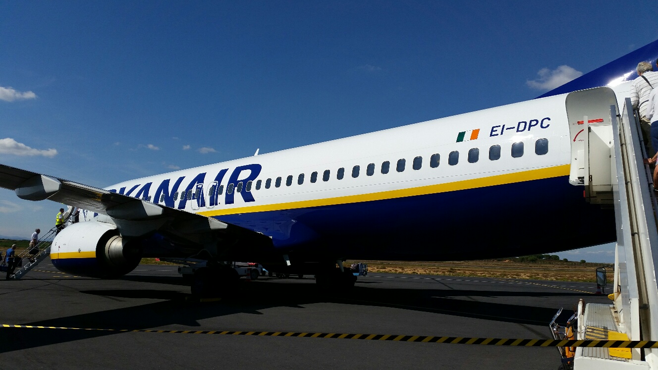
David is quite expert at the different ways of getting back to the UK from Argeles and he quickly found a cheap Ryanair flight from Beziers to Manchester, so that was booked using this phone, on which the boarding card was discreetly stored.

So by 10 am on Saturday I was back on the Avignon train, which takes an hour and a half to reach Beziers.

It was a shame to spend so little time with David and Jan, though I'm in two minds about getting out of today's task, which would have involved helping David to lay a synthetic lawn at his son's house in Argeles where clients are arriving tomorrow. I hope David can also resolve a minor problem involving the colour of the water in the pool!

Thanks again to D and J for having me and helping me to return to the English speaking world. And for a delicious meal last night.

Everything was quite fresh on Saturday morning after the first proper rain for two months - the lightning from the storm was quite spectacular.

The Languedoc Express duly deposited me in Beziers at 11.30. The bus to the airport didn't leave until 14.40, giving me plenty of time to explore the town - a reasonably pleasant place with a nice park near the station. But I'd had enough of lugging The Brick (my 15 kg rucksack in case you'd forgotten) around, so spent much of the time outside a café. I did try to get some goodies to boost my luggage to the 20 kg I'd paid for, but the insistence of shopkeepers that I part with my valuables whilst doing the shopping lost them the business.

The Ryanair flight saw me uneventfully back in Timperley before 7 pm.

Stuff:

Best Day: by a country mile - Day 13 over Cuello de Tebarrai.

Worst Day: by a country mile - the exhausting Day 34 out of Encamp.

I'm only aware of one other GR11 compleater amongst my encounters with other folk. That's German Martin. I expect that the Spanish dad and his twelve year old son also finished, as well as Ian and Jules who sadly I only met very briefly in Puigcerdà. This contrasts with at least half a dozen people I actually saw at the finish of my GR10 walk two years ago.

I was sorry to discover that Mick and Gayle had abandoned their GR10 walk in Luchon and returned home. I'd wondered how much they were enjoying it, but I'll miss Gayle's entertaining blog entries which I was looking forward to continuing to read over breakfast over the coming weeks. Mind you, I have 500 entries to catch up with on the blogs I follow, so that'll make a dent in my other activities.

Would I walk across the Pyrenees again? I've now strolled the HRP and GR10 and walked GR11 at a rather faster pace. I've also cycled across from east to west. For me the HRP was the outstanding route, GR10 was fun and sociable, and GR11 was more solitary and because of the pace I chose to go, more challenging. I won't be doing any of the walking routes again. What has been very obvious to me on this trip is the relatively straight line nature of a walk that passes by lots of interesting places. The same applies to GR10. So there are many more places to explore, both on the French and Spanish sides, from excellent bases with good accommodation and food. It might even be nice to devise a tour using the Spanish Paradors.

The only coast to coast route I'd consider would probably be east to west, more in the foothills and passing through places of interest, on a mountain bike. No camping would be involved. I'd love to do that with Tobi, if he could put up with my gentle pace, and Markus would also be a fine companion. It might take about three weeks.

Gear:

I'm pretty happy with the majority of my gear.

There's a slight question mark over my choice of footwear, as it may have contributed to my pressure sores. But the Keen Targhee ll shoes have worn well and would probably do the trip again. Except when my feet were sore they always felt extremely comfy.

Silk liners for sleeping bags wear out. I should have started with a new one.

My lightweight sleeping bag wasn't used very much, other than as an occasional blanket.

The Terra Nova Solar Competition 2 tent, despite having gone across the Pyrenees a couple of times and across Scotland at least once, has never been tested in strong winds. I'm more than happy with it though. Obviously it does withstand heavy rain. (I must have turned into a fair weather camper!) I later discovered lots of small holes in the groundsheet, perhaps from the pine needles on Day 44; a repair kit will be brought into service.

The Lowe-Alpine Nanon Hyperlite rucksack that I was given to test in 2011 has now been tested from cradle to grave. It has been an excellent and very comfortable rucksack, much better than its Go-lite Quest predecessor. But like the Go-lite it lacks long term durability. Stitching and zip failures, as well as serious deterioration of the shoulder straps and numerous holes and small tears in the Dyneema fabric, mean that this item will soon become landfill.

The Thermarest Neoair now leaks rather more than I'd like. It must have a pinhole puncture that needs mending. Now I'll be reverting to using the Karrimor Jaguar 65 litre rucksack, I'll have room for a Karrimat that is lighter and perhaps a better insulator than the Neoair, which Sue may continue to use if it can be mended.
 
I was disappointed that my two litre Ortlieb water carrier started to leak. Perhaps a thorn got it. If it's a problem with a seam I'm sure they will replace it.

Waterproofs kept the rain out as they should do, but the waterproof linings in the Keen shoes could only repel heavy rain for a few hours.

Tilley hat number four was for me an essential piece of kit. 

Gloves and water filter weren't needed.

Cooking equipment - MSR Superfly stove and Snowpeak titanium pan, worked flawlessly as usual.

Saucony Hattori running shoes were perfect for river crossings and for use in the evenings.

The GR11 strip maps at 1:40000 scale that I bought in 2004 were more than adequate, though if I go to the area again I'll try to get up to date mapping on a phone or tablet.

Technology: the Solarmonkey Adventurer charger was used but not really needed, and the Canon G16 camera and Samsung S5 phone both worked adequately. 

That's about it regarding significant items of gear. If anyone has any questions I'll be happy to answer them by email (martin@topwalks.com) or by way of comments hereto.

Today's pictures:
David admires his estate
Arriving in Beziers (the nearest I could get to a tractor!)
Leaving the Pyrenees - a sad moment after nearly seven weeks, but happy that the objective was achieved and that there were numerous memorable moments. 

Now to download the photos ... (2000 of them, and the first technological challenge of my return as the Canon G16 has decided it doesn't want to communicate with our computer)

Back to Index