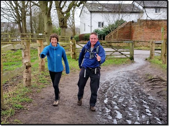
Sue and Martin in Mallorca 2019

Sue and Martin in Mallorca 2019
On the Archduke's Path in Mallorca

Saturday, 27 January 2018

Zillertal Rucksack Route, aka Berlinerweg, Stage 3 – Kasseler Hütte to Greizer Hut (2227m)

2302-Bridge-over-meltwater

Monday 23 July 2007

After the usual cheese and ham breakfast, we had a brief chat with a man from Colorado. He'd packed up his tent after the wind got up in the night and resorted to the hut. He is surprised that he finds no one else camping in the Austrian mountains. (Ed - wild camping is illegal in Austria, since at least 2010.)

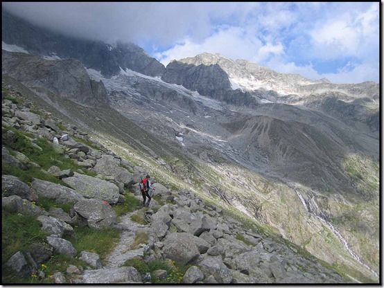
At 7.55, we set out in a stiff breeze, wearing fleece and gloves. Path 502 forms an arc around the end of the valley, and even the boulder fields are paved with flat boulders. There is a small amount of cloud on the tops, but as the day progresses, the wind clears it. Streams flow down from the glaciers, and there are wooden planks with handrails (see above) which are bouncing in the wind. Gaiters were useful as we stepped across rocks with water pouring down.

Large Flowered Leopardsbane near the start of the walk

2306-Large-Flowered-Leopardsbane-Doronicum-grandiflorum

The view ahead

2307-The-onward-path

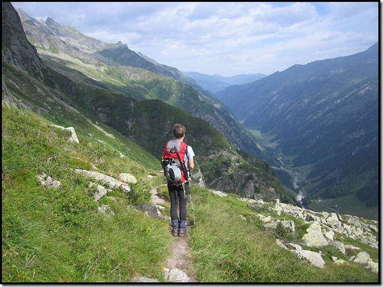
Views across the valley to yesterday's route were clear, and the Ahornbahn cable car station could be seen at the end of the ridge. Lots of leopardsbane and ox-eye daisies.

2310-View-North

Looking towards Stillupgrund

2315-Stillupgrund

Heard rock fall, and just caught a glimpse of the culprit - rock pouring down the end of a glacier.

Following a nicely paved section through a boulder field, we descended to a precipitously steep section which was wired and also had a fence. Much round-leaved saxifrage here. After one more stream with a wooden bridge, we started the long climb to the col.

The slope was wide and green as we wound upwards. Had a break where path 518 meets ours, then continued climbing over progressively more rocky ground, with the wind increasing in strength. Saw two people coming in the opposite direction - the only ones passed today.

2317-Precipitous-path

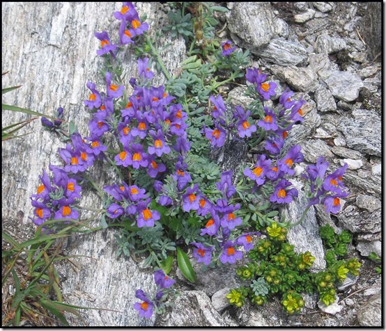
Alpine Toadflax

2319-Alpine-Toadflax-Linaria-alpina

A fleece was needed over the col - the wind was strong and cold. Nice views to adjacent rocky summits, and across the next valley to the glaciers.

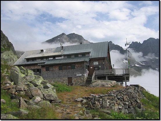
Highest point of the day - Lapenscharte at 2701 metres, with Gigalitz – 3001m – towering above us.

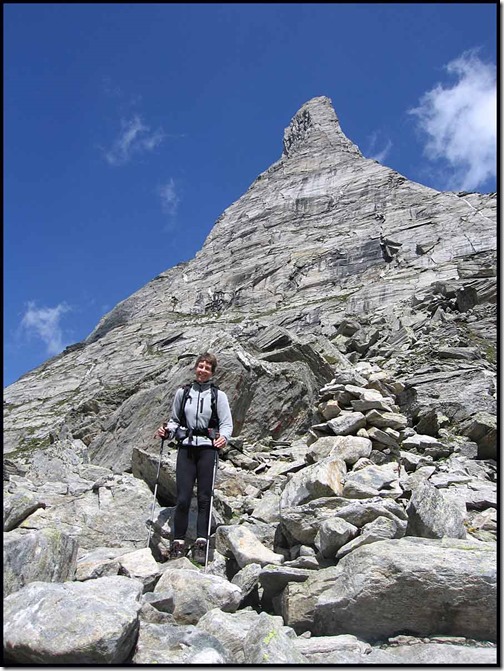
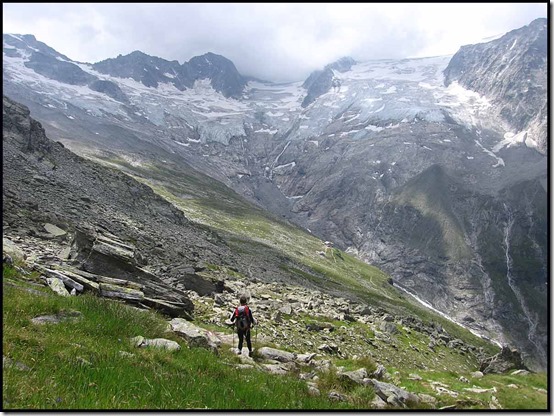
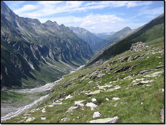
2320-Sue-at-Lapen-Scharte-with-Gigalitz-3001m2323-SueNow, the descent to the Greizer hut at 2227 metres. Good views down to the hut (can you spot it in the next picture?) and valley, and across to the ridge and glaciers.

2325-approach-to-Greizer

Arrived at 12.25 - quick check-in as the hut was busy with day visitors. We are in a room for 6 on the second floor.

Installed ourselves at a corner table with nice views and enjoyed goulash soup (S) and cheese omelette (M).

An afternoon stroll from 2.30 to 4.00 took us above the hut to get a closer look at the glaciers and down the valley. High point 2240m. Sunny, but a cold wind. We were alone again, apart from 5 goats.

Sue

2327-View-to-Ginzling2329-Martin-above-GreizerThen a return to the cosy hut, where I continue my editing of Allan Hartley's inaccurate guidebook.

Manfred is here, plus a couple of others from last night. We join him for dinner, as the wind gets up again, rattling the windows.

Manfred tries to reassure me - "You don't start to slow down until you are 65." He is 67 and I am 58. I try to take his comment to heart and forget about what I have been feeling since the age of 50 or earlier!

There are two horses outside - used to bring supplies up the valley to the hut. We are warned about having to sleep with the horses if allocated to the 'Winteraum'. (Luckily the hut is not full tonight.)

Pigs: Martin 3: Sue 1.

Martin

Here’s our route – about 9 km with 900 metres ascent.

2399route

I’m using Viewranger software to display these maps. I’ve not worked out how to place arrows at kilometre intervals on the maps, nor how to change the colour of the route line from red. Any ideas?

Back to Index
Stage 4

Friday, 26 January 2018

Zillertal Rucksack Route, aka Berlinerweg, Stage 2 – Edel Hütte to Kasseler Hütte (2177m)

2201-Goat-by-Edel

Sunday 22 July 2007

Last night we enjoyed a lovely sunset at Edel Hütte after some beers and a nice meal. Book reading followed - I've got 'Love over Scotland' by Alexander McCall Smith, and Sue has John Grisham's 'The Innocent Man'. But by 9pm we are in bed. In our dorm for 6 people.

Sleep well. Up at 6.45. Breakfast at 7.00. Leave at 7.45. But it's a cloudy day. We are in cloud. So we look down to the flowers. There are many.

Such as this Alpine Sow Thistle.

2222-Alpine-Sow-Thistle-Cicerbita-alpina

We have Allan Hartley's Cicerone Guide (2003 edition) 'Trekking in the Zillertal Alps' and discover it has route errors. [There’s a second edition published in 2013 that may correct some of these errors.] The route would be easy to do with just a map, and perhaps less confusing. Anyway, I've just spent 45 minutes marking up the book with red ink. Suffice to say, the route to Kasseler Hütte, 80 years old this year, undulates gently over a distance of about 12 km (850 metres ascent), crossing 7 or so ridges off the main mountain chain of which we have come down the western flank.

Soon we catch up with Manfred, from Cologne, who speaks some English and is on our route. We take 6½ hours, compared with the 9 hour standard time, which Manfred is closer to. The path is excellent but does have short aided sections and the small and large boulder fields that characterise this area.

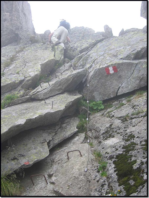
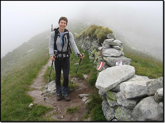
Path 519 signs on white plaques, and yellow signposts, occasionally supplement the frequent red and white paint markers. Some of the wires have recently been renewed and path 519 is currently in superb condition. Much easier than some of our recent Dolomitic paths.

We started past some friendly brown goats that live near (or at) Edel Hütte and are of the domestic variety. I saw a vole, and Manfred saw a salamander. We all saw robust and friendly sheep. And lots of flowers (see list below).

Martin reaches Popbergneider 2448m.

2203-At-Popbergneider-2448m

Stemples up to Sommerschartl.

2209-Stemples-up-to-Sommerschartl

Sue at Norfertensmauer - 2277m.

2211-Sue-at-Norfertensmauer-2277m

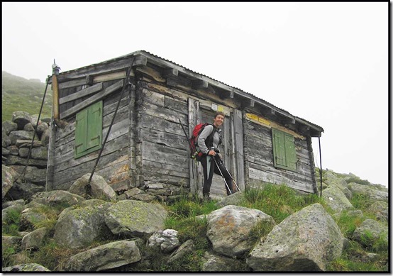
The two bed bothy at Madereggalm.

2213-The-Two-Bed-Bothy

By 10.30 the cloud was thinning, but we were getting wet legs from the grass, so gaiters were on. I quickly went to t-shirt - the RAB Vapour Rise fleece is far too hot, but Sue stayed fleeced all day. We saw nobody other than Manfred - there were just the three of us on this path today. Soon we dropped below the cloud base at 2200 metres and stayed below it until we finished in cloud at 2.15.

There are good views down the valley to Stillupgrund, and back along our route, even though the peaks were in cloud.

2218-View-with-Stillupspeicher

We are greeted by a friendly guardian at Kasseler - we compare Crocs - hers are jewelled!

2225-Kasseler-Hut

We are soon tucking into cups of tea (free with teewasser, and our own tea bags) and soup with frankfurters.

My right knee twinged a few times today but seems ok. Sue's boots and new Osprey Atmos 50 rucksack are potential problems, but seem ok for now.

Allan Hartley's book is a big disappointment. Not really necessary for this simple route, and surprisingly inaccurate. But it does have useful peripheral information.

The rain starts, gently, after we arrive, but the mountains are clearing. It's a friendly hut with about 20 in residence tonight, mostly having stayed here last night, or come from the valley today.

Martin

Beers were ordered around 4.30, and we relaxed in the cosy dining room reading and playing dominoes. We ate with Manfred at 6.00 - spaghetti arrabiata, and follow it with another beer. Chatted till bedtime around 9.30pm. We are on the bottom row of a bunk for 10 people. It's not full, but could sleep 40.

Not too disturbed - just a couple of snorers.

Dominoes: Martin 1 : Sue 0.

Sue

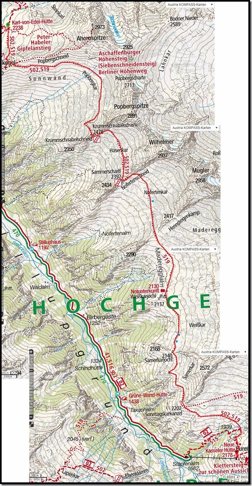
Here’s our approximate route – 12 km, 850 metres ascent.

2299route

Zillertal flowers identified on this trip

Adenostyles
Alpenrose
Tofield's Asphodel
Bedstraws (various)
Bearded Bellflower
Clustered Bellflower
Harebell
Alpine Birdsfoot Trefoil
Alpine Bistort
Great Burnet
Buttercups - various
Bladder Campion
Moss Campion
Nottingham Catchfly
Pink Cinquefoil
Brown Clover
Mountain Clover
Red Clover
Common Cow Wheat
Meadow Cranesbill
Ox-Eye Daisy
Alpine Eyebright
Common Eyebright
Dwarf Eyebright
Alpine Forgetmenot
Fox and Cubs
Field Gentian
Spotted Gentian
Spring Gentian
Golden Rod
Mountain Hawkbit
Large Flowered Houseleek
Mountain Houseleek
Common Kidney Vetch
Alpine Lady's Mantle
Large Flowered Leopardsbane
Martagon Lily
Ling
Milfoils (various)
Black Vanilla Orchid
Common Spotted Orchid
Fragrant Orchid
Black Rampion
Round-headed Rampion
Raspberry
Common Rockrose
Sticky Sage
Musky Saxifrage
Round-leaved Saxifrage
Yellow Mountain Saxifrage
Mountain Sheepsbit
Alpine Sow Thistle
Spiniest and other Thistles
Wood Stitchwort
Mountain St John's Wort
Biting Stonecrop (and other Stonecrops)
Alpine Toadflax
Tormentil
Mountain Willowherb
Rosebay Willowherb
Yarrow
Yellow Rattle

Back to Index
Stage 3

Thursday, 25 January 2018

Zillertal Rucksack Route, aka Berlinerweg, Stage 1 – Mayrhofen to Edel Hütte (2238 metres)

2101Mayrhofen-from-Ahornbahn-CC

Saturday 21 July 2007

Yet another wonderfully cloudless morning in the Dolomites! (That trip diary may be digitised at some future date.) Gary and Jenny packed to return to Venice and their flight home. Julia was walking, to fly back from Venice tomorrow, and we were packing for our hut to hut backpack.

The other three left, leaving us with gear resembling a car boot sale! And it was getting hotter all the time.

Eventually, we departed from our second home - the campsite at Colfosco - after another good week in the Dolomites, at 10am.

The journey was a slow but scenic one. First, to Dobbiaco, then east into Austria and green valleys. At Lienz, we headed north, avoiding the traffic queue through the centre.

The road climbed as the last one had descended. A river in the valley clearly provided opportunities for kayaking and rafting. At Mittelsee, another turn, and some smaller, twisty roads before we joined the main road again.

Stopped for lunch at Gasthof Neuhof, just off the main road. The wait, in the shade of a large umbrella, was worthwhile and we enjoyed nice salads, hitting the road again at 1.50pm.

Finally, a left turn into Mayrhofen, and a long queue. It was 3pm by now and we needed to get the cable car up to walk to the first hut!

The heavy traffic was due to some event in town, but, in the heat, we arranged to leave the car at the cable car station, and went to find a weather forecast.

The Tourist Information eluded us, but was finally discovered below the church, near Europahotel.

The forecast was acceptable for our plans, so we bought tickets for the cable car and were soon whisked out of the valley on the Ahornbahn cable car, from which the top view is pictured, leaving fields of cars and spreading campsites far below us. It was a relief, 6½ minutes later, to emerge to cooler air.

We shared the remaining melon on a newly constructed picnic table, then set off.

2103-Just-before-we-start

Our objective is just to the left of Sue’s head in the next picture.

2105-Path-to-Edel-Hut
2106-Edel-and-Ahornspitze-2973

The path was nicely graded, and the slopes displayed flowers of blue and lilac shades. It took just 50 minutes (guide time 1.5 hours) to reach the Edel Hütte (2288m), and our bed for the night.

On the way we passed this rubbish cairn. In 2008 we met one of its originators in Scotland and we have enjoyed frequent encounters with him ever since!

2107-Rubbish-Cairn

We share a room for 6, but have a nicely dark corner. A beer on the balcony goes down well, then we move into the cosy, sunlit dining room, as the cool breeze gets the better of us. We aren't sure of the dining arrangements/etiquette, but we order 'Bergsteineressen' for two, and we enjoy potatoes, ham and egg, with beans in vinaigrette.

2111-Sunset-with-Hut

Text messages from Mother and from Gary, now back at home, confirm that the UK is still blighted with rain.

Sue

So, that was Sue’s diary entry for 21 July 2007. Here’s the route we took – about 4 km with 400 metres ascent. A gentle start to a lovely route.

2199route

Back to Index
Stage 2

Monday 22 January 2017 – A Walk to Dunham, and a parkrun update

2202dunham2

You haven’t missed anything. We haven’t been out very much at all, in an effort to recover from the chest infections that took their toll at the start of the year. Apart from one glorious spell whilst we were confined to the house, the weather hasn’t been that good either.

JJ has also been afflicted by an assortment of infections, but, feeling a bit better on Monday morning, he decided on a gentle stroll to Dunham Massey. Luckily, Sue and I were both available to join him at very short notice, and by 11.30 we were waiting above the canal on Timperley Bridge, with the view that heads this posting stretching towards Altrincham. In common with quite a few former industrial sites bordering the canal, Nelson House – on the right of the picture – is being converted from an office block to apartments.

It was a dull morning weather wise, but free of rain and a very welcome burst of fresh air, albeit the towpath beyond the increasingly derelict Bay Malton pub was extremely muddy. We wondered when the Bay Malton to Lymm section will be resurfaced?
We left the canal at Little Bollington and crossed the Bollin by the weir. The river is quite full at present, and the fields bordering the track to Dunham Massey are good for the waterfowl that visit at this time of year.

2203dunham3

Sue and JJ were in a rush for coffee.

2204dunham4

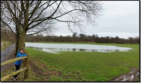
Whilst JJ ploughed through the ankle deep mud that spanned the track, Sue and I found a convenient fence!

2205dunham5

The National Trust café provided welcome filter coffee and hot milk, and JJ surreptitiously produced an assortment of excellent cake and scones.

Then we strolled over the golf course to the noise and bustle of the A56 road and Altrincham’s improving town centre. JJ and Sue walked back to Timperley Bridge by a more direct route, whilst I sourced dinner and got the tram to catch up with them.

Here’s my route – 12 km with less than 100 metres ascent, in about 2.5 hours plus breaks. Thanks to JJ for stimulating this little outing.

2299route

A parkrun update.

Our convalescence has involved a couple of very gentle parkruns at Wythenshawe. The one on 14 January, using the ‘Bow Tie’ course, was very muddy. Neither Sue nor I could keep up with the 30 minute pacer, and I was totally spent at the end despite being nearly ten minutes off my best pace.

A week later we were both a couple of minutes quicker, and not so tired afterwards, on another very muddy morning. ‘Muddy passage’ which was resurfaced and lost its ‘label’ for a while last year, lived fully up to its name, having deteriorated to an ankle deep slurry of mud and horse droppings.

I’ll take a picture next week if I remember.

The usual melee at the end of the run is shown, below a rare image of Michael, whose birthday is within a week of mine, so our ‘age-related’ results are always in the same category. Michael has normally finished and is on his way home by the time I trouble the time keepers, so it was a surprise to pass him at the end of the first lap. It turns out that we both have hamstring injuries, but currently his is worse than mine. I hope you can get back to full fitness and your 250th parkrun soon, Michael.

2002parkrun22004parkrun4

The Zillertal Alps

I’ve not been completely inactive whilst confined to the house, and the next series of postings results from a re-visit to a diary from 2007, shortly before the commencement of this blog. So I’ve digitised the entries and will reproduce them here for a trip to the Zillertal Alps where Sue and I completed a week long hutting trip from Mayrhofen. For anyone seeking an easy hutting trip in Austria, the route described in the diary that will follow this entry deserves serious consideration.

This posting may be a bit messy as I'm getting "The remote server returned an error: (500) Internal Server Error." when using Open Live Writer, so I've had to resort to the cumbersome 'Blogger' software. And it takes ages...

Now, a day later, Open Live Writer has returned to life so I’ve replaced yesterday’s posting – it’s the images that cause the problem, the text posts ok. Using Blogger, the images on the blog are very low resolution, but if you click on them you get a much clearer picture, whereas in OLW the images on the blog are better, but they only improve a little when you click on them. Ho hum. But migration to Wordpress, which may be a better platform, looks really tricky.

Thursday, 18 January 2018

Wednesday 17 January 2018 – Dream

1716dream9

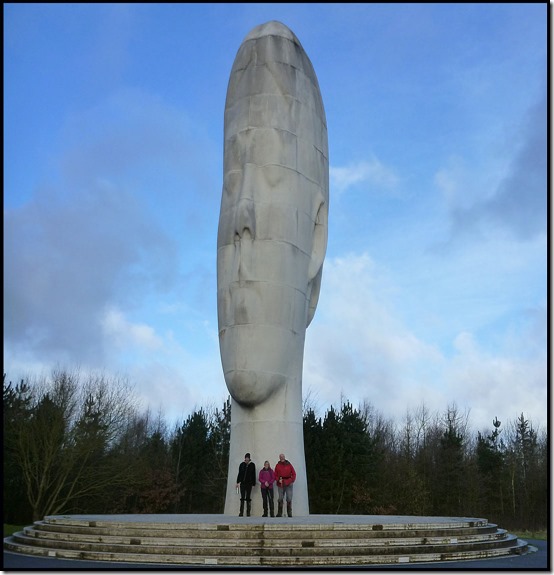
Dream, installed in 2009, is a sculpture and a piece of public art by Jaume Plensa in Sutton, St Helens, Merseyside. Costing approximately £1.8m, it was funded through The Big Art Project in coordination with the Arts Council England, The Art Fund and Channel 4.

In 2008 St Helens took part in Channel 4's "The Big Art Project" along with several other sites. The project culminated in the unveiling of Dream, a 20 metre high sculpture located on the old Sutton Manor Colliery site.

St Helens retains strong cultural ties to the coal industry and has several monuments including the wrought iron gates of Sutton Manor Colliery, as well as the 1995 town centre installation by Thompson Dagnall known as "The Landings" (depicting individuals working a coal seam) and Arthur Fleischmann's Anderton Shearer monument (a piece of machinery first used at the Ravenhead Mine).

The council and local residents (including approximately 15 former miners from the colliery) were involved in the consultation and commission process through which Dream was selected. The plans involved a full landscaping of the surrounding area on land previously allowed to go wild after the closure of the pit.

Dream consists of an elongated white structure weighing 500 tonnes, which has been cast to resemble the head and neck of a young woman with her eyes closed in meditation. The structure is coated in sparkling white Spanish dolomite, as a contrast to the coal which used to be mined here.

Jaume Plensa himself stated "When I first came to the site I immediately thought something coming out of the earth was needed. I decided to do a head of a nine-year-old girl which is representing this idea of the future. It's unique."

The original design of the sculpture called for a skyward beam of light from the top of the head, and the sculpture's working title was Ex Terra Lucem ("From the ground, light"), a reference to St Helens' previous motto. Due to objections from the Highways Agency, the sculpture was not lit, but in 2010 a new planning application was submitted to St Helens Council for it to be floodlit.

The Dream sculpture is built out of moulded and cast unique concrete shapes, 90 pieces in all contributing to over 14 tiers (54 individual elements for the head, each weighing 9 tonnes (8.9 long tons; 9.9 short tons)). Dolomite was utilised as a concrete aggregate in order to provide the brilliant white finish. Additionally titanium dioxide was added to the mix in order to provide a self-cleaning mechanism. The construction required the construction of individual moulds for each piece and took a total of 60 days to cast.

The foundations of the sculpture extend 125 feet (38 m) into the ground with 8 piles driven in to secure it.

The sculpture is sited on an old spoil tip of Sutton Manor Colliery which closed in 1991 and it overlooks the M62 motorway.

I’ve borrowed all that from Wikipedia. The Dream sculpture was the focal point of this week’s mid-week stroll, kindly arranged by Keith on this occasion. I’d not been to the Dream before, and it was installed after my frequent trips to and from Liverpool via the M62 had come to an end.

Here’s today’s ‘selfie’.

1703group

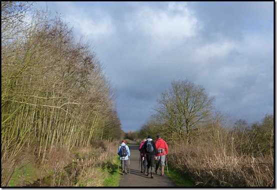
After a bit of urban walking from our parking spot at the end of Norland’s Lane, a good path led to the track bed of the St Helens and Runcorn-Gap Railway that operated from 1833 to 1982.

1705railway3

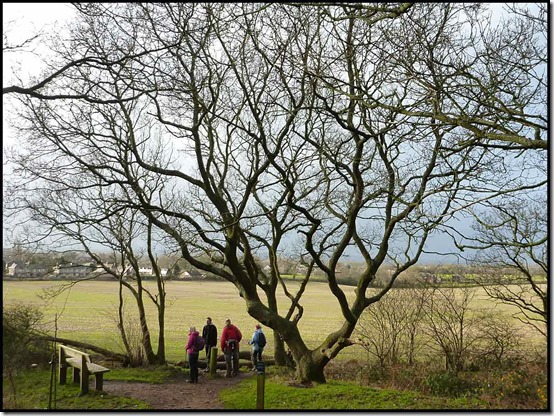
A well used path then led to the summit of the knoll, actually an old spoil tip, on which the sculpture is situated. We lingered for some time as the sun dodged in and out of some black clouds.

1712dream51715dream8

Eventually a large group of walkers arrived to admire the sculpture, which is looking a little tired after nine years of strong westerly wind and rain. So we left, in what was the brightest weather of the morning.

1717dream10

The only flowers in evidence were the bright yellow of some gorse, but there were also lots of these teasel seed heads.

1719teasel2

We continued along the pleasant route devised by Keith, pausing to admire a hunting kestrel and a majestic buzzard. Bird watchers would find plenty of interest hereabouts.

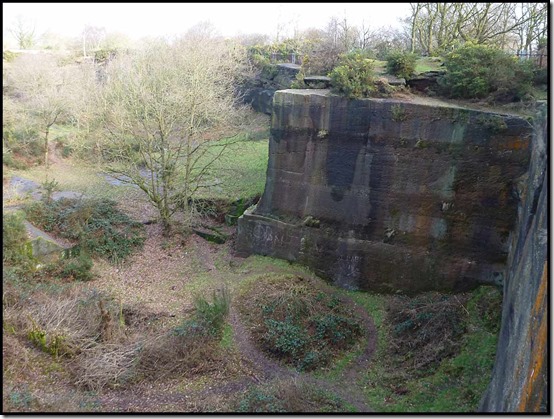
The walk ended a little beyond Pex Hill, a small nature reserve and magnet for dog walkers, which incorporates an old quarry that might provide the youth of Merseyside with their first experiences of rock climbing.

1721pex11723pex3

Here’s our route, from the good parking spot at the end of Norland’s Lane – 12 km with about 100 metres ascent. It took us 2.5 hours plus breaks.

1730route

Thanks to Keith for organising this, my first proper exercise since New Year’s Day, thanks to an annoying cold and subsequent chest infection.

Monday, 15 January 2018

Keen Men’s Targhee II Walking Shoes – Long Term Review

0808keen8

My first acquaintance with this shoe was in April 2011, when I was supplied with a pair for review back in the days when a few retailers felt that reviews from outdoor bloggers, in return for FOC products, might help their sales.

I duly earned my crust by writing a comprehensive review of these shoes, which together with all the relevant technical data, can be found here.

Since then, I have updated the original review and I am now on my third pair of Targhee II shoes. Unusually, Keen seem to have stuck with this product without ‘developing’ it, which must be some sort of tribute, in my mind.

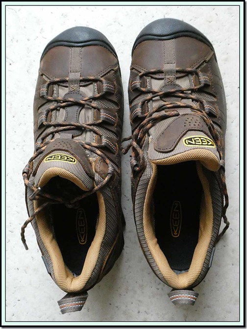
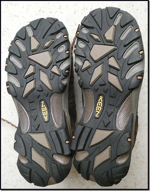
The first three pictures in this posting are of this third pair, bought recently on-line from Mastershoe in Trowbridge for £89.

0809keen90810keen10

Meanwhile, the original pair that was reviewed back in 2011 was ‘replaced’ in 2015 by a new pair bought at MEC in Ottawa (when exchange rates were more favourable than they are today). Those shoes, pictured below, were bought for the purpose of trekking 900 km across the Pyrenees on GR11 (the Spanish route).

0805keen50807keen7

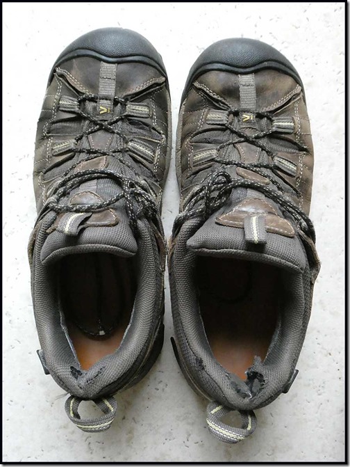
GR11 hardly dented the shoes, which I have continued to wear until the recent purchase from Mastershoe. They have now done 2400 km and are still going strong, but will now be used mainly for mountain biking. The waterproof membrane and the lacing system have remained intact, the main source of wear being on the soles and (shown below) the fabric in the heel area. That won’t have been helped by the frequent removal of the Salford insoles that I use. These are a tight fit and need to be removed to air the shoes properly.

0806keen6

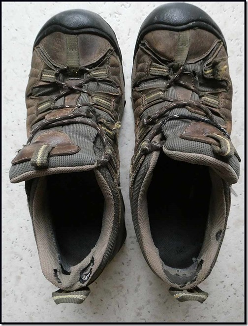
The final four pictures – below – are the last you will see of the original shoes from 2011. These have been worn for mountain biking in recent years, but before that they did clock over 2500 km (1560 miles) of use as trail walking shoes. The main source of wear was the fabric lacing system, and extra holes had to be made to thread the laces. This wasn’t really a problem, nor was the wear on the soles, for use as mountain biking shoes.

0801keen10803keen30804keen40802keen2

As you can see from these pictures, and given that these shoes cost me nothing in the first place, the shoes were pretty worn and owed me nothing, so after these pictures were taken they were recycled, albeit with reluctance.

I’ve noticed a comment on my original review, suggesting that the quality of some Keen products has deteriorated since then. In the case of these shoes, the second (newer) pair seem if anything to be more durable than the original pair. Remarkable, in fact, as the GR11 route was demanding on the shoes, and my track record for both Asolo and Scarpa three season walking boots is that they last for about 2000 to 2500 km, if anything less than these trail shoes.

Conclusion

This is my last review of these shoes, and I’m unlikely to review any other trail shoes as I can’t really imagine that I’ll find a better product. So as long as you can get them to fit properly using a suitable insole, heel cup, etc, I wholeheartedly commend this product.