Sue and Martin in Mallorca 2019

Sue and Martin in Mallorca 2019
On the Archduke's Path in Mallorca

Saturday, 27 November 2010

Saturday 27 November 2010 - XXL Team Conquers Creag nan Gabhar

I'm here in Braemar for the XXL (Aberdeen/BP Hillwalkers) Club Annual Dinner at the Fife Arms. [Not that I'm currently a member, nor have I ever worked for BP or lived any closer to Aberdeen than Teesside.]

It's traditional for some to arrive a day early and go for a walk - it is a walking club after all.

So after yesterday's driving - those arriving from Aberdeen encountered snow - nearly thirty of us enjoyed an evening in front of the Fife's roaring fire. Until we were elbowed out by the Golf Club.

I also enjoyed a pleasant hour or two chewing over backpacking routes old and new with TGO Challengers Doug and Richard, who braved a snowstorm to reach the Fife from their respective homes.

We woke to more snow this morning. Apparently all roads to Braemar were closed. So why did a couple of buses arrive from Aberdeen whilst we were breakfasting?

Various walks were planned. Nine of us elected for the longest of them, Creag nan Gabhar, a Corbett to the south. Others would tackle closer objectives.

Laurence, sadly, faltered on the starting blocks and was disqualified by virtue of his non-appearance. That left me, Mark, Ian, Gus, Margriet, Paul, Jerry and Dave strolling up the road past the golf course shortly after 10am. The fresh snow glinted under the low sun on the branches of the trees on the walk to Auchallater (top picture).

The going got harder as we ploughed through deep snow to reach the track that leads to Lochcallater Lodge, a haven for TGOers in May (but deserted today). Why did I leave my snow shoes in the spare bedroom at home? They would have been ideal for today's knee to thigh deep snow.

A dark black cloud developed over Braemar, but the sun illuminated our pause for elevenses (bottom picture).

As we left the snowy track to ascend the rough hillside towards Sròn Dubh, Paul peeled off as planned, in favour of an easier outing.

A little further on, as the first flakes of a snow shower dampened his trendy sunglasses, Gus declined to continue, perhaps distracted by the stress of having to guide a timid driver (his bus shy wife) from Aberdeen to Braemar.

That left six of us on the long plod up the ridge in deep snow to the 834 metre cairn that tops Creag nan Gabhar. Mark and Margriet surveyed the surroundings. The rest of us had been there before (four times in Dave's case). It looked to me much as it had done on my previous visit (5 January 2005) - snowy, cold (minus 7C), and with a limited view due to its incumbent snow shower.

It had taken four hours. Time for lunch - in the coldest, highest, most exposed point of the entire walk. My phone rang; too deeply buried to be answered, but I guessed correctly that the next part of this trip had been abandoned.

We debated whether to descend to the road, but by consensus decided to retrace our steps, literally, to Auchallater, from where we would stroll down the road, across the golf course, and back to the Fife for 4.30, just as darkness was falling.

On the way we encountered grouse, deer, and a couple of cross-country skiers (I wish...!).

It was a nice walk despite the absence of much needed snowshoes, a satisfying 20 km with 700 metres ascent in 6.5 hours, featuring Deep Snow.

Now for the annual bash - it's time for cocktails.

Oh, and my trip to Poolewe tomorrow has been abandoned due to snow on the west of Scotland that has foiled a brother and his wife in their bid to reach Poolewe today (that was the lunchtime phone call). A shame, but Sue is pining for her catering staff to return, so it seems I will be welcome at home.

May try to pop up something on the way home tomorrow...

Sent using BlackBerry® from Orange

Friday, 26 November 2010

On The Road Again

This morning's warnings of dire traffic conditions would work in my favour, I was sure.

And so it turned out. The wintry cloud over Manchester soon dispersed, to be replaced by bright sunshine as I travelled up the M6, past the frosted Howgills.

Further north, Cross Fell sported a sprinkling of snow on this cold day - the temperature having fluctuated between minus 3C and plus 3C by the time I reached my second refreshment point in Carlisle.

Beyond that, the border posts were deserted and there was virtually no traffic on the M74 motorway (upper picture) as it threaded its way through the much warmer Southern Uplands towards Glasgow.

Roadworks around Cumbernauld permitted a long glance at an impressive silver lady who now graces the western embankment. Quite a distraction really; perhaps the 40mph speed limit should be made permanent?

I'd originally planned to break my journey by nipping up nearby Lendrick Hill or Dumyat, but given the dire warnings and the information that several roads were closed, I pressed on to reach my destination in daylight.

After I'd dodged some kamikaze pheasants, the light began to fade at Blairgowrie. The temperature plummeted and there was evidence of a sprinkling of snow. By the Spittal of Glenshee the snow was deeper, and beyond that the road stretched ahead over the Devil's Elbow (lower picture) like a black thread on a white fleece.

It was blowy up there. Beyond the summit of the pass a thin covering of spindrift rendered that black thread white, well disguised on its white background! Unlike the hundreds of red deer that had assembled near the road. 'Not so easy after dark' I thought, as I pulled up outside Braemar's Fife Arms shortly after 4pm.

Sent using BlackBerry® from Orange

Last Leaves / First Ice

The Bridgewater Canal, Timperley, 25/11/10

The Bridgewater Canal on Thursday.  Sadly I missed both the sunshine and the dancing ducks, but the transition from autumn to winter is clearly taking place.

The full transition may be experienced tomorrow.

Wednesday, 24 November 2010

Tuesday 23 November 2010 – The Langdale Pikes, The Greater Traverse, including a variant of Great British Ridge Walk, Number 13

Lunch on Pike O' Stickle

I was due to pick Rick up at 7.15.  The alarm rang at 6.30; Sue woke, assumed I had left the bed, and went back to sleep.  I didn’t hear the alarm at all, but woke with a jolt at 6.59.

Somehow I managed to be only 5 minutes late at Rick’s house, and we made it up to our rendezvous point in Lancaster a couple of minutes before Stuart pulled in to collect us for the onward journey.  He had Peter and Richard with him, but the Jeep fitted us all comfortably.

The day’s plan was to walk Bill Birkett’s route ‘LAN5’ – The Greater Traverse of The Langdale Pikes, featuring nine ‘Birketts’ and six ‘Wainwrights’, not to mention seven ‘Lakeland 2000ers’, for those who count such things.

We started up Stickle Ghyll at 9.50am, at something of a sprint that left Richard searching from time to time for more lung capacity.

Approaching Stickle Tarn from Stickle Ghyll

An icy north easterly wind greeted us at Stickle Tarn, but we soldiered on and enjoyed the easy east ridge of Pavey Ark.  As we ascended, the ground became increasingly slithery due to a veneer of grease that could just as well have been ice.  In fact it turned to ice as we neared the summit.

We had decided against tackling Jack’s Rake, and those who did go that way seemed to be taking their time in today’s greasy conditions, so our easier route was a good call.

After stumbling around on the lumpy rocks of Pavey Ark’s broad summit, we headed off to gain Thunacar Knott’s easy summit.  The cloud base had been lurking just above our heads and had indeed obscured some views – mainly those towards Bowfell and the Scafell range – so we were pleased when it lifted a little, gracing us with sunny periods for the rest of the day.

Our highest point of the day, Harrison Stickle, came next.  Its summit rocks sported an icy rime.  We slithered some more before heading off to climb Thorn Crag.

But none of us was sure where Thorn Crag was.  I think we concluded that it was the small lump on the left of the picture below.  If so, we missed it, as we descended directly from Harrison Stickle to the heathery hollow.  Then we traversed the entire ridge from the centre of the picture up to Pike O’ Stickle, from where the picture was taken.  I now think the first of those summits may be Thorn Crag, after which we met a couple who had traversed below it on their way to the loftier summit of Loft Crag, seen here to the right of the picture.

Looking back to Harrison Stickle from Pike O' Stickle

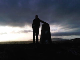
It had taken three hours to reach the top of Pike O’ Stickle, and we were pleased to find a sunny position on the summit (pictured at the head of this posting) that was sheltered from the wind and afforded excellent views.  Rick was particularly happy to have made it – his dickie shoulder had not appreciated the vertical variant route chosen by Peter and Richard!  Our eyes were however particularly drawn to a figure that was half way up the sheer face of Gimmer Crag, pictured below in the distance.  The figure failed to move during our tenure at the top of Pike O’ Stickle, despite much shouting.  We were worried for the person concerned, but saw no evidence of a rescue taking place.  The jets and trainer planes that buzzed us for a while weren’t capable of hovering.

Lunchtime view from Pike O' Stickle, with Windermere and Blea Tarn

As we moved on across Martcrag Moor the low sun cast a lovely light on Allen Crags and Glaramara and beyond to the Skiddaw summits.  It was a glorious afternoon, with innumerable Lakeland peaks laid out before us.

Heading across Martcrag Moor, with Great Gable conspicuous to the left

Whilst the path hereabouts has been improved, there remain boggy sections that tested our footwear.  It passed the test – I don’t think anyone’s feet got wet.  My new Scarpa Mantas, on just their third outing, were superbly comfortable and supportive – just the job for these conditions.

Stuart adopted a classic pose.

Stuart, in his Russian shepherd's outfit

We reached Stake Pass soon after 2pm, so had plenty of time to enjoy the low ridge that leads over Black Crag and Buck Pike to Rossett Pike, the last of today’s summits.  It wasn’t so icy up here, and there were lovely views down Mickleden, with sunlit Pike O’ Stickle standing as a sentinel above the deep glacial valley.

An afternoon view down Mickleden

A group of four men were the last people we encountered, having seen about 20 others on these hills today.  They were bumbling around in the Rossett Pike/Black Crags area, and eventually descended Rossett Gill, way behind us.  I suppose not everyone is as familiar with this terrain as our little group may have been, but those four men did seem to make hard work of getting off the hills!

We were happy to reach the Jeep at 4.50 pm, shortly before darkness took over.  The Stickle Barn was shut, but we managed a fireside pint and post walk banter in the New Dungeon Ghyll Hotel, before wending our way homewards, deeply satisfied after yet another successful outing.

A full slide show (29 images) is here.

Our 16 km route with 1100 metres of ascent took seven hours and is shown in outline below.  It’s a good one, and would be relatively easy even in winter conditions.

Our route - 16 km, 1100 metres ascent, in a leisurely 7 hours

The header refers to ‘Great British Ridge Walk Number 13.  This is ‘The Langdale Pikes via Jack’s Rake’.  Variants are allowed.  So, as we climbed all the summits and walked the ridge, I think we can say that walk was accomplished.  Jack’s Rake will however be revisited in dry conditions.  It’s a great route that I haven’t been on since backpacking it with Andrew and Gary on 8 June 2005.  Here they are on the route; happy days…

Gary and Andrew on Jack's Rake - 8 June 2005

Sunday, 21 November 2010

Sunday 21 November 2010 - Porth Dinllaen and Penrhyn Nefyn

We are back at home in Timperley tonight after another lovely day on the Lleyn Peninsula.

After parking up at Morfa Nefyn the six of us strolled along the beach (pictured) to Porth Dinllaen, taking care not to step on the stranded jellyfish.

"Are there seals around here?" enquired Jenny.
"I don't know" answered Richard.
"Maybe 'yes'", observed Sue, pointing to a large blubbery mammal that was foraging in some nearby surf.

Circumnavigation of a golf course was then achieved by way of the delightful coast path, with flocks of turnstones, shags, starlings and skylarks in evidence, as well as lone rock pipits and stonechats.

A muddy path led back to a scenic lane (pictured) towards Nefyn, and our afternoon's perambulations drew us on towards luxury residencies of that small town, past a baffled buzzard that had been mugged by crows.

More beach and coast paths found us back at the cars all too soon, after we had rounded the headland of Penrhyn Nefyn in fading light on this last day of our holiday.

Today's was a lovely beach and cliff walk, in beautiful light and with excellent views to the heights of the Peninsula and north to Holyhead Mountain. Curiously, there wasn't a boat to be seen in the vast arc of ocean that was open to our view.

I'll do a brief summary and a slide show next week, if there's time. Meanwhile, thanks go to all who contributed to the enjoyment of our week based in Porthmadog - it was great, we hope to be back soon.

Sent using BlackBerry® from Orange

Saturday, 20 November 2010

Saturday 20 November 2010 - A Great British Ridge Walk - Number 8 - The Nantlle Ridge - from Garnedd-Goch to Y Garn

Today's lingering cloud didn't put us off. By 10.20 we had dropped off a car at Rhymes and had set off towards Cwm Silyn. We soon met a local Ranger who explained how we could have arranged a cheap taxi service had we not had our own transport for this linear walk (details later).

Elevenses were late today - enjoyed after a 400 metre ascent, in the shelter of a wall by the summit of Garnedd-Goch, with fine views over the Lleyn Peninsula. Our own route ahead was obscured by nearby Craig Cwm Silyn, the highest point on the ridge. Snowdon, now free of snow but with an intermittent cap of cloud, shone brightly to the east.

Our traverse of the 6 km ridge commenced with an easy stroll over broken rock to Craig Cwm Silyn, where a bank of cloud provided much entertainment, with Glories and Brocken Spectres in abundance - see previous posting and the comments (thanks Gibson and Paul) - it'll be interesting to see how the 'proper' photos turn out.

The ridge slowly yielded to our slow but pleasurable progress along it. I am prohibited 'on pain of death' from revealing the principal culprit, but until that person mentioned it I wasn't really aware of a laggard other than myself. Anyway, all six of us managed to negotiate the greasy rocks and vertiginous knife-edged ridges with no more damage than brown bummed Rohans.

The whole 11 km episode included around 900 metres of ascent and took us just under 6.5 hours. We finished at 4.40, just as darkness was falling. We had seen about 20 others on the ridge today, all revelling in the excellent conditions.

Anne, Sue and Jenny then enjoyed refreshments at the highly recommended (by that trio) Cwellyn Inn, whilst the rest of us retrieved the cars.

By some miracle we all finished up back in Porthmadog with sufficient groceries and 'medical supplies' to last us the evening. The latter were much needed by a faction intent on monitoring a former politician's progress through an early evening offering from the BBC.

Hic....!

Sent using BlackBerry® from Orange

Brocken Spectre or Glory

There's debate as to which this is ...
... On the Nantlle Ridge this morning.

Sent using BlackBerry® from Orange

Friday, 19 November 2010

Friday 19 November 2010 - Carn Fadryn & Garn Bach

Improved weather brought with it a dilemma. Shall we walk the Nantlle Ridge (a Great British Ridge Walk), or should we continue our exploration of the Lleyn Peninsula?

Lingering cloud and the prospect of a persistent cold wind on the Ridge drew us to the Peninsula, but it was a close call. Ken, Anne, Sue and I enjoyed a short walk to Carn Fadryn, whose 371 metre summit sports a conspicuous yellow trig point, a recent addition to the Iron Age walled hillfort containing stone huts, and a small fort reputedly built by Roderic and Maelgwyn, the sons of Owain Gwynedd in 12thC.

Low cloud over the Peninsula inhibited the views, but the sun shone and K & A, fresh from sunny Portugal, were able to top up their tans.

A peregrine, and then a buzzard joined the ravens in following our progress to the lesser summit of Garn Bach. That proved to be another excellent viewpoint (pictured, with Sue looking to the east).

From here we headed north to a small crag that offered superb lunchtime views, before aiming for a boggy path next to a finely preserved stone wall to the north of Coed Garn Fadryn. This led conveniently to a green lane and back to the car. Just 7 km and 350 metres ascent, taking all of three and a half hours.

We've noticed that whilst most trees in the area have now lost their leaves, a few (not just the firs!) remain virtually untouched by the ravages of autumn. Similarly, most flowering plants have had their day for 2010, but a few - for example, herb robert, red campion, several thistles, gorse and clovers - soldier on, showing a healthy disregard of the season.

We had plenty of time to revisit Plas Glyn-y-Weddw tea room and gallery (see Wednesday's posting), but not before a short stroll along Llanbedrog's sandy beach, where we encountered numerous scallops and an octopus on the tide line, lots of oyster catchers and black-headed gulls, dog walkers and a man with a metal detector who was digging furiously in the soggy sand.

Then it was back to more à la carte cookery in the nearly overflowing cottage in Porthmadog, where R + J arrived later, as planned.

Sent using BlackBerry® from Orange

Thursday, 18 November 2010

Thursday 18 November 2010 - Portmeirion

Today's highlight, given that it was blowing a hoolie on the tops, was a visit to the Italianate village of Portmeirion. Constructed over a period of 50 years by Clough Williams-Ellis, the village is perhaps best known for its pottery and for being the setting for the cult '60s TV series - The Prisoner.

It was Sue's first visit.

Better late than never!

[Mark, and others, I'm glad you are enjoying this series of postings. Sorry to be so brief today. We have now been joined by A and K, and with J and R due to arrive tomorrow I'm afraid that postcards from this small cottage will be brief for the rest of our stay, with further observations and an annotated slide show next week to fill in the gaps.]

Sent using BlackBerry® from Orange

Wednesday, 17 November 2010

Wednesday 17 November 2010 - Mynydd Tir-y-Cwmwd, and the Iron Man

A thoroughly wet morning drew us to overdue domestic chores, albeit whilst watching egrets, goosanders, grebes, a heron and many more birds foraging in the harbour outside our living room window.

However, by lunch time the sun was shining again, so we ventured once more to the Lleyn Peninsula, which according to the map houses lots of excellent short walks.

It was sunny at Llanbedrog, between Pwllheli and Abersoch, and from there we could see that the 'mainland' was engulfed in dark cloud, so heading west was a good call today.

From the beach we headed south east along the shore to reach a steep path leading up a cliff. A barrier blocked our way. The path was shut due to a landslip. We looked around; the place was deserted. So we ignored the sign and climbed easily and safely up the steps to the top of the cliff, where we negotiated another barrier to escape from the closed path, and admired the Iron Man, a sculpture that looks out over a dangerously exposed (but freely available to the public) precipice.

The wrought iron man was a millennium project to replace a Tin Man that had looked out over Cardigan Bay to Barmouth and the Rhinogs since the 1980s.

Continuing along the path and around the headland into a blinding sun, the holiday town of Abersoch and its long sweeping beach came into view. Neither of us had seen Abersoch before. From this angle we didn't feel we had missed very much.

Gradually we progressed around the headland to a position where the low sun was behind us.

This was the signal to turn right and ascend gently to the trig point and cairn that mark the summit of Mynydd Tir-y-Cwmwd, a mere 133 metres in height but commanding views in all directions - west to Abersoch; east to Pwllheli and the mountains extending south from Snowdon along the periphery of Cardigan Bay; north to the Rivals (Yr Eifl and its outliers).

Three people followed us up - we didn't surprise them Mark, unlike the middle-aged couple who we startled the other day whilst they were engrossed in their lunch.

We lingered at this summit (pictured) admiring a Toposcope that confirmed that on a clear day much of Snowdonia is visible from here.

A short descent back to Llanbedrog took us past St Pedrog's Church Hall, home of St Pedrog's Knitting & Sewing Guild, then past the church itself to Plas Glyn-y-Weddw, a dower house built in 1856 by Lady Love Jones Parry. The Gothic mansion became an art gallery and ballroom in 1896 and was served by a horse-tramway from the railway terminus at Pwllheli until 1927. It remains a vibrant gallery, and is one of nine locations that houses the Celtic Neighbours partnership, a group of visual artists from native Celtic communities.

Their art, unlike their tea and cake, was sadly not to our conservative taste.

Sent using BlackBerry® from Orange

Tuesday, 16 November 2010

Tuesday 16 November 2010 - A Great British Ridge Walk - Number 6 - Cnicht and Moelwyn Mawr, The Cwm Horseshoe

The large car park at Croesor was empty when Sue and I arrived at 9.30am this morning.

But there were vocal residents in the form of flitting sparrows, chirpy robins and tweeting tits.

The route up Cnicht (pictured) from here requires no description. From this direction the 689 metre summit justifies its 'Matterhorn of Snowdonia' tag. It's a straightforward hour and a half's stroll, with ever more expansive views and some very easy scrambling up the final slopes to the airy summit.

The sun was bright; as we strolled along the easy ridge, with improving views across to snow-capped Snowdon, we pondered today's breakfast TV's 'happiness' survey. 5.3 out of 10 was (I think) the average, but hey - it was carried out before 8am - it must be skewed...

Our average was 8.5, marked down as a result of cloud on Snowdon's summit, and problems with our shadows invading our nicely framed images.

Half an hour beyond the summit, a cairn alerted us to a thin path to the east that snaked its way for fifty minutes or so over occasionally boggy ground to the abandoned quarry of Rhosydd. This occupies a huge area and has one wondering about what the place must have been like in its heyday.

I felt a 'Jim Perrin Moment' coming on, and scratched fervently in my notebook (edited out of this report!) during our lunch break at the top of the tramway incline behind the quarry buildings.

The route up Moelwyn Mawr is simple from here. There are no technical difficulties and the walker is afforded many excuses to pause whilst the whole of Snowdonia gradually appears on the wide horizon, with Cnicht now in Snowdon's foreground.

A thin veneer of ice below the 770 metre summit required care, and served as a reminder to stash my Yaktrax crampons in my day sack as a precautionary measure over the winter months.

We lingered on the summit, spotting seven walkers on Cnicht's fine ridge, the only people seen all day. From here, an easy knife edge then grassy slopes lead down the WSW ridge of Moelwyn Mawr, along Braich-y-parc, to join the road to Tan-y-Bwlch near a gate on the edge of Croesor.

The 12km walk with 930 metres ascent took us just over five hours.
It was a lovely little excursion in great weather.

Sent using BlackBerry® from Orange

Monday, 15 November 2010

Yr Eifl and Tre'r Ceiri

After settling in at the cottage and enjoying a stroll into town, Sue and I packed a flask and a buttie and set off along the Pwllheli road.

At 564 metres, Yr Eifl is the highest point on the Lleyn Peninsula. It's a short excursion, suitable for a winter's day with a late start.

We parked in the spacious car park at SH 353 440, virtually empty today but perhaps busy in summer.

A stony track led easily towards the top of Bwlch yr Eifl, before which we headed up by a wall to some disused buildings (where we surprised a couple) and on up steps to a transmitter mast. Turning left at the perimeter fence, we soon found an excellent path carved out of the rocky crest of the hill. This brought us up to a cairn at 444 metres that commanded a fine view over the Peninsula, across to Anglesey, and inland to snow-capped Snowdonia, where the mountains sat below a deep blue sky.

Our own local weather was more problematical. After lunching in a disused building carpeted with sheep poo, we set off into the cloud that had been skirmishing with Yr Eifl all day. A storm arrived to test our newly proofed waterproofs. The sleety rain was thick and cold. Even the crows were cowed into silence. But not the aircraft of the RAF, training for missions in far off lands.

On the summit we found a chap with a camera, looking for a café. He headed down. The cloud had cleared just as we arrived, giving us more fine views. A stroll over rocky terrain led us to the magnificent Tre'r Ceiri (Town of the Giants). This is an Iron Age hill fort built on a long, narrow summit at around 485 metres. It covers 2.5 hectares (big) and is encircled by a massive dry stone wall rampart that's about 3 metres high. The fort houses about 150 round stone huts. It pre-dates the Roman invasion of Wales in AD 78 and it was used throughout the Roman occupation, eventually being abandoned in C4 AD.

There was sunshine and shade up there today, and with more showers approaching it was hard to get a good picture. Today's image was taken from the fort, but however closely I look at it I can't see the huge waterspout that was featured on today's local news, and was pictured within a very similar view.

A pleasant heathery path took us over the rocky outcrop of Caergribin (more fine views) and back to the car after 8 km, 500 metres of ascent, and 3 hours of exertion.

In the car park, our friend with the camera confirmed that he had found the café. I wonder whether he saw the waterspout.

Sent using BlackBerry® from Orange

A Room With a View

This is the view from our living room for the next few days.

Maps and currency have been purchased and coffee and CCS has been savoured at leisure. It has been a lazy morning, but boots are now being donned for a short venture into Showell Styles country.

Sent using BlackBerry® from Orange

Saturday, 13 November 2010

Wednesday 10 November 2010 – Darwen Tower and White Nancy

The landscape of Darwen Moor
Last Wednesday JJ’s finely honed team of runners dragged me up Darwen Tower on a 14km recce for a fell running trip over Darwen Moor for which they are laying the trail next Saturday.

It was a lovely day.  We climbed to the top of the tower.
 On the trig point by Darwen Tower
I don’t think they’ll be doing that on the fell run, not least because the top of the tower blew away on Thursday!

We had a bit of trouble with rickety stiles and barbed wire fences – great care was needed, Steve and JJ will bring wire cutters, hammer and nails when they lay the trail for the runners.

A tricky fence

It was wonderfully clear, with the peaks of Snowdonia standing clear some 80 miles to the south west, and the snow laden summits of the Lake District looking much closer than 50 miles distant to the north.

Sunset over Snowdonia

There’s a slide show (31 images) here.

And the route (roughly) is shown below:

Our route - 14km, 460 metres of ascent, 4.5 hours
It took us over four and a half hours for the 14km.  Perhaps the runners will go faster!

As for White Nancy – Sue and I were joined by JJ and another John at the Vale Inn in Bollington.  Richard E also turned up – it was good to see him after a long hiatus.  He’s been working hard – with one press of a button his new car’s boot flew open and the door handles all lit up – amazing…

It was dark by the time we set off, on a lovely clear evening, to negotiate a 7km circuit with fine views over Greater Manchester.

Oh, and we found White Nancy, pictured here in the background.

By White Nancy, admiring the views over Greater Manchester

Friday, 12 November 2010

Tuesday 9 November – South African Memories

A cloud inversion near Franschoek, in the Winelands, with Table Mountain in the distance

On 28 April, Sue and I enjoyed giving a little slide show to the Stockport Walking Group.  It covered trips to the Drakensberg and the Cape regions of South Africa.

Tonight we were booked for a second delivery of the same slide show, with Sue in charge and me as projectionist.  This time the willing victims were Tim and Kate Wood’s local church group in Southport.

A more welcoming group could not be imagined.  We enjoyed giving the approx 45 minute show to about 15 folk, some of whom had been to places that were in the show.  Happy memories all round.

Tim and Kate are TGO Challengers.  Their hospitality is second to none, and we were treated to a superb dinner before the meeting.  Their house is full of cards – Tim’s 75th birthday, 54th wedding anniversary cards, and get well cards for Kate.  We do hope that she can overcome her health problems, and that we’ll be seeing the familiar profiles of ‘Little and Large’ on next year’s TGO Challenge.

The photo (I’ve not really mastered the art of scanning slides, I’m afraid) shows Sue above a cloud inversion in the Winelands, with the flat summit of Table Mountain visible in the far distance.

Tuesday 9 November 2010 - An Important Announcement and an Expectant Grandad

Simon and Kate
Here they are on 24 July 2009.

Since then, Simon and Kate have been busy. 

A sproglet is due to arrive on 17 May 2011.

Congratulations 

I’ll have to hurry back from Montrose on 27 May after the TGO Challenge.  I won’t be needed before then.  Given that Kate’s mum and I both re-married some time ago, the little blighter darling will have three sets of attentive Grandparents.

That could be confusing.

Apart from some minor dietary quirks, Kate’s condition doesn’t seem to have caused her any inconvenience so far.  Long may that continue.

So there’s a fair chance that during next year this blog will wander off into ‘Mark Alvarez territory’.  Mark’s is still a walking blog, but these days it is also a fanzine for ‘Sweet B’.  I’ll enjoy re-reading it, Mark, you’ll be an ideal role model!

Thursday, 11 November 2010

Sunday 7 November 2010 – Elite Karting

There's an aggressive glint in No 4's eyes as he readies himself for the green light in the final
My son in law, Simon (more about him in the next posting) kindly organised a trip to Elite Karting in Wigan.

It took me over an hour to complete the 30 minute journey to this venue, and my performance in the kart mirrored that effort.  I never did work out the racing line, and when I got close to it someone always seemed to bash me out of the way!

There were 33 of us in the Grand Prix, including rather too many testosterone/adrenaline fuelled men with Alonso/Webber/Vettel masks.

Mere mortals stood no chance, so having made it into the last eighteen, together with Bernie (Simon’s dad), Simon and I thought we’d done quite well.  The top two from each semi progressed to the final (pictured).  Simon (especially) and I were therefore gutted to be thumped by illegal manoeuvres into third place in our respective semis, but at least he managed one of the fastest laps.

A very small (4 images) album is here.

Next time Simon will be inviting a party of schoolchildren.  That may allow us a better chance of success!

PS Should anyone else who attended this event read this, I do apologise for the smidging of poetic licence employed within this report.  A special apology goes to the young lad who suffered at least twice as a result of the violent and uncontrollable antics of my kart. 

Saturday 6 November 2010 – A Sunny Saturday Morning at Dunham Massey

0604hall2
It’s a bit like April weather just now in the Timperley area.  Sunshine and showers.

On Saturday Sue and I enjoyed a short visit to Dunham Massey.  The low sun illuminated the house, gardens and park beautifully.

I took just a handful of snaps, in my effort to get a few more images of leafy trees before the frost and wind finally release the remaining foliage to the ravages of gravity.

I wonder whether the gardening staff will continue to wash the trunks  of these birch trees during the winter months.  I expect they will…

Silver birch trees in the Winter Garden

The short slide show from today is here.

All my Dunham Massey postings can be seen here.

Wednesday, 10 November 2010

Friday 5 November 2010 – The Bridgewater Way

A typical 'Bridgewater Way' information board

I frequently stroll down the section of the canal that runs between  Timperley and Sale.  Today, a gang of Polish workmen was installing numerous signposts and this information board.  As you can see below, the towpath at this point has been restored to a pristine condition.  Unfortunately, beyond Marsland Bridge – seen here in the distance – the section of the towpath from Brooklands, through Timperley and Altrincham to Lymm, is in places a quagmire at this time of year.

It’s a shame that the funding for the elaborate signposts doesn’t extend to a bit of hard core (even as a temporary measure) on the towpath, which is on the whole in good condition.

The Bridgewater Canal at Urban Road, Sale

There’s lots more about the Bridgewater Canal and the Bridgewater Way here.

Maybe I shouldn’t be too harsh.  This press release indicates that the whole of the 40 mile Bridgewater Way project may take some time.  We can perhaps expect some local towpath closures.

It does seem crazy though that there don’t seem to be plans to improve the narrow section of towpath between Stretford and Deansgate (Manchester City Centre).  That would encourage more people to cycle to work in preference to crowding onto the inadequate rush hour trams.

Tuesday, 9 November 2010

Thursday 4 November 2010 - Shutlingsloe

The summit of Shutlingsloe

Is it really January since I was last up here?

Today I revisited that walk in the snow with JJ and Graham Brookes, this time on my own, with the object of further walking-in my new winter boots.  They had been comfy on the flat; how would they fare on some steepish slopes?

The route is shown below and is also described in my reports on previous visits here and here, though on those occasions we went clockwise around the reservoir at the end of the walk.

All recent visits to Shutlingsloe are described here – it’s a regular venue.

Rain was forecast – that’s becoming a habit – but it never appeared despite the low cloud and general dampness.

I was on my own today; the only others out walking were a few dog walkers and two noisy men (I’ve no idea why they were exchanging uncouth shouts) who reached the top of Shutlingsloe whilst I was enjoying my elevenses below the hill’s steep eastern flanks.  I was glad they returned the way they’d come.

The ground soon levels out below those eastern flanks and reaches a tarmac lane that leads down to the Crag Inn.  The brilliant chef of bygone years has long since departed, but this hostelry remains welcoming and friendly, with good pub food.

The Crag Inn

Beyond The Crag, field paths lead to another tarmac lane that is accessed via an ancient stile that the farmer seems paranoid about walkers not using.  Why anyone should wish to climb a high stone wall in preference to using this fine old stile is beyond me, but the farmer is certainly concerned (click link to slide show below for more).

The lane is soon left to climb steeply, whilst we take a gentle and well marked path from the valley floor to Oakenclough, near where a youth allowed his young labrador to bathe in the stream and then ‘mug’ me.

Hey, it was no laughing matter!

This is a lovely route.  Shutlingsloe slowly reveals itself behind you, whilst the flatlands of Greater Manchester and the Cheshire plain are suddenly revealed at the top of the sunken lane that runs down to The Hanging Gate.

That path can be boggy, so a pause to regain breath and drain the flask is always welcome before the ascent.  A visit to the pub is optional, it’s not off route as the path runs through its garden before dropping down to join the Gritstone Trail, which is followed most of the way back to Ridgegate Reservoir.

Today’s route left the ‘G’ Trail in favour of a narrow path to the right, in and out of a small valley, leading to the main ‘drive’ around the reservoir, across which the yellow leaves on the trees certainly brightened the otherwise dull day.

Woodland by Ridgegate Reservoir

And that was it – this time Naismith would have taken 3 hours 10 minutes, a time that I was happy to better by some 20 minutes.  The new boots had remained comfortable throughout; my fears about having to spend some time breaking them in appear to be unfounded.

That left me plenty of time to get to Macclesfield, where coffee and cake and a good old chinwag with Geoffrey and Nick was the highlight of the day.  Geoffrey (hello, sorry this has taken so long to write) is one of very few friends from my former life (ie w**k) who despite his love of trail biking follows this blog; and I still harbour happy memories of weeks of ‘study’ on Donald Rich’s residential courses held in Andover, when Nick and I took our evening medicine in warm surroundings by a pool (table) whilst others remained frozen (literally) to their study manuals except when Bohemian Rhapsody was playing on TOTP. 

It was great to see you both.

As promised, today’s route (enjoy – it’s a good one) is shown below, and there’s a slide show here.

The route - 12 km, 520 metres ascent, around 3 hours