Sue and Martin in Mallorca 2019

Sue and Martin in Mallorca 2019
On the Archduke's Path in Mallorca

Tuesday, 15 September 2020

23 July 1989 - Alta Via 2 - Day 9 - Wild Camp near Bivouac Hut Carlo Minazio to Wild Camp by Bivacco Feltre

 
Sunday 23 July (Diarist: Laurie)

Laurie's Day

Extended soupy weight reducing breakfast followed by strenuous effort not to be last packed for once, nearly frustrated by forgetting my picnic tablecloth.
 
Well marked steeply descending path, not really deserving its dot status on the map. Salamander spotted by the path, rather camera shy; also big bright orange lilies further down.
 
 
Martin W was lost in the vicinity of a signpost and was abandoned to his fate as the rest of us were going the wrong way anyway, descending a bit too far downstream in the Val Canali. The path rises in steep zigzags to Treviso Hut. I get talking to a party of five middle-aged Italians and discover that one of them knows my friend's father in Bassano.

No Martin at the Hut, even after apricot juice, cappuccino and fizzy orange. The others decide that it is my duty to wait for Martin W as they have to rush for their earlier plane, but I need to be persuaded with bribes.

 
Martin W arrives, Dave, John and Martin B depart, and I settle into yet more rifugio food and drink.
 
A view from near Rifugio Treviso
 
Looking back to Rifugio Treviso
 
 
The path then contours along the wooded valley side for a mile before facing up to the Forcella d'Oltro. I plod up, promising Martin that I'll stop at the first water. But it's a dry valley. At the top the group of Italians tell me that Dave, John and Martin B brewed up here and left 15 minutes earlier. The gap increases to 50 minutes by the time Martin is up and ready for off again.


Martin W took these pictures before Laurie headed off on his own
 
The path now turns along the ridge for 2 miles, keeping high and exposed. By now I'm getting fed up with alternately chasing the three then waiting for the one. Martin says he'd rather take an extra day and do the next section on his own, so I don't bother stopping any more. Soon the path begins a gentle descent into an amazing area of fir trees and rock pinnacles. My slightly guilty feelings at leaving Martin increase as it starts to rain, and increase further as the rain becomes a thunderstorm, with lightning flashing around the firs and the rock needles.

The paths become impossibly slippery and I slither down off the path with an Italian couple. Lightning strikes uncomfortably close and I as I leave the woods, then the storm eases and I reach the Passo Cereda rifugio. A quick stop and then on down the road. The other rifugio, the Padreterno, looks closed. I talk to the woman there, she gets me some water and I go on down the lane to the hamlet of Mattiuzzi.

Some passers-by say there are three others five minutes ahead, but these turned out to be Italians going the other way, and they say Dave, Martin and John are an hour further on. I fill up with extra water at an Artesian well.

More thunder rolls and I'm worried about entering wild remote country in a storm and maybe missing the others. So I turn back, relieving my conscience into the bargain. And it pours, another thunderstorm.

 
Martin W took this picture of impressive fungi at some point on his journey to Mattiuzzi
 
Two miles back, and at the Padreterno hut they say Martin has already passed: so how did I miss him? Then a man explains, in English, that Martin went to the 'House in the Trees', and gives clear directions. So back again into the storm, dodging the lightning, crossing the valley for a third time, and up to a house with a large conservatory type extension. And sure enough, when I open the door, there is Martin, plus about forty kids of all ages making the sort of racket you might expect.

I take off my sack and waterproofs, sit down by Martin, and share the pestering he is getting. Some kids are curious about the mountains - "do you climb" "do you use ropes?" - and some are curious about our nationality. Some read to us out of an old-fashioned English textbook. One child reads words from my dictionary with the same expansive gesture for each one. Since they generally follow the Italian rule of pronouncing each and every letter, almost nothing is recognisable, and we realise what a stupid language English is. They bring us coffee and tell us there are a couple of spare beds with the children if we wish to sleep inside. I wonder if sleep is likely. Another hour of half understood conversations, and they come up with dinner. Soup and cheese for Martin, with tomatoes and grated carrots, then coffee and grappa for the older kids and adults. They let us dry our boots under the stove, and this offer is quickly followed by directions to the outside wash basins. (The older ones who are classed as 'helpers' are more interesting to talk to and we eventually establish that the place is a children's holiday camp run by a church organisation, with a few permanent residents from families with problems.

Martin uses his head torch to wash by, which is a mistake as it proves a popular toy and he almost loses it. Eventually bedtime comes and the noise ceases surprisingly quickly, apart from fits of coughing which don't subside until I have quietly put a plastic bag over my smelly trainers.

Sunday (still) - Martin B, Dave and John's Day (Diarist: Martin B)

We start with a steep descent and then a sharp ascent to the Treviso Hut. My cappuccino arrived before the others. The ascent had featured the girl in yellow with the sore boob, and the girl in grey with no underwear.
 
We decided to part company with Laurie and Martin W due to Martin W's pace (half an hour behind us at Treviso) and the dynamic trio's need to catch a plane on Wednesday.

Our view back to Rifugio Treviso
 
On up to Forcella d'Oltro. Uneventful.
 
Forcella d'Oltro (above and below)
 
 
Before we leave we see Laurie half way up, forging on, but Martin W appears to be sunbathing below him. The contouring path which followed required great care. Lots of concentration needed. Steep drops.
 
Eventually we descended through rock towers, stones, grass, mud, Italians, etc. John kept falling over.
 
John forges on towards Passo Cereda and the start of the final stage of our walk
 
Rifugio Cereda brought ice creams and a thunderstorm.
 
 
A stroll down to Rifugio Padreterno should have solved the problem (drinks) but it was shut. On then to Mattiuzzi for water, and then lunch where the ascending path finally leaves the road at 1200 metres. Conveniently sit out a storm whilst lunching (4:30 pm).

On up a pleasant path through woods and up a ravine. No sign of the fixed rope across landslip debris mentioned in the guidebook, but the path did go up a very bouldery river bed for a while.
 
 
Eventually reached a highish point, only to find we needed to go a lot higher. Things now got tricky (6 pm). After 50 yards we were on an aided section when a thunderstorm got going. We sheltered under an overhang. John was very agitated. Sat on rucksacks as suggested in Laurie's book.
 
 
The storm passed and we continued on interminably. It was hard going all the way. Aided in places, not in others. Steep, nasty scree, steep frozen snow, but only I used my axe. Cloud below, as all day, and above.

Stupendous views, if atmospheric and not capturable on film. Giddying drops. It was a great relief to reach the Forcella di Comedon (2067 metres), after an 850 metre climb, at about 8 pm. It didn't take long to descend to the Bivacco Feltre (1930 metres) which we spurned in favour of a lovely meadow. My freeze dried supper was quickly cooked and this entry made by 10 pm by candlelight.

Decide on a 7:30 start again tomorrow. Just the route description makes me giddy. Lots of interesting flowers today, but no time to identify them. Nearly 13 hours on the hoof.
 
 Here's our route - 20 km, with 2400 metres of ascent. 
 
Click on the images for better versions.
 
Thanks go to Martin W for supplying the pictures taken during Laurie's tenure as diarist.

Monday, 14 September 2020

Sunday 13 September 2020 - 'Run Through Tatton Park' - a 10km race

 
Here I am, with Sue and Al, after a most enjoyable 10 km jog/run in Tatton Park on a lovely Sunday morning. Around 700 people took part, all having received timing chips and numbers before the event. These days, timing chips are disposable tags that fasten to your shoe laces; haven't times moved on from the cumbersome returnable tags of the past!
 
In these tedious days of 'social distancing', the organisers split us into pre-defined groups according to estimated finishing time - there were ten areas marked by posts in a big field. It worked fine - Sue and I assembled in area 8, having estimated our 10 km times to be just inside an hour. There was plenty of space for everyone, and socially distanced toilets for those who needed them.
 
 
After a while we were ushered to a 200 metre line of runners. You can just about see the start ahead of us in the next picture.
 

Behind us, the hordes of slower runners gathered, slowly making their way towards the start. These people look as if they are all jammed together - that's foreshortening for you.


The start worked really well. Given the use of timing chips, there was no need to rush to the front, and Sue and I started about 11 minutes after the first people got away. We were asked to move from marker to marker, keeping in two lines with one marker, set at 2 metre intervals, between each person.
 
It worked a treat.
 
 
The run was on easy terrain, on paths similar to or wider than the one shown above.
 
Al started ahead of Sue and me, and he managed to get into a position near the finish to take the next three pictures. Thanks Al.


I had got a bit ahead of Sue, and I had a chat with Colin Davies of Altrincham AC near the finish. Because of the starting times it was unclear which of us had finished before the other. (But I am Colin's Nemesis, and so it proved again!) He told me Sue was miles behind. Cheeky devil, she soon zoomed in, having slipped back only a bit during the second half of the race.
 
 
For the record, our results are shown below, followed by the course according to my Garmin gadget.
 
There were just 4 over 70's taking part, and we all did credit to our (old) age group. My first 5 km time was 26.23, the second 5 km was 26.08, thanks largely to a slow (warming up) start and a fast finish. 52.31 for the 10 km.
 
 
Sue came 6th out of 29 in her age group, with a time of 54.57.
 

Al came 20th out of 44 in an excellent time of 50.58.


This was a great way to start a Sunday morning (if you like that sort of thing!).

Sunday, 13 September 2020

Friday 11 September 2020 - Parlick and Fair Snape Fell

 
Today's venue was chosen as 'new ground'. I'd not been there before, and nor had my companion for the day, Paul S.
 
Our satnavs succeeded in delivering us to our rendezvous point at Beacon Fell Country Park, where car parking was free (the pay and display machines were not in use) and the toilets were open. It was very quiet. We saw just a handful of folk all day, whereas on the previous day's ride around 'the wheel' we saw loads of people.
 
After perusing the information board, we strolled up to the snake sculpture pictured above.
 
 
A short stroll took us to the deserted 266 metre summit of Beacon Fell. Paul leant against the trig point, with Parlick and Fair Snape Fell just poking out above the trees behind him.
 
 
A well paved path leads eastwards to gain a variety of field paths that head inexorably towards Parlick.


Thankfully the little used paths past Broadhead, Wood Acre, Watery Gate, Lower Core and Blindhurst weren't too boggy, and we soon ascended some steep zigzags past kestrels and buzzards to the 432 metre summit of Parlick. Pendle Hill in the distance was trying to pretend to be a cloud, and in the other direction was the wind assisted trudge up Fair Snape Fell.


The wind break was just about sufficient for us to enjoy a tea/coffee and cake break, though windproof tops were donned and our peaked caps were replaced by winter hats.
 
 
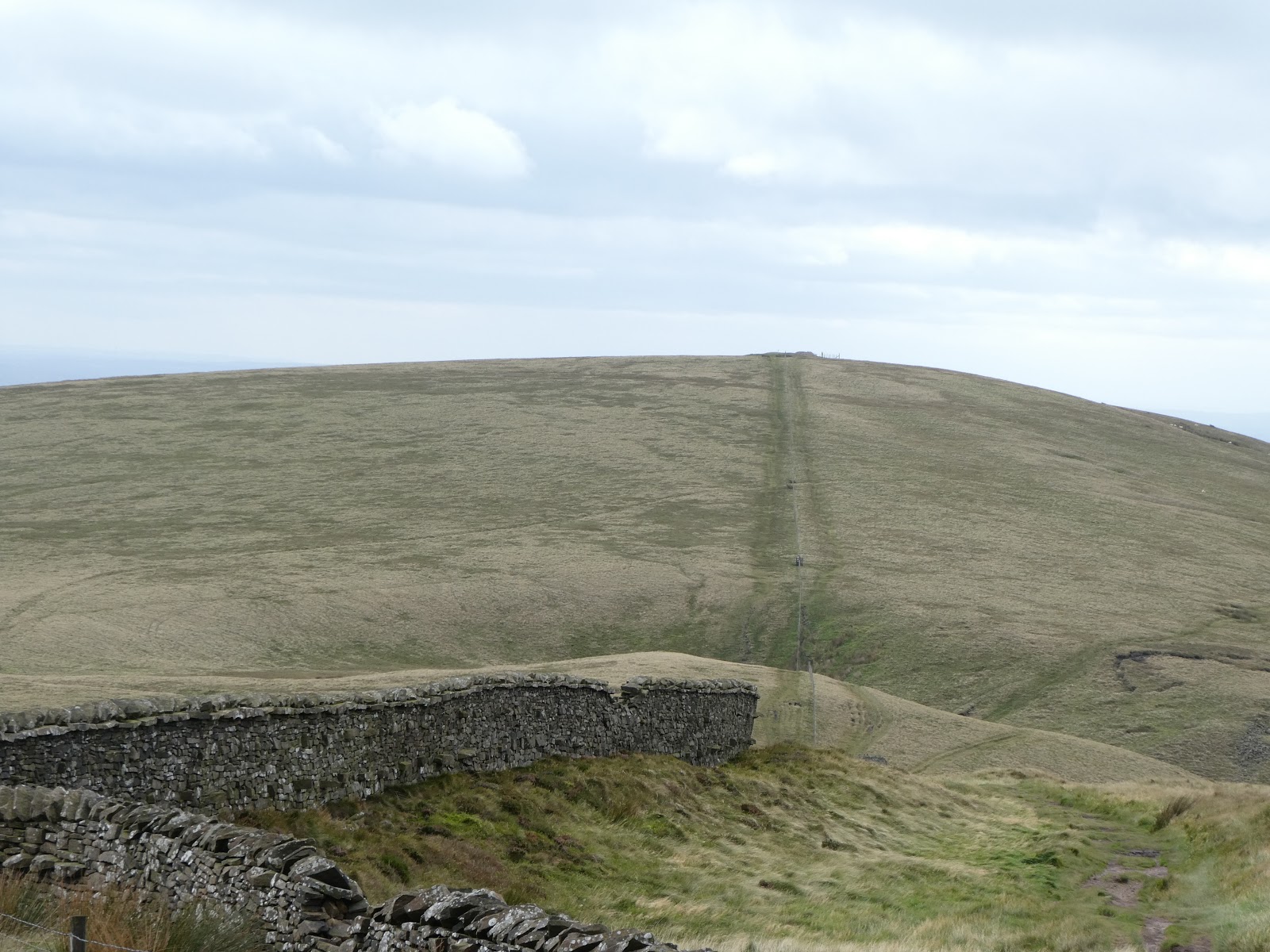
After descending to Blindhurst Fell, where we didn't spot 'Nick's Chair' [BC?], we sought protection from the wind by way of a high wall. Here's the view back to Parlick.
 
 
Parlick is also featured in the next picture, of me on the (not the) top of Fair Snape Fell (510 metres).
 
 
It was pretty windy, so we wandered around the summit for a while but saved our lunch for later. An elderly lady was there.
 
This was the only point on the walk that I found myself at a place that I'd been to before - in March 2015, from a completely different direction. And I note from that report that we didn't actually reach the true summit of Fair Snape Fell on this current occasion, the trig point and cairns being a few hundred metres from the true 520 metre summit.


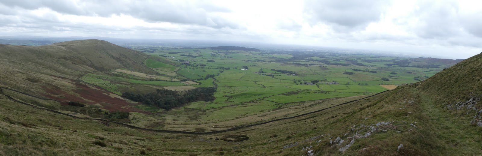
We soon found a zigzag path on which to descend to Higher Fair Snape, from which there was a good panoramic view to the west, with Beacon Fell to the right of Parlick in the next picture. Blackpool Tower was just discernible on the western horizon from here and from the higher points of the day's walk.
 
 
This area is not suitable for those who are unable to negotiate high ladder stiles. The metal kissing gates of Cheshire have not yet been exported to these parts.
 
 
We soon enjoyed our lunches on a grassy bank, before finally reaching Higher Fair Snape, where the fence decorated with unfortunate moles probably gives an indication of the local attitude towards the Hen Harriers that try to live peacefully nearby. [BC may comment.]
 
 
Looking back up to the fell, we were puzzled by this area of apparently dead grass. Why?
 
 
Few people, it seems, walk these paths in view of Parlick. Even fewer care to maintain the footpath signposts.
 
 
Easy paths and tracks led us to the hamlet of Bleasdale, and an impressive church for such a small place.
 
 
We passed a signpost to Bleasdale Circle - accessed by a permissive path. We should have taken it. A little further on we came across this information plaque. According to this, 'Permission to visit the Circle may be obtained from the headteacher of Bleasdale School', which appeared to be closed.
 
 
The circle that we failed to visit is a prehistoric timber circle dating from the Bronze Age (1700 to 500 BC). It may denote a religious centre, and it was only discovered in 1898.
 
There's a leaflet here, and BC, who commented on my previous posting, has written about it here, back in March, just before Lockdown. He confirms that the school has been closed for a while.
 
I was looking forward to the next section of our walk, beside the infant River Brock, a tributary of the River Wyre. Starting near Weaver's Farm, a good path led us to a footbridge between Bob's Wood and Gill Barn Wood. Two ladies and their dogs were chatting in the meadow. Can you spot them below?
 
 
Waddecar Scout Activity Centre was soon reached. It's facilities extend over quite a wide area, and the public are requested to stay on the paths. There's a good view back to Parlick and Fair Snape Fell.
 
 
At the end of the scouting paraphernalia the path passes through an area named on the map as 'Boggy Wood'. It was certainly well named.
 
 
At one point an arrow pointed us to the left, through apparently deep bog. A narrow path led ahead beside the river. We followed that. After a while the path took a turn - across the river on submerged and intermittent stepping stones. Do we go back, enjoy a thigh deep wade, or take a diversion through forest? A track wasn't far away, so we took the 'jungle' option.
 
Paul was elated after a rather slithery ascent, the pictures of which are in my library...
 
 
Later, an unmarked right turn ensured our pleasant riverside stroll all the way to Higher Brock Bridge. Dippers and a cormorant were in evidence here. Apart from this short section (during which we passed a strange residence with cars outside the house and a very well blocked entrance gate), on which the path could easily have been missed, today's footpaths were all well marked.
 
 
After this, we took pleasant paths past Lower Lickhurst and Middle Lickhurst, then zigzagging to avoid roads, and a final steep ascent back up to the closed visitor centre.


Here are two pictures of the route - the first at 1:50,000 scale, the second at 1:25,000. I couldn't decide which would be best. Click on these or on any other image, for a better version and access to a slideshow.
 
We took about 6 hours over the 21 km route, which included over 600 metres ascent.


An excellent day out. Thanks for your company, Paul.