Yes, just a bit. But congratulations to all those short-listed for this unheralded new award. I’m sure their routes were every bit as well planned as mine in their varying ways.
Wow!

Yes, just a bit. But congratulations to all those short-listed for this unheralded new award. I’m sure their routes were every bit as well planned as mine in their varying ways.
Wow!
We popped out to St Cyrus, in the hope of a stroll along the beach. But the heavens opened. The café by the bus stop had been expecting its annual surge in business a week earlier, so they were relieved to get it today. My 'ploughmans' was excellent. A stream of Challengers passed through before heading to the bus stop. A lucky trio - Andrew, John and Norma - all part of this year's 'Lochailort Tribe' enjoyed being delivered to the door of the Park in Graham's charabanc.
More of the same - rain, chats, to and fro from the camp site, refreshments, etc, until the bar gradually filled prior to the traditional Thursday evening dinner attended by over 200 Challengers and the great and good from TGO magazine.
MC Roger Smith conducted proceedings impeccably as always, with all Challengers in the room being called upon to take a bow according to the number of Challenges they have completed, plus a special mention of certain individuals, absent friends and overseas participants.
Then special awards to those who had just completed their 10 crossings - including Mike Knipe, the infamous Pie Man of Crook Town, followed by just two awards for those who completed their 20th crossings this year - to a very Proud Scotsman and an equally proud (not to say eloquent) Englishman from Settle.
After that, before more time in the bar and a very late stagger back to the camp site - a surprise - a new award.
More of that later.
So, that's almost it. The 31st TGO Challenge is nearly over. Stragglers will arrive on Friday and proceedings will draw to a close. Then preparations for next year's event will swing into process. It's a year round job for Roger Smiith, the stalwart organiser of the event.
I should also mention Cameron McNeish's announcement that Emily Rodway will shortly be taking over from him as editor of TGO magazine. Cameron will become 'Editor at Large', whatever that is.
There will be a short further posting and the insertion of an index and a few more images and tidying up of information, with links to a web page and a slide show. It'll be a couple of weeks before that happens. In the meantime I plan to rest and recuperate in sunnier climes far away from the Montrose Rain, which seems strangely absent from today's snap of a small section of the final camp - it's an illusion!
Sent using BlackBerry® from Orange
A leisurely start saw me strolling down to The Retreat (aka Glenesk Folk Museum) for breakfast with Tim and Kate.
Then it was on down the picturesque Esk valley, along pleasant paths in good company (Tim, Kate, Bernie, Martin, Jeremy and others) to Edzell. The last section, on my own through beech glades beside a river gorge, was particularly scenic.
A field ginnel led to the main street, where rucksacks outside the Tuck Inn revealed one of the Challenge's favourite pots of gold. Lunch, with Steve Gough and later joined by many others, including Alan Kay, who was the first person I encountered on my first Challenge three years ago, was sumptuous, delicious and lengthy. The chocolate nut sundae was wonderful.
It's not far to North Water Bridge from here, and despite the leisurely day so far it was only 2pm. Phone messages indicated there may be a small 'Bash' tonight with Heather T-S and others, with Heather having to leave for home early on Thursday.
It would be rude not to make the effort to say hello to an old friend...
So, a quick change of gear, on a full tank of fuel, saw me zooming on, past North Water Bridge, along the planned route, almost exactly as shown on the previous posting, to the dunes at Montrose.
Of all my approaches to the coast, this was the most direct and had the least road walking. Very satisfactory, with nice woodland interludes between quiet lanes, though there was a narrow passage of prickly gorse towards the end.
It also provided a last taste of solitude before the Fleshpots of Montrose and next week's partying with the Pixies of Hale.
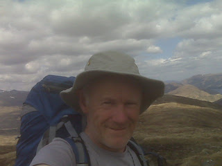
A storm that hit me for an hour or two after passing North Water Bridge eased sufficiently for me to take a self-timed picture at my finishing point.
The firm sand steadily became softer as I approached the camp site via an increasingly laborious 3 km plod down the deserted beach, its pristine sands glistening in the low sun. Then it started to rain again. Quite hard. So when the camp site was finally reached at around 6.45pm it was good to see the familiar faces of David Albon and Heather T-S and accept their offer of porch space for the rucksack whilst I whipped up the Phreerunner.
Graham Brookes also arrived after a 'bagging' trip in the Arrochar area, so after saying hello to him, experiencing a warm dribble in the 'shower', and gathering my few valuables, I set off to The George for a beer with a select band of Heather, David, Skippy and Julie. Numerous other Challengers were enjoying the George's good food, but we were to move on.
It was a short stroll to the excellent 'Indian Cottage' restaurant, where we saw the day out in style. This included an 'awards ceremony' during which David Albon conducted a 'toast' for all Challengers present, depending on the number of times they have finished. Cameron McNeish's table yielded the largest number of 'first timers' (including Cameron), with today's toasts culminating in one for Skippy and Humphrey, who had just completed their ninth crossings.
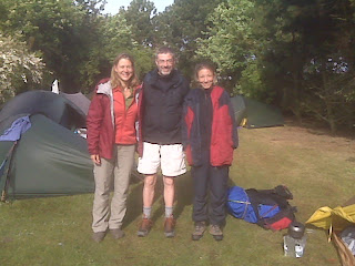
The picture is of Julie, David and Heather, who all finished today (Wednesday), at Montrose camp site in Thursday morning's sunshine.
Sent using BlackBerry® from Orange
Martin’s planned route and statistics for today are shown below:
1 North Water Bridge
2 South of Marymill
3 Hillside
4 Dunes at Montrose (THE END)
5 Montrose Campsite
Statistics
16 km
119 metres ascent
5.0 hours
Our planned route and statistics for today are shown below:
1 Tarfside
2 Bridge at Millden Lodge
3 Dalbog
4 Path junction
5 Bridge at Gannochy
6 Bridge at Edzell
7 Track junction
8 North Water Bridge Campsite – 30 metres (NO 649 662)
Statistics
26 km
273 metres ascent
8.6 hours
Martin’s planned route and statistics for today are shown below:
1 Glen Clova Hotel
2 Green Hill
3 The Goet (Ben Tirran) (Corbett)
4 Muckle Cairn
5 Glenlee
6 Tarfside – 200 metres (NO 491 797)
Statistics
23 km
953 metres ascent
9.4 hours
(1 Corbett)
An early start paid dividends today. The birds were singing as I strolled beside Loch Beanie in the early light, leaving 30 kg man snoozing contentedly.
Lumpy tussocks gave way to easy paths and a short section of road before the gentle climb up Badandum Hill. The views from the summit were extensive, but the experience of being at the edge of a storm is my overriding memory of this summit. Whilst others were receiving a dousing in the middle of the storm, my waterproofs were on and off like yo-yos and at one point I had one wet and one dry side. I was truly at the edge of the bad weather.
The route down to the ruin at Kilbo was rough and slow. Time there for brunch. I could swear I saw the ghost of the Pie Man appear through The Glack of Balquhadar and pick his way down towards me. The gait was his, the deathly black tights as well, but does he have a blood red jacket? He was 200 metres away. I regretted not having brought my binoculars.
My brunch hollow by the stream was actually off the main Kilbo path, which I rejoined at the top of a plantation after taking a shortcut up wheel tracks that I'd misconstrued as the path.
Three likely lads appeared, coming down the hill into Glen Prosen. The third, fourth and fifth Challengers I'd seen. Bill, Alex and John, first timers from Dollar and Comrie, all in their sixties. Well done lads!
Another figure lumbered up from behind me. Steve Gough, who had only seen three other Challengers before today. He was heading towards Clova, but not by my Munro infested route. We chatted for a while before I left him to nip packless up my first Munro of the trip, Mayar. I've been up it a few times before, but after the stormy weather the day had turned out nice, so I just couldn't bring myself to walk past this nearby summit. It turned out that it was Steve who had been impersonating the ghost of the Pie Man.
"This is my 143rd Munro", enthused the young lady on the summit, "I hope to do them all within another five years." I looked at her more closely. 'Is Kylie really a Munro bagger, or are my eyes deceiving me?' I thought. Looking nervously behind me, I saw the deathly shadow of the ghost of the Pie Man...
"Keep off, she's mine" whispered the wind...
My planned route would have left me dumping the rucksack to visit Driesh, my second Munro of the day, then heading down through The Shank of Drumfollow to Glen Doll, followed by a long road walk down Glen Clova. This foolish plan was discarded. The rucksack, pretty light now, with just a few remnants of provisions, could come with me to the 947 metre summit of Driesh, high point of the whole trip, then over the Hill of Strone and down the broad ridge to Clova.
It was an excellent choice, avoiding the foot pounding road walk, despite some rather lumpy tussocks on the final descent to Clova, where the bunkhouse and hotel are fairly brimming with Challengers.
I'm sharing a room with Susan and Brian from Liverpool, and have enjoyed helping in drinking Big Lusty May's naughty bits dry with John and Norma, from Great Eccleston, who I last saw at Lochailort.
Life is good, as on the entire trip. It's sociable now, as well.
Sent using BlackBerry® from Orange
Martin’s planned route and statistics for today are shown below:
1 Loch Beanie
2 Col beyond Loch Beanie
3 Possible camping spot by wood
4 Road junction - Dalvanie
5 Fergus
6 End of path
7 Minor col
8 Badandun Hill (Graham)
7 Minor col
9 Path
10 Kilbo
11 Path to Mayar
12 Mayar (Munro)
11 Path to Mayar
13 Shank of Drumfollow
14 Dreish (Munro)
13 Shank of Drumfollow
15 Glendoll Lodge
16 Campsite (closed)
17 Glen Clova Hotel – 240 metres (NO 326 731)
Statistics
36 km
1514 metres ascent
15.0 hours
(2 Munros, 1 Graham)
It's a beautiful evening here at Loch Beanie. I'd worried about this camp site as Colin (vetter) seemed a little unsure, but there's plenty of flat space where he surmised, by the Old Boathouse, to make this last wild camp a memorable one. I'm watching Brian try to catch his supper whilst two love birds look on with amusement without pausing in their amorous intentions. It's very frustrating for Brian as all he can catch is weed and all we can hear on this perfectly still evening is jumping fish.
The morning started fine. I opened the tent to see orange early light diffusing through a veneer of mist.
However, as I shouldered the pack the mist thickened, and, to cut a long story short, it rained for three hours. It rained properly, not just short showers as on earlier days. This made my yomp up Creag nan Gobhar, then Ben Vuirich (at 903 metres nearly a Munro) a little taxing. Occasional sightings of blue sky held good omens but didn't affect the ferocity of the rain. As I left Vuirich's summit the nearby Corbett Top appeared, so I went up there in the hope of getting a view. The mist beat me, so I headed down to Daldhu for a second breakfast (of lunch provisions).
Some miserable looking DOE kids hobbled past. Their supervisor followed. We chatted. The children had not appreciated the unexpected rain.
A rickety bridge at Creag Loisk led to more rough ground before the Upper Lunch Hut was reached. Here I joined the Cateran Trail, remaining on it for most of the rest of the day.
Lunch comprised a breakfast, lunch actually having been eaten for breakfast.
By now my sunburnt arms from yesterday were stinging in today's bright sunshine, the clouds having finally evaporated. Rather than use valuable sun tan cream (perhaps a re-supply visit yesterday to Blair Atholl would have been wise) I chose to call in at the Spittal of Glenshee Hotel. It has changed hands since last year and has become 'walker friendly', with a 20% discount for Challengers. Some have actually been seen go through here! I bought a meal. It was 3 pm. Cyclists on a 200 km endurance ride were passing through, getting their cards signed in the hotel and testing its soft drink resources.
The change of hands is good news.
Then, on along the Cateran Trail and up to this delightful spot by Loch Beanie, where Brian, originally from Christchurch, arrived shortly after my tent was set up. He's walking the Cateran Trail and is using New Zealand survival techniques. That means he has a surfeit of clothes, food and sundry survival equipment. But he has no fish. There is too much weed in the loch despite the love-bird swans doing their best to eat it. Brian admits he has a thing or two to learn about lightweight backpacking. But "I can carry it, so what's the problem, I have everything I need" he observes "anyway it only weighs 30 kg". I look at him in amazement. He's a strapping lad, yes, but 30 kg...?
I try to lift Brian's rucksack, already lightened by removal of his tent. I fail! It really is extremely heavy, and he's doing up to 20 miles a day.
Good to meet you Brian; have fun with your UK backpacking exploits.
The evening passed quickly. My worry about upsetting Gayle with frivolous comments on these pages has been eased by a series of text messages - she knows a wind-up when she sees one; I shouldn't have worried...
Today's yomping has been closely attended by trilling curlew and anxious lapwings. I've been careful to avoid standing on any nests. And this morning, whilst in the cloud, I noticed lots of 'cloudberry' - abundant but not yet in flower in these parts.
We are camped a few metres from another sad reminder of our own mortality. A large cairn with a plaque:
Heather (Hepburn) Halhead
1956 - 2001
Beloved Wife and Mum
Tomorrow I join a 'trade route' ('trade = easy) where there's an outside chance I may meet some other Challengers. You see, it's not all hard stuff for me - I think I'll wind down with some easy days. Have to get there first, of course.
Sent using BlackBerry® from Orange
Martin’s planned route and statistics for today are shown below:
1 Watershed at NN 974 656
2 Creag nan Gobhar
3 Ben Vuirich (Corbett)
4 Daldhu
5 Bridge at Creag Loisk
6 Track junction by lunch hut
7 Spittal of Glenshee
8 Westerton of Runavey
9 Boathouse at Loch Beanie – 410 metres (NO 156 685)
Statistics
27 km
1179 metres ascent
11.4 hours
(1 Corbett)
"That's a long way down the road" Amanda observed, looking at the 11 km thin blue line on my map to Garry Bridge, "why don't you use the footpath to Blair Atholl? It starts next door."
I looked up the road to 'next door'. Sure enough, "Blair Atholl" announced the green footpath sign.
The map confirmed that by taking this route to Killicrankie rather than my planned route I would be walking just 3 km along a minor road rather than 11 km along a main road, the overall distance remaining similar and the height gain being slightly less by the Blair Atholl route, with the promise of better views.
A 'no-brainer'. Thank you Amanda. She and Tom run the establishment that is the 200 year old Loch Tummel Inn. They were very disappointed in having been forced to close the previous day because of Scottish Power having turned off their supply for most of the day. They apologise to any disappointed Challengers.
Those people rightly deserve to be disappointed. I sampled as much of the menu as I could and found myself asking about the recipes.
"Chefs' own" Tom explained, "one them is from Gleneagles and the other trained as a pastry chef under Gary Rhodes."
So, after the best part of a day spent luxuriating in the lovely surroundings of Loch Tummel and Schiehallion, and waiting patiently for my 8.30 breakfast (I suppose it's only reasonable to start late if you work late into the evening running a busy restaurant) I set off along the footpath to Blair Atholl, fortified by the bacon, egg, haggis, black pudding, mushrooms, tomato, potato scone and (just one) sausage that constituted their excellent Full Scottish Breakfast.
As yesterday, when it actually rained as I took the tent down, low cloud dominated the early morning, slowly raising its cloak to produce another warm sunny day.
Great!
The footpath was well marked with Scottish Rights of Way Society signs and finger posts. The reflections in Loch Tummel were replaced by views in mature woodland, the paths lined with wood anemones, wood sorrel, speedwell, etc. Only one short section was akin to a forest 'ride' in Snowdonia.
Shorts were deployed.
The woodland route reached pretty Loch Bhac, from where a footpath across open moorland provided an easy heathery stroll down to Blair Atholl, the ugly scar of the Munro baggers' route up Carn Liath (Beinn a' Ghlo) drawing ever closer.
Butterwort, tormentil, vetches, milkwort and speedwells were all in flower. Perhaps I know why...
It was Hot.
Cool Mountain Air was required.
My route provided the solution. After a quiet lane lined by a plethora of brightly coloured flowers, and lunch at the Killiecrankie Visitor Centre (it's a shame I didn't get to walk up the riverside path from Garry Bridge, but I've done that a few times, and the route via Blair Atholl was in all other respects superior) I set off up a well marked path up Ben Vrackie. As the traffic noise from the A9 slowly subsided, so did the air temperature, making it feel like a high Alpine day. Delightful.
Suddenly I started meeting people, for the first time on the hill in four days. One of them explained why:
"It's the only decent hill that you can walk up from the door of any B&B in Pitlochry. And it's a well constructed path."
Anyway, it was very pleasant on top, where I lingered for a while before donning trouser legs and gaiters for the 5 km yomp past herds of deer to this delightful 8th wild camp of the trip (pictured).
The deer are very noisy, I hope I'm not in their way.
Talking of yomping, I've worked out that out of 9 days so far I've walked the equivalent of 5 days on pathless terrain. Perhaps it is a truly exclusive route...
There's more yomping tomorrow. And a Fleshpot. Will I see my third Challenger?
Now for a few messages and a gear supplement:
Gayle, are you inferring that my friends, my fellow bloggers, are taking 'girlie' routes. Tut tut! The hit squad will be after you! I have however noted that one of my fellow bloggers has wimped out of crossing the Fords of Avon. Maybe he's lost his crutches? Yes, I'm sure. That Must be the reason.
Geoffrey, I'm not really against trial (or is it 'trail' bikes), other than the numpties who bring them into disrepute in the Peaks and Dales. But I've seen ancient, fragile paths ripped to shreds by them during the course of this trip.
As for the crutches - see below.
Nick, you can't tell me in one breath that you are going to live in Zug, and in the next breath you won't be fit enough for TGOC 2011! The two don't compute.
Gear:
I'm not a gear freak, and I don't think going light is necessarily the most comfortable way to travel. But I'm lucky, I seem to be happy to carry more to stay comfy. I've not bought anything significant specifically for this year's backpacking trips, but I'll comment on the following fairly recent acquisitions:
Thermarest NeoAir (short) - I didn't get on well with this at first and nearly re-sold it. But I have to say that on this dry trip, with seven successive wild camps, it has been brilliant. So in dry weather, on flat pitches, it's great.
Pacerpole Crutches - I find these much easier on my wrists than the Lekis that I lost in Italy. Crutches are of course a Necessity of Life, Geoffrey, when your knees have had as many bits taken out or exchanged as mine have done.
Scarpa Infinity boots. Like last year's equally comfy Asolo Fugitives, these have now spent many days sloshing through boggy, pathless terrain. Unlike the Fugitives they are still keeping my feet dry.
John West seared tuna fillets - an excellent addition to flavoured 'pasta n sauce'.
Aquagear Water Filter (now 'Travel Tap') - a provider of much peace of mind, even if it does encourage laziness regarding the sourcing of spring water.
Golite Quest rucksack - ok in good weather, really annoying in bad weather, for which I find the slightly heavier Karrimor Jaguar better because it has a tent compartment. Is there anything like the Quest on the market that has a tent compartment, which is really useful on wet days?
Alpkit titanium tent pegs - as recommended by Gayle and Mick - for complete peace of mind in a storm.
Sent using BlackBerry® from Orange
Martin’s planned route and statistics for today are shown below:
1 Loch Tummel Inn
2 Campsite
3 Road junction
4 Garry Bridge
5 Killicrankie
6 Path junction
7 Ben Vrackie (Corbett)
8 Meall Breac
9 Watershed at 440 metres (NN 974 656)
Statistics
23 km
1221 metres ascent
10.1 hours
(1 Corbett)
Enjoyed a lie in then headed down through a cloud inversion, past a female black grouse on her nest (I got to within a metre - she'd have pecked me rather than leave), then strolled along the B846 road for a while, beside the tumbling waters of the River Tummel, before hitting forest tracks at Easter Bohespic.
In contrast to the uplands of previous days, the riverside woods were full of the twitter of songbirds, whilst oyster catchers, grouse and chickens competed for space in the neighbouring fields.
Wood sorrel and primroses lined the hedgerows.
The pinewoods after Easter Bohespic were a little oppressive on the hot day, but the scent of fresh pine was gorgeous.
A long brew stop and early consumption of my last tin of fish was enjoyed overlooking Loch Tummel and Schiehallion.
A great spot.
After a further diversion by way of a phone call home whilst I had a signal, the inevitable happened. It was just 12 noon when I reached Loch Tummel Inn - much earlier than originally planned. That gave me time for a tasty lunch outside, watching goldcrests in the fir trees and the reflection of hills in the placid waters of Loch Tummel, before setting out on the task of washing all my clothes. There aren't many. It didn't take long!
Annoyingly, there's no phone signal inside, but whilst lunching outside I perused the activities of some of my fellow bloggers.
(Since I've hardly met anyone, this is the closest I can get by way of a feel for how others are getting on.)
I'm not going to insert links (until back home) but you can easily Google them or pick them up from the TGO Challenge message board (to which I can't seem to respond to comments using this phone, but thanks Gibson for the mention).
The blog report will certainly 'mature', but here's my current take on them, and no criticism should be inferred - I know it's much harder to make postings on the move than it is from your keyboard at home.
'London Backpacker' (George) seems marooned on Day 2 - where 'Tales from the Riverbank' hint at an easy, low level, meander across Scotland.
Bellavist (Aussie Mike) tells of a wild camp at Glen Tromie yesterday - a brief report on a long day, but I can't see any evidence of what he got up to during the intervening week.
Alan Sloman's reports are punchy, entertaining and up to date. The F16s (was that what they were?) flew very low yesterday - far below me - they must have been quite scary for those beneath them. Whilst Alan may be putting more energy into blogging than into actually walking, he has at least tried to go high - baulked by the bad timing of the only two poor bits of weather on the Challenge. He has bagged a Munro, which is more than I've done. That's 1:0 to you Alan. Well done!
Phil Turner is up to his Day 4 (Tuesday) and seems marooned in the Monadliath with Humphrey, no doubt at one of Humphrey's many 'secret places'. So they may never be found. His blog is hard to view on this Blackberry phone.
'Sheddweller' (new to me) is up to his Day 5 (also Tuesday). He must be in a completely different climate to me. He has been cold! With two sleeping bags and a down jacket! Is his blog a work of fiction, I wonder? Or has he forgotten to bring a tent/shed? He seems to be on a low level route with lots of roads and erratic distances. A novice?
Litehiker (Geoff), who I met on the train, is blogging like a professional and is up to his Day 6 (Wednesday). He has rushed across on an easy, low level, route - choosing to ignore even easy summits like the one from the top of the Burma Road. He has reached Loch Morvich and will next report on his Cairngorm crossing - by the easiest route available, I presume. Is Geoff's route much of a challenge for such an experienced backpacker? I think not, but he seems to be enjoying it.
Steve Horner is supposed to be blogging, but it appears I am not authorised to access his website!
Sectionhiker (an American) has posted a route but doesn't seem to be blogging about his progress along it.
UKmase - another on the list, but he doesn't seem to be posting anything.
So there don't appear to be many of us active, just Geoff and Sheddweller, and maybe George, on low level routes, Phil Turner lost in the Monads, me taking my (excessively?) exclusive high line, and dear old Alan pretending he's Paul Theroux. His blog is the pick of the bunch, and it's impressive that he's doing it whilst carrying on various other nefarious activities. He must be keeping 'his man' busy.
I'll do a gear report tomorrow, but after this afternoon's rest in the sun beside Loch Tummel, and this evening's sumptuous feast...
Zzzzzzz
Sent using BlackBerry® from Orange
Martin’s planned route and statistics for today are shown below:
1 Duinish
2 Col by Gualann Sheileach
3 Creag a Mhadaidh (Graham)
4 Bridge (I hope!)
5 End of ‘path’ (if there is one)
6 Beinn a’ Chuallaich (Corbett)
7 B846 at Drumglas
8 Road junction
9 Track junction
10 Track junction
11 Track junction
12 Loch Tummel Inn – 220 metres (NN 818 602)
Statistics
30 km
1151 metres ascent
12.3 hours
(1 Corbett, 1 Graham)

The predicted rain came, gently, in the middle of the night. I woke to a gloomy, mizzly world of mountains draped in cloud.
So I lay in bed and did some washing. I may have no 'Linolight' (see Alan Sloman's blog) but I can do my washing whilst still in bed. I think Alan has a 'man' to do his washing for him, and from what I can see, his Challenge is to get across Scotland using as many hotel rooms as possible and never camping for more than one night at a time..
(I'm just bitter, Alan, that nobody is being sociable on this route with no hotels - yet.)
Setting off towards Corrour Station, I discovered a path. I'd inadvertently camped on it.
The station was deserted.
Loch Ossian Youth Hostel had a few tents outside. Challengers having a lie in?
I stumbled on along a nice green lane to Peter's Rock - marked on OS maps. It's a small rock with a rather sad plaque:
In Memory of Peter J Trowell
Born Sept 1949 -- Died March 1979
At Loch Ossian
I have a friend a song and a glass
Gaily along life's road I pass
Joyous and free out of doors for me
Over the hills in the morning
My overnight temptation to traverse Carn Dearg from here, only an extra 400 metres ascent, was quelled by the low cloud, though by now it had virtually stopped raining. I'll keep the memory of my ascent on a lovely summer's day, with Nick before his globe trotting days.
There were cuckoos in the Ossian woods, but it was otherwise very calm and quiet apart from the occasional trickle of a stream under the soft blanket of cloud that cloaked the moor.
Further on, the extensive ruins of what must once have been a magnificent sight, and a hive of activity - Corrour Old Lodge. I enjoyed a second breakfast there and, on the advice of my vetter, explored the ruins. The Lodge possibly entered into disuse before the age of photography, but if there are photos, or even paintings, these would be very interesting and would certainly not feature the Blackwater Reservoir in the background.
Over the past few days I've walked on paths shredded by the recent passage of trial bikes. This fine old path, or 'mule track', as it would be known in the Alps, is a prime example. It was not, and is not, built for trial bikes. I know that it's all above board - part of an annual event based in Fort William - and that the bikers are enthusiasts, passionate about their sport, and their routes can be as challenging as many a TGOC route, so I'm reluctant to make an issue of it. It's an observation, then; the paths have been 'shredded'.
In contrast, the walk up Sron Smeur was pathless and pleasantly easy.
"You can't walk past Sron Smeur" opined my esteemed vetter.
Correct. It's a fine little hill with tremendous views to all points of the compass, with lochs and reservoirs radiating as if this were the centre of the world. Not surprising then that a phone signal miraculously appeared as I approached the summit - giving me all the more reason to linger at this special place. It was the highlight of the day.
However, I missed a trick. By blinkeredly following my planned route, and forgetting how dry it is, I missed the opportunity to take a short cut over some no doubt boggy terrain. It would have saved a lot of road walking.
Anyway, after confirming that my planned camping spot would have been fine, with the 'camping spot beside track' waymark ok in an emergency, I had lunch in the sun (not that enjoyable due to a nose bleed) then headed off down the road to Bridge of Gaur.
"Mr Ellis, I presume" - I was greeted warmly by the Challenge Friendly proprietor of the Bridge of Gaur Guesthouse, whose Linolights most definitely work. He was looking out for Les Ellis and assumed I was his man. We chatted, as a result of which my trial bike comment appears above - I wasn't going to say anything, by way of a quid pro quo for the privilege of being allowed to wild camp. But wild camping doesn't shred paths.
Then after a pre-planned call to 'Uncle Roger' at TGOC Control to confirm I was alive and well, I set off up this rather ordinary glen along a metaled estate road, to camp in another excellent spot - at 400 metres - across the river from the ruin of a two roomed house.
A heron is fishing nearby as the sky reddens. Is this a 'volcanic ash sunset'?
Martin R - thanks!
Louise - I heard you met Sloman - no doubt whinging about his Linolight. It seems to be Most Important to him at present. I hope we meet up - I still owe you a prize.
Mark - thanks - I never cease to be amazed that a 'proper writer' should be interested, especially when one blogger comments disparagingly "I prefer to write it up properly when I get home" - you never know what's going to happen next doing it this way, and it has greater 'immediacy'. Will we see you on the Challenge next year?
Sent using BlackBerry® from Orange
Martin’s planned route and statistics for today are shown below:
0 (Not shown) Path junction below Sron Smeur
1 Possible camping spot beside track
2 B846 road
3 Bridge of Ericht
4 Head of Loch Ericht
5 Path junction
6 Beinn Boidheach
7 Beinn Mholach (Corbett)
8 Duinish – 430 metres (NN 617 669)
Statistics
31 km
960 metres ascent
11.6 hours
(1 Corbett)
A fabulous day in perfect weather. If only we'd had such weather on Sunday...
I joined the nervous lemmings and headed unerringly east. Didn't see any though. There must be some close by?
After a night without a breath of wind on the high balcony of dry grass with no deer poo to be seen, it was a shame to move from such a perfect spot, but I headed over Beinn na Caillich, feeling sorry for Gayle and Mick who had missed out on this a couple of weeks earlier due to bad weather, and back down to the deserted West Highland Way, which was a surprise on such a lovely morning.
Any lingering cloud cleared as I wandered along the track to the Mamore Lodge Hotel, sadly a dilapidated shadow of its former regal splendour. The tenants had left Ann Ansell in charge as house-sitter, with clear instructions as to how to deal with the 4 kg package left outside their front door a couple of weeks ago. If she hadn't been in, it would have migrated to the back door, but that wasn't necessary, and we enjoyed a chat over a cup of coffee. Thanks, Ann, it was a pleasure to meet you.
This is Mamores country. Five Star Walking Country.
First I met Sandy and Nadia, who were steaming along in the direction of the main ridge, until they paused on a bench to admire the classic view down Loch Leven, with the Pap of Glencoe on the left. Good to meet you both, I bet you had a great walk.
Then there was Elwyn, from North Wales, picking off the two eastern outliers whilst his son was traversing the whole ridge. Elwyn would need to climb just 52 more Munros after today to gain admission to that most exclusive of places, The Munro Society.
Four English backpackers were setting off to enjoy the ridge before descending down that stern prow of Stob Ban and camping near the WHW..
So, after nearly an hour with Ann, and these three encounters all within a few minutes, I was feeling quite sociable.
I haven't seen a single person since then.
My route to Corrour took in a couple of Corbetts and a Graham. Good exercise, despite the extra 4 kg tugging painfully on my (frozen?) shoulder. Anyway, it didn't really feel any heavier than yesterday - probably only about 16-17 kg today.
Boot prints, all heading in the same direction, led me to conclude that other Challengers have passed this way. I may eventually catch them.
They won't have shared my delight in savouring the giddying panoramas from the peaks I visited, as most Challengers seem to eschew Peak Bagging in favour of Glen Slogging, which has its place in poor weather, but not on days like today.
I reached today's planned destination, Meall na Cruaidhe, around lunch time. There were plenty of spots to camp, but you'd have to collect water from a stream on the way up. The Pap of Glencoe looked exceedingly 'Papy' from here.
Glas Bheinn, with a deer studded profile, was an easy ascent, despite the peat hags, and the Graham - Beinn na Cloiche soon followed. The views from these hills are extensive - my 1:250,000 scale map was handy for confirming the identities of various mountain ranges. Wonderful panoramas to feast the eyes. The unmistakable profile of Schiehallion has appeared to the east and will be with me for days to come.
With a prediction from Sue (thanks - v helpful) that a band of rain would arrive overnight, and encouragement from Notchy from his stravaiging on Mull, I abandoned a plan to camp near the bothy by Loch Chiarain and tackled the steep ascent of Beinn a' Bhric. It turned out to be easy and pleasurable. (Most ascents are after a spell in Ardgour!)
I debated continuing until it got dark, but common sense prevailed and I descended gently towards Corrour from the final Corbett, heading off to the left to reach this excellent nook by the stream in Allt Coire a' Bhric Beag at around 7pm. My knees and shoulder chorused "thank you for stopping" even if my head didn't.
A wonderful day. There will be delirious Challengers spread all over the Highlands as they wend their ways east. If they travelled high today they will have enjoyed giddying panoramas that will long remain with them.
Sent using BlackBerry® from Orange
Martin’s planned route and statistics for today are shown below:
1 Meall na Cruaidhe
2 Glas Bheinn (Corbett)
3 Beinn na Cloiche (Graham)
4 Path junction
5 Beinn a Bhric
6 Leum Uilleim (Corbett)
7 Corrour Station
8 Path junction by SYHA
9 Corrour Old Lodge
10 Path junction
11 Sron Smeur (Marilyn)
10 Path junction at 360 metres (NN 435 609)
Statistics
29 km
1480 metres ascent
12.9 hours
(2 Corbetts, 1 Graham, 1 Marilyn)
Martin’s planned route and statistics for today are shown below:
1 Edge of Forest at NN 075 645
2 Blar a’ Chaorainn
3 Lairigmor
4 Path Junction
5 Mam na Gualainn (Corbett)
6 Beinn na Caillich
7 Junction with West Highland Way path
8 Crossing Allt Coire na Ba
9 Path junction (for ascent of Na Gruagaichean)
10 Path junction (for ascent of Sgor Eilde Beag)
11 Path junction to the south of Loch Eilde Mor
12 Meall na Cruaidhe – 558 metres (NN 249 627)
Statistics
27 km
1580 metres ascent
12.2 hours
(1 Corbett)
Thanks, everyone, for your messages/comments. Keep them coming.
Nick - following your return to Europe (news that Stuart and Maria were pleased to hear) are you up for this (TGOC) next year?
Paul - the view from this camp site is to die for. It matches the one Sue and I had of Monte Viso on our IBR trip (go on - click that label!). You'd be very happy here, as well, Sue.
Susan.... next year?
Lyn - glad you made it home. I was wondering whether you would survive the ash. It was about 3 inches thick on my tent Glad you had a rewarding trip.
Alan - thanks for your comments. It's the usual score re Challengers heading east like lemmings (see below). It's actually good to have a few challenging days in the west and catch up with the rabble towards the end.
It was with some sadness that I escaped from the wild country of Moidart and Ardgour this morning. This is wilderness of the highest order, rarely visited because the hills rise to just under 3000 feet, denying them Munro status. Perhaps this is a good thing. They rise from the sea and are finer hills than many Munros. I commend them. But take your time - don't expect to move quickly.
It was t-shirt weather this morning for my 2 km descent to a bridge and track. Even that took well over an hour - there were all the normal obstacles, plus an unexpected cliff, to negotiate.
Eventually I made it down through the wet tussocks etc, past anxious wheatears and plovers, carefully avoiding the caterpillars and small jumping frogs amongst the lousewort, milkwort and wood anemones, all clinging on to the steep crags.
Lower down, more deer scooted off, whilst bluebells and lesser celandine joined the wood anemones in their struggle to fight a way through the bracken. Butterwort is also abundant, but not yet in flower.
It was a relief to get to the bridge and end the yomping for the time being. My progress east had been slow and needed some inertia. The main road to Ardgour is single track with passing places. Not busy. There were lovely reflections of the mountains in Loch Linnhe.
I took advantage of the phone signal and caught up with some of the other bloggers. Alan and Phil appeared becalmed in Lochailort (but have since resurfaced - bloodied but not beaten), and others seemed to be nervously dashing to the east rather than savouring the delights of the western summits. This dismays me - they are missing out on so much. These are world class summits with fine routes and views. Why dash past? This comment obviously doesn't apply to those who for medical reasons are faced with an extreme challenge in getting across at all. I thought about such folk yesterday when agonising about amending my planned route. That was easy for me to do, but others don't have such options. I admire their tenacity.
I discovered why they want to work on the Corran Ferry slipways when I watched a coach leave the ferry. The back underside of the bus scraped the ground, damaging the rear end.
A pot of coffee and a huge slab of chocolate cake went down well at the Corran Inn. My first human contact since Glenfinnan.
" Why don't you go by bus?" I was asked.
"My pass only works in England; yours will only work in Scotland" I countered.
A plan was hatched. I will become a resident of Corran. He will be resident in Timperley. We will get bus passes based on those residencies. We will travel free throughout the UK. Does that make us dual nationality? And what about Wales? Is it still a suburb of England in the world of pensioners' bus passes?
I continued on my way, along a short section of the A82, fortunately lined by a pavement. Goldfinches flitted in the hedgerow and some goats paused from their munching to watch me go past.
Beyond Inchree, a spectacular waterfall, mewing buzzards and a heron overhead, and an easy track to my planned camping spot at the edge of a forest. It was an idyllic location - flat turf in a sheltered spot beside a gentle stream. But it was only lunchtime. It rained whilst I brewed up. One of those annoying showers from an apparently blue sky. I'd just applied sun tan cream.
I continued on to join the West Highland Way for a few km. Easy going. I counted 11 (I'm sad like that) tourists. Most said hello.
I passed an information board about the Battle of Inverlochy. Inverlochy is up near Fort William, so this board is at the site of the retreating Campbells, defeated by the MacDonalds in 1645, commemorating the retreat of the luckless Campbells to the soup kitchens of England.
Soon my attention was drawn to the magnificent profile of Stob Ban, as I rounded a corner leading to the ruin of Lairigmor. Then it was a final ascent to the 796 metre summit of Mam na Gualainn, about 600 metres beyond which I am ensconced in this brilliant spot overlooking Loch Leven and Glencoe, whose mountain summits are arrayed before me. Brilliant. It's a lovely evening; I'll leave the door open tonight.
(I'm a bit ahead of schedule now; this afternoon's map will follow in the morning. Sorry about that.)
Sent using BlackBerry® from Orange
Martin’s planned route and statistics for today are shown below:
1 Lochan at 690 metres
2 Beinn na h-Uamha (Corbett)
1 Lochan at 690 metres
3 End of track
4 Beinn Bheag (Graham)
5 Lochan at col
6 Garbh Bheinn (Corbett)
7 A861 road
8 Sallachan
9 Corran
10 Corran Ferry Jetty
11 Glean Seileach
12 Edge of Forest at NN 075 645 – 150 metres
Statistics
31 km
1533 metres ascent
14.0 hours
(2 Corbetts, 1 Graham)
Martin’s planned route and statistics for today are shown below:
1 Lochan at Col (NM 885 750)
2 Sgurr Ghiughsachain (Corbett)
3 Meall nan Creag Leac
4 Bealach
5 Stob a’ Bhealach an Sgriodain (Corbett)
6 Meall Mor
7 By Lochan Dubh
8 Carn na Nathrach (Corbett)
9 Bealach
10 Point 803
11 Bealach
12 Sgurr Dhomhnuill (Corbett)
13 Sgurr na h-Ighinn
14 Bealach
15 Sgurr a’ Chaorainn (Graham)
16 Lochan at 690 metres near Beinn na h-Uamha (NM 911 664)
Statistics
18 km
2453 metres ascent (oh dear!)
12.5 hours
(4 Corbetts, 1 Graham)
Martin’s planned route and statistics for today are shown below:
1 Lochan Feith Easain
2 Beinn Mhic Cedidh (Corbett)
3 Bealach a’ Choire Bhuidhe
4 Beinn Odhar Bheag (Corbett)
5 Beinn Odhar Mhor
6 A830 road
7 Glenfinnan Visitor Centre
8 Path junction at A830
9 Leave path to ascend
10 Sgorr Craobh a’ Chaorainn (Corbett)
11 Lochan at Col - 590 metres (NM 885 750)
Statistics
22 km
1883 metres ascent
11.7 hours
(3 Corbetts)
Away we go...
After saying goodbye to those at the hotel, and being snapped for the album by JJ, I set off alone.
Out of 44 folk setting off from Lochailort, I seem to be the only one to be bagging the three Corbetts (mountains of 2500 to 3000 feet in height, with at least a 500 ft drop between them) immediately to the south of the hotel. Maybe they have all progressed further in an easterly direction than my paltry 5 km!
Anyway, today went well and has left me with the (I predict rare on this trip) chance for an early night.
The day started cloudy and showery, gradually improving to excellent walking weather - not too hot, very little wind, etc.
My planned route suffered an immediate amendment when I realised I'd failed to incorporate a visit to the ocean (Loch Ailort). I met two of the Americans in Russ Mannion's team who had also appreciated that particular nicety of the Challenge, but I don't know whether anyone else actually bothered to start at the coast (bar someone who was almost camping in the loch!).
There was a thin, but unexpected, path up the Allt a' Bhuiridh valley, so I took the advice of Colin Crawford (my vetter) and by-passed Seann Chruach by taking the valley path. I just about got a view from An Stac, but had to descend in mist.
Rois-Bheinn was also in mist, so there was no point in visiting its western summit. That contributed nicely to my early finish, as did the terrain, which was not as rough as I had expected. Until, that is, the final knife edge ridge of Druim Fiaclach and the following sharp descent down steep ground with randomly placed small cliffs. The key to success on the ridge was to stay on the blade of the knife - quite entertaining at times. Good views too (see snap).
I'd enjoyed lunch on the summit of my third Corbett, Sgurr Ba Glaise, after a satisfying morning's walk. Here I received a message of encouragement from Geoffrey (who I promise to visit in Macc asap) and the first of two pairs of day walkers passed by. They are the only people I saw all day.
It's a lovely evening as I gaze from the open tent down Glen Aladale to Loch Shiel, as I tuck in to my pasta and tuna dinner.
Sent using BlackBerry® from Orange
Martin’s planned route and statistics for today are shown below:
1 Lochailort Inn
2 Seann Chruach
3 An Stac (Corbett)
4 Col at 560 metres
5 Bealach an Fhiona
6 Rois-Bheinn (Corbett)
7 Rois-Bheinn – western summit
6 Rois-Bheinn
5 Bealach an Fhiona
8 Sgurr na Ba Glaise (Corbett)
9 Lochan at 810 metres
10 Bealachan Fhalaisg Dhuibh
11 Druim Fiaclach
12 By Lochan Feith Easain – 360 metres (NM 817 792)
Statistics
16 km
1783 metres ascent
9.6 hours
(3 Corbetts)

The time has come…
I set off in a few hours time to the fleshpots of Lochailort, where around 40 out of a total of 300+ Challengers will be assembling before starting their walk across Scotland on Friday morning.
I’ve not had time to produce the usual web page, so my planned route will be revealed here on a day to day basis. I’ll be setting off in a southerly direction, unlike the vast majority of those starting at Lochailort, who I suspect will be heading east.
For now, you’ll have to make do with the outline shown below; a route of 360 km (225 miles) with around 18,100 metres of ascent. It’s highly unlikely that I’ll be able to meet this Challenge despite the encouragement of my vetter (who I thought would ‘rubbish’ my plans). So it’s just as well that I have an alternative ‘Foul Weather Alternative’ (FWA) which comes out at a mere 320 km with only 8,600 metres of ascent. The disadvantage is that it omits the 28 summits (2 Munros, 20 Corbetts, 5 Grahams and a Marilyn) that are included in the longer route.
Realistically, I hope to make at least 10 of those summits

Day 1 – Lochailort to Lochan Feith Easain (NM 817 792)
Day 2 – to Lochan at High Col (NM 885 750)
Day 3 – to Lochan below Beinn na h-Uamha (NM 911 664)
Day 4 – to Edge of Forest (NN 075 645)
Day 5 – to Meall na Cruaidhe (NN 249 627)
Day 6 – to Path Junction below Sron Smeur (NN 435 609)
Day 7 – to Duinish (NN 617 669)
Day 8 – to Loch Tummel Inn (NN 818 602)
Day 9 – to Watershed at NN 974 656
Day 10 – to Loch Beanie (NO 156 685)
Day 11 – to Glen Clova Hotel (NO 326 731)
Day 12 – to Tarfside (NO 491 797)
Day 13 – to North Water Bridge (NO 649 662)
Day 14 – to Montrose (NO 732 603)
My best wishes go to all the other Challengers, including the Proud Scotsmen amongst them and the various bloggers – think of them as they stand aloft Scottish peaks trying to transmit their hastily compiled words over the course of the next two weeks…
My previous three Challenges are described here, just in case anyone is interested.