Sue and Martin in Mallorca 2019

Sue and Martin in Mallorca 2019
On the Archduke's Path in Mallorca

Saturday, 22 June 2013

Saturday 22 June 2013 - Pyrenees GR10 - Day 8 - St-Jean-Pied-de-Port

We walked about 6 km with 200 metres ascent during the course of this rest day.                              

Weather: warm and sunny - John and David appear to have taken their rain cloud with them. 

We enjoyed a lazy day in this lovely old town. The sun shone to dry our washing and the forecast is set fair.

It was a shame to have so much rain over the past week - about twenty of the thirty or so hours of walking were in rain - but it did no harm to the sense of cameraderie.

We very much enjoyed our 'not so much an encounter, more a sort of holiday' with John and David, and our encounters with Bruno and Christof, Stuart, Dave, Pierre and his lovely wife, Panos and various other itinerants. We may meet some of them again if they have a 'day off' before reaching Lescun; if so it will be like meeting old friends.

What a contrast to last year's E5 trip, and this year's Apennine trip,  when we met hardly anyone on the trails.

I wonder who we'll encounter tomorrow. 

St-Jean is full of pilgrims about to set off along the Way of St James towards Santiago de Compostella. Ranging from decrepit old stumblers to spotty dreadlocked youths they are a rag tag group that look just like those depicted in the film 'The Way'.  Whilst we know some folk relish that sort of trip, we are glad to be walking the less popular but more scenic GR10. 

We enjoyed a fairly comprehensive tour of the walled town this morning, but I'll leave the detail to a slide show in due course. The top picture today was taken from the top of the Rue de la Citadelle, near where the pilgrims get their 'passports'. Below that is a view over the town from the 17th Century Citadelle, looking towards the Iparla ridge that we traversed in cloud and rain a couple of days ago. 

Sent from our GR10 trip - see here for our itinerary

Friday, 21 June 2013

Friday 21 June 2013 - Pyrenees GR10 - Day 7 - Stage 5 - St-Étienne-de-Baïgorry to St-Jean-Pied-de-Port

Distance: 21 km (Cum: 103 km)     

Ascent: 950 metres (Cum: 5000 metres)
                     
Time taken: 6.25 hrs including 1.25 hrs stops                                     

Weather: rain for five hours then slowly improving

We set off before 9 am after a filling breakfast at Gite Mendy.  This was our last day with John and David, as they aren't having a day off tomorrow. 

As has become the norm, it was raining hard, with the cloud right down to the valley. I'm pictured in a normally sunlit café.

We formed part of a bedraggled group of walkers, many with only ponchos or umbrellas for protection, stumbling up the muddy paths towards Col d'Aharza. There's a new and very good variant to GR10 that now has the main route markings, contouring to the east of Oylarandoy; we commend that path. 

Soon after the col, our companions took a lower path, but by a strange dint of fortune (we can't seem to get rid of them) John and David reappeared like a couple of bad potatoes at the next col - Col d'Urdanzia. After a few hundred metres they found another excuse to ditch us, by declining to ascend to the 1021 metre summit of Monhoa. We followed geordie Stuart (Inov-8 Man - if his Roclite shoes last as long as mine did he'll need three pairs to get to Banyuls) towards the summit but he threw us off his scent by taking an unexpected contour. 

There was no view from the summit.  Not until a few minutes after we had left. Never mind, views down to St Jean and beyond soon opened out in profusion. The 'below the gloom' picture above captures the essence.

Far below was the Belgian support car for two ageing walkers in shorts and ponchos, with a splash of red and yellow next to it. John and David had parked their bums near the support car but it hadn't taken the hint. 

Anyway, by a strange dint of fortune (they can't seem to get rid of us) we reappeared like a couple of bad eggs just in time to snaffle their excess lunch before the vultures got it.

After that it was downhill all the way to Lasse, where we poured into a hapless auberge and demanded tea and coffee with a menacing clarity. Dave and Stuart joined us, possibly to their regret.

St-Jean turns out to be a quaint bustling place, full of pilgrims (it's at the start of a famous pilgrim trail), trekkers, bikers and 'ordinary' tourists. Our accommodation, on which more tomorrow, is excellent. 

The evening was again spent with John and David, who have become firm friends during the course of the past week. We enjoyed another gourmet experience, this time at Txitxipapa restaurant, which once the corked wine had been dealt with provided a fine repast.

For the first time since Sunday, we emerged from the restaurant under a clear sky, the rain having finally moved to pastures new. An almost full moon grinned as we paid our final farewells to John and David, who have made such fine companions; we've never before walked with complete strangers for so long.

Good luck and bon voyage, gents...

Sent from our GR10 trip - see here for our itinerary

Thursday, 20 June 2013

Thursday 20 June 2013 - Pyrenees GR10 - Day 6 - Stage 4 - Bidarray to St-Étienne-de-Baïgorry

Distance: 16 km (Cum: 82 km)     

Ascent: 1300 metres (Cum: 4050 metres)
                     
Time taken: 7.25 hrs including 0.75 hrs stops                                     

Weather: fine for an hour, rain for five hours, fine after that, but hills still shrouded in cloud

Breakfast at Barberaenea restaurant set us up for a gentle plod up to Pic d'Iparla. The path took us over and past boulders that looked like huge lumps of concrete. Twenty five vultures circled menacingly above us.  It was just about not raining, with a bit of blue sky, and some distant Pyrenean peaks poking out in the distance to the east.

Today's image is the view back to Bidarray from this morning's ascent. 

The rain started as we rose to the splendid Iparla ridge through beds of clover littered with milkwort and crosswort. Ancient cromlechs and old sheep enclosures were passed as we steadily gained the crown of the broad ridge.

After rising above the wooded valleys our views were negligible. Those with gloves donned them. The 9C temperature was considerably diminished by wind chill. 

We soldiered on to the 1044 metre summit, conscious that we were as well equipped as anyone else on the path today. Especially the fell runners. Where did they come from! 

After a brief pause at the summit, and a photo taken by a French couple, we descended through thin mizzle to Col d'Harrieta, where a luxurious beech wood offered some lunchtime shelter. Others were brewing up in a corrugated iron howf, illuminated by head torches.

After lunch we climbed sharply back to two more summits above 1000 metres. John's ankle hurt. David heroically provided a bandage from his first aid kit. It looked more like a snotty handkerchief from his trouser pocket.

After the final col, from which we descended to our lodgings, Sue and I went ahead to deal with the gite booking, etc. This was new ground for us, as we had previously continued to Col d'Ispéguy to camp. It was a lovely descent through asphodel meadows, past clumps of White Stonecrop, under wheeling vultures.  We encountered Dave, who is spending a couple of weeks on GR10. 

Gite d'etape Mendy is different from the others we've stayed at. Tea bags are no use here, unless you have a stove. The kitchen is reserved for the chef's team. So we have gone half board. Others are camping. The gite is full.

Later: for €10, I suppose the meal was quite good, though most of us would probably have preferred more than just butter with our spaghetti. At least there were three filling courses, plus wine and coffee. 

We rounded off the day with a visit to the village, a pristine sort of place where nothing was open. 

I'm sure this will contrast significantly with Conrad's recollections, and Conrad may also be entertained by our notes on our 2004 HRP trip, the postcards from which have been transcribed onto
 
http://www.topwalks.com/pyreneespostcards.html

Sent from our GR10 trip - see here for our itinerary

Wednesday, 19 June 2013

Wednesday 19 June 2013 - Pyrenees GR10 - Day 5 - Stage 3 - Ainhoa to Bidarray

Distance: 21 km (Cum: 66 km)      

Ascent: 900 metres (Cum: 2750 metres)
                     
Time taken: 8.0 hrs including 1.75 hrs stops                                     

Weather: forecast rain all day, and we started under light rain, but waterproofs were soon stashed. More rain for an hour or so after lunch dissolved into warm, sunny periods. Heavy rain returned at 5.15, soon after we arrived at gite Aire Zabal, but had abated by beer o'clock.

(The local news headlines seem to highlight a few local weather issues! )

As their gite didn't provide breakfast, David and John, still replete from last night's excellent meal, and smug now that they had been able to dry their wet clothes in the gite's industrial drier, joined us at Chambres d'Hote Ohantzea, where Jean prides himself in being multilingual. 

Breakfast was not exotic, more sort of 'continental', with good coffee. 

Suddenly the atmosphere changed. My companions had noticed yesterday's entry. "Bimbo!" exclaimed one; "It's all lies!" observed another. David came to my rescue as the lynch mob was about to descend, "Actually that pork belly really was the best I've ever had! "

Then Ron arrived and I was able to deflect the rabble into enjoying a 'mock the naive North American' session. 

We set off around 9am and strolled up to Col des Trois Croix, passing at least fourteen crosses and la Chapelle de l'Aubépine on the way.

The beautiful countryside reminded me slightly of mid Wales. Except that in mid Wales you don't usually see gatherings of Griffon Vultures. They are very common hereabouts and we enjoyed their soaring company all day.  When not soaring they perched in nearby trees drying their wings.  

By after 12 noon we'd reached the friendly gite at Ferme Esteben. Just in time for lunch - tasty omelettes all round, apart from Panos, our new Greek friend, who managed to consume an enormous baguette. 

It was here that David again produced a drenched shirt from underneath his waterproof jacket. 

"See how it leaks!" he exclaimed. 

"But it hasn't been raining" replied a chorus of voices.

David's jacket warranted closer inspection. 

"Nylon shell, 100% polyamide" reported Sue, adding "otherwise known as a 'Berghaus Mobile Sauna' jacket." 

Three sniggers emanated from a trio of nearby RAB Drillium jackets.

So David's jacket is waterproof but not breathable. He's wet but not unhappy, as his weight loss plan is clearly working, judging by the amount of fluid being produced from inside this non-breathable jacket. 

After a brief shower, we enjoyed a lovely afternoon on the fine path where the HRP and GR10 routes coincide before reaching Bidarray. 

We followed the border for a while. Sue is pictured above beside a border post, before the long descent to Bidarray that had some interesting steep rocky sections. The vultures were particularly attentive above this part of the walk, where they seemed to be paying particular attention to John.  But I think they we just visiting the area 'on spec' whilst waiting for Ron.

One gite is full; this one (Aire Zabal) is quite busy.  But we have a cosy room for the four of us and we'll no doubt find a suitable restaurant. 

If coming this way, bring some basics - tea bags, coffee, etc, as the gites don't tend to provide them.  Today we had to make do with some discarded cocoa. 

Later: the restaurant was indeed good, and miraculously Ron turned up with Bruno and Christof, the gentlemen from Tours, moreover they were able to reunite me with part of my rucksack lost near Biriatou! 

Sent from our GR10 trip - see here for our itinerary

Tuesday, 18 June 2013

Tuesday 18 June 2013 - Pyrenees GR10 - Day 4 - Stage 2 - Olhette to Ainhoa

Distance: 22 km (Cum: 45 km)      

Ascent: 730 metres (Cum: 1850 metres)
                     
Time taken: 7.25 hrs including 1.5 hrs stops                                     

Weather: rain, torrential at times, easing early afternoon before returning later.

Breakfast was at 7am. It had started to throw it down outside.

We left at 8 with John and David, and splodged our way along GR10, which we followed scrupulously all the way to Ainhoa. 

As yesterday, the 900 metre summit of La Rhune was hidden from view under a thick tarpaulin of cloud. 

David and John (pictured with a passing bimbo) tried to admire the views from below their dribbling visors.

"I'm wet" announced David from above his back to front overtrousers.

"I'm homesick" blurted John from his blood red anorak.

"And me" admitted his bedraggled companion, "but we've started so we'll finish this thing."

John said nothing,  and failed to remove a chunk of rock from his boot, in a vain attempt to cripple himself and thereby extricate his worn out body from the clutches of his old friend, who then asserted "failure is not an option".

Later we encountered Ron, from north of Toronto, who has taken five days to get to the end of stage two of GR10. That made John and David feel like supermen and cheered them up no end.  Ron is aiming for the Mediterranean.  (I had a quiet word with him and suggested he really ought to purchase a map!)

Sue found a leech under the trees near our high point of the day beyond Col des Trois Fontaines. It seemed appropriately 'rain foresty'.

A dilapidated train rumbled past on its way to the summit of La Rhune, very much like the cog railway up Snowdon.

By mid morning we had reached the pretty village of Sare. We dripped for nearly an hour in a friendly café. Sue found some tasty croissants for us to share before stocked up at an epicerie ando headed off again past the usual avenues of plane trees and into the rain.

Lunch was under a farm awning, where a bedraggled group of French walkers seemingly clothed in umbrellas nonchalantly strolled past.

The afternoon passed uneventfully, apart from our encounter with Ron and a rather muddy episode next to a boiling river, and on the approach to Ainhoa we were even able to discard our waterproofs.  David tried to jettison his into a nearby skip, but John restrained him, offering those immortal words - "Failure is not an Option."

Sue and I soon settled into our luxurious room at Maison Ohantzea,  where Ron pinched the last 'chambre' before David could open his mouth. So he and John sloshed (it was raining again) off to share a crowded dormitory in the gite at Camping Harazpy, which contrary to the information in our guide book is open.

"Fantastic wine" enthused David - the Navarra Piedemonte Gamma 2010 stocked by La Maison Oppoca went down a treat when we reconvened at its Michelin rated restaurant.  The wine was matched by the meal, which we all agreed was absolutely delicious. Certainly the best meal out that Sue and I have had since Juniper changed its name to 21212 and moved to Edinburgh. 

The belly pork that David and I enjoyed for our mains was 'the best ever', matched by the rest of the meal.  If you come this way you shouldn't be disappointed - www.oppoca.com. But if David's there you may have to put up with his bare feet, and sweaty socks drying over a radiator! 

Sent from our GR10 trip - see here for our itinerary

Occasional Pyrenean Flowers (1)

David's comment has triggered this posting. 

I had debated a 'flower of the day' section, as on last year's E5 trip, but decided against it. 

Instead, I'll post occasional flower images.

This orchid was pictured yesterday morning on a trackside verge above Hendaye. It was about 30-40 cm tall. The leaves were spotted. I'd guess at Common Spotted. What do you think, David? 

Sent from our GR10 trip

Monday, 17 June 2013

Monday 17 June 2013 - Pyrenees GR10 - Day 3 - Stage 1b - Hendaye (Campanile Hendaye) to Olhette

Distance: 20 km (Cum: 23 km)     

Ascent: 1100 metres (Cum: 1120 metres)
                     
Time taken: 7.0 hrs including 1.25 hrs stops                                     

Weather: sunny, then cloudy, then light rain

Mainly tarmac to Biriatou, where Sue is pictured below the church,  then lovely forest and mountain paths to Olhette, with a good refreshment stop before Col d'Ibardin.  Ancient sunken lanes and old paved routes to Spain were delightful, though Sue found the strawberries to be inedible.  Near the 486 metre summit of Choldokogagna (how did it get that name?) a red kite flew past and a family of young vultures were receiving hovering and landing lessons.  It was fascinating to watch. Nearby the skeleton of a horse had been picked clean. Lots of wild horses were seen today - they are a feature of the Basque countryside. 

We had started by stocking up at Lidl and then taking a lane to rejoin GR10 just as Bruno and Christof were arriving at the same point from the beach.

We bumped into these two chaps from Tours a few times today, but they don't appear to be staying in our crowded dormitory at Gite d'etape de Olhette. Sue booked half board but all that seems to be available is breakfast. Had we known we would have brought supplies. And tea bags.

Never mind, there's a restaurant down the road. 

A few people were seen on today's paths but it's generally pretty quiet.

Later: we enjoyed another delicious meal with John and David at the Trabenia restaurant, where Bruno and Christof are staying, which luckily was open. And as expected it was full. Apparently it's not always open. There may be a takeaway delivery service from another establishment, but my advice to those coming this way is "Buy some ingredients at one of Col d'Ibardin's many shops." 

The rain has stopped, but more is forecast.

That's all for now from a very sociable day in the Pyrenees. 

Sent from our GR10 trip - see here for our itinerary

Sunday, 16 June 2013

Sunday 16 June 2013 - Pyrenees GR10 - Day 2 (2) - Stage 1a - Hendaye Plage to Campanile Hendaye

Distance: 3 km (Cum: 3 km)     

Ascent: 20 metres (Cum: 20 metres)
                     
Time taken: 0.75 hrs plus 2.25 hrs stops                                     

Weather: sunny until dusk, then a lovely evening

We were planning to start tomorrow, but since we had arrived at the start, and our hotel was about 3 km along the route, we decided it made sense to start today.

We managed about 100 metres before succumbing to the temptation of beer and food.

John and David soon joined us, and after our meal at Bar Epsilone, they took a five minute stroll back to their room with an Atlantic view, whilst we staggered off along the GR10 route as far as Campanile Hendaye, a Travelodge sort of place which we hope is near to a café and food shop from which to stock up before we start walking more seriously tomorrow. 

Or should that read 'hobbling' - Sue still has a sore achilles and one of my knees is still swollen and sore from too much kneeling down on the TGO Challenge. 

Anyway, we've started, in perfect weather if a bit dark, even if we still need to convert our luggage from flight mode to backpacking mode.

Thanks go to John for managing to take the above picture despite the blinding sun.

Sent from our GR10 trip - see here for our itinerary

Sunday 16 June 2013 - Pyrenees GR10 - Day 2 - Elsenham to Hendaye Plage

Weather: sunny periods and warm in Stansted; hot and sunny in Biarritz and Hendaye. 

A very relaxing 9.30 am start from Mariola's B&B, in the company of Jane - who had arrived from Bari in Italy at 3.30 am after some Ryanair technical problems, on her way to Haslemere - saw us through Stansted security after dropping off a bag a good two hours before our flight to Biarritz.                           

A smooth journey with clearing skies and fine views through a heat haze to snow-clad mountains, and a baggage collection within 15 minutes of landing would have seen us on the 4 pm number 876 bus to Hendaye on a weekday.  But that bus doesn't operate on a Sunday, so we made a temporary home in a bar at the airport before catching the 4.50 bus for the scenic ride to Hendaye. 

We noticed floods from burst river banks during our descent, so perhaps the weather here hasn't been great. It's wonderful today but rain is forecast from tomorrow. 

Having met John at the bus stop, we walked with him from Hendaye's station to Hendaye Plage, a splendid beach full of Sunday afternoon sun worshippers. 

Sue enjoyed half an hour in the Atlantic surf and John disappeared to find his hotel and his walking pal, David. They are planning to walk GR10 as far as Cauterets.

We soon met up with them both for a pleasant meal at Bar Epsilone.  Our beer cost as much as the food. Ouch. It's wine from now on.  Sometimes. Maybe!

Then Sue and I set off on GR10.

Sent from our GR10 trip - see here for our itinerary

Saturday, 15 June 2013

Saturday 15 June 2013 - Pyrenees GR10 - Day 1 - Timperley to Elsenham

Weather: warm and sunny
Interesting encounters: not a lot

There was an air of anticipation as we left the house this afternoon.  This will be the longest time I've ever been away from home. 

Will I get homesick? 

The journey went smoothly, everything was on time. There were no incidents.  Even Paul Thoreau would have struggled for ammunition. 

A tram from Timperley. 
A train from Navigation Road.
A Pendolino train to London Euston. 
London Underground Victoria Line to Seven Sisters. 
Anglia Regional train to Elsenham. 
Finally, a walk to our B&B - Stansted Lodge, aka Aspens.

So you can guess where we head for tomorrow! 

Had I realised earlier, the journey to Hendaye may have been better planned to take place entirely by train.  I suspect it would be cheaper than the grand total of £220 (for the two of us) that we've paid to travel by train and plane.  However, the B&B is very pleasant and we should get a better night's sleep than on a couchette. 

Sent from our GR10 trip - see here for our itinerary - will day 2 be more exciting? 

Friday, 14 June 2013

A Pyrenean Adventure

GR10route

Sue and I set off tomorrow – on the 16.06 from Navigation Road to Elsenham – on this year’s Alpine adventure, which is in the Pyrenees.

Having walked the HRP (Haute Randonnée Pyrénéenne) in 2004, our path on this occasion is the easier GR10 route on the French side of the Pyrenees.  It’s shown above on Traildino’s map, as a thin red line from Hendaye-Plage, on the Atlantic coast, to Banyuls-sur-Mer on the Mediterranean.

The whole trip will take about two months to cover 900 km (560 miles) in a rather leisurely fashion with plenty of rest days.  We will ascend a total of around 50,000 metres, topping out at about 2,500 metres.

Sue still can’t carry backpacking kit, so she is returning home from Luchon, approximately half way, after a month, as a tent is needed after that.  We have spent the last couple of days booking accommodation for ‘Phase 1’, so we are fairly committed to the itinerary that can be viewed here

I’ve also sorted out a bit of camping gear for ‘Phase 2’ and have today posted it to Luchon – thanks go to Mike and Annette Jones at Villa Portillon for agreeing to store it for me.

TGO Challenger Graham Brookes is planning to join me from Luchon for a wild couple of weeks, up to Vicdessos, following which I’ll enjoy my own and random bodies’ company for the stroll to the Med.

I’ll enjoy composing regular postings, though I still have much to learn regarding the S3 phone.  I hope you’ll enjoy reading them.

Regular readers may be familiar with this picture of one of our best camping spots from 2004 (there were lots of very good ones), by Lac d’Ansabere.

blog-080504-ansabere

Have a great summer, everyone.

Thursday, 13 June 2013

Tuesday 11 June 2013 – An Evening Stroll Around Delamere

1101Eddisbury

This evening walk was a similar route to that taken with Richard and Jenny on 7 September 2008, when I wrote about it in a little more detail, here.

This time we started from the Visitor Centre near Delamere Station, with Andrew, Bridget and Mary, and soon found ourselves admiring the views from the ramparts of Eddisbury Hill.  The header picture shows the immediate surroundings – looking down to Delamere and Blakemere Moss, but the wider view spanned the Cheshire plain, with the Peak District on the horizon and Jodrell Bank telescope just visible in the middle distance.

Here we are, after rounding Eddisbury Hill and joining the route of the Roman Road that used to link Manchester with Chester, the Watling Street..

1102group

Modern farmland has obliterated most signs of the ancient heritage of this area, but Eddisbury Hillfort is the largest and most complex Iron Age site in Cheshire, and there are well concealed remains of the later Roman presence.

The path eventually reached a junction where we turned right, and we were soon greeted by this unmistakeable evidence of the Sandstone Trail.

1103sandstoneTrail

After a couple of easy miles through pleasant woodland, I decided the assembled company might prefer not to go all the way to Frodsham on this occasion, so we turned back towards Delamere, passing Blakemere Moss just as hundreds of Black-headed Gulls were coming in from all directions to roost for the night.

1104Blakemere

This was an excellent breath of fresh air on a pleasantly warm evening, and very sociable to boot.

Here’s what my Garmin Gadget thought of the route, should anyone wish to follow in our footsteps:

Tuesday, 11 June 2013

Newgale Sands to Abercastle – June 2013

0165SolvaInlet5

This is basically an index page for our recent 70 km series of day walks based in St David’s.

Here are links to the individual postings made ‘from the trail':

You can click them in order, returning each time to this page by clicking on the Back button (the arrow pointing to the left at the top of the screen).

Day 1 – Newgale Sands to St David’s

Day 2 – St David’s to Whitesands Bay and back to St David’s

Day 3 – Whitesands Bay to Porthgain

Day 4 – Porthgain to Abercastle

I’ve done a couple of slide shows:

Mainly for those who were on the trip – 210 images here.

For those who are content with a few of the images – 71 images here.

Press the ‘Slideshow icon to see the slideshow, and to view the pictures on the full screen, pressing F11 may work.  Press ‘Esc’ to revert to the normal screen.  To go through the images at your own pace, hover over the bottom of the screen and press the ll ‘stop’ icon.  You should then be able to move through the images in your own time using the arrows on your keyboard. 

0131scene

Enjoy!

Monday, 10 June 2013

Friday 7 June 2013 – An Alderley Circuit, with Buttercups

0715view

Sadly, only Andrew was able to join me on a gloriously sunny summer’s day for this postponed (from snowy 22 March) ramble around Alderley.

Two and a half months make a huge difference.  Everything is now pretty dry, the buttercups and other flowers are in full bloom, and the trees are in full leaf.

0701woods

We started from the National Trust car park, wandering past The Wizard restaurant, whose former name, the Miners Arms, gives a clue to the industrial heritage of the area, to reach the site of the Armada Beacon.  There’s a plaque here now, but from 1779 to 1931 a square stone building adorned this spot, at 200 metres (650 feet) above sea level on the highest part of the Edge.

0702beacon

For many years the Beacon stood out above the trees on the western edge of the woods.  In earlier times, when the Edge was a bare and treeless heath, the mound was visible for miles around, and the Beacon appears on Saxton’s 1577 map of Cheshire.  It was no doubt used to signal to the Helsby, Frodsham and Runcorn beacons the coming of the Spanish Armada in 1588.

The square building on top of the mound, which was blown down on a windy December night in 1931, is said to have housed a huge iron pot full of pitch that could be lit at a moment’s notice to repel raiders.

These days the lush Cheshire countryside and woodland blocks most views when the trees are in leaf, though occasional glimpses of Manchester’s city centre buildings are gained through the hazy summer light.

0704bridge

Today our route took us to the north east of Mottram St Andrew, through field paths still laden with dew despite the hot weather, to cross the River Bollin by Mill Farm.

0706Bollin

Here the River Bollin has seriously eroded its banks, resulting in a long term diversion of the Bollin Valley Way – a 23 mile marked footpath from near the source of the river above Macclesfield to the point at which it drains into the Mersey/Manchester Ship Canal system near Lymm.

We found our way, having been this way before, and weren’t fooled this time by the routing of the path down somebody’s driveway.  Lunch was taken on return to the Bollin, from where we strolled up river, past Prestbury’s sewage works, to cross by a bridge near Spittle House.

The buttercups are stunning just now.

0709buttercups2

Our route took us up to Legh Hall, past some ponds, and along a path that had been carefully marked out across a field “to protect the privacy of the residents”.

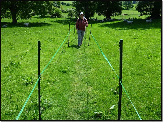
0711pond0712path1

It seemed a bit strange, but perhaps they have suffered from indiscriminate picnickers.  We gave them the benefit of doubt, though Andrew did complain that the path wasn’t wide enough for him!  (He hasn’t yet learnt how to comment on the blog, so can’t answer back!)

Further on, the path leading back to Alderley Edge has always been narrow, but unlike some Cheshire pathways, it’s protected from the farmer’s plough.

0714path3

We returned past the Engine Vein, pictured below, which a few years ago was an ugly open scar, where a line of early mining pits was excavated in around 1900.  After being fenced off, it now looks grassy and benign, hiding centuries of mineral excavation.

Numerous old tools, dating back as far as the Bronze Age (2500 to 800 BC) have been found hereabouts.  Many minerals are found here in the space of a few acres, including copper, lead, iron, zinc, silver, arsenic, silicon, barium, vanadium, and magnesium, in a variety of forms, mainly as thin films coating the pebbles and grains of the porous sandstone.  From the Engine Vein, later galleries and levels amounting to 22 miles in length, reach out beneath the Edge.

0717engineseam

There’s much more history to this place, but that’s enough for this instalment!

We were back at the car park soon after 2.30, after this most pleasant of bimbles – about 16 km (10 miles) with 250 metres of mainly unnoticed ascent, taking just over 4 hours.  Here’s the route:

0700route

Next – a 9 km evening walk on Tuesday (tomorrow) – meeting at 7.30 at the Information Centre near Delamere Station (SJ 546 703).  All are welcome.

Tuesday, 4 June 2013

Tuesday 4 June 2013 - Porthgain to Abercastle

Liz and Rachel had children to attend to at home, but the remaining eleven of us headed off to Porthgain in the school bus to complete this year's coast path adventure. 

The weather remained perfect - cloudless and warm. We didn't need to rush. Today we were to cover all of 8 km (5 miles) in two and a half hours, so time could be spent admiring the remains of the old brickworks and lime kilns, this being an area where much quarrying took place between 1840 and the 1930s.

There's also a bright white phallic tower on the headland beyond Porthgain, and further on, a stone circle at Aber Draw has the aura of a recent construction. 

Elevenses were taken beyond here, at the site of some ruined buildings. A seal swam along the coastline below us. A little further on, choughs were nesting in caves and crevices whilst a pair of Canada geese explored an inlet as if on their summer holiday. 

Fulmars and cormorants were also in evidence, amongst many other species, some of which have been referred to in earlier postings.

Today's cliff tops were swathed in bluebells as well as the usual Thrift, Sea Campion and Spring Squill. They were also adorned in places with a robust form of Red Clover and giant Foxgloves. 

Cattle were huddled into shady corners of their fields and all too soon we were huddled into a shady corner of Abercastle, waiting for the school bus. It was half an hour late; the driver got lost!

No matter, we enjoyed the moment before returning to Treleddyd-fawr and dispersing or staying on for more sun by the seaside. In our case the former - we dropped Andrew off in deepest Cheshire before getting home by 8 pm.

What a lovely trip. We'll try to upload a slide show before we head off again. 

Today's picture was taken on the final descent to Abercastle. 

Monday, 3 June 2013

Monday 3 June 2013 - Whitesands Bay to Porthgain

Well, not quite Whitesands Bay. We started from the cottage at Treleddyd-fawr and headed back along the lovely heathland path to rejoin the coast path at Penlledwen.

Another wonderfully sunny day saw us yet again admiring this route at its very best.

Out at St David's Head a homing pigeon befriended us.  Soon afterwards, after passing through orchid meadows, we came upon a tame kestrel. Nearby, after we'd passed through a corridor of tormentil, cowslips,  birds foot trefoil, primroses and bluebells, we watched as a gannet caught its lunch.  Spectacular.  A buzzard glided overhead whilst choughs and oystercatchers argued in the bay far below.  Black redstarts cackled at us from their viewpoints in the gorse. We failed however to spot any seals. 

Meanwhile, the burning sun blasted us from an azure sky. Much sun tan cream was required. Miss Application ruled ok - everyone has red bits.

A great black-backed gull toured the coast line. We watched through a haze of bluebells as it glided past the spectacular cliffs.

Lunch was taken near Aberdinas, then we eschewed Abereiddy in favour of Traeth Llyfn (pictured) where the two Sues and Liz enjoyed a swim.

The Shed at Porthgain provided a fitting end to the day by way of Cornish style cream teas for everyone. Then an old school bus appeared to deliver us back to Treleddyd-fawr, where we later reassembled for an evening of international cuisine and debate. 

What fun! About 18 km in not much less than 8 hours was today's impressive tally.

Sunday, 2 June 2013

Sunday 2 June 2013 - A Circuit from St David's

Another perfect summer's day found all thirteen of us back on the coast path from St Non's to Whitesands Bay (pictured).

We somehow managed to rendezvous at St Non's from our various lodgings, and once again we admired the artefacts and the stunning coastal views. 

Stonechats chatted in the gorse and jackdaws swooped and glided within the coastal inlets. A gannet floated uncertainly over the churning waters of Ramsey Sound and several parties of kayakers. 

Ox-eye Daisies dominated the verges of the path for a while, with Gorse and Thrift providing a panorama of yellow and pink. Heath Spotted Orchids and Common Star-of-Bethlehem had managed to colonise some damper areas.

Lunch was taken overlooking the Lifeboat Station at St Justinian. Swimming at Porthselau provided a diversion for Sue, Rachel, Liz and Sue, whilst the rest looked on as they shivered in the icy water. A more inclusive activity was the purchase of ice creams for most of the party from a kiosk at Whitesands Bay. Then we continued to Porthmelgan before heading up to Carn Han and on to the rented house at Treleddyd-fawr for tea and cake. 

The others stopped here, after 19 km in a good 8 hours, but while Andrew and Sue got a lift back to Y Gorlan, I explored some inland paths for another 6 km of late afternoon pleasure. They were little used and a trifle boggy, but very enjoyable. 

A quick turnaround saw us back at Treleddyd-fawr, this time for a barbecue and a convivial evening amongst friends. 

Saturday, 1 June 2013

Saturday 1 June 2013 - Newgale Sands to St David's

Having completed the South West Coast Path last year, Sue Emmett's ageing followers have this year tracked her to Pembroke, for a go at Wales. 

Today's walk was a complete contrast with last week's forlorn efforts around Fraserburgh. Perfect weather and footpaths have made for a wonderful day out in what must be 'World Class' scenery. Whatever words I now compose can't do justice to the quality of the landscape and its flora and fauna. 

After an interesting ride on an old school bus, especially commissioned by Sue E from the local transport museum to blend in with its passengers, thirteen of us set off from Newgale. Jacqui, Hilde and Anita immediately caused confusion by embarking in the wrong direction. Many years of "Keep the sea on your right" had perhaps ingrained to the extent that they were unable to adapt to the Welsh convention whereby the sea is on the left.

Eventually they realised their error and by the time elevenses was taken they had joined the rest of us - Sue, David, Sue, David, Betty, Liz, Rachel, Andrew, Gaynor and me. This was the last time we convened as a group today!

Sue and I soon fell behind. Flower photos were to blame. Sue continues to experiment with her new Canon G15 camera, and it takes time. 

The Gorse, as can be seen in today's image, is in fine fettle just now, with it's vivid yellow flowers. There are also large swathes of Thrift, Spring Squill, Sea Campion, Scabious and more. We watched Linnets and Stonechats forage in the gorse, and a Peregrine soared overhead for a while. 

Tea and cake outside a café overlooking the inlet at Solva was followed for Sue and me by lunch on a bench just above the village. People were jumping in off the quay. A family passed, carrying a kayak up the hill. "Extreme Kayaking" muttered dad.

We then caught up with some of the others and ambled along with them on the gorse bedded cliffs above the shimmering sea for the rest of the day. 

Before heading into St David's, some of us went down to the well and the chapel at St Non's. The well is said to have sprung up during a thunderstorm when St David was born around 500 AD. Its waters are alleged to cure infirmities. Anita tried to go for a swim, but it wasn't deep enough. The chapel is very small, with an exquisite stained glass window. 

Last night Sue, Andrew and I enjoyed nosh at the Farmers Arms before adjourning to meet the others at their de luxe residence a couple of miles away near the Youth Hostel. Tonight it's Bishops - just down the road from our B&B, Y Gorlan.

Just 19 km in 6.5 hours today. All very leisurely. Fabulous coastal scenery. 

Friday, 31 May 2013

Another Day, Another Trip

And where might we be tonight?  

Here's the view from our B&B.

(It can't be Scotland, of course, as it's not raining! )

Sent from 'abroad'

Thursday 30 May 2013 – Hail Storm Hill

3008sunset2

It was a lovely evening for this six mile exploration of Hail Storm Hill, just to the south of Waterfoot.

Sue and I set off from the otherwise deserted picnic spot at Waterfoot at 7.30 and after a false start through someone’s garden we headed relentlessly upwards, overtaking a couple of mountain bikers, past the gardens of Rake Head and onto Brandwood Moor.

3001Brandwood3002RooleyMoor

There is a single wind turbine on display as you rise to the south, but beyond the track junction, if you head towards that turbine, many more come into view.

Our mission to seek the summit of Hail Storm Hill took us first past Top of Leach’s trig point at 474 metres, which I’d visited before with Alan R and had a little difficulty persuading him that it wasn’t the highest point.

There’s a stone pillar here inscribed with the names of some of the local towns – Bacup, Whitworth, Rawtenstall, Haslingden and Rossendale, I think.

3003TopofLeach

The other direction, from a higher point, reveals the wind farm.

3004turbine

We walked to this other point that looked higher than Top of Leach, then through the shadow of the whirling blades and along the access track for a while, trying to minimise the amount of bog needing to be crossed to reach our target.  Just 800 metres of it from this direction.  Luckily it was fairly dry and no foot wetness was sustained.

Eventually we reached the summit – at 477 metres, the highest point in this area.  Marked by a massive cairn of about four stones.

3006HailStormHill3007sunset1

Heading north with good sunset views we passed through the mountain biking mecca of Cragg Quarry and soon regained the Pennine Bridleway, with good dusky views across Cowpe Reservoir to Bacup.

3009Cowpe

The Bridleway, which is also the Mary Towneley Loop at this point, took us nicely back to Waterfoot after just over two hours and a little more than 9 km with 276 metres ascent.  Our actual route and other data is shown below. (Click on ‘View details’ to do exactly that!)

An excellent venue for a summer’s evening stroll – a shame nobody else could join us…