Sue and Martin in Mallorca 2019

Sue and Martin in Mallorca 2019
On the Archduke's Path in Mallorca

Saturday, 11 July 2015

Friday 10 July 2015 - Pyrenees GR11 - Day 26 - Benasque (Hotel Avenida) to Barranc de Lac Redon (1815 metres)


Distance: 21 km (Cum: 437 km)

Ascent: 1350 metres (Cum: 22600 metres)

Time taken: 10.3 hrs including 1.7 hrs stops (Cum: 172.4 hrs including 34.3 hrs stops)

Plus a bus ride of 11 km with 700 metres ascent as far as Puen del Corones, from where the walking statistics start.

Weather: guess what? sunny and hot

Like Tobi and many more before me, I'm a GR11 cheat. On the advice of Humphrey, Brian (the guide book author) and others - namely my own two feet, I caught the 7.15 am bus from more or less outside the hotel for an hour's ride up to 1980 metres. 'The track's a Snore' said HMP3,  'take the bus'. This appears to be perfectly acceptable, as on the excellent E5 route between Verona and Lake Constance.

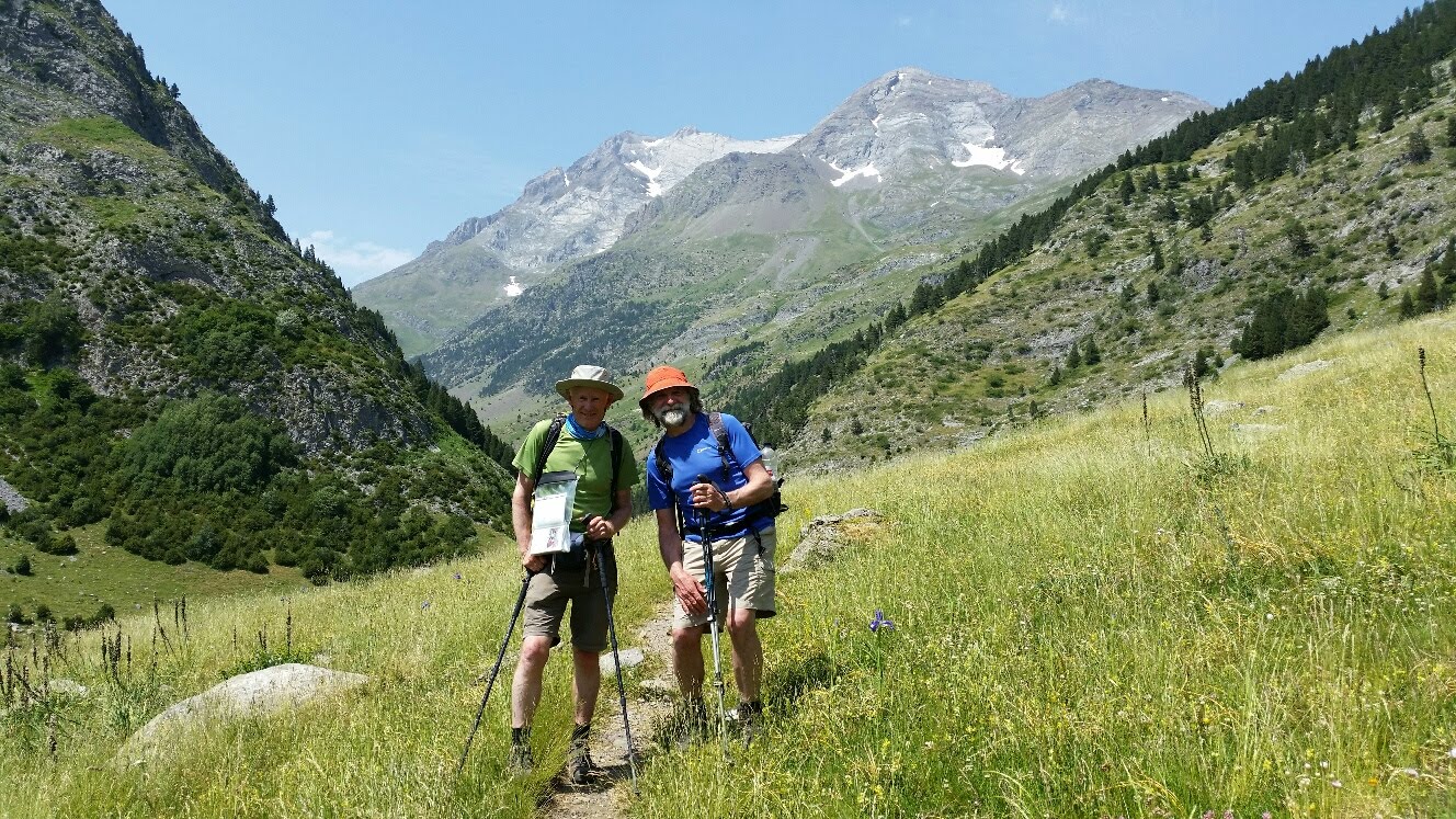
Others on the bus included the first two English speaking voices I've heard for a while - Rona and Danny, a young Irish couple struggling with very heavy loads. They started from Irun but skipped the hefty section between Candanchu and Benasque in order to meet up with Rona's parents. They were moving very slowly. I don't think I'll see them again.

So, having covered the first three hours of today's route by 8.15, I was able to linger and take my time eating the bag of breakfast the hotel gave me last night together with a flask of coffee that I did drink. I should have looked inside the bag before I set off, as I now have a hotel tea spoon, several packets of sugar and some other goodies that I might have left behind had I known about them. The butter has just gone in my pasta. I examined the poorly feet and applied a plaster where the skin had broken. But with clean socks and Sue's advice, my policy today was one of immersing the feet in cold water every now and then. They are still sore, but holding their own. They were so bad on Wednesday night I thought the trip was in jeopardy; now I know that if it happens again a day's rest should relieve the problem.

What about the walk? Another fine mountain day in the HRP / GR11 style. That is, there were long sections across and up and down boulder fields of the nature that GR10 doesn't encounter. At each end of the walk, long sections through woodland. Humphrey was right about the ascent to Puen del Corones. We had plenty of time to admire what really amounted to the same view all the way up, from the bus, which provided it's own entertainment. First gear was extremely difficult to engage, and I noticed the engine cover would have been flapping had their been any breeze. It's not a route on which to use your newest assets...

The middle section of today's walk, including the boulder hopping, was absolutely glorious. Rocks and lakes in the high Pyrenees.

The high point of the day was reached quite early by way of a good path with occasional rock steps, from where the bus dropped us. An easy 800 metre ascent to a fine viewpoint. There were good views back to Posets, but in contrast to previous days there wasn't any one huge massif in front of us, just five ranges of mountains stretching into the distance ahead.

Soon the half built Refugio de Cap de Llauset came into view. The main structure looks complete, but judging by the response from the Barrabes staff when I enquired as to whether it was open, there's a long story about a disastrous project.

I lunched beside a musical stream - it couldn't decide between Indian music or folk music, but it was a good concert - near the faltered refuge construction before heading up to the next col with a couple of Spaniards. We couldn't understand a word of each other's language until I pointed to one of their ancient ice axes with a wooden shaft - "classic" - "si" they seemed pleased in the same way as I soak up admiration for my old mountain bike.

I was planning to camp by the Anglios lakes, but it was only three o'clock. I couldn't face four hours of frying in the sun. So I continued down into steep woodland on a good path. For four hours, passing Refugi de Conangles. I debated whether to stay there, but with alleged good camping a bit further on, I headed for that.

Brian says there is good water and camping at the start of this ascent. I've found the water - brilliant, I can almost reach out and  collect spring water from the tent. But the wild boar seem to have destroyed all the flat spots. Never mind, I'm comfy and will sleep well with the soothing sound of running water, despite the slight slope.

Interestingly, I'm now back on the HRP route we took in 2004. I think we left Julie to hitch back to civilisation along the main road that runs past the Conangles refuge, after an exciting descent, which I can remember as if it was yesterday, from Collada Mulleres. Happy days.

No phone signal here. I'll try to find somewhere tomorrow.

Today's pictures:
Looking back to Ibón Inferior de Ballibierna early in the day
Estanys Cap d'Anglios from Collada d'es Ibons
Foot maintenance
A slopey campsite, looking back towards Aneto

PS Thanks for the comments. I'll reply sometime when the screen isn't sunblinded!

Next Day - Day 27

Back to Index
 

Thursday, 9 July 2015

Thursday 9 July 2015 - Pyrenees GR11 - Day 25 - A Day off in Benasque (Hotel Avenida)


A day off at last. And I need it.

Weather: cloudless and hot

I woke at 8.30 thanks to the shuttered windows.

Breakfast wasn't anything to shout home about and I've no idea how the coffee machine was meant to work. I did get a nice meal last night at Hotel Llibrada though. TV in the background led the news with 'Grexit'.

The day has been spent lazily, mainly in the spacious apartment, planning the next stages, buying too many supplies, and nursing my feet.

I've bought various items that I hope will protect the feet from further damage, but there seems no point in bandaging them until I start walking again. So we'll see what happens tomorrow.

Benasque is a quaint little town with various outdoors shops, including Barrabes, which is a bit like Ellis Brigham's shop in Castlefield. There's a Visitor Information office, but nobody there speaks English. The staff at Barrabes have made up for that and given me the information I need. I think. Perhaps.

I'll be loaded up with all sorts of interesting bars and gels for the next section - stuff I've turned my nose up at in the UK, but with the rare opportunity to buy some proper hill food I took the plunge.

I've had another issue with the phone, which recently gave me a new to me message - 'Device out of memory' and refused to do very much at all. Consequently I've deleted some stuff, most significantly lots of emails and all the music, which I can manage without and reinstall when I get home. After deleting everything I could think of I noticed that the photo 'gallery' is now showing three separate folders - camera (216), download (5) and picasa (25952). So perhaps that's where the problem lies! Why do I need 25952 picasa images on the phone? I've since managed to work out how to stop the sync with Picasa, and I may have removed a sizable 'cache' from the gallery, but I can't see how to remove the Picasa images without also removing the photos I've taken on this trip. There's always something! (Later - clearing the cache seems to have sort of worked as I now have 25951 grey images and a picture of an elephant.)

Yesterday I mentioned my chat with Jean-Luc about the comparison between the three usual walking routes across the Pyrenees.

There's the HRP, Haute Route Pyrenées or Haute Randonée Pyrénéenne, which translates literally as the High Route of the Pyrenees - a high level route that isn't specifically waymarked and isn't a prescribed route, though some publishers, eg Cicerone, have guides that describe one person's take on the route. It was Frenchman Georges Véron who pioneered and defined the HRP. He promoted the climbing of certain peaks as an essential part of the route, and there are a few other notable peaks which aren't far off track. It doesn't necessitate actual climbing at any point, but a head for heights, good navigational sense and some scrambling ability are essential. Depending on the season, luck with the weather and your own route choice, familiarity with an ice axe may also be essential. Sue and I walked a version of this route in 2004 - a superb walk. It's popular, and currently many people will be enjoying their high traverse, spending more time in France than in Spain.

GR10, which we walked in 2013 and which Mick and Gayle are about to embark upon, is a long established and well waymarked route on the French side, whereas GR11 is Spain's more recent answer to GR10, also very well waymarked.

Jean-Luc told me that his son works at an establishment on the GR10 route and reports that during the 'season' around ten to twenty people pass through on GR10 every day.

I didn't realise how quiet in comparison GR11 would be. I had a brief encounter with Mitxel in the Basque country and am still in touch with Tobi, who is about three days ahead of me. I've also met a few folk coming the other way (all these crossings can be done east to west as well as west to east); mostly they have been walking just sections of the route.

I may have started a little early to encounter the main GR11 'traffic'. It'll be interesting to discover how many folk Rosie and her partner encounter two to three weeks behind me.

The weather can vary immensely between GR10 and GR11, with the HRP somewhere in the middle. When in sunny Spain, you can often see cloud spilling over from France. So the GR11 walkers may be in a lather of heat and sun cream, whilst those on GR10 may be under heavy cloud or even enduring a rainy day.

This all means that GR10 brings with it a greater sense of camaraderie than the other routes, especially as there is lots of good 'gite d'étape' accommodation along the way, geared to the needs of the like minded walkers. There is plenty of accommodation along GR11, but little knowledge or understanding of the route.

Today's photos taken around Benasque will hopefully bring back happy memories for Humphrey in particular. The third picture down is taken outside my hotel; the Barrabes store is just out of picture to the left. Music is playing in the background.

Next Day - Day 26

Back to Index

Wednesday 8 July 2015 - Pyrenees GR11 - Day 24 - Barranco Llardaneta (2470 metres) to Benasque (Hotel Avenida)


Distance: 19 km (Cum: 416 km)

Ascent: 600 metres (Cum: 21250 metres)

Time taken: 8.3 hrs including 1.2 hrs stops (Cum: 162.1 hrs including 32.6 hrs stops)

Weather: sunny and hot, but with a pleasant breeze above 2000 metres

My diversion from the main GR11 route was justified by this morning's superb mountain walk over undulating rocky terrain.

The day started from my campsite that probably wasn't seen from the path, with the opposite of that semi circular bridge way back in the Basque country. This one was 'V' shaped. Much easier than fording the river though.

Which was exactly what I had to do a few minutes later when I turned left off the path to the Refugio and headed towards Collada de la Plana. Nearly all the way to the col the modern Refugio d'Ángel Orús with its semi circular balcony was glowing in the morning sun. Just a small dash of humanity in a vast landscape that I gave up trying to capture with my camera. (It's there in the top picture - I think you get a bigger image if you click on it.)

It was slow going for the entire morning, but not stressful as there were easy rock-hopping sections in between the climbs up and the climbs down where nuisance walking poles could be thrown down a few metres. Much easier than the descent to Pineto on Sunday, on which the discarded poles would have been lost forever.

I had company for an hour or so. Jean-Luc turned up at the 2702 metre Collada and we admired the views back to Posets and ahead to the Aneto massif. He reminded me of myself about fifteen years ago. Coming from Toulouse he's a big fan of the Pyrenees. We discussed the various long distance walking routes, about which more tomorrow. His rucksack was small enough to have the aura of a day sack, but he was doing a six day circular backpack, carrying all his provisions and complaining about being out of condition. He camped further on than I did last night, but he got a later start. His tent must have been in the shade for longer.

The first 500 metres of descent to a lake at 2200 metres was through beautiful rock scenery, on a path that wasn't really a path, just the safest route as indicated by blue dots on occasional rocks.

There was no need to carry much water, thanks to the almost perpetual flow of spring water from Posets.

I made a note that there were no clouds and I surmised they would appear later. They didn't.

For most of the day my left foot, with the troublesome toes, behaved well, wrapped in my spare handkerchief. Last night when washing my feet I'd questioned why one foot should be causing problems and the other was perfectly fine. I shouldn't have. By the end of today the right foot had developed the same, but worse, symptoms. By the time I walked into Benasque at 4.30 both feet felt as if the shoes were full of gravel.

Back at the lake at 2200 metres I got a distant view of total nudity. I couldn't help glancing in that direction when I got closer. It was one of those occasions when the view from a distance over promised. I went back to concentrating on avoiding the lizards and frogs on the path.

The long descent progressed from boulder hopping and rock manoeuvring to a path through lush vegetation with nettles, showing signs of some sort of former habitation at the 2200 metre lake, below which the heat rose but the shade increased as an area of steep pine forest was negotiated. There were quite a few people around. I sat down for a break. It wasn't to be, the rock was too hot.

Further down, the pine gave way to a lovely winding path through beech and birch woods lined with tall thistles and clovers, with the ever present spring water for face washing and drinking.

But the path was not level and however light on my feet I tried to be I could feel increasing soreness in both feet during the 1500 metre descent.

In the sweltering heat I was reminded of the lyrics from a song in 'The Rock Machine Turns You On' compilation, likening things to 'a Chinese wrestler's jock strap cooked in chip fat on a greasy afternoon'. But in my case it is the cheese fat, not chip fat, that has prospective hoteliers running for cover.

I decided not to inflict my smelly persona on any sweet smelling Spanish driver and walked an extra 3 km, leaving GR11 at Puen de San Chaime in favour of the hot and dusty road to Benasque, where Sue had booked me in to Hotel Avenida.

They had the booking but thought it was for two people. Accordingly I was shown to an apartment round the corner from the hotel. It would accommodate six people. It'll do.

Today's pictures:
The view back to my campsite and yesterday afternoon's descent. Can you spot Refugio d'Ángel Orús?
The view ahead, from Collada de la Plana, with the Aneto massif
Pyrenean Eryngo (Queen of the Alps)
The woodland path near Puen de San Chaime, by way of contrast

Next Day - Day 25

Back to Index

Tuesday, 7 July 2015

Tuesday 7 July 2015 - Pyrenees GR11 - Day 23 - Barranco Montarruego  (2110 metres) to Barranco Llardaneta (2470 metres) near Refugio d'Ángel Orús


Distance: 16 km (Cum: 397 km)

Ascent: 1450 metres (Cum: 20650 metres)

Time taken: 9.5 hrs including 2.5 hrs stops (Cum: 153.8 hrs including 31.4 hrs stops)

Weather: like the fumes from a witches' cauldron being stirred by the devil

I didn't have that much to eat last night thanks to the huge lunch, but by midnight the chocolate I'd bought had hardened just sufficiently for it to be eatable rather than drinkable, so it had to go before it melted again.

On another cloudless day I braved the midges, waiting for the sun to disperse them but leaving the tent as the sun hit it (fine timing required), and set off on the easy walk to Biadós. Our 2004 HRP team stayed at the campsite here before heading to the north of my route today.

The walk down to Biadós was through cotton grass and great yellow gentians, with the Posets-Maladeta massif blocking the horizon ahead.

I found Refugio de Biadós a little elusive. In the event I stopped for elevenses just below it, eschewing the temptation to find the Refugio and enjoy a cold coke there.

It soon came into view as I walked off in the opposite direction.

I'd decided to take a minor variation on the standard GR11 route and follow the southern section of the Circuito de los Tres Refugios, which circumnavigates the Posets massif and rejoins the standard route tomorrow.

I must be a glutton for punishment. My route climbed about 1300 metres from the low point of the day, up to Collada Eriste, at 2864 metres the highest point of the trip. It was higher than Cuello de Tebarrai, before Panticosa, but easier. Nevertheless the scree was very steep in places and there were some easy snow slopes just below the pass.

Today I didn't need to stop quite so frequently, but with no time pressure I moved pretty slowly. At one point, after a steep slope beyond the distinctive spike of Cantal de Barrau, the guide book suggests heading for the 'obvious col'. To me it wasn't quite so, but the waymarks over the rocky terrain were more than adequate.

There were a few people on today's paths, mostly day walkers. No sign of anyone doing GR11 in my direction.

That's a shame, as encounters with other people are I think necessary to keep this diary interesting.

Moss Campion featured strongly as I strode through the snow today, and a flock of snow finches graced the high point. There was no angry chamois today.

I dropped down into the new vista, finding this place to camp as suggested in the guide book. It would be possible to camp next to the high lake, Ibón Llardaneta, pictured in my guide book as a snow scene. Today there was no snow there, but a massive waterfall coming from the slopes of Posets required a river crossing. Shame about the bandages on my poorly toes. I'll have to improvise tomorrow and restock my first aid kit in Benasque. 

Curiously, the outflow from Ibón Llardaneta flows inexplicably south, towards the mountains. Barranco Llardaneta, appears to flow from high up the slopes of Posets, and by-passes the lake by a few metres.

The descent to this excellent site, where I could enjoy a brew in the sunshine without being plagued by insects, passed through an area full of stunning deep blue clumps of Spring Gentians, with some equally stunning Trumpets for good measure. The afternoon brought a few clouds and a light wind, so today was not quite so sweltering, perhaps because I'm a bit higher.

Today's pictures:
The view to the 'obvious col'
Now it's a bit more obvious
The view ahead, from Collada Eriste
Today's campsite at 2470 metres

Next Day - Day 24

Back to Index


Monday 6 July 2015 - Pyrenees GR11 - Day 22 - Plana Fonda (2080 metres) to Barranco Montarruego  (2110 metres)


Distance: 28 km (Cum: 381 km)

Ascent: 1350 metres (Cum: 19200 metres)

Time taken: 11.0 hrs including 3.2 hrs stops (Cum: 144.3 hrs including 28.9 hrs stops)

Weather: sunny and unerringly hot

On another cloudless day I managed to pack up before the sun encroached on my shady meadow, and I was away by 8 o'clock.

Despite the statistics it was an easier day, spent mainly on easily graded tracks that were kind to my poorly toes. Just as well they were easily graded. The 1200 metre ascent from Parzán to Collata Chistau took me five hours, during which I stopped for a drink and a rest after each 100 metres of ascent, getting through three litres of water in the process. I'm usually faster and drink less, but with the temperature being nearly 35C in the shade I reckoned best be on the  safe side. Also, camping before the sun goes down brings it's own issues.

Even now at 9 pm, long after the sun went, it's well over 20C in here. I've managed a much needed full wash, but the process of chucking the dirty water out let a cloud of midges in. So I'm relatively clean, but covered in midge bites and sweating like a pig.

Do pigs sweat?

This morning's walk was hot but easy. Once over the nearby col, from where the top photo was taken, the path dropped pleasantly down a rock staircase lined with Fairies Thimbles and saxifrages and passing a large family of marmots and a lone horse - perhaps it was his bell I could hear last night - to a dirt road that was followed for a further 13 km down a twisty valley full of conifers, to Parzán.

The village looks fairly new, though apparently it has been a mining centre since at least the 11th century. Sadly it was destroyed in 1936 in the Spanish Civil War and has been rebuilt since then.

I went to the spectacularly good supermarket, bought lunch supplies, then went to the restaurant across the road for a coke. 11.30. Finding open access wifi there, I lingered. Lunch menus came out. I couldn't resist. I also knew that two hours spent outside a nice restaurant might have the edge on two hours spent in a tent under siege from insects, albeit tonight's cloud of midges took me by surprise - it's my first encounter with them on this trip. The ones that got in (hundreds) are slowly being eliminated. Perhaps the weather is to blame; as you might gather I'm spending my nights as high as possible. I'm not up to date with the news, but I suspect I'm not the only one battling with a  heatwave.

When in Parzán, I noticed the line of our HRP route on the map. Sue, Julie and I passed through on our way to Bielsa on 19 August 2004. I don't remember Parzán, but I do remember waiting, dripping, in the church at Bielsa with Julie while Sue scoured the village for the last room for three people. Once the storm had abated, I think it was the day of Julie's kit check whereby the rubbish bin in our room was the receptacle for the excess baggage that was preventing my Phreerunner tent from assuming its rightful place inside her rucksack. Curiously, our HRP route went somewhat south of my route today. I think the HRP route we took (or mis-took) may be harder, featuring 'raspberry rise' and 'the wrong valley', and claiming any items that weren't securely fastened to our rucksacks.

The only walkers I saw today were a few DofE type teenagers on the approach to Parzán. I've seen nobody apart from hydro plant workers this side of Parzán. Mind you, I can think of better things to do than walk up nearly 1200 metres of dirt track on a Monday afternoon!

St John's Wort and a tall blue plant lined the track that goes all the way up past a hydro plant and it's impressive generator building, as far as Ibón d'Ordizeto, a lake that I didn't get to see as I turned off at Collata Chistau. But I did see my first nutcracker of this trip, and a large black squirrel. The water point at 1715 metres (pictured) was extremely welcome.

Even the sections of ascent that shortcut the track to the lake were well constructed, possibly a throwback to the area's history of iron and silver mining dating back many centuries.

The final pull to the 2346 metre col was up steep scree as the well graded path still lay under snow. You could see the different, progressively easier, routes taken as the snow slowly (even in this weather?) melts.

Beyond the col, a bothy that looked in good condition was soon passed. The condition of various bothies I've passed is generally unchanged from Brian Johnson's observations in his 2014 edition of the Cicerone guide. Personally I wouldn't want to stay in them, but they are available (often very small and not very clean).

This bothy had a big male chamois outside. The chap moved away and then eyeballed me for a few minutes, making aggressive barking noises. I moved on.

A pleasant high level traverse eventually brought me to the left turn that took me over boggy ground past a choice of water sources to this excellent site near Barranco Montarruego, about an hour further on from the high col where the track on which I'd spent much of the afternoon was finally abandoned in favour of the narrow mountain paths that are harder on my toes.

Flies supervised the pitching of the tent, later bringing along their midgy friends. I have a good system of cooking etc, involving the tent's midge defence and the use of my arms similar to that in the chemistry lab when we performed dangerous experiments behind a barrier.

I'm not complaining - the system is now working, the temperature is no longer uncomfortable, and I have good views.

Goodnight.

Today's pictures:
Looking back to Plana Fonda, with yesterday's descent route and Monte Perdido behind
Lunch
A spring fed water point - very handy on days like today
Camp above Barranco Montarruego 

If this posting has already appeared it's because I sent it earlier. But it 'sent' much faster than expected with a  weak signal, and I can't spot it having 'arrived'. Sorry for any confusion. I'll blame a blend of altitude and heat!

Next Day - Day 23

Back to Index


Monday, 6 July 2015

Sunday 5 July 2015 - Pyrenees GR11 - Day 21 - Rio Bellos (1880 metres) to Plana Fonda (2080 metres)


Distance: 14 km (Cum: 353 km)

Ascent: 1450 metres (Cum: 17850 metres)

Time taken: 10.3 hrs including 2.4 hrs stops (Cum: 133.3 hrs including 25.7 hrs stops)

Weather: sunny and blisteringly hot

Humphrey warned me about this being a tough day. He was right. The first 6 km took me 6 hours.

I packed up slowly, partly because it went dark last night before I'd finished the diary, so that had to be done this morning.

Nevertheless, the first 250 metres of a steep 550 metre ascent to where I'd have liked to camp were in shade. After that it just got hotter and hotter, and yes I do have blood blisters on the toes of one of my feet. There's a first time for everything! I'm glad I didn't continue up there last night - I'd have arrived too late to appreciate the great spot.

That initial 550 metres took me through an area dominated by black vanilla orchids, alpine asters and edelweiss. Unrelentingly steep through a landscape of rock bands and pretty waterfalls, punctuated with flowery meadows.

I was walking with a posse of harmless but annoying flies towards an area of the grey volcanic rock similar to that which we've been examining from afar during the past week. 

A further gentle 50 metre ascent took me to Collata Añisclo (2453 metres). This is the start of, in Humphrey speak, A Monster Descent. So I paused and chatted to some Spaniards who were walking a section of GR11 from east to west. They were debating whether to tackle the balcony route to Góriz. It looked scary, a bit like the lower cycle path in the Brenta Dolomites. Hopefully it is as easy as the latter when you get to the section that looks from a distance like impossibly steep scree.

I also found a phone signal and paid for the privilege of being able to download a couple of messages before losing the signal for the rest of the day.

Yes Tim, I did notice that Paula was running quite fast, such was her desperate need for ... an ice cream...

So yesterday's posting failed to 'send' despite many attempts, which to be fair gave me an excuse to stop frequently on the vertiginous 1200 metre descent to Refugio de Pineto, whose 'wiffi' was not for public use.

I was surprised at the number of people ascending the cliff, given its gradient, but they were mostly day walkers who were happy to do a bit of scrambling without loads on their backs.

At one point an Egyptian vulture floated serenely past, just a few metres away. The thermometer rose into the 30's as I approached the bottom of the valley and the rocks I needed to hold on to got hotter and hotter.

At Rifugio de Pineto I headed indoors for some respite from the heat. A coke went down well. Nobody spoke English. I asked for 'the menu'. This turned out to be the standard lunch of a massive tuna salad followed by two giant sausages, two pork chops and a plate of chips, rounded off by a 'flan'. I spent over an hour on this, but it eventually defeated me. I didn't need much food later on in the tent.

The 'menu' lunch gave me the energy for a hot 3 km road walk to an enticing looking Parador hotel. Then another unrelenting steep ascent, at times requiring care with navigation, brought me up to a bothy at 2100 metres. There were excellent views to the cliff I'd walked down earlier, and to Monte Perdido, whose glacier is reportedly receding. In this heat, I'm not surprised!

The bothy was occupied, with no sign of the occupants other than their line of washing. The meadow in which I'm camped is just a little further along the path. There's some convenient spring water and the ground is flat. But being a cow meadow there are the inevitable flies and mosquitoes. As I arrived, a vulture laboriously flew off, and the marmots and wheatears around here are exceptionally noisy.

It's 20C in the tent, which is now comfortably in the shade.

Today's pictures:
The view back down the Río Bellos canyon from Collata Añisclo
I was too scared to photograph the descent, so here's the sign
Irises in the meadow at La Larri
My campsite at Plana Fonda 

Next Day - Day 22

Back to Index
    

Saturday 4 July 2015 - Pyrenees GR11 - Day 20 - Ordesa National Park main car park to Rio Bellos at 1880 metres


Distance: 18 km (Cum: 339 km)

Ascent: 1300 metres (Cum: 16400 metres)

Time taken: 8.0 hrs including 1.5 hrs stops (Cum: 123.0 hrs including 23.3 hrs stops)

Weather: sunny and unrelentingly hot

Thankfully the tent is in a deep valley from which the sun withdrew as I pitched camp at 6.30. But it's still hot in here. Perhaps I should have continued a little higher...

It was a shame to have to leave Hotel Sabocos this morning. The staff are great, and we've made some good friends amongst the other guests. Harry and Ann, and Tim and Paula have been especially good company, and we were just getting to know Stephen, a malaria guru, when he left to return to Australia. The Macclesfield crew also deserve a mention - they are a great bunch, and I'd like to thank the Collett's team of Will, Clare, Remy and Claire for their efforts to make everyone's holiday meet their expectations.

Humphrey's vicarious presence also deserves mention, with much good advice and information for my ongoing journey arriving from his dyslexic pen. We regularly toasted you at Beer o'clock HMP3, and we hope your Monster Projects go well.

A last hearty breakfast was followed by a car ride with Sue in the gutless Twingo (a French car seemingly powered by clockwork) to Torla. Sue then returned to a high point en route, for a day walk. I got the last seat on the next bus up to the Ordesa Canyon car park.

So, back to the simple life, with just what I had on my back (I would later regret bringing one superfluous item), as supplemented by purchases along the way, for the next five weeks. Despite a load of extra food brought from the UK by Sue, as well as top ups of tea bags, dried milk, raisins and sultanas, etc, 'The Brick' didn't seem too heavy and I've now returned to my backpacking rhythm. I did leave a few items behind - crampons, ankle gaiters and a few maps - but they didn't amount to more than a few grammes in weight.

Setting off at 10.30, I was amongst numerous folk simply bimbling up the canyon. There was also a handful of people with ice axes, planning on spending tonight at the Góriz refugio then climbing Monte Perdido (3348 metres). It's supposedly an easy climb. But not for me.

For the first few kilometres some respite from the heat was afforded by trees, and iconic waterfalls were passed. Then, at around 1700 metres the canyon opens into a wide meadow with a mare's tail waterfall, Cascada de Caballo at its head. This is the terminus for many people. They were lunching in the sunshine and cooling their feet in the river before heading back down.

The woodland section had been lined with Bladder Campion and Nottingham Catchfly, with Spring Gentians, Moss Campion and bright yellow vetches forming mats of colour higher up. Pyrenean Eryngo, aka Queen of the Alps, loitered more or less everywhere with its distinctive cylindrical flowerhead with a ruff of metallic blue-lilac spikes.

The path was quieter above the mare's tail waterfall. Just a select few were heading up to Refugio Góriz, one of the busiest mountain huts in Spain. I'd been there before and had no desire to repeat the experience. There were over fifty folk lounging outside when I arrived there at 3 o'clock.

I topped up with water and continued on easily to the high point of my day, Collata Arrablo (2343 metres). By now the wonderful canyon views had retired, but the mountain scenery remained superb. A geologist's paradise, I imagine. For me, the pleasure and excitement of being on ground that was new to me, having previously reached Ordesa via the Brêche de Roland or the Ara valley. I was disappointed not to be able to spot the Brêche today.

The descent to the bridge over the Rio Bellos took longer than expected. I stashed my walking poles to make some rock bands easier to negotiate. It was slow going. Edelweiss made its first appearance and clumps of Ramonda sprouted from crevices.

The shepherd's hut near the foot of the climb was occupied by a French lady. I gave her some space and headed down to the bridge. Fancying some cheese, I got out my food bag. It had melted into an oily mess. All my provisions - covered in a thin film of oil from the melted cheese, which I didn't really need anyway. My newly washed fleece/pillow had protected most other things, but after setting out with everything nice and clean, the oily mess wasn't really what I wanted.

Half an hour later, some 200 metres above the bridge, I found a good side stream and a dinky little place for the tent. Not quite as far as planned, but I was ready to stop. It has been 25-30 Centigrade all day and has only dropped below 20C in the tent after 9.30 pm. Still, I'll sleep better here than in a hot hotel room.

Today's pictures:
Setting off from Torla
A canyon waterfall - one of many
The Ordesa Canyon from the approach to Góriz
My temporary home by Rio Bellos

Next Day - Day 21

Back to Index


Friday, 3 July 2015

Friday 3 July 2015 - Pyrenees GR11 - Day 19 - Interlude 3 - A Peña Foratata Circuit


Distance: 10 km

Ascent: 900 metres

Time taken: 5.0 hrs

Weather: hot and sunny, breezy high up so much more pleasant to walk in than of late.

Today was supposed to be a complete rest day - my first since setting off. We were going to pop over to France for a gondola ride to a narrow gauge railway.

But Harry was the only taker for Clare's Peña Foratata walk from Formigal. It wouldn't 'run' with just one guest. So Sue and I came to the rescue.

It was conveniently short and gave excellent views as far back as my route into Sallent a week ago.

Lamergaiers were seen today, as well as a selection of other vultures, probably mainly Griffon and Egyptian, notably whilst Sue and Harry were at the top of the mountain, which required a scramble.

Clare and I waited a little lower, at a high col. Clare's not allowed to venture to such a scrambly place with guests for insurance reasons, but the guests are allowed into such life threatening places as long as it's of their own volition.

There were masses of flowers. The time passed quickly. As it did when we stopped for lunch in an idyllic meadow a little further down the mountain. Alpine Swifts were active here, and we could see a herd of twenty or more chamois cooling themselves on a distant snow patch.

Back in Formigal it was ice creams and cokes all round before returning to base. A short foray to Gorgol outdoor shop in Sallent resolved my sunglasses, camping gas and 'how to change an altimeter battery' problem, after which Sue went for a swim and I enjoyed another large beer. After a bit of preliminary packing...

Then we spent a lovely evening at Hotel Sabocos with friends new and old.

Transmissions may now be less reliable, as I head back into the wilds of the Pyrenees tomorrow.

Today's pictures:
Formigal and Embalse de Lanuza from the start of the walk
Peña Foratata (2295 metres) from the ascent
The view north from the slopes of Peña Foratata

Next Day - Day 20

Back to Index

Thursday, 2 July 2015

Thursday 2 July 2015 - Pyrenees GR11 - Day 18 - Torla to beyond Ordesa Canyon road terminus, via Camping Valle de Bujaruelo


Distance: 20 km (Cum: 321 km)

Ascent: 700 metres (Cum: 15100 metres)

Time taken: 5.9 hrs including 1.0 hrs stops (Cum: 115.0 hrs including 21.8 hrs stops)

Weather: very hot, with sunshine and slowly building cloud

Tim and Paula kindly offered us the lift that enabled Sue to enjoy a good walk high in the Ordesa Canyon, whilst I could make a little GR11 progress from last night's stopping point to the Ordesa road head.

Thursday is 'Ordesa Canyon Day' for Collett's, but whilst the others all hopped on a bright blue bus that took them up the valley on an otherwise closed road - a similar system to that operated in Zion National Park - I strolled through the pretty village of Torla, then up the 7 km of road that took me back to the Bujaruelo campground. Back across the sturdy beige bridge and along the lovely woodland path, past a fisherman in the river, to Puen de Santa Elena. Here the path, which doubles as the Camino de Santiago en Sobrarbe pilgrim trail, crossed the gorge and took a splendid high route involving a few cables from time to time. I met a large group of children coming the other way.

Martagon lilies and St John's Wort were among the many plant species that lined the path that was also home to some very tuneful songbirds.

At the junction at the bottom, all paths seemed to lead to either Torla or Goriz. Choosing the latter, I found myself on the other side of the gorge to the bus lane, slowly rising in the wide canyon. Lunch was taken on a balcony with a view across to the much narrower Ara gorge.

By 2.30 I'd reached the road head, so I continued for half an hour before turning round in the face of a threat of rain. That threat came to nought, but I soon met Remy, Ann and Harry, so strolled down to the bus stop with them, enjoying the views either side of the gorge as we went.

They caught the first available bus. I bought a cold drink at the café and waited.

... and waited ...

... they must be with someone from Macclesfield Squash Club!

They were, eventually turning up after 5.30 after about 17 km with 800 metres ascent. Paula, desperate, was somewhat ahead of the pack.

And another jolly good evening was had by all, including James and Alison who have just arrived.

Today's pictures:
Starting out over the beige bridge
Ordesa Canyon views

Next Day - Day 19

Back to Index

Wednesday July 2015 - Pyrenees GR11 - Day 17 - Baños de Panticosa to Camping Valle de Bujaruelo


Distance: 24 km (Cum: 301 km)

Ascent: 1000 metres (Cum: 14400 metres)

Time taken: 8.6 hrs including 1.3 hrs stops (Cum: 109.1 hrs including 20.8 hrs stops)

Weather: sunny and very hot

Another good breakfast at Hotel Sabocos set Harry and me up for a good day on GR11.

We drove up to Baños de Panticosa and recommenced my GR11 traverse with just day sacks. This made the superbly graded 900 metre ascent to Cuello de Brazato past a very depleted reservoir, Ibón dero Brazato, less than taxing despite the noises coming from a distant pipe that sounded as if someone was trying to cut it into pieces using a powerful saw.

On the 2566 metre col, about 30 children from San Sebastian were enjoying  a backpacking trip from Panticosa. Harry was delighted to be in this wonderful spot. He sent an enthusiastic message to a good friend who sadly suffers from cerebral palsy.

Here but for the grace of ...

Boulderfields featured strongly in the descent to the Ara valley, together with stupendous views towards Vignemale.

The nice people at Sabocos Hotel had provided an excellent lunch. We ate it shortly before meeting Sue, who had driven round via Torla.

A knee deep crossing of the Ara united our threesome for the fairly windy three hour walk down to the medieval bridge at San Nicolás de Bujaruelo, where Sue enjoyed a cold dip in the river before driving 3 km back along the dirt road to pick up Harry and me. We'd continued that distance into the next stage of GR11 along a lovely undulating riverside path past a few pill box like 'caves' through shady woodland - shade that was most welcome on another day of temperatures in the 30's Centigrade.

The day also featured frequent marmots, the debris caused by unseen wild boar, and the usual proliferation of flowers - notably an ascent through Alpenrose and orchids, meadows of deep blue Irises, and hillsides tinted bright yellow with broom.

There were plenty of people about in the Ara canyon, and whilst I didn't spot any GR11 walkers, Sue may have met one or two as she walked up the valley from 1400 to 2000 metres to join us.

Welcome beers after the hour long drive back to Hotel Sabocos were as necessary as ever. As on all Collett's holidays, the staff have a day off on Wednesdays, so we went with the Irish contingent (Harry and Ann) and Stephen from Melbourne, for a lavish spread at the restaurant with two cows outside.

A full day, so a brief report. Thanks also for all your comments.

Today's pictures:
The morning view back down to Baños de Panticosa and its western ramparts
Backpacking children with Vignemale
Harry and me in the Ara valley

Next Day - Day 18

Back to Index

Tuesday, 30 June 2015

Tuesday 30 June 2015 - Pyrenees GR11 - Day 16 - Interlude 2 - The Lacs d'Ayous Circuit


Distance: 17 km

Ascent: 750 metres

Time taken: 5.0 hrs

Weather: sunny and even hotter

The glorious weather continued whilst 16 guests and Clare enjoyed this easy counter-clockwise circuit from the car park below Lac de Bious-Artigues, across the French border a 50 minute drive from Panticosa over the Col du Pourtalet.

A series of lakes, and close views of Pic du Midi d'Ossau featured strongly, together with an excellent lunch break at Refuge d'Ayous.

Then a volt of at least nine vultures, probably Egyptian, flew over whilst Sue, Tim and Harry cooled off with a swim in Lac Bersau, watched over by a posse of horses.

Lower down, flying trout were trying their best to escape from another overheated lake.

Gentians and orchids accompanied us throughout.

Beers, G&Ts and lots of wine either preceded or accompanied another fine nosh at Hotel Sabocos.

An excellent day, albeit progress along GR11 seems to have slowed a bit. We did however manage to complete a section of GR10 that evaded us in 2013 due to inclement weather.

Today's pictures:
Hikers, with Pic du Midi d'Ossau
Horses and swimmers
Hikers, with Pic du Midi d'Ossau

Next Day - Day 17

Back to Index

Monday, 29 June 2015

Monday 29 June 2015 - Pyrenees GR11 - Day 15 - Interlude 1 - The Sabocos Valley - a circuit from Panticosa 


Distance: 11 km

Ascent: 500 metres

Time taken: 5.0 hrs

Weather: sunny and very hot

The hotel is great, the Collett's staff are most helpful, and the food is excellent.

Today I spent a pleasurable five hours with Remy (Collett's) and thirteen other guests, strolling on easy paths in the Sabocos valley above the village.

To all intents and purposes a well earned rest day with some of the Macclesfield Squash Club group that we encountered in Haus Valentin in Badia last July. It's a small world!

The walk featured:
 - a large lizard nearly 2 ft long
 - evidence of a wild foraging party enjoyed by some boars
 - lots of flowers, including
Queen of the Alps
Yellow Rattle
A selection of spotted Orchids
Irises
Mountain House-leek
and many more.

Back at the hotel by 2 pm for large beers and a lazy afternoon.

Sue arrived via Jet2's service from Manchester to Toulouse, and a five hour drive, at soon after 6 pm, so now we can enjoy a little holiday together.

Excellent.

Pictures comprise the view from the hotel (top), walkers in the Sabocos valley, and a view up the Sabocos valley.

(Notes from Mr Kindle: Wolf Hall is on hold at 46%, and Humphrey's recommended tale from the Pyrenees - The Invisible Guardian by Dolores Redondo has been commenced)

Next Day - Day 16

Back to Index

Sunday 28 June 2015 - Pyrenees GR11 - Day 14 - Ibón Azul Alto (2409 metres) to Panticosa  (Hotel Sabocos)


Distance: 14 km (Cum: 277 km)

Ascent: 200 metres (Cum: 13400 metres)

Time taken: 5.0 hrs including 0.8 hrs stops (Cum: 100.5 hrs including 19.5 hrs stops)

Weather: sunny and very hot

After rising at 7, I finally departed from the idyllic spot at Ibón Azul Alto at about 9. With great reluctance. I'd watched the evening turn to dusk and the sun then the alpenglow slowly fade from distant peaks to the east. Later, when the moon had shifted beyond the horizon, I savoured the deep black of a starry night unencumbered with light pollution.

Eventually, after a long sleep in the cool of the mountain meadow, I woke to the first signs of dawn, eventually leading to the slow undrawing of the shadow to reveal our home for the night in all the glory of the new day.

I didn't need to move from my bed to witness the calm waters, the glistening snow and the solid reflections.

Three others had arrived late last night, and others passed on their way up to the Cuello. It was all quite jolly.

The walk down to Baños de Panticosa started over rock scenery typical of the Central Pyrenees and concluded down a deep V-shaped valley.

I found excuses to stop whenever possible. There are lots of photos of flowers to sift through. Primroses feature strongly. Yellow Wood Violet and Alpenrose proved less photogenic.

At some point (or even last night) I put my sunglasses down and moved on.

Baños de Panticosa was reached after a very leisurely three hours. It's a landmark on my GR11 crossing as it's the point where I veer off to the village of Panticosa, some 7 km down the valley, included in today's statistics.

After a welcome cold Pepsi outside Refugio Casa de Piedra, I strolled off down the road to Panticosa, eschewing the offer of a lift from Vincent and Maria as I wanted to be able to brag about having walked all the way to Hotel Sabocos from the Atlantic.

Pride comes before a fall, or so I'm told. Having lectured myself on how now on the tarmac road to Panticosa a fall was most likely, I proceeded to trip over my own feet and spreadeagle myself headlong on that same tarmac.

So I arrived bleeding at Collett's base in the Pyrenees. I'm three days early, so I have six nights here. GR11 will have to wait, but I've now walked 13 of the 45 stages, so there are plenty more to go. Just bear with me for a few days while I chat to the amazing screeching swifts of the Sabocos Hotel.

Today's pictures show the early morning view from my tent, rock scenery on the descent, and my home for the next few days.

Next Day - Day 15

Back to Index

Sunday, 28 June 2015

Saturday 27 June 2015 - Pyrenees GR11 - Day 13 - Sallent de Gállego (Hotel El Reyno) to Ibón Azul Alto (2409 metres)


Distance: 18 km (Cum: 263 km)

Ascent: 1500 metres (Cum: 13200 metres)

Time taken: 7.1 hrs including 1.2 hrs stops (Cum: 95.5 hrs including 18.7 hrs stops)

Weather: stunning.

Days like this don't come round too often. You remember them for the rest of your life.

El Reyno provided a good breakfast. That and yesterday's good meals put me in a good position to enjoy the long ascent that occupied most of my walking day.

It was another leisurely start, as I'd agreed to wait for Tobi and start after 9.30 if he wanted to join me for the day (he needed supplies and the supermarket doesn't open until 9.30).

In the event Tobi decided to have a semi rest day and walk to Baños de Panticosa via Panticosa, as he was discouraged from the GR11 route via Cuello de Tebarrai by the perceived need for ice axe and crampons.

(Sorry Tobi, I hope you don't shed too many tears as you read on.)

My own plan was to walk beyond Rifugio de Respomuso and camp at Ibón de Llena Cantal (Gibson will be pleased he bought the guidebook). Then I would return the same way on Sunday, continuing on down to Panticosa.

I'd been sorely tempted to buy an ice axe to enable me to go over the Cuello, but in a mixture of emotions I'd been to the ice axe shop and decided to save €100 by sticking to my plan and avoiding anything terrifying.

The path up to the Rifugio follows a largely wooded gorge, past the remains of some old buildings opposite a power station, the hum from which reminded me of a sleep deprived night in Chiesa. Onwards then, up a long V-shaped valley of granite. It was cloudless and hot, but not too humid. I was going well. A runner overtook me then slowed down. Her expression of shock when she was then overtaken by an old man with a backpack was worth the extra few calories expended.

Great Yellow Gentians lined the path as it approached the Respomuso reservoir, above which the path took me to Refugio de Respomuso.

Outside were two chaps talking in English. It's funny how you can go for nearly two weeks and see just one English person (Ian at Zuriza), then you meet someone you recognise. Will had been at Haus Valentin in Badia when we visited last July.

"What are you doing here?"

"Remy and I have just cycled over the Cuello de Tebarrai. We are supposed to be on duty at Collett's in Panticosa in a few minutes, so we'd better get going."

"I didn't realise Cuello de Tebarrai was a 'road pass'!"

"Some things just have to be done..."

And off they went.

So now we have the official view on one hand, condoned by Humphrey's respected opinion, whereby ice axe and crampons are virtually essential for a successful crossing of Cuello de Tebarrai, and on the other hand we have a couple of cyclists (albeit mountain bikers) pedalling over it. Perhaps I'd better take a closer look!

I've already said the weather was stunning, so I had many hours to have a look. After a can of Pepsi at the Refugio and a half hour break I set off again in search of red and white markings. Soon they disappeared under water at the end of the reservoir, and several river crossings were needed. Will and Remy had said I'd get wet feet - I didn't, I had my trusty Saucony Hattori shoes with me.

The path gradually ascended through clumps of butterwort and past marmots covorting across snow patches, to the spot where I'd planned to camp. Someone was using it as a diving board. Further up the hill was a group who had clearly just descended from the Cuello. I went up for a chat. They had come over with no equipment other than their walking poles.

"No problem - easy" they reported.

That's about it. The snow was steep but very soft, not even warranting putting on my Grivel Spider crampons, and the final section of scree was, as predicted by my excellent guidebook, uncomfortably steep. But I was expecting that. There were wonderful views and what may be the high point of this entire trip - 2765 metres - was reached with an overwhelming sense of satisfaction.

The predicted 'short unpleasant descent' proved easy, and I was soon romping along an excellent contouring path across moraine above the picturesque Ibón de Tebarrai. 

After another Cuello my walking day concluded with a lovely half hour down a huge snow filled coire to this idyllic campsite, and it is in all respects idyllic - no hidden mosquitoes or cows here.

On the way down I encountered Maria and Vincent, a couple from Madrid doing a couple of GR11 sections over the weekend. I have the privilege of sharing this spot with them for the night. They have no tent but in this weather that's not a problem (Will and Remy may have stayed near here last night without a tent), otherwise they seem to have everything they may need.

The sun has gone now (8 pm) but it's still brightly illuminating the mountains to the east. Vincent has a fine camera and is hoping for some good pictures at dawn.

My tent will remain open all night.

Magic!

Today's pictures:
Saying goodbye to Tobi
Refugio de Respomuso and the way ahead (to the right)
Ibón de Tebarrai from the contouring moraine path
A truly idyllic campsite
Looking down on the campsite and the descent route from a nearby knoll (can you spot the tent?)

Next Day - Day 14

Back to Index