Sue and Martin in Mallorca 2019

Sue and Martin in Mallorca 2019
On the Archduke's Path in Mallorca

Saturday, 5 November 2011

29 to 31 October 2011 – The Annual TGO Challengers Weekend in Fort William

Graham Brookes at Point 767 on Beinn Trilleachan, on Sunday morning

I reported on this weekend at the time, here and here.  It’s the first time I’ve been able to attend, as the weekend usually clashes with a long-standing commitment – the Ramsoc weekend – so I was grateful that this year’s TGOC weekend was a week later than usual.

I was lucky to be chauffeured by Graham and Sue, and I joined Graham in climbing a couple of easy Corbetts in Glen Etive.  We made the best of the, at times inclement, weather.

In addition to the previous postings, I’ve uploaded an annotated slideshow here.  I’m surprised that there are so many photos, some of which have been provided by Graham.  I hope you enjoy them, although they weren’t taken with my new Canon G12 – it was deemed to wet to risk its baptism! 

Finally, the actual routes taken, as recorded by the Garmin Gadget, are here:

Saturday – Beinn Maol Chaluim:

Sunday – Beinn Trilleachan:

Thursday, 3 November 2011

A Slideshow for Stockport Walking and Outdoor Group

'Fairy Chimneys' near Zelve
Thanks go to the 40 or so people who attended last night’s slideshow in Hazel Grove.  It was great to see people from far and wide, including Dave from Hexham, one of those who came on the Turkish trip, who popped in on his way home from Leeds!?

A splendid evening.

I’ll put a Picasa slideshow on the web shortly, and index the postings from the trip.

There’s a minor intervening distraction, as Mick and Gayle turned up last night…

“We’re going on a backpack tomorrow morning, starting from Glossop.  Fancy coming?”

So I’ve packed a new bag with a new tent, both of which require review, and am heading off into the Dark Peak with M&G in a few minutes.

I’ll be in touch.

Have fun!

Sunday, 30 October 2011

Sunday 30 October 2011 - Beinn Trilleachan

Last night's festivities went well. Roger Smith (standing in for his successor) announced that there are 426 entries for next year's TGO Challenge, so as the limit is 330 there will be a draw for places in early November. Good luck with that, everyone.

Dancing took place in a professional manner, accompanied by a noisy singer. So after the excellent meal Roger B and I adjourned our delicate knees to the bar area, from which we operated a Respite Centre for tired or reluctant dancers. We were aided by a valued assistant, Rod Ross, and provided succour to a variety of folk before they got dragged away by their better halves.

We needed at least the extra hour this morning, and I've been grateful for Graham's driving today. I've been a bit tired.

We headed off in the same direction as yesterday, this time to the road head. A new pier has been built there to enable the forest (250,000 tonnes of it) to be taken away by boat - much preferable to clogging up the roads.

Deer lingered beside the road, allowing us to pass within inches of them. And the daft gander of Druimachoish chased us down the road. It was still raining.

By the time (10.15) we were ready to set off along the forest edge path from Gualachulain, the sun was emerging! We enjoyed a waterproof free ascent in blinding sunshine to point 767 above the Trilleachan Slabs, from where the above picture of Graham, backed by Glen Etive was taken.

After a slither down the slabs, it was an easy stroll along the ridge to the 839 metre summit of Beinn Trilleachan. We even enjoyed some views before heading to a nearby sheltered spot for lunch. During our sojourn we were rudely interupted by splashes in our cups. The three hour break in the weather was over; waterproofs were donned for a sweaty descent in highly humid conditions. I managed to avoid further damage to a knee I jarred yesterday (I've been unable to match Graham's pace all weekend), and we were safely back at sea level by 3pm. As yesterday, we saw nobody else out walking.

It had been another excellent day out, taking full advantage of the short gap in the rain, which is lashing the hotel window as I write.

I'll add a few more pics in due course - we return home tomorrow.

Goodbye from wet and warm Fort William.

Saturday, 29 October 2011

Saturday 29 October 2011 - Beinn Maol Chaluim

The above picture was taken from the lay-by in Glen Etive at NN 149 495, when Graham (Brookes) and I arrived there at 10.30 this morning. It was about the best view that we had during our ascent of the Corbett, Beinn Maol Chaluim.

I'll add a few more pictures in due course. Few being the operative word. The new Canon G12 wouldn't have been used today, even if I had remembered to pack a memory card for it. The 'wet weather' camera was one of very few items that remained dry.

The rain was persistent and at times heavy, but it wasn't cold. Just as well! We both finished up pretty wet. Graham expected leaks. I didn't. The waterproofs that didn't let in a drop of water during this year's TGO Challenge allowed it to pour in during today's four hour escapade.

We did have views up to about 750 metres, but whilst the cloud wasn't down the sight of lashing rain weren't entirely inspiring.

The walk, however, was easy and satisfying - a steep haul NNW up to a pleasant ridge, at the far (NW) end of which we enjoyed lunch at the twin cairned summit during a lull in the rain that enabled the lunch tent to remain in my rucksack, which performed well on its first outing.

Our descent by the same route could accurately be described as 'WET'.

Now we are back at the Alexandra Hotel here in Fort William, where a horde of legendary and not so legendary TGO Challengers, is looking forward to an evening of fun.

Will anyone remember anything about it??

Friday, 28 October 2011

A Trip to Scotland, and Other Stuff

I'm in the car with Graham and Sue, on our way to the annual TGO Challengers reunion in Fort William.
It's a social trip, but should include a bit of walking, possibly of the damper variety. Though it's a lovely day today.

Postings have been sparse lately, partly due to my spending ages 'processing' around 1500 images from our recent trip to Turkey. The pictures are needed for Wednesday's (2 November) slide show for Stockport Walking Group. They have now been culled to about 150, so there are just about 50 more to be removed. All of you are welcome - 8pm at Hazel Grove Civic Centre.

Yesterday I became aware that Google Chrome is indicating to visitors that I may be spreading malware due to embedded material from 'Northern Walker'. This may be of interest to other outdoors bloggers, especially those who have 'Northern Walker' on their blogroll. I can't recall the name of the 'Northern Walker' blogger. I never met him, and I don't think he has made any postings for some time. His site may be the victim of hackers. The problem for me seems to stem from the presence of my blogroll link, which I have now deleted. But it could take Google some time to spot that the danger has gone, so readers may continue to receive the warning message. Ho hum. Observations from those more computer literate than me would be welcome, but I really don't think I'm spreading malware through this blog.

On a happier note, some goodies arrived this morning - a new camera (Canon G12) and a new GPS (Satmap Active 10). Whether or not they get used this weekend will depend on a few factors, eg my ability to charge the batteries. Also being used for the first time this weekend is a Lowe Alpine Nanon rucksack that I've been sent for review. Whilst I hope this will replace my not very durable Go-Lite Quest backpacking rucksack, this weekend I'll be using it as a day sack.

I'll report back on all of the above in due course. As today's sunny Lancashire countryside is flashing past at a rather rapid rate, the picture is from one of the summer's Alpine trips - fun on a glacier, on the Haute Route. Oh dear, that's another slide show that needs to be created...

Have a great weekend, everyone.

Sent using BlackBerry® from Orange

Thursday, 27 October 2011

Ramsoc Weekend at Eyam – 22/23 October 2011

Eyam Youth Hostel

Again, it seems no time at all since the last Ramsoc weekend, on which I reported here.  This is the fourth of these events recorded on these pages (Sue and I missed 2008) – for reminiscences click here.

The new epoch of Sue W’s organisational talents (it was our reluctant MC’s 11th year in the job - “come back Mark and Janet” she was heard to mutter) yielded a significant change.  No rain!  This really is momentous news, as it Always Rains on Sue W’s weekends.

Anyway there was plenty of room in the Youth Hostel for our group of around 40, with numerous people in very relaxed moods due to short journeys.  The Peak District really is a good venue for this ‘meet’, albeit well within day walking range for many of those attending.

Saturday

18 of us set off on a 14 mile circuit from the Youth Hostel.

Health Warning:
The following tale/list may offend.  Persons with a gentle disposition may prefer to go straight to the slideshow, click here.

Our leader shall remain nameless…. No, let’s call him ‘Worzel’. 

There were many complaints:

  • the starting time was 9.15.  Hanging around for ages after that was simply not acceptable to those who had complied with the request
  • latecomers complained bitterly when the group set off before they had time to put their boots on

You may already be able to see where this was leading; poor old Worzel had no chance, really.

Here’s the route we took – 22 km, 670 metres ascent, taking a leisurely, albeit a bit brisk for Worzel, who finished an hour later than the main bunch, taking most of us 7.4 hours.

Our route - 22km, 670m ascent, 7.4 hours

The children in this group are growing up.  Just a few years ago they were in push chairs (some still are), but today three of them, James, Josh and Beth, joined the big people for our walk in the sunshine.

We strolled through Eyam, famous for the way its residents handled the bubonic plague in 1665, then through Stoney Middleton and Wardlow to Cressbrook Dale.

There was a small hill on our route from Cressbrook Dale, a veritable pimple, but only one person managed to find a way through its defensive ramparts to the summit.

Peter's Stone

Later, dire warnings indicated that this huge beast was likely to gore every member of the party.

A bull near Silly Dale

Beth got tired soon after the bull, and refused to venture down Silly Lane on account of its name.  She was ushered back to Eyam by a couple who selflessly sacrificed the rest of Worzel’s thrilling adventure.

Unfortunately, a little further on, Worsel, by now becoming weary of the constant barrage of complaints, not to mention his inability to keep up with the cracking pace, also became separated, along with two henchmen, from the rest of his disparate group, whom he abandoned, seemingly without any care or compassion.

You could say he ‘Barreled In’.

The Barrel Inn

Meanwhile, the remaining dozen enjoyed a lovely afternoon wandering in various directions, depending on whose Satmap they believed in, around Bretton Clough then up a long ascent to the summit of Sir William Hill, where some are pictured, Tom is in a state of some surprise after having been told that he had won the sweepstake.

Walkers on the summit of Sir William Hill

As mentioned, there were complaints today:

  • too many hills
  • slippery paths
  • no toilets
  • stiles too narrow
  • flowers not in flower
  • leader unable to control his group
  • grumpy landlord
  • too many pubs
  • grumpy bull
  • not enough pubs
  • unacceptable splinter groups
  • one boy had very rustly trousers
  • cool wind
  • blinding sunshine
  • pace too fast
  • too many rest stops
  • too many competing Satmap GPS devices
  • unnecessary gaiters
  • pace too slow
  • failure of leader to organise zipwire descents
  • low branches (or was the ground too high?) caused head damage
  • silly place names
  • a disturbing encounter with a desiccated cat
  • the failure of Sir William Hill to provide a café
  • not enough rest stops
  • leader unable to keep up

That’s just the top 25 complaints.  I’ll leave you to imagine the rest of them.

We were back at Eyam in time to enjoy Sue W’s cakes and adjourn for a snooze before dinner.  It had been a lovely day, despite the whinging.

Sunday

Unbelievably, Sue W’s grip on the weather continued, and whilst a few people sidled off, exhausted after yesterday’s exertions, some 26 victims assembled under her stern eye in the car park at Chatsworth House.  She would surely be more effective than Worzel, who was seen hastening through Chatsworth Park to a life of obscurity along with Rob’em and Tom.  They were later found rummaging amongst some old stones in Andrew Montgomerie’s ‘garden’ in Baslow.  “Just looking for geocaches” they murmured, scurrying away before said vicar could apprehend them.  [Note there is slight conjecture on the author’s part as to what actually took place, as he wasn’t there and is relying purely on ‘form’ and reputation in arriving at this probable scenario.]

Here’s the day’s route – 13km, 300 metres ascent, 4.5 hours.  Led entirely from the front by the inimitable Mrs W.

2300route

We didn’t have time to explore Queen Mary’s Bower, instead heading for a quaint bridge over the River Derwent, where we spent a while watching leaves and mallards in the dark water.

“We can’t stay here all day!” asserted our leader.

So we moved on (literally) to a tree.  Many of the group enjoyed climbing this for a while.

Tree people

“Help!” “I’m stuck” “Please rescue me”  “I want my mum” whimpered one poor darling.

Goblin

So she managed to escape the clutches of the tree, thankfully without resort to any greater emergency service than Phil’s Phluster, and she departed in favour of some retail therapy with mumsy.

I breathed a sigh of relief.  I only had 24 brownies, and those two would surely have demanded second helpings.  Anyway, suitably re-fuelled and after several “we can’t stay here all day!” broadcasts from our leader wherever we paused, we found our way eventually to Calton Lees, where we frightened a jittery politician into thinking he was about to be trampled again.  “Let your dog off its lead” some wit muttered in response.

Anyway, we soon arrived in Beeley, where the family that was too lazy to make any butties went to a luxurious café whilst the rest of us squashed stale butties down our necks under a drippy tree, watched attentively by ‘The Hound of Beeley’.

Lunch at Beeley

Others found better things to do than sit on damp grass.  This is Garden Cache - SK 26597 67671 – a geocache.  My second geocache but Horatio Puddleduck’s 65th find.

Garden Cache - SK 26597 67671

Then, after being rejoined by the various splinter groups and blasted by another “we can’t stay here all day!” call to arms, we set off through a field of tired cows to gain the heights above Chatsworth House.

A lazy, hazy Sunday afternoon

The Boss had great trouble keeping the 24 strong group together, as they were prone to charging off looking for more geocaches, their enthusiasm whetted by the easy find in that garden in Beeley.

Eventually, a library was found.  Yes, a proper library.  In a tree.  Apart from the library, the cache had a Travel Bug, Guernsey Ormer, which Tom (aka Horatio P) undertook to place in another cache on the Ormer’s journey around the world.

We continued through ghostly trees on a not quite knife edge ridge, eventually reaching a waterfall, above which the braver members of the party would have enjoyed a perimeter stroll.  If their mums hadn’t been there.

Pride before a fall?

By now the ‘I don’t do outdoor weewees’ contingent was beginning to nag, so without further ado, there was a “we can’t stay here all day!” chorus, and we ran down to the comfort of Chatsworth House’s convenient ‘publics’. 

Then we all went home, momentarily puzzled by someone coming on the radio: “This morning Alec Ferguson’s wife woke him from a deep sleep… ‘It’s six’ she informed him.  ‘I know’ he cried, from the middle of his nightmare”.

[You’ll notice an absence of complaints today.  That’s not because there weren’t any.  I’m just scared of the repercussions.]

And here’s the slideshow – quite a few images in total.

Friday, 21 October 2011

Sunday 16 October 2011 – Jump in the Lake

This report is courtesy of a Guest Blogger, JJ, aka John Jocys, who together with two comrades, Fast Blackshaw and Artichoke Lady, organised this walk for East Lancs LDWA.  I’d like to thank JJ for allowing me to use his words, in blue below, enabling me to ‘catch up’ with postings (I’ve had an uneventful week – a posting about the effort involved in editing 1500 images from our Turkish trip isn’t really warranted) and restrict my efforts regarding Sunday’s walk to this annotated slide show.

27 LDWA ers in Hale, with one hidden and one other behind the camera

The conditions were rather damp and drizzly as 24 (28 - sic - ed) eager(ish) walkers gathered in the quiet environs of Hale, all ready to embark on the 2nd ‘Jump in the Lake’ walk – a gentle wander around some of the little walked paths of north Cheshire.

The start of the walk, due at 9am, was delayed slightly due to two walkers deciding to start their version of the walk elsewhere. A phone call to Martin & Sue, querying their whereabouts, soon had them appearing in the near distance - Martin looking slightly sheepish at getting the wrong start location.

A passer-by was kind enough to photograph the group, but not before questioning the sanity of our mission.

At 9.13am prompt, 26 walkers and no dogs left the tarmac of Bank Hall Lane to join the slightly muddy north bank of the River Bollin which we followed upstream, under the M56 and then under the magnificently engineered Runway 2 River Bollin culvert.

Culvert for the River Bollin under Runway Number 2

It was the construction of this idol to the aeroplane, or more accurately, the destruction of the countryside, that gave great fame (but little reward) to ‘Swampy’, the environmental protester.

The group, suitably impressed by this man-made structure, headed SW alongside Runway 2 of Manchester International Airport, but not before stopping to admire Norman’s Trig-Point – a famous local landmark.

Norman's trig point (60 metres) - a famous landmark of Meadowlands

Sadly, Norman (57), was unable to join us on this stravaig, preferring to stay at home and eat bacon sandwiches.

The poor visibility made it difficult to see the aircraft as they hurtled down the runway – but we certainly heard them well enough. There were fewer aircraft taking off this morning than two weeks ago when the route was last reconnoitred, indication of the end of the holiday season or perhaps the recession.

Manchester Airport, previously called Ringway, was named after the village of Ringheye which has long since disappeared under the tarmac and concrete of the airport. It was used extensively during WW2 for a variety of purposes, most famously as the home of No1 Parachute School, where The Parachute Regiment did their parachute training. Churchill’s Special Operations Executive (SOE) – his dirty-tricks brigade, whose main purpose was ‘to set Europe on fire’, also received their parachute training here.

Leaving the airport behind, our route skirted the village of Mobberley at about the same time as the sun had decided to make a welcome appearance. This coincided with the decision to call a halt to proceedings and enjoy elevenses in surprisingly hot sunshine.

Elevenses with 'cake'

It was at this point that Sue, Martin’s wife, decided she had had enough of our company and headed off to catch the train home from nearby Mobberley Station. Sue had recently started work so her spare time was now at a premium, she had stuff to do at home.

Martin chose this moment to reveal his secret weapon, his guarantee of being invited on our walks: a tupperware container of Chocolate Caramel Shortbread and Chocolate Fudge Brownies. Martin had however rather blotted his copy-book, he had under-estimated the number of walkers on this trip. I had a piece so that was okay!

Waterproofs were packed away, shirts sleeves rolled up and sunglasses donned as the group of 25 (27 - sic - ed) set off, this time to cross the railway line and then on to the affluent Cheshire town of Knutsford, named after the little known experimental car produced by the Ford Motor Company. The illiterate marketing manager of Ford, disgusted by the failure of this automotive adventure, described the designer as a knut…hence ‘Knutsford’. Honest. Norman told me.

The American General Patton had his headquarters in Knutsford. It was here that he made a speech which almost cost him his job. He announced that when the war was over, the world should be ruled by Great Britain and America. This speech, which became known as ‘The Knutsford Incident’, rather miffed the Russians whose sense of humour had taken a bit of a pasting during the war…..they had decided that THEY wanted to rule the world. Now that bit IS true.

An unwelcome kilometre of tarmac took us to the southerly-most entry gate of Tatton Park, the back garden of Tatton Hall, family seat of the Egertons. The property is now jointly managed by the National Trust and Cheshire County Council. NT members still need to pay for car parking, although they are exempt from the entry fee to the hall.

Walking north, along the eastern shoreline of Tatton Mere, we soon arrived at the site of Tatton Old Hall – a manor house built at the turn of the fifteenth century. Looking west across a large and open expanse of grassland, we could see groups of hinds being jealously guarded by magnificently antlered stags. We are entering the rutting season.

This open ground was used as an airstrip in both world wars, and also a dropping zone for trainee paratroopers during the last war. Tatton Mere and the soon to be seen Rostherne Mere were used to train the troops to land on water – hence the name of this walk, ‘Jump in the Lake’. The Special Operations Executive had a training centre at nearby Dunham, they also received parachute and other training here at Tatton.

'Jumping in the Lake' at Tatton Mere

We crossed the open ground to the monument, erected as a tribute to No1 Parachute Training School, 1940-1945. Bunches of flowers usually adorn this memorial, whatever the time of year. Looking East towards the Peak District, bathed in sunshine, we were easily able to identify Shutlingsloe and other points of interest.

The rumbling of empty stomachs drove our band on to Tatton Hall, a neo-classical mansion designed by Samuel and Lewis Wyatt. Our lunch stop was to be in the courtyard of the hall. The courtyard was very crowded, the sunshine having brought the day-trippers out. We all managed to find somewhere to sit to eat and enjoy the break.

The courtyard at Tatton Hall

The courtyard has a small, semi-permanent fairground - a great attraction for children of all ages. Unfortunately there was insufficient time for this child to take a ride on the merry-go-round. Fast Blackshaw marched our merry band away from the courtyard and through to Home Farm where time has stood still since the 1930s. It is an authentic working farm that uses traditional farming methods and where traditional breeds are still resident.

Leaving the park behind, the village of Rostherne soon came into view. Its church, dedicated to St. Mary, is quite ancient. Although little is known about the building, a deed dated 1188 states that a church had been on the site at that time. The colours of the local Parachute Regiment Association hang in the church, the more observant visitors spotted the kneelers and cushions bearing the regiment’s colours and insignia. We were treated to a short guided tour of the church by a local resident – who promised us tea if we came back next year. I think we shall have to!

Rostherne Parish Church

Now on the final leg of our little jaunt, we left Rostherne on the recently created concessionary path that grants views over Rostherne Mere, the largest expanse of water in Cheshire. At it’s deepest point of 100ft it rarely freezes, such is the sheer volume of water.

More tarmac (not THAT much) led us to Birkin House Farm where we once again tramped along pleasant footpaths which took us to a footbridge over the M56. It was an unpleasant shock to be faced with the sight and sound of busy road traffic after we had been enjoying the tranquility of rural Cheshire.

A long farm track from Ryecroft Farm took us north-east for almost a mile where a footpath across farmland led us to a footbridge across the River Bollin, close by Ashley Heath. It was then a short walk on tarmac which took us back to Bank Hall Lane and the end of our walk.

JJ, Fast Blackshaw and Artichoke Lady, our leaders for the day

Thanks to everyone who joined our party – especially those who had travelled quite a distance to get there, I really enjoyed the day and I hope you did too.

John

Thanks John, that’s an excellent report.  You can ‘guest’ again.

John’s slideshow is here, and mine is here.

Here’s our route – 26km, 250 metres ascent, 6.5 hours.

Jump in the Lake - 26km, 250 m ascent, 6.5 hours

Thursday, 20 October 2011

Friday 14 October 2011 – Around Audlem

Beside the Shropshire Union canal near Audlem

Having cancelled a Wednesday evening walk due to Sue’s recall to active duty at the NHS, I decided to do the walk anyway.  Last Friday morning.  It was probably better in daylight.  Route finding was certainly much easier.

Andrew and I met at 9am and took about 3 hours over the 13km stroll traced in blue on the map shown below.

The dullness of the day didn’t really detract from the enjoyment, and the route was fairly straightforward.  If anyone wants a ‘blow by blow’ description, please request it way way of a comment or email and I’ll add it to the posting.

But for now the walk is described by illustration in the slide show from the day – click here – there is even a ‘tractor quiz’ for Alan R.

That enables this entry to be satisfactorily brief – in a bid to ‘catch up’ after running almost a week behind with the blog postings.  Nothing very exciting happened – nobody fell in, no dogs were encountered or even taken with us (I’m sure Lucy would have enjoyed this outing, Andrew), and no mountain bikers fell into the canal in front of us (there being no mountains for miles around, that was no real surprise).

So if you want more pictures, go to the slide show, but please note that the Canon G10 is dead and the Ixus 105 doesn’t perform very well in poor light like today’s.

We will return to this lovely village, and then we might even have time to visit Rod and Christine, whose house we walked past today (sorry to miss you), and I’ll write a bit more about stuff like the Gothic church and the pillared buttermarket, built in 1733, that features on the final image in the slide show.

Here’s our 13km route - it's fairly flat and took just over 3 hours.

Our 13km route - it's fairly flat and took just over 3 hours

Stumpy’s Return to Health

Stumpy takes a break on the TPT footbridge over the M60 motorway

I don’t think Stumpy had a hard life before he fell into my hands.  I recall that when he met Shogun a few years ago he was a little in awe of the steely resolve of the older bike.  And Stumpy was regularly serviced during his five years with Dave.  However, after five years of use, it was time for a bit of a makeover following Stumpy’s chain incident and in the knowledge that he also had a squealing brake problem. 

If he’s going to be used ‘in anger’ he may as well enjoy a thorough examination, I thought.

So it was that last week he spent a few days in hospital with the nice people at Bike Shak.  A new chain I expected (I’d thrown the old one away), but after five years of use Stumpy also benefited from a new rear cassette, two front chain rings and new jockey wheels, as well as the expected disc pads and cables.

Just for good measure I gave him some nice mudguards and a speedometer, and even some bright lights for wintry escapades, so by Thursday afternoon he was raring to go.

We set off on a familiar 23km circuit – along the canal towpath to and from home, with a few miles of the Trans Pennine Trail thrown into the middle.  I have to admit that this didn’t really test Stumpy, who rather frowned on the sedate nature of the route.  He refused to race around it like the lighter Shogun tends to do, and he was keen to demonstrate the relaxing properties of full suspension compared with Shogun’s ‘feel every stone’ approach.

I’ll still be using Shogun for these sort of rides, but I’m sure Stumpy will come into his own on some of the mountain routes where Shogun can behave a bit like a bucking bronco.  Stumpy may be slower and heavier, but should provide a more comfortable experience for his aging boss!

We may even enjoy meeting up with Tony and his new steed.

Stumpy on the Trans Pennine Trail

Here’s Stumpy’s first meander after his release from hospital.

Wednesday, 19 October 2011

Wednesday 12 October 2011 – The Lancashire Trail (Part 1)

Starting the Lancashire Trail at Queen Victoria's statue in St Helens

The Lancashire Trail was proposed in 1978 to commemorate the Golden Jubilee Year of the St Helens and District CHA and HF Rambling Club, the idea being to establish a long distance footpath route connecting St Helens with the Pennine Way, 70 miles away at Thornton-in-Craven.

Several members of that club put together the route and published a guide book that has subsequently been updated by Brian Smailes. 

Whilst Norman has a copy dedicated to him by Brian, his name does not appear in my edition of the booklet, which has been on my shelves since July 1983, when I must have though ‘I fancy doing that, sometime’!

The old guide was fine for this section from St Helens to Abbey Lakes, though when in doubt we did refer to the more recent versions carried by Reg and Norman.

A select group of five gathered at Wigan Station (I arrived several hours early after my last experience with – or more accurately without – the Plodders) for the 9.38 to St Helens, leaving us time for a quick coffee at a hard to find location (it seemed too early for the coffee shops of St Helens to be open) before meeting Don outside the Town Hall.

The ever youthful R Norman (57) set off from the War Memorial, whilst the more infirm of our number chose Queen Victoria’s statue as an appropriate point of departure (see above) on this 70 mile trek that will probably take us many months to complete.

A flower bed glistened in the gloom of the mizzly day.

Almost immediately we were ‘off-road’ as we headed over grassy slopes and across some playing fields before going under Gerard’s Bridge to join the bank of the St Helens Canal (aka the Sankey Canal).  Opened in 1757, this was perhaps the first canal of the 'modern era', even pre-dating the Bridgewater Canal by a year or two, though unlike the latter it did follow an existing water course - the River Sankey.

This canal is no longer in use, and is very ‘bitty’ in its route, being short when first constructed, then extended in various directions to nearby collieries, from which it provided transport for the coal.  The tow path is still in fine shape.
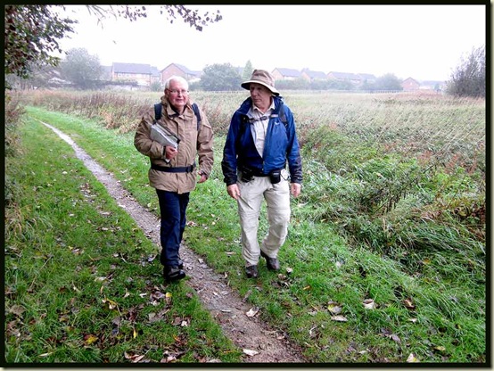
Reg and Allan beside the St Helens Canal

Himalayan Balsam was hanging on in flower, providing shelter for the pheasants of St Helens town, and I also noticed clovers, yarrow, white dead nettle, thistles, michaelmas daisies (asters), knapweed, (cow?) parsley, bindweed, brambles and lots of ragwort.

On reaching a lock system, one of the first lock staircases in the country, we observed a passing cyclist being thrown off his bike by an unexpected issue of wind. We did what we could to save the errant mountain biker but sadly we were unable to recover the body.

Crash, or suicide?

Luckily, the rest of us crossed the weir safely and soon put this experience behind us.  “He must have eaten one Jerusalem artichoke too many” observed the ever attentive R Norman.

We seemed to be making little progress towards our destination, but after heading east thus far, this old cobbled path led satisfactorily to the north, towards the fleshpots of Billinge.

A cobbled path in the Sankey Valley

The Ship Inn’s name reflected the age-old presence of an inland waterway hereabouts.

There’s a Visitor Centre by the Stanley Bank entrance to Sankey Valley Park, and knowing Reg’s skills in these matters the rest of us salivated on sight of the impressive building (to the right in the picture below), where Reg would undoubtedly have arranged for coffee and cake to be ‘on tap’ for his doddery Plodders.
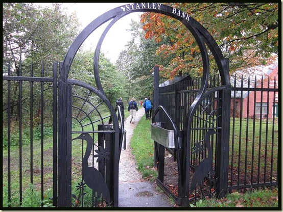
The Stanley Bank entrance to Sankey Valley Park

Luckily for Reg, he’s quite heavy, and the canal was overgrown at this point, so by the time we reached a pond full of mallards the short term memory of his charges left his faux pas unpunished.

There’s quite a bit of bird life around here, with the usual mallards, pigeons, magpies and LBJs being joined by gulls (black headed), coots, pied wagtails, a heron, and a great crested grebe that was fishing with success.

We passed under the A580 (a sensation familiar to all those who had walked The Salford Trail) and continued up a slope to Carr Mill Dam.

Norman explained that the engineering bricks used to build the railway viaduct would never crumble, recalling his days as a youthful plumber before the time of electric drills.  “It could take hours to chip your way through a single brick” he asserted, casting his mind back to what must have been one of the commonest plumbing jobs of his youth – the installation of indoor toilets in houses with outdoor privies.  Remember them?
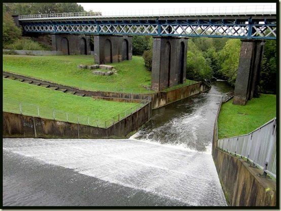
By Carr Mill Dam

We wandered slowly around the reservoir and lunched at a conveniently placed triangular table. Brownies and shortbread both went down well.
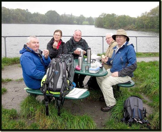
Lunch by Carr Mill Dam

The mizzle had eased, so we continued merrily on towards Billinge, past a fine stone sign to 'The Goyt' (stream) - there are plenty near here.

Then it was up Carr Mill Old Road, past Otterswift Farm, where we saw neither otters nor swifts (what a surprise!).

There was something about Norman today that seemed to attract the attention of Mr Plod wherever he went, as a result of which we were tailed by police cars all the way through Billinge.

"Hang on whilst I nip in for a couple of pints and try to throw off my tail" announced the dodgy one, diving into the Brown Cow.

Then we headed on in thickening mizzle up to today's high point - Billinge Hill (179 metres).

Billinge Hill - 179 metres

It was time to mop up those dregs from the flasks, and some brownies of course. "You can see my house from here" observed Norman, ever the optimist.  He did look a bit rough though, so perhaps he really is living under a tarp in a ditch below Billinge Hill?  Has he been thrown out of the family home?  These are all Important Questions, as AS (5) would say.

And what is Don doing behind the Tower?

Billinge Tower

The onward route to Brownlow jinked in and out of woodland, requiring all of Reg’s navigational skills and rather more than the back of Norman’s hand to bring us across a field to a fine view back to the cloud laden Billinge Tower through a grassy garden with a fine crab apple tree.

Crab Apple Tree

Beyond Brownlow the rain thickened and the bog deepened.  It was a day for boots, not trainers.

A minor navigational error led to a brick works.  Apparently it has only recently fallen into disrepair.  I wonder what will happen to the land.

Brick Works

The path then went straight through a field of vegetables that we suspect will be used as animal feed, despite some of the broccoli heads being very succulent and certainly better than some of the supermarket stuff.  There are also lots of freshly planted crops appearing from the rich Lancashire soil hereabouts just now.

Between Far Moor and Up Holland, a Wigan to Liverpool railway line uses a well ventilated tunnel, so the railway proved no obstacle to our progress, nor did the M58 motorway, which we found a way underneath, to access the ancient village of Up Holland, which has some posh new houses with views (not today) of Winter Hill.

St Thomas the Martyr Parish Church is over 700 years old, and the village is mentioned in the Domesday Book, apparently – I haven’t checked.

St Thomas's - Up Holland

Next door to the church is, of course, The Conservative Club.

And across the road ... the Labour Club White Lion… Norman's inside, the rest of us soon followed.

The White Lion, Up Holland

Later, a bus came and took us back to Wigan. Very little money changed hands.

Here’s our route – 16km, 250 metres ascent, 4.5 hours at a very leisurely pace.

Our route - 16km (10 miles), 250 metres ascent, 4.5 hours

Altogether an excellent day out despite the mizzle.

There’s a slideshow here.

Thanks for your company, everyone, and apologies for any poetic licence (did you spot it?), and for any other mistakes.

Reg has also written a report on this walk, quite different to mine except in that R Norman is again exposed as a … victim?  It’s on this web page.

Part 2 will start from Abbey Lakes (via a bus from Wigan) on Wednesday 9 November at 10,30am.  It’s an 11 mile section to Coppull, from where a bus back to Wigan is easy.

Back to Lancashire Trail Index

Monday, 17 October 2011

Sunday 9 October 2011 - The Calderdale Mountain Bike Marathon (CMBM)

Martin approaches the end of the CMBM
This is the fifth time I’ve recorded my efforts on this annual 26 mile event on these pages.  Click here to view all the reports.  That link also provides full route details, and a summary of results.  The event’s website is here.

I was joined by Robert this year.  We met at the start.  He was sporting a large hole in his Ron Hill leggings, having fallen over a kerb on his way to registration!  There was a large graze, clearly visible through the gaping hole, on his knee.  He didn’t however use this accident as an excuse for yet again failing to finish in under three hours.  Finishing in 3.04, this was the fourth time he has finished inside 3 hours 10 minutes.

That’s Robert’s personal challenge - “I will have to do some training next year to break the 3 hour mark” he asserts.

He was however in plenty of time to finish, get changed, and wander down the course to take the above picture of me, near the finish, nearly half an hour later.

You’ll maybe notice that I’m on the 21 year old Shogun Trail Breaker bike, on its tenth CMBM.  My ‘new’ bike – Stumpy – was still awaiting surgery.

The weather forecast had been dreadful.  A week earlier, at the end of our Indian Summer, the moors would have been crisp and dry.  Today, after a week of rain, they were somewhat gooey.  To say the least.

However, the worst of the rain saved itself for the afternoon, so those of us who finished before 12.30 were really quite lucky.

The organisers provide excellent support – drinks, cakes, fruit, chocolate, etc at roughly five mile intervals after an initial support point here on a railway bridge between Hebden Bridge and Mytholmroyd.

0901cmbm1

Strangely, nobody seems to be on their bike!

That support point is shortly after a technical descent into Mytholmroyd, which this year was being tackled more bravely than usual by many riders who normally seem to walk down the rocky track.  So it was good fun.  Until the bottom, where someone had crashed painfully and caused a significant delay whilst the body was recovered.

It’s a dangerous business, Mountain Biking!

Robert soon disappeared off ahead of me on the second ascent of the route, and he managed to get round uneventfully aside from his earlier kerb incident.  Meanwhile, apart from a gear problem whereby I had to change down by handling the oily chain, I had a safe and leisurely morning out, chatting to quite a few of the riders who were going at about the same pace.  Until I fell off on a fast, flat, rocky section on the approach to Luddenden.  No damage was done, so I straightened the handlebars and continued to the finish, where bikes were piled in the rain whilst their owners went to collect tea, soup, chilli, t-shirts, certificates, etc.

Robert took this picture.  By the time I arrived, the bike with drop handlebars had (I think) gone.  I’m impressed with that piece of kit though – I only saw one other bike without suspension but this racer must have been far ahead of me.

Mountain Bikes at the finish

The pub has reopened.  Thankfully.  We enjoyed a pint and a chat.

The Church Stile Inn

It was pouring down by now, a good hour after Robert had finished, but riders were still streaming in to the finish.

Next year’s event will be on Sunday 14 October 2012.  It’s a great route, and always good fun.  A personal challenge rather than a race.

Today’s Statistics:

Winner – 2 hrs 3 min – 317 finishers – slowest 6 hrs 3 min
Robert: 3 hrs 4 min – 88
Martin: 3 hrs 30 min – 146

A footwear note:

I usually wear trainers for this event, though some Innov8 Roclites were used one year.  This year I used my Keen Targhee 11 Walking Shoes, now fairly worn after heavy use, together with ankle gaiters and some old Sealskinz socks.  I washed them in a puddle after the ride, and didn’t need to remove them until I got home.  My feet were perfectly dry.  I didn’t see anyone else with dry feet.  The route was very boggy in places, and at times it was not at all easy to cycle through these bogs, so the shoes endured some deep dunks.  The Keens really are versatile shoes.  These have walked 650km plus numerous bike rides.

Keen Targhee 11 Walking Shoes after 650km