Sue and Martin in Mallorca 2019

Sue and Martin in Mallorca 2019
On the Archduke's Path in Mallorca

Thursday, 30 September 2010

Peebles to Moffat – it’s all over now, and Good News on the Hand front

The view from my tent around sunset on Day 2, near the Megget Stone
Alan’s hand will be OK.  See here for news from Peewiglet (Shirley) on that front.  You’ll need to click on the individual headings.

There’s little to add to my own entries, except that most people did about 56km (35 miles) and 2200 metres of ascent over the course of the two and a half day trip.

To view my postings click here and scroll to the bottom of the postings to start at the earliest entries….but first:

Some code names have been used that may puzzle those unfamiliar with W E Bowman’s account of ‘The Ascent of Rum Doodle’ – a fictional account of the ascent of a mountain higher than Everest.

‘Binder’ – already used by Alan Sloman over on his blog, is the leader (a figure of fun)
’Jungle’ – Peewiglet already has this nickname – is the route finder (who is always lost)
’Prone’ is the doctor (who is always ill)
’Burley’ is the crack mountaineer and strong man (who always suffers from Lassitude)
’Medical Supplies’ = champagne

A slide show of my pictures and a few of JJ’s is here.  There are none of the gory hand as photography wasn’t appropriate at the time of the accident – Shirley’s blog contains a gruesome image taken later.

Mike’s blog, Northern Pies, has a report in his usual entertaining style:
Day 0  Day 1  Day 2  Day 3

Tony’s blog, Pennine Ranger, also has an excellent report here.

I think that’s all, for now.  I’m off to replenish my first aid kit, which was totally inadequate for Alan’s injury.  Luckily, others were better equipped.

Tuesday, 28 September 2010

Peebles to Moffat - Disaster Strikes

We made it to Moffat.

But not without a serious mishap.

Binder, aka Alan Sloman, unfortunately slit his hand on a handrail below Greygill Head, about 200 metres from an easy track to Moffat.

A team effort got him down as quickly as possible, and as I write (quite late) he is hopefully being attended to by experts in Carlisle.

Meanwhile, the remnants of the Pie Man's ever diminishing team enjoyed some nourishment at the Black Bull together with a Proud Scotsman. But sadly it was not the 'minor celebration' we had hoped for.

Our thoughts were with Alan, who seems to have a rather nasty injury. We hope he makes a speedy recovery.

With all except our leader, the Pope, and myself having decided against returning by foot to Peebles over the next three days, and with 'Heavy Rain' forecast for much of that time, a decision to postpone the return leg, possibly until April 2011, has been made.

The picture shows JJ and the Pie Man luxuriating in the sunshine after emerging from the cloud before the fateful descent of Greygill Head.

Our thoughts are with you, Alan.

Sent using BlackBerry® from Orange

Monday, 27 September 2010

Handrailing

Today was spent mostly above 600 metres and as already intimated was described by our esteemed leader as 'handrailing'.

"It's an easy way of navigating, you just have to follow the wall or fence marked on the 1:25,000 map", he remarked, "the worst that can happen is that you could get impaled on the handrail."

Here, Binder is shown to be dangerously close to the handrail in a view that is typical of today's scenery.

Sent using BlackBerry® from Orange

Hart Fell


Asthma antidotes (Jungle needs Prone), and other incentives were required.

But we made it up here soon after 2pm.

Summit Lassitude has been overcome by the desire to reach Border Control at Moffat.

Sent using BlackBerry® from Orange

Tea Party at Rotten Bottom

No, we are not at Alan's rear end, although that is suffering from Plumber's Lassitude.

Mr Grumpy has kindly turned up with tea and Medical Provisions.

What a star!

Tormentil, scabious, bell heather, wire fences and stone walls (known to our leader as 'handrails'), luscious bogs, peat hags and occasional rocky outcrops. But only within a 50 metre circumference of our jolly band of wayfarers. That's a summary of today's view.

And doing this isn't very easy in the moist conditions. Next report will be later. Perhaps much later.

Sent using BlackBerry® from Orange

Summit Lassitude

Firthhope Rig. We made it!

Now heading south towards Border Control.

Sent using BlackBerry® from Orange

Megget Lassitude

Burley (aka JJ Mk2) is to blame. And HMP3. Burley claimed a sleepless night due to much cheese and McEwans Export.

Binder and Jungle were also to blame and are suffering from Piglet Lassitude. The Pie Man is suffering from cheese induced Kylie Lassitude.

Others have their own problems.

The cloud base is 600 metres.

We've now made it that far....

Sent using BlackBerry® from Orange

Peebles to Moffat - Megget Stone reveals Hidden Medical Supplies

Today we tramped around 22 km (a bit more for some) in lovely late September weather, with around 900 metres of ascent, over various summits, most notably Broad Law, a Corbett (on which some junior members of the party, confused as to the direction in which we should be heading, are pictured above), to reach a cache of 'Medical Supplies', kindly provided by our inspirational leader, who goes by the name of 'Pie Man', but would more appropriately be named 'Binder-Jungle-Pong, however we already have characters with those names, and also one called 'The Pope', who admitted that his most recent backpacking trip had been in 1972.

The morning was spent on tussocks. Excepting the periods spent in bogs and the short diversion to Dun Rig taken by Jungle and Phreerunner. Our leader insisted that the way ahead would soon be paved with short grass. It wasn't. Lunch was taken in the sun. Four trail bikers briefly relieved the tension of resting in the sunshine pondering why anyone should be wishing it to rain on us. Here, JJ Mk2 was unable to contain his joy at finding a path. He set off purposefully down it, towards Tibbie Shiels Inn, in search of 'Medical Supplies'. He has a 'Bad Knee' (yes, another one).

After 9.5 hours of marching under a hot sun, including a surprisingly grassy if disconcertingly undulating afternoon, we found ourselves at NT 147 200, a less lumpy oasis well endowed with sheep s**t near the Megget Stone, which nobody visited, as fresh Medical Supplies were close at hand.

Those supplies, and hors d'oevres provided by HMP3 and Jungle were soon applied to ease the aches and pains of the day. JJ Mk2 had reappeared at said map reference and greedily tucked into the fresh supplies and a pan of 'Beef Smash'.

Then everyone had a Love In and went to sleep.

Telegram to Martin Wry reads:
"Please send fresh Medical Supplies."

Sent using BlackBerry® from Orange

Sunday, 26 September 2010

Peebles to Moffat - Lunch in the Sun

Some will be pleased to hear that it's a lovely day here in Sunny Scotland.

We've had a Wry Smile about that!

Thanks for your comments....

Sent using BlackBerry® from Orange

Peebles to Moffat - Setting Off

We arrived shortly before 6pm, here at NT 247 318, a small grassy oasis at 520 metres surrounded by heathery lumps. A burbling stream breaks the silence, at least when the faint sound of chatter and the breaking of wind from nearby tents subsides.

We had assembled in Moffat, and again at the Bridge Inn in Peebles. Some had arrived nearly a day early! Others were late.

Baguette heaven offered sustenance for two, before our 2pm departure.

HMP3, veteran of nine TGO Challenges, was there to wave us off, before having to return to edit his love child, Big Jugs Weekly.

A vicar turned up to bless the congregation and pour consoles over various ailing knees. This fine fellow even joined us for an hour before hugging everyone and skipping off like Eric Morecambe.

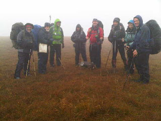
That left nine heavily laden backpackers trudging up Glensax on a sunny Saturday afternoon:

The Pie Man of Crook Town
JJ Mk2
Andrew
Binder (aka Alan S) and Jungle
Piglet (Jungle's pooch)
Tony (Pennine Ranger) and Christine
The Pope (aka Another Mike)
And myself (Phreerunner)

We covered around 11km in 4 hours and rose a good 450 metres before reaching this spot, where our seven tents seem to fit quite cosily on the slope. There were a few minor obstacles en route, namely the repeated crossing of the same stream. Jungle and Piglet eventually got the hang of it!

My wild camping is usually solo or with Sue, so it was strange to be in such a big group.

We all enjoyed large meals of dried provisions and medicine. Then it went dark so we settled down for a long night on the heathery lumps of Glensax.

Ho ho. What fun! There are five UK outdoors blogger amongst us - I wonder what the others are saying...

Sent using BlackBerry® from Orange

Saturday, 25 September 2010

Peebles – Moffat: Earwiggo

It has been a busy week. 

A South West Coast Path summary will follow in October, but in the meantime feel free to peruse a slide show.  The short one is here, but if you are called Andrew, or have more time, you may choose this one.

Suicide pact in South Devon?

A report on the walk that Sue and I enjoyed around Woolston on 18 September will have to wait, or forever be forgotten.

Lunch at Latchford Locks

Here’s part of the reason for the busy week – repatriation of a container load (we filled the ‘van’) of possessions after around eight years – it’s like a treasure trove – but where to put them all.

The containerat the back of the 'van' is a similar size to the 'box' on the 'van'

The evening walks have now become ‘night’ walks, although we were blessed with a full moon during our short perambulation around Little Budworth on 23 September.

The Sculpted Chair in Little Budworth Country Park 
On Saturday morning (later today) a trip to Moffat/Peebles will be undertaken, and during the next six days a 130 km circular route will be attempted.  Some friends failed last time.  One of them is a fellow blogger.  ‘Earwiggo Again’ he reports, having scoured the land for reinforcements for this second attempt.  Curious as to what happened last time?  It’s described here.  And the picture below (courtesy of the Pie Man) provides a clue as to the reason for failure.

2401phil

Friday, 17 September 2010

Friday 17 September 2010 - South West Coast Path - Chideock to Abbotsbury

Distance: 20km
Ascent: 590 metres
Time: 5.5 hours including stops

Just a brief entry for now, as we return home tonight and I can't do this whilst driving.

After another good breakfast, we set off on a blue sky day, so the waterproofs were deployed for just five minutes of this four day excursion.

Today's hills were small and early on, so presented no difficulties.

Then, after passing under the geologically remarkable and visibly crumbling East Cliff, I went over and Notchy went around Burton Cliffs.

We hit the beaches, backed not by cliffs but by gently rising arable land; any cliffs hereabouts having been eroded away aeons ago. These must have been prime targets for foreign invaders in days past (as evidenced by numerous pill boxes). First, Burton Beach, then Cogden Beach, before we headed around unseen Burton Mere and along a long section of beach prior to turning inland to the posh town of Abbotsbury (reminding me of the Cotswolds with all its thatched cottages), and our 3.30pm taxi back to Exeter.

As usual, the folk we encountered today were almost all retired. It's still holiday season, and most B&Bs are fully booked. "It's all the grandparents, taking a break from child minding now the kids are back at school" commented one proprietor.

Mind you, many of the folk we've seen look as if they need their own minders!

We've also seen a few younger backpackers. Wild camping appears to be the favoured approach, due to the high cost of campsites and the cleansing properties of the sea.

Today's picture was taken early on - it's the view back to Seatown and Golden Cap.

Sent using BlackBerry® from Orange

Thursday, 16 September 2010

Thursday 16 September 2010 - South West Coast Path - Seaton to Chideock

Distance: 23km
Ascent: 950 metres
Time: 8.0 hours including stops

After Notchy's early morning Light and Sound Show, and a fine breakfast from Gaynor, another 9am start, and we were soon crossing the oldest, but not very picturesque, concrete bridge in England. Up a hill past a golf club where dire warnings gave the impression that if one's car was lucky enough to evade being clamped, it was highly likely to be stolen.

Soon afterwards, more dire warnings, this time the gist being 'it's a long and bumpy muddy way to Lyme Regis with no escape routes so think carefully before you tackle this path'.

This was the Axmouth-Lyme Regis Undercliff, a 304 hectare National Nature Reserve. Several miles (with no escape) of lovely deciduous woodland with lots of ferns, broomrape and pheasants. It reminded me of the rain forests in New Zealand, with ivy instead of mosses and lichens, it being much dryer here. The whole area was created by a massive landslip in C19, following which it became a mecca for Victorian sightseers.

Today's first image was taken in this woodland. A visit to Chimney Rock looked as if it would yield scenic views, but I left that until next time and pressed on in Notchy's anxious wake.

Towards Lyme Regis we met various folk engaged in short forays into the wood, and by 1pm we had reached that town. I enjoyed coffee and a pastie at The Old Boathouse on the seafront, whilst Notchy preferred to seek out Tesco for his supplies.

Reunited on the long path to Charmouth, diverted due to a landslip and unable to follow the beach due to high tide, we slogged through another golf course and along minor roads to reach this sunny haven.

From Charmouth, more undulating ground, past dog walkers (including a swallow chasing labrador) and a man with a basket containing a mushroom (it filled the basket), then a steep path led to the summit of Golden Cap. A sun-drenched spot where we lingered for a while admiring the view in today's second image.

The final descent to Bay Tree House (www.baytreechideock.co.uk) in the historic village of Chideock, was down an ancient sunken lane. It was 5pm. Time for cream teas, which luckily are served by Sarah, our host at Bay Tree House.

Then it was off to the George for a meal. Did we really need those cream teas?

Meanwhile, Baz Gray spent the whole day moving slowly towards Poole, completing his epic 176 mile run along the coast path at 6.30pm, over 50 hours after starting his mammoth effort a couple of days ago. Brilliant.

Sent using BlackBerry® from Orange

Wednesday, 15 September 2010

Wednesday 15 September 2010 - South West Coast Path - Sidmouth to Seaton

Distance: 15km
Ascent: 830 metres
Time: 6.5 hours including stops

After yesterday's gloom and overnight rain, we woke to blue skies and a warm north westerly breeze. Breakfast was marred only by our host (David - not Dave) calling Notchy 'Andy', which those who know my dear companion may well recognise is a heinous crime!

By 9am we were busy negotiating our way to Tesco and then across the ford and up the hill to rejoin the coast path. Today's image is the view back, from the hill out of Sidmouth.

Shortly after this we were passed by a couple of runners. They were Royal Marines doing their 22 mile relay section of an 88 mile course from their base at Lympstone, near Exeter, to Poole. "You won't see anyone else, except for Baz, because we are the last of quite a few teams" one of them explained, kindly slowing to a strolling pace to protect my legs from undue exercise.

Then we met Baz, coming the other way, with a small entourage of ridiculously fit looking Marines. Baz is raising money for Royal Marines Charities in order to help wounded servicemen. His isn't a 10km run, or even a half or full marathon (though I do realise that such events may be a serious challenge to many folk, and deserving of sponsorship). Baz Gray's fund raising challenge is 'running' from Poole to Lympstone and back again, a total of 176 miles. His target for this was 48 hours, but that's already slipped. I will be donating - the effort involved is absolutely phenomenal, and worthy of a few bob of my money whatever the outcome. He looked tired when we saw him, and was pleased to pause and chat. Wouldn't anyone, after 77 miles and with 99 to go? If he can keep going he will be out on the very hilly coast path for a second night tonight, and for most of tomorrow. You can follow Baz's progress (and donate if you wish) at www.176milesnonstop.org

Good luck, Baz Gray...

Notchy and I meandered on towards Branscombe, which some will recall was the site of the beaching of a 62,000 tonne container ship in January 2007. The ship is now gone, but its 14 tonne anchor now sits outside the Sea Shanty tea rooms, where we enjoyed our lunch, in memory of the traumatic episode.

On the way to Branscombe I had come across Notchy (he usually goes ahead, outpacing me with ease) sitting on a bench chatting to Phil and Margaret Holmes. They had never met before, but it turned out that this jolly couple have season tickets a few rows in front of Notchy at Eastlands, home of the world's richest football team. It's a small world! We discovered that we also have mutual friends in Stockport Walking Group.

After lunch, today's short section of the coast path took us through spectacular cliff scenery with hundreds of crows, to Beer, where I enjoyed an ice cream, then on to Seaton, which lacks the ambience of Sidmouth but does have an excellent B&B, www.holmleighhouse.com where we are now happily ensconced.

The memory of today's lovely section of coast path will be dominated by red cliffs and an exhausted Marine.

We are now off to 'Monsoon', for some Indian fayre, I believe...

Sent using BlackBerry® from Orange

Tuesday, 14 September 2010

Tuesday 14 September 2010 - South West Coast Path (SWCP) - Exmouth to Sidmouth [Aka More Adventures with Notchy]

Distance: 22km
Ascent: 850 metres
Time: 6 hours including stops

Picture: before the final section to Sidmouth, with tomorrow's route obscured by low cloud beyond the small town.

After a pleasant Sunday stroll in Styal woods with Stay At Home Hazel, The Pixies and other Hangers On (see small album here), something a bit meatier seemed in order.

So yesterday I rescued Notchy from the clutches of deepest Cheshire, from where we pottered down to Exeter.

Hotel Priddle provided excellent B&B and a fine pie - the name for which opened a lively debate. Could it really have been a Shepherd's Pie, if made with beef?

Anyway, this morning Colin, the Basil Fawlty of Hotel Priddle, helpfully gave us a lift to Polsloe Bridge Station, from where a rattly train delivered us to Exmouth, our starting point for this year's section of the coast path.

[Our progress over the past couple of years can be followed by typing 'SWCP' in the search box at the top of the blog.]

We are not purists, we didn't swim across the Exe estuary, or even get a ferry. But we did start roughly opposite where we stopped or passed by last year.

The dull day and the damp following wind did little to dampen our enthusiasm, though it does seem a little odd to be walking as a twosome in September, when most of the route from Minehead has been walked as part of a large group in late May, over the last 10 to 15 years.

The mussels of Exmouth have a hard time - seabirds hovered over the road east, past Conger Rocks, dropping their mussels from heights for which the victims' shells were not designed.

Near Littleham Cove a hillside full of mobile homes overlooks a noisy army firing range. Beyond that, Budleigh Salterton lurks on the other side of a sandy hillock that's making a concentrated effort to crumble into the sea. High brambles form a 'green lane' between the cliff and a golf course.

An early lunch at A Slice of Lyme in Budleigh Salterton - excellent pannini/toasted sandwich - set us up for the afternoon.

A marshy inlet offered good reason for a nature reserve, which we were obliged to pass through as the only sensible means of navigating a narrow passage at Otterton Ledge. Egrets and cormorants vied with herring gulls and a miscellany of smaller birds for space on the sandy banks.

Despite the lateness of the season, wild flowers abound, with some of the early spring flowers such as Herb Robert and Red Campion still going strong, along with Thistles, Clovers, Mustards, Ragwort, Thrift, Yarrow and many more.

Lots of fruits are ripe for harvesting, with a fine crop of blackberries hereabouts.

There were many folk about today; the caravan parks were busy; Sidmouth's B&Bs were mostly full. It was hot and humid.

The path from Budleigh Salterton rises over a few little nobbles through pretty woodland above high cliffs on one side, with pastoral farmland and a huge pig farm on the landward side.

After a while a sharp descent dropped us past an amphitheatre of benches to Connaught Gardens, where we enjoyed tea and cake in the Clock Tower tearooms before continuing on past the Sidmouth Fiddler and into the centre of this small but perfectly formed town.

Berwick House (www.berwick-house.co.uk), was soon discovered. Sue and David are our hosts, and they recommended the Swan Inn, a quintessential English pub. My meal was excellent; Notchy's only complaint about his liver and bacon was that there was too much!

Sent using BlackBerry® from Orange

Sunday, 12 September 2010

Saturday 11 September 2010 – The Langley 11 – and a Slight Misunderstanding

The Macclesfield Canal at Sutton
   
It’s always good to catch up with old friends.  Alan and I worked, for different firms, on the same cases in years past, with happy outcomes despite the occasional attentions from dodgy directors and Private Eye.

“Fancy lunch in town?” I suggested.

“It’s the Langley 11 on Saturday” came the reply “how about it?”

I wasn’t sure.  I Googled ‘Langley 11’.  Just one result – from Buxton and District Athletic Club. (See below*)

So, it was a run.  “I’m not running fit” I responded.  “Nor me, I’ll be walking” came the reply.
We duly met, ticketless, at St. Dunstan at 10.30 am.  I’d passed the pub on my way to Alan’s house.  There was no traffic.  So we were taking part in an event that had been sold out, to which I was the only motorised arrival. [Suspicious!]

A suitable donation gained us access to the pub and to bacon butties and coffee.  About 100 people were milling around.  There were 100 tickets, sold out weeks ago, the limit being dictated by available space in the pub and by catering constraints.  This local event has no ‘web’ presence - “there’s no need, it always sells out” explained Richard and Pauline, of St. Dunstan.

Those with tickets had to get them stamped as they went round the route, which was not quite that detailed in the text below (the one below is better).  They would then qualify for various goodies en route and food at St. Dunstan from 6pm.

Brains whirred.  ‘That’s 7½ hours for 15 miles’ thought Alan and I.  Hardly running pace!

Oops, a ‘Slight Misunderstanding’.

We freely admit, we cheated.  Next time perhaps we’ll do it properly.  This time we were, in any event, interlopers (albeit welcomed as such).  Besides, I had a car and didn’t want to finish up in the cells.  So we cheated.

It was showery, so we got a bit wet.  We took 4½ hours, just a brisk walking pace with a stop for refreshments at The Crag.  It was about 22 km, with 600 metres ascent, and Naismith would have taken an hour longer, so we were happy with our pace.

But we’d completely missed the point (or should that be ‘pint’) of this event.  We’d thoroughly cheated.  If Richard and Pauline hadn’t been so polite, they’d have laid into us.  As it was we did enjoy a pint in the last pub (St. Dunstan) whilst Richard explained that he had just collected vats of chilli, curry, etc, from the other ten establishments, by way of their contributions to the event, to be served after 6pm.

I should point out here that St. Dunstan is a real ‘walkers’ pub’, where walkers always receive a warm welcome and good beer.  There is no need to secrete your butties under the table here.  “Bring your own food and eat it inside” say Richard and Pauline.

There’s a pictorial representation of the route here (27 images); as I write this, some of those taking part are probably still stumbling from point to point.

Here’s a taster from that Album, which includes one or two other items of interest.

Pub Number 3 (and a rare instance of compliance with the Langley 11 philosophy)
 Number 11 - we've finished...
And here’s the route we took.
The Langley 11 route

*“Good xmas run route perhaps ? Goes past various pubs in Langley, Sutton area.
Leave St Dunstan, Langley (1).
Up road to Leather’s Smithy (2).
Follow Forest Five route to Forest Chapel then down the stony track to Stanley Arms (3).
Could use road for next section but I suggest back up to Standing Stone and over Buxtor Hill, then drop down to Crag (4) from Shutlingsloe path.
Carry on down road for 1.25 miles then up path to Hammerton Knowl Farm and across fields to Wildboar (5). This is the only place where navigation skills are called into action. The clue is heading left for the wall corner from the bend in the farm track when level with the second farm.
Up the A54 for 200metres then right through Longgutter Farm and up to top road and along ridge to Hanging Gate (6).
Down steps past the toilets and down to road. Use either of next twp paths on left to drop down fields to Ryles (7).
Along road the the Lamb(8) in Sutton, the go on past war memorial and take muddy little path left beside the stream and over the fields to farm and Bullocks Lane and Sutton Hall (9).
Back to Bullocks Lane and towpath along canal for 300 metres then down steps to Old King’s Head (10).
Under canal, fork left along Jarman to Church House (11) and on to St Dunstan (1).
14 miles for the 11.”

Thursday, 9 September 2010

Thursday 9 September 2010 – Another ‘Big Macc Ramble’

On the 'Big Macc' trail near Sparbent
It was a pleasure to be back on the old boneshaker today, for a two hour buzz around this familiar route.  Despite some rain, the sun did shine as I was passing Sparbent on my way down the rocky path towards Wildboarclough.

Whilst suspension may be nice, this bike is lighter and more manoeuvrable than The Tank.  I should have had it serviced and taken it on the Transalp trip.

I tried later to remove some of the accumulated grime, as it’s being serviced tomorrow*.  I got very oily!

* “The steel frame will last for ever” said Joe, when I took it in to Bikeshak.  So it’s a refurbishment, with some welcome advice - “full mudguards, and a new chain every six months, would be a good idea.”  So, am I still dreaming of a new bike?  Perhaps not.

Wednesday, 8 September 2010

Monday 6 September 2010 - A Stroll from Knonau

The local farmers were busy with their late summer activities as I started through the pretty village on an amble that had a final destination but no other plan.

The noisy church at Knonau
The farmers of Knonau are cashing in.  Much of the land in the village seems to have been sold for housing.  Apartments for rent in large grey buildings.  Stamford Brook (in Timperley) on a grander scale.

New apartments in Knonau
Following the smell of freshly cut grass, and using an excellent 1:25000 scale map, resulted in the squares on the map passing quickly by, despite today's lack of pedal power.

I passed signs asking for information about missing cats; buzzards wheeled overhead; some say the two are linked by more than just their mewings.

Past the evidence of a good maize harvest, into green woodland not yet touched by Autumn.  Here, the distinctive yellow flowers of Touch-me-not were rampant, making a change from the Himalayan Balsam we endure at home.

Touch-me-not
The woods were full of fungi – here’s a Polyporaceae (perhaps Trametes versicolor).

A Polyporaceae fungus

Vaguely following a roundabout route towards Cham, I passed through the small hamlet of Niederroil, with its neatly rendered church and its quaint wooden houses.

A wooden house at Niederroil
Further on, past apple orchards laden with fruit, there was lots of ugly building work and roadworks at Hogendorn/Rumentikon, rendering my dogleg to that small town obsolete from the scenic angle.

Down by the River Louxe, a pleasant pathway led all the way to Cham.  The tree-lined river bank was in fact an arboretum, with a huge water treatment plant on the other side of the path.

Big fish swished against the current in the area of a large paper mill below the smart Reformatory Church of Chan.

The Reformatory Church of Cham

It was very pleasant by the foot of Lake Zug, where I luxuriated on the warm, sunny day, watching the workers as they snatched a quick break beside the calm waters, looking across to nearby mountains that were faint on the horizon due to the haze.

Workers lunching in Cham

Lake Zug
Lots of information boards detailed the history of the area and its industrial heritage, but I understood little of the (Swiss?) German script.  An unkempt garden housed a sculpture - ‘Balance’ by Eva Burkey in 2000.

Eva Burkey's sculpture - Balance

Strolling on past a nudist colony next to a children’s beach, a long line of bike racks led in to Zug, where an impressive building awaited.

Posh house in Zug

Lunch by a children’s  playground revealed many English voices – there must be a significant ex-pat community around here.

With several hours to go before meeting Nick and Daniela, I headed up a few hundred metres to the Verena Chapel.  Very serene.

Then across to Blasenberg, my high point for the day at around 800 metres (the lake being at around 400 metres).  Farmers were working furiously in the dimming light due to the imminent onset of rain.

The view down to Zug from Blasenberg

Then back to Zug to wait for N and D, who are having a hard time looking for permanent rented accommodation.  Swiss rules are getting them down.  I was able to people-watch for some time – many English voices, and caged birds - Ibis, Kookaburra, Snowy Owls and many more kept me entertained before we all enjoyed another alfresco meal, albeit dominated by bemoaning of the difficulties of moving from Shanghai to Zug. That’s a shame, because today I had discovered a lovely area full of paths, bike trails and fine views.  It should be a pleasure to live in such a place.

Scarlet and other Ibis

Here’s a Google Earth screen dump of the area.  My wanderings amounted to about 20 km and 500 metres of ascent in a very leisurely 9 hours or so.

Knonau and Zug

The images above are just a small selection of the many taken on this leisurely stroll.  The rest are in this 68 image slideshow, should anyone be interested.

Tuesday, 7 September 2010

Going Home - Torbole to Manchester

Saturday:
Josef's Ford Transit Estate Van proved an ideal way of transporting us and the bikes to Dornbirn, being rather more convenient than the 'Bike Bus', and cheaper even after paying all his expenses.
It took around 7 hours, then there was the Cleaning of the Bike.
Markus's remains dirty!
A trip back to the pub/restaurant by the Rolls Royce museum yielded an excellent meal of spetzl and salad, then Markus and I were picked up by Jutta (just returned from Thailand) and driven around for a while whilst Wolfie (just returned from his own Transalp crossing and the successful summiting of Gran Paradiso and Castor) pondered the nature of his birthday/wedding anniversary surprise.
Unfortunately he turned out to be not quite as skilled at ten-pin bowling as he is at climbing 4000 metre Alpine summits, but, joined by Ange and Dominic we all enjoyed Jutta's excellent choice of venue.
A very jolly evening.
Sunday:
Leaving Markus to luxuriate in his own company at his flat (ie for a change he didn't have to put up with my snoring), I also enjoyed a good sleep in W+J's spare room. Markus joined us for breakfast and a slide show from Wolfie, then The Tank was returned, shiny but used, to its generous owner.
After 11 days of my non-stop company, it was probably to his great relief that there remained no further impediment to Markus dropping me into Switzerland to enable me to resume my journey at St. Margrethen railway station.
It was a smooth ride to Zurich on a sunny day. Just one minor difficulty - I was nearly two days early for my flight home.
Whilst a stroll around Zurich on a holiday Sunday in the sunshine did pleasantly pass some of that time, 48 hours of such strolling could inevitably prove to be something of an endurance test.
Until very recently, a visit to Nick and Daniela would have involved a trip to Shanghai. Luckily, they have returned to Europe thanks to Nick's success in getting a job with SKINS, who make compression base layer garments and bikewear,
and are based in Zug, just south of Zurich. They live temporarily in nearby Knonau, so I headed out there, armed usefully with Nick's email and mobile contact details. The inconvenience of my arriving just after they had returned from five days at Eurobike didn't show, and we enjoyed an evening of leisure and catching up.
Monday:
No further progress towards Manchester was achieved today. A delightful country walk to Cham and Zug in lovely warm, sunny weather occupied most of my day (see separate posting if I get around to it), before spending another pleasant evening with the Workers, Nick and Daniela.
Tuesday:
A leisurely departure from Knonau in deteriorating weather has returned me to Zurich, and onwards to the airport, where I've failed to succumb to the vigorous Volvo S60 and Honda CR-Z advertisements and am waiting at the gate for the EasyJet flight to Manchester.
I'll be home for lunch!
The images are from Zurich and Cham - I'll leave you to work out which is which...

Back to Index

Friday, 3 September 2010

Friday 3 September 2010 - Chilling Out in Riva/Torbole

Wow! A lie in!

From my bed I could see green hillside merging into grey cloud that concealed the summit of Monte Baldo. But as the senses awakened, sunshine on the Pregasina hillside indicated a fine day, with just a touch of cloud on the highest tops.

A full breakfast was followed by a trip to a nearby bike mechanic, where 30 minutes and €20 later the rear brake on the bike I will never ride again was as good as new.

After enjoying a coffee with Markus in the harbour area whilst on bike repair duty, he took to the pool and I strolled into Riva.

The day's exertions were restricted to the 150 metre ascent to the Bastione (pictured, along with the view down to Riva from its balcony) along a pleasant winding path, but sufficiently energetic to warrant a beer at the top. A via ferrata route starts near here, but I had no equipment.

That's my excuse!

Back at Torbole by late afternoon, Josef and Elisabeth had arrived. They had driven all the way from Dornbirn this morning to enjoy an afternoon beside Lago di Garda before transporting us and the bikes back to Dornbirn tomorrow.

We enjoyed a pleasant, albeit uneventful (unless something happened in Voralberg German that I didn't notice), evening with them.

Next Posting - Going Home
Back to Index

Transalp '10 - Epilogue

Regular readers will know that I find this 'post trip' entry necessary as a means of inserting an index and some links to try to make reading the trip report in chronological order that much easier, and to provide more by way of resource for anyone wishing to emulate our pleasurable Transalp experience.

So the index will be linked from here.

And there will be a link to a web page with only a brief daily summary, a kit list, and other useful information.

There will also be a slide show.

The image is one of many taken but not used in earlier postings, chosen as it typifies the scenery through which a Transalp crossing will pass.

Next Posting - Chilling out in Riva and Torbole
Back to Index

Transalp '10 - Day 8 - 2 September 2010 - Val d'Algone to Torbole

Route: Albergo Brenta – Preore – Tione di Trento – Storo – Passo di Tremalzo - Passo/Bocca di Various (circa 1800m) - Pregasina – Riva – Torbole (Night: Hotel Villa Franca)
Distance: 80-85 km (Total: 395-435 km)
Ascent: 1950 metres (Total: 13900 metres)
Descent: 3050 metres (Total: over 14000 metres)
Time: 9.5 hours (Total: 69 hours)
[Distances subject to checking when I get home, otherwise fairly accurate.]
A fitting last day. Markus's quote for the day: "If you haven't tackled the downhill from Tremalzo to Riva, you haven't lived."
In keeping with most other days the Esteemed Coordinator changed our planned route, this time to a more challenging day with a fine final descent.
After a brisk descent to Tione in the cool morning air we abandoned our detailed maps once again. "It should be an easy valley descent to Storo" remarked our leader, scrutinising my A4 sheet covering our entire route. My eyes told a different story, so the 350 metre ascent to a col were less of a surprise to me than to the rather miffed and optically challenged Coordinator.
The extra height gained did however result in quite a swift 20km, 400m descent to Storo, albeit on a rather unpleasant main road, aided for part of the way by the slipstream of three German Transalp cyclists.
The first 40km of the day had taken just two hours, and we were rewarded by coffee and croissants at a pleasant café in Storo, our breakfast at Albergo Brenta having been rather inadequate.
Now, the chosen route and our final significant climb, was the 1300 metre haul up to Tremalzo. Sue will recall this, as we drove up the road a few weeks ago, passing many cyclists on the way. It would be hard work, I knew that, so I bought some chocolate.
For the first 300 metres of ascent along the main road to Riva via Lago di Ledro, I kept falling behind Markus (as usual) but with a bit of grit between my teeth I always managed to haul him back, so we arrived together at the turn where a minor road leads up to Tremalzo.
Photos were taken. A stream of bike buses was dropping off cyclists here, or taking them all the way to the col, much to Markus's disgust. He is outraged by this behaviour, taking the view that they should cycle up from Riva. I think it seems like a nice afternoon out - starting from the top. After all, we don't plan to cycle back to Bludenz; or perhaps I am missing something.
"You go ahead" Markus surprised me. Perhaps he doesn't want his usual long wait at the top, I thought. "There will be a treat at 1000 metres and at 1500 metres" I promised, assuming Markus would be tailing me all the way.
I set off, going quite well for a change. In fact, rising at over 550 metres an hour compared with my previous best of 400 metres in an hour. 1000 metres came; no sign of Markus. I'll treat him by not making him wait, I thought, and continued up to the top, passing quite a few Transalpers on the way. None passed me. I am no longer the slowest Transalper. I was pleased. Markus was Not Impressed. Unbeknown to me he was suffering from a minor medical problem and had not requested the antidote that I carry. So he was sore, and had missed his treats, when he finally arrived at the top.
I bought him some lunch, and we were friends again. I think.
The lunch at Rif Garda was rather poor, so perhaps I owe him another treat.
Anyway, my superhuman effort to make it up at a reasonable pace meant that we had plenty of time to enjoy the long descent to Riva. This had been A Worry.
It's a stony uphill track to a short tunnel, then a superb (if stony - suspension is useful) undulating journey on a fairly busy track compared to most that we have been on, over Passo di Various along track 421 and then down path 422. We mistakenly took a steep footpath for part of the descent to Pregasina, rather than the accepted bike route, but it made for a bit extra excitement and we made it down intact.
The upper sections of this fine route are along sweeping stony tracks high on the vertiginous mountainside above Lago di Garda. Care is needed, as are frequent stops to admire the views to Monte Baldo and elsewhere - a little hazy today but not as bad as last time I was here.
Below Pregasina the bike track follows the course of the old road, gently descending along the edge of the abyss below which the green waters of Lago di Garda await the unwary. It's a superb descent to Riva, and a fitting conclusion to any Transalp trip.
Giant ice creams were our chosen celebratory fare, then we pootled along Lago di Garda's busy cycle tracks, narrowly avoiding several fatal incidents, to Torbole and the luxurious Hotel Villa Franca. Pizzas, beers, and tiramisu for Markus ("The Best Ever") concluded an excellent day and a fine trip through the Alps.
The image is the view towards Rocchetta Giochello that I have enjoyed from my bench in Riva whilst composing this entry.
Thanks to those who have commented, latterly to Louise and The Weekend Dude, and to Sue for the 'Pass Out' - it's a shame you weren't able to join us here in sunny Riva. I hope you've all enjoyed these entries from your armchairs. We've certainly had a great time in 'The Saddle'.
Next time: The Epilogue...

Next Posting - Epilogue
Back to Index

Thursday, 2 September 2010

Torbole - we've Arrived

Here's our view, earlier this afternoon, from above Pregasina.

Riva is hidden to the left, but our destination, Torbole, where we are safely installed in a good hotel for a couple of nights, is in clear view at the head of Lago di Garda on a sunny afternoon.

We have a day of leisure tomorrow, during which I'll enjoy writing the posting for our final, most satisfying, day.

Now we are off to celebrate Markus's fourth and my first Transalp success.

Next Posting - Day 8
Back to Index

Transalp '10 - Day 7 - 1 September 2010 - Dimaro to Val d'Algone

Route: Dimaro – Madonna di Campiglio – Lago di Val d´Agola – Passo Bregn del Ors (1836 m) – Val d'Algone (Night: Albergo Brenta)
Distance: 40-45 km
Ascent: 1700 metres
Descent: 1300 metres
Time: 8.5 hours
The 'Jolly' breakfast lived up to its reputation. More bits kept arriving. They are proud of their sumptuous continental breakfast fare.
Gloves and windshirts were deployed for the long forest track up to the posh town of Madonna. It was cool, even down at 800 metres. But sunny, if you were not in the shadow of the mountains. We were in that shadow, cast by the northern ramparts of the Brenta Dolomites, for well over two hours.
There weren't extensive views from the woods (mainly pine, with dashing black squirrels) through which the LRT (land rover track) styled cycle path passed. We just rose slowly (a bit more quickly in Markus's case) up the 950 metre slope, occasionally on foot on the steeper sections in my case. A few cyclists passed me, travelling much faster than I could contemplate.
I am the slowest Transalper, or should that be 'Transalpiniste'? Hundreds have passed me during the past week. I have yet to gain that satisfaction, and am not expecting it to come my way.
I'd pushed on as hard as possible to get to Madonna. We arrived after 3 hours, before 11.30, in plenty of time to get my brake attended to at the bike shop before it shut for lunch. A swarm of Swiss cyclists with another brake problem delivered the bad news. Despite the array of new bikes outside, the shop was shut. "Just take a new one" some wag suggested.
So, after pausing for cappucini in the Suisse Bar, we continued south along a pleasantly downhill and windy path, to Bar Ristorante Cascate - situated in a wonderful position adjacent to some extensive waterfalls and with a view to the glaciated plateau from which the Adamello peaks protrude. Very pleasant, and there was not enough wind today to blow our pasta bolognaise into the river.
Having refuelled, we BOTH flew down a few hundred metres of descent. We had swapped bikes. I found Markus's fine, and could keep up for a change. He declared my rear brake to be working if you apply enough pressure. I must try harder! I think part of the problem is my unfamiliarity with disc brakes, which I had always assumed would be sharper than my 'non-discs'. The opposite appears to be the case...
This is all a bit puzzling. I will now leave the subject and try hard to be braver with the braking tomorrow.
Anyway, we swapped back and headed up another LRT, blagging our way past a road closure by carrying the bikes above a precipice. After a pretty lake, Lago di Val d´Agola, with a wonderful Brenta Dolomites backdrop marred only by the presence of a large crane, we endured a steep 250 metre 'push' to the day's high point, Passo Bregn del Ors (1836 m). We lingered (pictured) in that beautiful spot, surrounded by Dolomitic peaks. High above us was Passo 12 Apostoli and its nearby rifugio, from where Alan Roberts brought a signpost home to Cheshire - collected during a memorable 'Via delle Bocchette' trip, if my memory serves me.
An enjoyable 600 metre descent down Val d'Algone on stony LRTs brought us neatly to tonight's resting place, Albergo Brenta, where Markus had booked us in long before I arrived. "I overtook three cars" he proudly claimed.
This was all nicely done by 6.30, whilst Markus enjoyed his afternoon nap, only to find that Orange (aka Tim) hasn't reached these parts just yet. Anyway, we've now had a lovely meal and need lots of rest in preparation for the final episode of this 'Two Men on a Bummel' escapade, which will be in progress when this posting finally transmits....
Now it's back to 'Rum Doodle' to study how this sort of trip should be 'properly' orchestrated!

Next Posting - Torbole, we've Arrived
Back to Index

Tuesday, 31 August 2010

Transalp '10 - Day 6 - 31 August 2010 - La Baita to Dimaro

Route: Val Rezzalo – Passo dell´Alpe – Passo Gavia (2618 m) – Pezzo – Ponte di Legno - Passo del Tonale – Ossana - Dimaro (Night: Jolly Bar/B+B)
Distance: 60-65 km
Ascent: 1550 metres
Descent: 2650 metres
Time: 8.0 hours
The day dawned cold and clear. A dusting of fresh snow on the nearby mountains of the Stelvio National Park remained as evidence of the onset of Autumn.
Alessandro provided a good breakfast, then we kitted up. My 'leg warmers' went on for the first time, fitting neatly under my cycling shorts. They had been purchased in deference to Markus's kit list. They stayed on all day. Markus hadn't brought his. "I've not needed them on any of my previous three Transalp crossings" he explained, "but I've never been as cold on any crossing as I was today."
We started off, now with the benefit of a map, along a land rover track, heading up a further 600 metres to Passo dell´Alpe. I tried to cycle, but after 50 metres or so it was just too steep for me. Markus kept going for a bit longer, but was soon pushing, just a bit further up the hill.
So including yesterday's final 400 metres, I had now pushed The Tank up nearly 1000 continuous metres. Markus seemed surprised to hear that I hadn't enjoyed it. I realise that some pushing is necessary on this sort of trip. But 1000 metres? It would have been great in the other direction!
The short descent to the Gavia road would have been fun with fully functional brakes.
That concluded our off-roading for the day, as Markus subsequently deemed it too cold to venture over Bochetta di Montozzo.
No brakes were needed for the scenic 350 metre ascent to Passo Gavia (2618 m), where Rifugio Bonetta provided welcome cappuccinos, and a helpful lady who was guiding a couple of German mountain bikers explained the problem with my brake. I have accidentally got air into the system, and it needs a special machine to remove it. She kindly explained how best to ride to handle the problem.
Enticing paths to nearby summits; jagged peaks which on the map are riddled with red dashed lines; this area is one to visit with a pair of walking boots and a via ferrata kit. It looks great. Today's image, entitled 'Dressed to Kill', was taken at Lago Blanco, by Passo Gavia. Unlike my companion, the camera shy Austrian fashion guru, I was very warm thank you...
The 1300 metre descent to Ponte di Legno, mostly down a narrow road, was negotiated slowly, but safely. Near the bottom we sat outside a nice little restaurant and stuffed ourselves with spaghetti carbonara, wolfing it down as fast as we could to avoid it joining the Fanta can on a trip to the nearby river, borne by an icy blast from the gusty wind. Why didn't we eat inside? It was sunny...
We passed a little above the main part of Ponte di Legno. Down below a puff of smoke increased in intensity; it started to billow - a dark grey plume. At the source, in the middle of the road, flames leapt high into the sky. Fire engines rushed to the scene. A helicopter arrived. As we rose up the Tonale road our view became clearer, partly due to the emergence of my binoculars from the depths of my bag. Two thirds of a bus were sitting astride the blocked road, a grimy black smudge marking where the rest of the vehicle had once been. We hope everyone got out before the fire took hold.
The road up to Passo del Tonale, where an ugly ski resort reminded me of Andorra, was busy but wide enough not to be unpleasant, especially as it rose only 600 metres over a distance of 8km.
The 900 metre descent to Ossana, over more than twice that distance, was down a moderately gentle gradient, so quite enjoyable even with dodgy brakes. Then half an hour along the busy main road to Bolzano and Trento took us to the village of Dimaro, from where an off-road cycle route is on the agenda for tomorrow (I'm looking forward to that!).
I came across Markus, halted outside a B+B, chatting to a mountain biker. This chap, Robert, seemed to have connections with the B+B, and we were soon installed in two very nice double rooms, but not before Markus had discovered a hose pipe and assiduously cleaned his dusty bike. My bike is also a bit grimy, but I obstinately declined to show any enthusiasm for cleaning it, I just don't see the point in doing this before the end of the trip. I'm not sure whether Markus understands; perhaps I'm letting down the owner of The Tank by failing to wash it at every opportunity, though he can rest assured - it'll be returned fully cleansed!
The 'Jolly' B+B even got us a discount at the Dolomiti restaurant, purveyors of fine pizzas, Hacker-Pschoff beer and cappuccinos of the liquid and frozen varieties that concluded our Transalp proceedings for the day.
Thank you, SAHH (Stay At Home Hazel), for your comment; I hope you and the pixies have a nice day out tomorrow.

Next Posting - Day 7
Back to Index

Transalp '10 - Day 5 - 30 August 2010 - Arnoga to La Baita

Route: Arnoga – Passo di Verva (2301 m) – Eita – Grosio - Sondalo – Le Prese – Fumaro – Baita Rezzalo (Night: Rifugio La Baita)
Distance: 40-45 km
Ascent: 1800 metres
Descent: 1800 metres
Time: 8.5 hours
First, thanks for the comments, and sorry about the delay in sending this. We are at one of those rare places in Italy with no 'phone signal. There is actually an internet connection, but so slow I've failed to log into blogger or identify 'BrextonT', who should be aware that I may be tagging along with Alastair for the Calderdale Marathon in much the same way as we tackled the Macc Half Marathon last year.
Last night's hotel occupied the eye of a hairpin. This morning both sides of our room revealed a wet road. A leisurely breakfast was in order, before we said goodbye to Hans and Danni, paid our bill (€74 each for half board plus drinks - fortunately not as much as advertised on the back of our door), and donned our waterproofs.
We seem to have developed a habit of starting at 8.30 and finishing at 5.00 (give or take), and today was no exception, though I fear it may have been had we taken the planned route over Passo della Forcola.
The rain hit as we descended briefly on a land rover track before turning up the scenic valley littered with information boards that leads eventually to Passo di Verva.
We were the only visitors today to the high valleys either side of the pass. Perhaps this was due to the sleety rain that was falling as snow above about 2200 metres.
Luckily the storm subsided as we reached the pass, where on 10 July 2010 a memorial to the Italian soldiers of WW1 had been erected. It was still very shiny!
I'd enjoyed the ascent, despite the cold rain, as I was tucked up nice and warm in various layers of gear, and the not so steep, but rather gravelly track seemed like home ground. Markus lagged behind, for a change. He says he was optically challenged.
There was a fair amount of bird life, with Pied Wagtails, Chaffinches, Wheatears and various larger 'brown jobs' in evidence, though yesterday's fly catching Martins and similar were, for obvious reasons, not around today.
The 500 metre descent to Eita was also fun, over equally rough ground, but the subsequent 1100 metre drop to Grosio was a bit of a nightmare for me. The most challenging hour of this trip. It should have been quick and fun, a rapid blast down damp tarmac. But my newly serviced rear brake didn't play ball. It has all but failed and needs attention from a tool that we don't possess.
Anyway, whilst Markus thinks I could have been braver with the front brake, that doesn't have an anti-lock system, so I took extreme care.
Arriving in one piece in Grosio, we headed straight to the friendly Albergo Sassella (a bikers hotel) to share a pasta for lunch.
Outside, one of a group of motorcyclists dropped his bike, much more of a tank than mine, onto a car. I was impressed that instead of riding off, the bikers tried to seek out the car owner, and left their details.
Having by-passed our planned route over Passo della Forcola due to the weather, which actually improved after Passo di Verva, we now set about tackling a 1200 metre ascent to La Baita (www.rezzalovacanze.com). A main road took us slowly up, as we battled with a head wind, to rejoin our planned route at Sondalo, then on to Le Prese, from where we took a minor road for 7km to Fumero. It was steep and zigzagy for 600 metres. Markus went ahead. He wanted to test his ability to cycle all the way to La Baita, as he had failed on a hot day in June last year. He succeeded, but I pushed the final 400 metres of ascent from Fumero, unaware of any 'challenge'. It was a lovely sunny afternoon, but cold, as was Markus after waiting for me for 30 minutes.
Alessandro was waiting outside for us on his sunny verandah sheltered from the cold wind. We are his only guests tonight in the waterwheel powered 20 bed rifugio.
A beer went down well. Markus was delighted to find a hose to wash his bike, and gleefully accepted Alessandro's offer to wash our clothes.
He assured us it will be clean and dry by morning, then fed us with a mixed salad, mushroom risotto, succulent chunks of pork ribs with courgettes, and Italian cake. Our best meal to date perhaps, and probably the cheapest.
It's very jolly here, albeit there are just the three of us. The rifugio is in a splendid setting at around 1900 metres. Today's images were taken this evening, from the front door, shortly after the sun had disappeared over our horizon.

Next Posting - Day 6
Back to Index