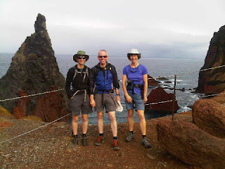
Sue and Martin in Mallorca 2019

Sue and Martin in Mallorca 2019
On the Archduke's Path in Mallorca

Saturday, 19 November 2011

Three Hats in a Basket Shop

Basket Cases. All of them.

Today we took 15 minutes in a taxi - €22 again, but at least this driver didn't accuse us of being 'The Lazy English' on account of our inability to speak Portuguese - to reach yesterday's end of walk point....

....The basket shop at Camacha. We left the 'purchasing' to coach loads of cruise liner escapees, but we did enjoy a coffee before setting off on foot back to our hotel. Gayle, a WiFi junkie, was allowed to download news from an assortment of bloggers. That gave us all a laugh.

So, we got a taxi for 15 minutes, then spent the next six hours walking 21km back to the hotel. Yes, that's what some of us do on our holidays. Crazy!? But almost true. The other three obviously thought it was crazy as they gave up after 18km and succumbed to the allure of another taxi - on the pretence that one of their number needed to be back in time for some completely unnecessary beauty treatment.*

The route was actually excellent - Levada da Serra to Choupana, then down to the Levada dos Tournos. Along that towards Monte until the vertiginous section (we went too far and hit that section - there were nearly tears) before which a steep downhill path eventually reaches the excellent Levada Bom Sucesso; beyond that steep steps lead to the centre of Funchal.

We are now enjoying sunset over Funchal from the roof of our hotel, celebrating 'beer o'clock'. Must go. Have a lovely evening.

*"So that'd be Mick" whirred the worn out cogs of President Sloman's brain.

Late News: M+G won the quiz again, by five clear points. Geniuses! So that's why they were so anxious to get back...

Friday, 18 November 2011

Levada Lunches

Pictured above are three survivors from the Levada Lunch of 18 November.

Perhaps it was not so wise to follow the euphoria experienced in the magnificent surroundings of Monte Palace Tropical Gardens with a tramp along a footpath 18 inches wide with a vertical drop of hundreds of feet on one side. Especially as the tickets for the gardens had fortuitously included 'free wine'. That had come in quite handy for our celebrations, but it wasn't so sensible when it came to the vertiginous tramp that followed.

I cheated by crawling. I got muddy knees. Gayle cried. Sue said we shouldn't have had that last bottle of wine. I emphasised, in deference to Alan Sloman (see his recent posting), the importance of at least one lunchtime bottle of wine for all Foreign Office staff as being a pre-requisite for their ability to spend the afternoon puzzling over the strange nature of the world's time zones.

Vultures circled above us, expecting a free lunch to be offered at any moment on the blood splattered rocks far below us.*

By some dint of fortune, with no thanks to a German fraulein who marched through us shouting "Achtung", we managed to survive, and miraculously we made it all the way along the Levada dos Tournos to Camacha. By then, Mick had been given a bravery award for negotiating a 500 metre tunnel (aka 'Barry's Splash Zone') without falling into the canal, despite the fact that he had locked his head torch in the safe of his hotel room. "My Anti Panic glasses saved me" he asserted.

"You look as blind as a bat" observed the man with a blue Berghaus Freeflow rucksack, "have you seen my missing colleague?" We directed him, probably completely the wrong way, towards a non-existent garden. He's probably still out there somewhere.

The 15km walk had taken almost five hours. We had passed at least eight drowned rats in the levada, had gorged on trackside bananas and passion fruit, and had failed to convince with our Guiding Service. Then a passing taxi hijacked us from a busy bus stop and returned us to FO HQ in about 20 minutes. Gayle immediately ordered more wine, asserting "I'll fall over without it."

Afterwards we all agreed that it had been a routine, if scary, day out and that whilst being envious of the team's close-knit cameraderie, President Sloman would on the whole be pleased with the ability of his hand chosen team to survive in the field of duty.

* I later discovered these were buzzards, and that the redness in the rocks below us was caused by iron, not blood.

We're In!

Skipping along in the Tropical Gardens at Monte, we discovered from a number of sources that we are ALL 'in' next year's TGO Challenge, as well as various other 'likely suspects'.

Thanks everyone for keeping us informed, and Alan R for your erudite comment. You'll be pleased to know that our dining table at the hotel is of course...

...Number 42...

Thursday, 17 November 2011

Paradise

Today was spent 'swanning' around Funchal, with visits to the cathedral, the market, an assortment of churches, the ochre Fort de São Tiago*, and the President's Garden.

The 'bird of paradise' is Madeira's national flower. We saw lot of them today, but only one swan, hanging from a noose in the art gallery. The blue and gold Macaws in the President's Garden (isn't he kind to allow visitors to rampage amongst his shrubs?) were much more lively - boisterously enjoying life in their huge cage.

We were back at our luxury pad just in time to win the afternoon quiz. Thanks mainly to Gayle's planetarium sized brain.

Curiously, we appear to have walked at least 11km on this 'rest day in town'.

* The fort was built in 1614 to defend the city from pirates. Later, during the Napoleonic wars it became an extremely cramped billet for 3500 British troops who wanted to ensure the French didn't take the island. In 1803 it was used to house thousands of local people made homeless by devastating floods. Now it houses, inter alia, a strangled denim swan.

More snippets of historical and other interest will in due course accompany a slideshow of this trip to Paradise.

Are We In?

This was the burning question at this morning's hastily convened TGO Challengers emergency coffee break held in Funchal's main 'Mercado'.

A question mark still hovers threateningly over the three aspirants who turned up late for today's meeting.

Wednesday, 16 November 2011

Just One Step Back, Please

Only Mick stepped back. Sue and Gayle grabbed in vain at his slippery clothing. Luckily the long loose lace of his left plimsoll caught the wire as he fell through it, the friction grip providing an anchor for him to extricate his dangling body from the angry void.

Or should that be 'angry body from the dangling void'? I'll never make it as a writer of fiction...

It was a rainy morning in Funchal, so we decided to head for the short walk along the São Lourenço peninsula, as that may provide the best weather on the island. A taxi driver wanted €80 for the privilege of acting as chauffeur for the day. We offered €40. We bargained him down to €75. Not good enough. A short walk to Mr Hertz's Car Emporium bought us a Micrascopic motor for the day for €55 including fuel.

By the time we reached the peninsula it was still raining. But after less than a minute from departure waterproofs were removed and we enjoyed a fine if blustery 8km ramble over the lizard strewn volcanic debris that makes up this part of the island. Fine seascape views dominated, whilst low cloud engulfed the mountainous core of the island. We even continued to a fine (unnamed) summit viewpoint beyond the only house on the peninsula - Casa do Sardinha, outside which we later enjoyed lunch in a gale.

An interesting drive over a steep hill (I missed the turn for a tunnel) took us to the small town of Santana, where steep-roofed thatched houses trap tourists before they adjourn for snacks at a café that was twice the price of yesterday's snack bar on the outskirts of Funchal. M+G left their macs in the car and got soaked when, on leaving the café, Madeira's weather gods tried to inflict as many of the island's 52 known microclimates on us as it could, simultaneously.

We spent the evening gaining wide-eyed responses of incredulity as a result of interrogating hapless guests:
"Are you Bob Andrews' walking buddies?"

Tuesday, 15 November 2011

'Mine's a Coffee, Obrigado'

Despite the allure of a taxi for the day for €60 between the four of us, we chose a more traditional start to our week.

The 'town lavada' - Levada dos Piornais, has been bringing water to Funchal for 400 years. It runs about 100 metres above our hotel, so provides an interesting first day without the hassle of having to organise any transport.

Thus we spent most of the day on the increasingly narrow walkways that run beside and on top of the Piornais levada and the Levada Nova do Curral, both of which run deep into the Socorridos valley, high above its industrial floor.

I've never made it to the end of the Piornais path, and today was no exception. I baled out near a vertiginous bridge. Gayle got a bit further, and Mick and Sue made it a further 1km to a gate, beyond which the path is officially 'dangerous'.

The Curral levada narrows in a similar way, on the same hillside about 100 metres above Piornais. I bottled out on the Vereda de Santa Quiteria, but the others continued. Mick and Gayle, dressed in plimsolls, took to walking along the channel of the levada rather than risk falling off the edge.

They all turned back after a boulder detached itself from the rock face above, narrowly missing them and a German who had attached himself to the confident trio. Meanwhile, I lazed in the comfort of a wide section of path under vine trellises.

The rest of the walk passed relatively uneventfully, and with the assistance of Gayle's GPS we arrived back in daylight after a very satisfying 21km in 7 hours.

Alan, we may not make it up to Pico Ruivo as it's usually engulfed in cloud at this time of year - I did get up it on 11/11/07, if that's of any interest - the report will be one of my early postings.

Louise, time will be tight this week, and I've previously blogged about most of the places we'll visit, so please don't expect too much!

Monday, 14 November 2011

A Thorn Between Two Roses

Yes, Mick and Gayle have deserted Colin in favour of tea outside the Savoy Gardens.

Well, the tea is ours actually, imported by Sue to sustain us during the long wait for M + G to arrive. That was a mistake. Somehow their bus left the airport long after ours but still managed to overtake us. So they were here all the time - drinking beer and demolishing the chef's good work, whilst we were cooking under a hot sun on the patio.

The plan was to escape from the UK's cold November weather for a week, and it is appreciably warmer here in Funchal, despite the unseasonable warmth left behind in Timperley.

Pass the beer, Gayle!

Thursday 10 November 2011 – An Evening Stroll from The Vine

The Bridgewater Canal near Lymm

Andrew joined Sue and me at the Vine in Dunham Woodhouses for a cheap beer, before strolling down the Trans Pennine Trail and back to the Vine along the canal towpath.  We were joined in the Vine by four rather battered cyclists.  It seemed they had been involved in a multiple pile-up.  We took it that some wild driver had seen them off the road, but eventually they admitted that their leader had lost control and the others had piled into him.  It all sounded rather farcically slapstick, but they were leaking genuine red fluid and sporting considerable grazes etc.  We left them tucking into their second beers.

It was a delightfully calm, warm, November evening.  We’d have paused for an extra beer at the fine hostelry pictured above across the glassy canal, but the ferry wasn’t working, so after 9km and two hours we enjoyed the old-fashioned ambience of the Vine, again. 

The cyclists had left.

Sunday, 13 November 2011

Wednesday 9 November 2011 – The Lancashire Trail (Part 2) – Abbey Lakes to Coppull Moor

Plodders: Martin, Reg, John, Jim, Norman, Bernard, Don and Allan

I’m afraid that time pressures call for a very short entry.  Reg has managed a more considered record of events – on this web page.

Eight stalwart Plodders assembled at Abbey Lakes for this little stroll.  It was very short for R Norman (58) on account of his having recently lost some tubes from his legs.  (Very careless!)  He deserted us in favour of an ice cream van.

A liberal dosage of mud was involved, on this fine but gloomy day.

We passed three pubs and a restaurant during our headlong rush to Coppull Moor, but thankfully Reg (our leader) relented at the end and allowed us to succumb to the pleasures of drink.

Route adjustments were needed.  Bizarrely, I was able to assist with some of these, thanks to my first edition guide book, although I’d never before walked the route, which R Norman thought he knew like the back of his hand.

Some impressive vegetables, an Armada Beacon, at which brownies were consumed, and a dessicated windmill all featured on the route, from which North Wales and the Isle of Man would have been clearly visible in finer weather.

Not that it was raining!

Here’s our route – 21km, 350 metres ascent, in a leisurely 5.5 hours.

Our route - 21km, 350 metres ascent, 5.5 hours

A hastily annotated (please excuse the poetic license) slideshow of this fun day out is here.

Back to Lancashire Trail Index

Saturday, 12 November 2011

Monday 7 November 2011 – Fountains Fell

Pen-y-ghent from near Stainforth

“Any walks planned in this neck of the woods in the near future?” pinged a text message from Heather, who lives in the Yorkshire Dales.

There were no plans, but that was no hindrance to my setting off on Monday morning to Long Preston, and thence to Stainforth to the start of a stroll up Fountains Fell.  I’d forgotten my wallet, so Heather had to pay for the parking (sorry, Heather).

It was a lovely fresh autumnal morning as we headed out of the village and up to Catrigg Force, which was gushing pleasantly, but was difficult to photograph in the contrasty light.

Catrigg Force

There’s a fine view of Pen-y-ghent from above the Force.

Catrigg Beck and Pen-y-ghent

Today, Heather was eagle-eyed when it came to spotting Waxcap mushrooms.  The one below is a Scarlet hooded Waxcap, and we she found larger specimens of Crimson Waxcaps and Meadow Waxcaps.  Apparently most Waxcaps are edible and it appears that Heather may have vast quantities stashed in her freezer.

Scarlet hooded Waxcap

We reached the trig point at 593 metres in good spirits, before the cloud immersed us.

Heather reaches the trig point at 593 metres

Navigation to the summit of Fountains Fell proved quite straightforward, as Heather is an expert mountain leader (ML).  She passed her ML Assessment a couple of weeks ago – not an easy task – and should be congratulated for that.  Congratulations, Heather.

Meanwhile between the trig point and the summit, my map, a scratty piece of A4 paper, had accidentally blown away.  I had no spare.  Luckily, Heather had her own rather more secure version.

On the summit of Fountains Fell

We met Lionel and Susan Bidwell on the summit of Fountains Fell.  They were ‘bagging’ summits – Lionel is Munroist number 4584 and has climbed about 480 ‘Marilyns’ - hills with a 150 metre prominence relative to their surroundings.  He is striving to extricate himself from the ‘Corridor of Obscurity’ to the ‘Hall of Fame’ that conquerors of 600 or more Marilyns are eligible for membership.

I have to thank Heather for getting us to that summit, as following the loss of my map I discovered that my compass (yes, I had one!) had reversed its polarity, sending me south when I thought I was going north.  I had a trusty Garmin GPS in reserve, of course.  Its batteries turned out to be flat.

We bade our farewells to the Bidwells and trundled off along the Pennine Way on the route shown below, passing Dale Head Farm, which surprised Heather by the absence of its usual pack of baying hounds.

Lunch was taken at this delightful spot beside Churn Milk Hole.  Well, most of lunch was ‘taken’ – it transpired that I’d left half of mine on the kitchen table at home.

Churn Milk Hole

By now the cloud had completely taken over and this morning’s crisp brightness had deteriorated into a cold greyness.  That didn’t stop Heather pausing to identify several more Waxcaps, admiring their virtues as culinary delights.

Another tasty Waxcap

I don’t recall them being quite that corrosive!

Then suddenly she bolted off towards Stainforth, in search of refreshments.

Heather leads the dash to the tea emporium

What an excellent day out.  21km, with 570 metres ascent, in 5.5 hours.  The route is shown below and a short slideshow is here.

Our route - 21km, 570 metres ascent, 5.5 hours

Friday, 11 November 2011

Sunday 6 November 2011 – A Monyash Meander

Starting from outside The Barn (Limestone Cottages) - Gaynor, Jill, Hilde, Jacqui, Sue, David, Sue

On a lovely sunny morning, Sue and I popped out to the White Peak for a day out with a few friends who were staying at 'The Barn' (Limestone Cottages).

I’d planned a route, in line with a specific request.  It was rejected on the grounds of potentially muddy fields and a ‘boring’ section of disused railway.  So I reverted to familiar ground and the motley crew set off in the opposite direction to that planned, from outside The Bulls Head.

We soon missed the path beside the church that provides a link with the Limestone Way.  I was distracted by the sunlight in the foliage…

Late leaves in Monyash church yard

Anyway, it was easy to retrace our steps (nobody seemed to complain), pass the church and cross fields, to join the Limestone Way, which was followed all the way to Youlgreave.

There were lovely views across the White Peak from the path which pottered along to reach One Ash Grange Farm, where we expected to enjoy a chat with the pigs which live in houses beside the path and are usually very talkative.

Unfortunately, the pigs appeared to have been baconised, but we were befriended by Donald, who needed a cuddle!

Sue catches supper

After a slithery descent into Cales Dale and a steep pull out of the dale past a huge group of ramblers, we proceeded towards a bench near Lomberdale that Sue E had recced for an elevenses break.

Sadly the bench was surrounded by another huge group of 30+ ramblers, so we moved on to enjoy a cuppa in the shade of a fine old tree.

Elevenses near Lomberdale

I think the remaining leaves are ready to drop, but calm weather is prolonging our enjoyment of the season’s colourful foliage.

Late leaves

Soon we were down in the valley, marching beside what remains of the River Bradford.  The river is a little low in places - it's a limestone area that has been heavily mined, so drainage is maybe too good.  There are normally trout in the river, but none were spotted today, and the bird life – coots, moorhens, etc – was shyer than usual.  At one point the river has been dredged to form a pool suitable for bathing, but that was a shallow mud bath today.

Our path skirted below Youlgreave and entered Lathkill Dale below Alport.  We strolled along the west bank, with stomachs rumbling, re-crossing the river at the mediaeval Conksbury Bridge, beyond which there’s an excellent spot for lunch.

Lunch in Lathkill Dale

We were joined for lunch by a couple of mallard, but the coots that nest just here were on their holidays today.  Further up the dale a swan was hoovering the weeds, and dabchicks were popping up and down from the river bed, but there was no sign of the usual dippers and heron.  We passed a series of weirs, indicating that there was once a mill near here, and in places, as in Bradford Dale, the river is dammed to form ponds for the fish.

As the sun dipped below the high sides of the dale, we were cooled by the sharp change in temperature.  Over Haddon leered at us from its sunny hill top position.

Over Haddon

‘Caves’ and drainage channels at intervals along the dale provided a reminder of lead mining activities in days past.  The section of the dale between Over Haddon and Cales Dale was once home to several very profitable lead mines, of which the most important was the Mandale Mine, which was worked from the 13th century until operations finally ceased in 1851, defeated by water problems.

By 2.30 the sun was already low, and by the time we re-emerged from the dale and returned to Monyash via Bagshaw Dale the departing orb was casting a golden glow on the Bulls Head.

The Bulls Head

Here’s the route of this 20km walk with about 300 metres ascent:

Our route - 20km with about 300 metres ascent

It was 3.30 – too early for the pub, but before returning home to cook Sunday dinner Sue and I found plenty of time to enjoy tea and cake in the barn.  And Jacqui's birthday party was joyously celebrated.

Jacqui's birthday party

Happy Birthday Jacqui, and thank you everyone for a most enjoyable day out.

Principally for those who were there, there’s a slideshow (40+) – the first pictures taken with my new Canon G12 camera – click here.

Tuesday, 8 November 2011

November 3-4, 2011 – a Dark Peak Backpack

Setting off from Heath Road, Glossop

“We’re going on a backpack tomorrow morning, starting from Glossop.  Fancy coming?” chorused Mick and Gayle in The Grapes last Wednesday evening.

It was a bit of a struggle, as I’d not been out camping with my own gear since the end of the TGO Challenge in May.  But I had both a new rucksack and a borrowed tent to try out.

The least I could do was arrange parking and refreshments in Glossop , before we set off up Doctor’s Gate on a murky day.  Then, after a short wander along the Pennine Way towards Bleaklow, we took a very pleasant path down Alport Dale.  Here are Gayle and Mick looking back up the dale.

Above Alport Dale

It was a misty afternoon, with intermittent rain, but there were still pleasant views down the valley in the direction of Ladybower.

Alport Dale

M&G managed to navigate us away from the valley, via a steep ascent, and up to a trig point stranded in a bog and surrounded by rain splattered puddles.

From there we moved briskly on to Alport Castles, the scene of a massive ancient landslip.  Today it was the only time we saw the sun, very briefly, before it slid down behind the long bulk of Black Ashop Moor.

Sunset

Life became briefly frenetic, as we raced against the darkening sky to collect water (well, emulsified peat) and bash our way across uncharted moorland to the corner of a wood at Lockerbrook (SK 162 894), where I ‘froze’ in front of a heap of nylon whilst M&G quickly assembled Vera.  Their expertise was needed to erect my home for the night, ‘Obi’, a sample on loan from Webtogs.  A new, smaller, rucksack has finally persuaded me that I should get a lighter one man tent, and Obi is a kilo lighter than Phreerunner.  Anyway, after working out where sockets for the balls were, and inserting some fiddly clips, the tent was up and taut, even though a couple of guys weren’t found.  Then at last I could wander off with my trowel, etc, in the dark.

Obi 1P

We chatted and cooked for a while, then found books to read, then it must have been all of eight o’clock before we passed out for the night.  I did anyway.  It was M&G’s wedding anniversary – congratulations, btw – so I felt bad about pitching so close to them.  But I’m deaf at night, and I understand there was some noisy rain during the course of the night.  I didn’t hear a thing, and woke soon after 6am after my longest sleep of the year.

Obi may look a bit odd, and as you can see from above wasn’t particularly well pitched, but he proved to be very comfy.

Anyway, without any planned departure time, it was probably quite lucky that we were all ready to leave at exactly the same time on Friday morning – just before 8am.  (I know from previous trips with M&G that we synchronise quite well, though I did keep them waiting a bit on this trip – I was trying not to aggravate a knee jarred last weekend whilst I was trying to keep up with Superman [Graham Brookes].

We spent a fair part of the morning clad in waterproofs under a weeping sky.

Rowlee

It was pure luck that I had an A4 piece of paper with me with my guestimate of the area in which we would be walking, and that my guestimate had been correct, so I looked at my map and was definitely in favour of following a track rather than walking for a kilometre down the busy A57 road.  I didn’t expect a bridge to be absent, though, replaced by an uncrossable ford.

We proceeded across farm land to the south of the roaring River Ashop.  There were barbed wire fences, which needed to be crossed with care.  I have no issue with these and the use of wire cutters would have been totally inappropriate – we could have chosen higher ground that wasn’t fenced in – but we chose to stay low on this occasion.  “Don’t let’s have an Alan Sloman incident” asserted Gayle, nearly ripping her new trousers.

Wire damage

“Oops” said Gayle “I must talk less and concentrate more!”

The flesh wound soon paled into insignificance compared with the foot problem.  For some strange reason both M&G were wearing glorified plimsolls.  These are prone to leakage, though to be fair they had wrapped their tootsies in plastic bags as a second line of defence.

Blackden Brook

After crossing Blackden Brook and enjoying a brew before wandering on the correct, open, side of the border between farmland and the open moor, we finally reached a footpath, and even a bridge across the river.

The sun came out!

River Ashop

Having recently brewed up, we eschewed the delights of the Snake Inn and toddled on up the Snake Path towards Hayfield.

After a pleasant lunch stop below Ashop Head, we were in good spirits by the time we reached the Pennine Way path junction at the head of William Clough.

Mick, Gayle and Martin at Ashop Head

From there, a short amble up a well laid path drew us to the high point of this trip – Mill Hill, 544 metres.

The path to Mill Hill

After having been buzzed by a helicopter delivering products for the Kinder Scout regeneration project, we discovered the remains of an incident in 1944.  A Liberator ‘plane crashed here, but both crew survived.*

The Liberator crashed in 1944

Pleasant paths led down to Glossop, via a minor navigational faux pas (not my fault!) and a field full of friendly horses.

Descending to Glossop

Pam and Paul’s 24 hour cafĂ© was still open, and we enjoyed an hour with them before hitting the road home.

This was a most enjoyable 40km excursion, with around 1400 metres ascent.  The route is shown below.

Our route - 40 km, 1400m ascent, 2 days

Thanks go to Mick and Gayle for inviting me along – I had a great time, sorry about the tardiness of this write up.

There’s a full annotated slideshow here, and Gayle’s postings are here (Day 1) and here (Day 2).

* “Crashed while on a ferrying flight from Burtonwood near Warrington to Hardwick near Norwich. On a very foggy morning in October, Pilot Lieutenant Creighton Haopt and Flight Engineer Jerry Najvar thundered down the runway into the grey wall of fog, so bad was the weather even the birds were walking! After smashing into several runway lights and two failed attempts to get airborne, the Liberator finally lumbered into the air, but only just.

It had been a shaky take off, but Haopt became more relaxed when he gained full control of the aircraft. Jerry unbuckled his harness and went aft to check for damage that might have occurred during the take off. Back in the cockpit Jerry gave the thumbs up that everything was ok and proceeded to take out a map, he noticed they were on a direct course for high ground. "I checked the altimeter and it was indicating 1,500 feet, we were too low to clear the hills," recalled Jerry. " I Jabbed my finger at the high ground on the map and read off the elevation for that area. Then I indicated with my thumb that we had better get some height." Haopt nodded as if he understood, but he made no attempt to climb. Had he misunderstood the signal to climb for a 'thumbs up - all's well' indication? Jerry was growing more concerned over pilot's inaction. Jerry peered out of the cockpit window when he suddenly saw something dark pass under the aircraft. " I grabbed the control column and pulled back on it with all my strength , the pilot realised what I was doing and tried to help." They were too late, they were travelling at 150 mph as the underbelly of the aircraft started slicing through the heather, then onto moorland grass and rocks, the aircraft disintegrated along the way. Jerry remembers waking up in hospital, and apart from the shock and some cuts to the face and some bruising, he had got off lightly. Haopt had more serious facial injuries, however they both made a full recovery.”

This information was obtained from the Astrecks website.

Saturday, 5 November 2011

29 to 31 October 2011 – The Annual TGO Challengers Weekend in Fort William

Graham Brookes at Point 767 on Beinn Trilleachan, on Sunday morning

I reported on this weekend at the time, here and here.  It’s the first time I’ve been able to attend, as the weekend usually clashes with a long-standing commitment – the Ramsoc weekend – so I was grateful that this year’s TGOC weekend was a week later than usual.

I was lucky to be chauffeured by Graham and Sue, and I joined Graham in climbing a couple of easy Corbetts in Glen Etive.  We made the best of the, at times inclement, weather.

In addition to the previous postings, I’ve uploaded an annotated slideshow here.  I’m surprised that there are so many photos, some of which have been provided by Graham.  I hope you enjoy them, although they weren’t taken with my new Canon G12 – it was deemed to wet to risk its baptism! 

Finally, the actual routes taken, as recorded by the Garmin Gadget, are here:

Saturday – Beinn Maol Chaluim:

Sunday – Beinn Trilleachan:

Thursday, 3 November 2011

A Slideshow for Stockport Walking and Outdoor Group

'Fairy Chimneys' near Zelve
Thanks go to the 40 or so people who attended last night’s slideshow in Hazel Grove.  It was great to see people from far and wide, including Dave from Hexham, one of those who came on the Turkish trip, who popped in on his way home from Leeds!?

A splendid evening.

I’ll put a Picasa slideshow on the web shortly, and index the postings from the trip.

There’s a minor intervening distraction, as Mick and Gayle turned up last night…

“We’re going on a backpack tomorrow morning, starting from Glossop.  Fancy coming?”

So I’ve packed a new bag with a new tent, both of which require review, and am heading off into the Dark Peak with M&G in a few minutes.

I’ll be in touch.

Have fun!

Sunday, 30 October 2011

Sunday 30 October 2011 - Beinn Trilleachan

Last night's festivities went well. Roger Smith (standing in for his successor) announced that there are 426 entries for next year's TGO Challenge, so as the limit is 330 there will be a draw for places in early November. Good luck with that, everyone.

Dancing took place in a professional manner, accompanied by a noisy singer. So after the excellent meal Roger B and I adjourned our delicate knees to the bar area, from which we operated a Respite Centre for tired or reluctant dancers. We were aided by a valued assistant, Rod Ross, and provided succour to a variety of folk before they got dragged away by their better halves.

We needed at least the extra hour this morning, and I've been grateful for Graham's driving today. I've been a bit tired.

We headed off in the same direction as yesterday, this time to the road head. A new pier has been built there to enable the forest (250,000 tonnes of it) to be taken away by boat - much preferable to clogging up the roads.

Deer lingered beside the road, allowing us to pass within inches of them. And the daft gander of Druimachoish chased us down the road. It was still raining.

By the time (10.15) we were ready to set off along the forest edge path from Gualachulain, the sun was emerging! We enjoyed a waterproof free ascent in blinding sunshine to point 767 above the Trilleachan Slabs, from where the above picture of Graham, backed by Glen Etive was taken.

After a slither down the slabs, it was an easy stroll along the ridge to the 839 metre summit of Beinn Trilleachan. We even enjoyed some views before heading to a nearby sheltered spot for lunch. During our sojourn we were rudely interupted by splashes in our cups. The three hour break in the weather was over; waterproofs were donned for a sweaty descent in highly humid conditions. I managed to avoid further damage to a knee I jarred yesterday (I've been unable to match Graham's pace all weekend), and we were safely back at sea level by 3pm. As yesterday, we saw nobody else out walking.

It had been another excellent day out, taking full advantage of the short gap in the rain, which is lashing the hotel window as I write.

I'll add a few more pics in due course - we return home tomorrow.

Goodbye from wet and warm Fort William.

Saturday, 29 October 2011

Saturday 29 October 2011 - Beinn Maol Chaluim

The above picture was taken from the lay-by in Glen Etive at NN 149 495, when Graham (Brookes) and I arrived there at 10.30 this morning. It was about the best view that we had during our ascent of the Corbett, Beinn Maol Chaluim.

I'll add a few more pictures in due course. Few being the operative word. The new Canon G12 wouldn't have been used today, even if I had remembered to pack a memory card for it. The 'wet weather' camera was one of very few items that remained dry.

The rain was persistent and at times heavy, but it wasn't cold. Just as well! We both finished up pretty wet. Graham expected leaks. I didn't. The waterproofs that didn't let in a drop of water during this year's TGO Challenge allowed it to pour in during today's four hour escapade.

We did have views up to about 750 metres, but whilst the cloud wasn't down the sight of lashing rain weren't entirely inspiring.

The walk, however, was easy and satisfying - a steep haul NNW up to a pleasant ridge, at the far (NW) end of which we enjoyed lunch at the twin cairned summit during a lull in the rain that enabled the lunch tent to remain in my rucksack, which performed well on its first outing.

Our descent by the same route could accurately be described as 'WET'.

Now we are back at the Alexandra Hotel here in Fort William, where a horde of legendary and not so legendary TGO Challengers, is looking forward to an evening of fun.

Will anyone remember anything about it??

Friday, 28 October 2011

A Trip to Scotland, and Other Stuff

I'm in the car with Graham and Sue, on our way to the annual TGO Challengers reunion in Fort William.
It's a social trip, but should include a bit of walking, possibly of the damper variety. Though it's a lovely day today.

Postings have been sparse lately, partly due to my spending ages 'processing' around 1500 images from our recent trip to Turkey. The pictures are needed for Wednesday's (2 November) slide show for Stockport Walking Group. They have now been culled to about 150, so there are just about 50 more to be removed. All of you are welcome - 8pm at Hazel Grove Civic Centre.

Yesterday I became aware that Google Chrome is indicating to visitors that I may be spreading malware due to embedded material from 'Northern Walker'. This may be of interest to other outdoors bloggers, especially those who have 'Northern Walker' on their blogroll. I can't recall the name of the 'Northern Walker' blogger. I never met him, and I don't think he has made any postings for some time. His site may be the victim of hackers. The problem for me seems to stem from the presence of my blogroll link, which I have now deleted. But it could take Google some time to spot that the danger has gone, so readers may continue to receive the warning message. Ho hum. Observations from those more computer literate than me would be welcome, but I really don't think I'm spreading malware through this blog.

On a happier note, some goodies arrived this morning - a new camera (Canon G12) and a new GPS (Satmap Active 10). Whether or not they get used this weekend will depend on a few factors, eg my ability to charge the batteries. Also being used for the first time this weekend is a Lowe Alpine Nanon rucksack that I've been sent for review. Whilst I hope this will replace my not very durable Go-Lite Quest backpacking rucksack, this weekend I'll be using it as a day sack.

I'll report back on all of the above in due course. As today's sunny Lancashire countryside is flashing past at a rather rapid rate, the picture is from one of the summer's Alpine trips - fun on a glacier, on the Haute Route. Oh dear, that's another slide show that needs to be created...

Have a great weekend, everyone.

Sent using BlackBerry® from Orange