Sue and Martin in Mallorca 2019

Sue and Martin in Mallorca 2019
On the Archduke's Path in Mallorca

Saturday, 27 April 2013

Not Quite Spring in the Peak District

2603Burbage3

Yesterday Sue and I enjoyed a brief stroll from Upper Burbage Bridge, over Burbage Rocks to Burbage Bridge, returning over some slightly boggy ground on which Higger Tor marks the high point.

Only 6-7 km, in around an hour and a quarter, but a good dose of fresh air after a lengthy visit to ‘Outside’ in Hathersage, and a reminder that winter is not over – there was a cold wind and we could see hail showers, though none got us.

Higger Tor is the high point above Sue’s head (above) and I am pictured there, below.

2605MonHiggerTor

Mission accomplished:  Sue now has some new boots, Superfeet, and replacement t-shirts, so she won’t be evicted from the GR10 (Pyrenees) party…

Friday, 26 April 2013

Thursday 25 April 2013 - Lantern Pike

The long days of April bring with them the pleasure of enjoying our regular evening walks .... in daylight.

Tonight's 7 km stroll up Lantern Pike from the Pack Horse in Hayfield was certainly a pleasure. The six of us who turned up were blessed with good company, fine views to the sunlit edges of Kinder Scout above Hayfield, and a lovely sunset.

It was warm, but not quite warm enough to sit outside the pub when we got back to Hayfield.

It's an easy route to follow - Sett Valley Trail to join the Pennine Bridleway just beyond Birch Vale, then climb the track until turning left beyond a wall to gain Lantern Pike's summit, where today the inaugural batch of Timperley Crunch Biscuits was scoffed. Continue onwards to rejoin the track that skirts the hill to the east, and follow that almost as far as Blackshaw Farm. Turn sharp right (about 340 degrees) as if in fear of the Blackshaws, and follow the thin paths, above Little Hayfield, all the way back to Hayfield. Allow about 2 hours.

Gayle - you'll notice the old phone lives on. I tried to change it today but the need to 'prepare', and the prospect of a lower tariff in May, meant the attempt stalled.

Sent using BlackBerry® from Orange

Thursday, 25 April 2013

Trekking in Greenland - The Arctic Circle Trail, by Paddy Dillon

2501Greenland

Sue and I had the pleasure last night of attending a talk/slideshow by Paddy Dillon at Stockport Walking & Outdoor Group’s weekly get together.

The presentation was slick and precise, as must have been his packing in order to get 18 kilos of gear and food into his 50 litre rucksack for the 7-10 day route that comprises the Arctic Circle Trail.

You can get a fair idea of what it’s all about from the Cicerone website, here, and Paddy Dillon’s own website, here.

It’s for seasoned backpackers who are able to carry around 20 kilos or more.  It’ll cost you €600 for the flights between Copenhagen and Greenland, plus the cost of getting to Copenhagen and back from wherever you live.  All you’ll need to buy once you get there is fuel for your stove.

The season is less than three months, from mid to late June, to mid September.  The mosquitoes die down with the first frost in mid August, so the best time for the trip could be late August/early September.

Some people camp, and it may be wise to take a small tent, but most stay in the small red huts that punctuate the 100 mile route.

Paddy will be at a Backpackers Club event in Ulverston this weekend, and I’m sure will be delighted to chat to anyone who has a penchant for this sort of trip…

It was good to meet Paddy.  We’ve used a few of his guide books and wondered what he was like: a consummate professional.

Saturday, 20 April 2013

Apennine Spring Flowers

We are still enjoying the pleasures of sunny Rome, with little to report since the bull died.

So the above pictures are a taster - a full 'Apennine Spring Flowers' list and slideshow will appear in due course.

We go home tomorrow, so the airwaves may be quiet for a few days. We hope readers enjoyed our reports on this trip, and we thank you for the comments and emails, some of which we know still need a response.

Ciao.

Sent using BlackBerry® from Orange

Friday, 19 April 2013

A Postcard From Rome

A lovely warm sunny day here.

Went to a big stadium to see some racing. The red chariot won.

Then Sue decided she wanted a reminder of her sore foot, so she got an old boy to copy her big toe in stone.

Then we went to watch some more sport. The amphitheatre fitted 75,000 people. The gladiator in green and the griffon vultures won. The Bull lost, we think because it was tired from pulling the red chariot earlier.

This afternoon's earthquake was a bit of a shock. It seriously damaged the Colosseum (pictured below Sue's toe). Several tourists and around 20,000 children had to make a quick exit. The streets were full of them.

Last night we popped into Monte Carlo for a pizza, but tonight we are eating in. Beer (as you can perhaps tell) is on the menu, together with Bull fritters.

We went a fair distance today - 12,820 of your Roman Emperor's metres in 8.7 of your earthly hours.

Sent using BlackBerry® from Orange

Thursday, 18 April 2013

Back to Rome

As ever, last night's hospitality was superb. At Agriturismo Ponte alla Villa, Marco and his wife Sonia, and her sister Erica, fed us with tasty home-made traditional dishes, and Marco was delighted to be able to test Sue's command of the Italian language to its limits.

It was a pleasure to see Martins and Swallows hoovering up insects outside our room, and to hear the familiar screech of a flock of Swifts for the first time this year.

Marco is a mountain biking guide and was expounding on the high quality of MTB routes in this area. He also confirmed that there should be no evidence of trial bikes on the GEA after Montepiano. Their very existence on paths anywhere seemed rightly to upset him.

Regarding paths generally. Although we were on the GEA and 00 paths, it was clear that the area has an extensive and well waymarked footpath/bridleway/MTB route network. Perhaps it is well populated with all of those later in the season. We saw an average of one walker each day, and no horses or mountain bikers at all, despite some perfect weather.

Marco confirmed that this is the first week of good weather after a prolonged wet and windy spell, as evidenced by landslips and the many branches we have seen on the trail, in bud despite being detached from their hosts.

The arrangement at the Agriturismo was typical of half board accommodation in the area - €50 per person 'all inclusive' - including wine and beer. Some places charge a bit less and you pay for beer and wine separately. A couple of large beers and a bottle of wine will usually set you back less than €10.

We often order a half litre of wine with our dinner. Hereabouts, this still results in a bottle being brought to you. You are then charged for what you drink - usually the whole bottle, the 'house' wine is very good. To our taste, anyway.

This morning's bus ride to Prato (Sue is pictured waiting at the bus stop) was simple enough, excepting the fact that we didn't have tickets, which are supposed to be bought in advance and validated on the bus. Where would we have bought a ticket though? In Montepiano? Anyway, when the buses changed over in Vernio the driver helpfully sold us tickets to Prato.

Prato is a city with an interesting centre that we explored only briefly, in between topping up with coffee and cash, and looking in vain for a shop from which to purchase the four maps needed to complete our GEA traverse at a later date.

After an hour or so on the Trieste to Rome train, we called at Arezzo, the starting point for many a GEA adventure. All that effort for an hour's journey!

The scenery that was a uniform brown when we arrived is now many shades of green. The season has completely changed in ten days.

It's lovely and sunny in Rome, where we have a homely apartment just around the corner from an architectural masterpiece (pictured) from Emperor Hadrian's era - it was finished in 125 AD.

After being on our own for so long, Rome is a complete contrast - we have to be careful not to get separated in the crowds.

Just as well we aren't coming home tomorrow - there's a transport strike.

Sent using BlackBerry® from Orange

Wednesday, 17 April 2013

Wednesday 17 April 2013 - GEA - Day 10 - Montepiano to Agriturismo Ponte alla Villa, via Rifugio Pacini and Cantagallo

Our final day on the GEA trail on this trip dawned sunny, as usual, in the pleasant village of Montepiano.

We enjoyed lovely paths to Rifugio Pacini - 18 km and 6 and a quarter hours of pure delight. Unmolested by trial bikers and only mildly scarified by wild boar.

Views are becoming a little hazier due to the continuing warm weather, so the snow-capped peaks to the WNW don't really look much closer, as we march towards them!

It was perfect walking weather again - sunny, calm, 20-25C, no insects, with good views through the unfurling tree canopy.

Snow still adorns some northern slopes above 1000 metres, and today we found ourselves striding across several snow patches in the sun.

We had two maps* (all that I could find in the UK, and not the ones recommended by Gillian) for this trip, one of which started 5 km into the walk on Day 1, and the second of which we fell off the western edge about 5 km before we reached Montepiano yesterday. Perhaps that's why we made a minor, inconsequential, error at the end of yesterday's walk. So today we had no map, but luckily the signposting (until the end of the day) was good so all that we lacked was the 'peripheral vision' that a map would have provided.

To cut the c**p, anyone planning to stay here should, on reaching Cantagallo, telephone Erica on 00390574956244 and ask to be collected. We walked, and succumbed to a badly positioned signpost that led to us covering an unnecessary 3 km, bringing our total for the day to 29 km in 9 hours 30 minutes. The celebratory beer was indeed most welcome.

Later: fantastic hospitality here, from lovely people. Not unexpectedly, we are the only guests.

Alan R - I think it must have been a 3HP Massey Harris Mower, as there were three cow tags hanging off the front! (Sorry, I should have mentioned them!)

Jules - 2014 - go for it - feel free to borrow our maps and to consult further.

Today's photos:
Top - the lake at Montepiano
Middle - Sue takes a swig from Fonte del Canapale (cup on a chain provided)
Bottom - a view WNW from the Apennine crest.

*Our maps - Kompass 1:50000 numbers 2459 and 2453 were adequate for sections 1 to 11 of the GEA.

[Apologies if today's. Entry seems. A bit. Disjointed - keyboard. Problems. First job when home is toreplace phone.]

Sent using BlackBerry® from Orange

Tuesday, 16 April 2013

Tuesday 16 April 2013 - GEA - Day 9 - Passo del Giogo to Montepiano

Another great day's walking, mainly on the Apennine crest. We met two Germans who were walking a route from Bologna to Florence. We met nobody yesterday.

The Germans were encountered at Passo dell'Osteria Bruciata, where the triangular marker (picture - top) relates the history of this 'Burnt Inn Pass'. A few years ago an enterprising chap set up an inn here, to meet the needs of passing pilgrims. Meat was always on the menu, but sadly a pilgrim or two would regularly disappear. The locals put two and two together and burnt the inn down.

Nearby, I found an Alfa Romeo (Alan R can correct me if necessary) on which to make my bid for freedom from Sue's ongoing foot problems (middle picture).

Yesterday we passed a massive quarry that in summer would largely be concealed by foliage. We heard about a dozen blasts then, but only a couple today. The area is renowned for its marble quarries.

The main issue with the last couple of days' paths is that for much of the time they have been shared with trial bikers, who (except for two brief encounters on Sunday) remain invisible. So noise is not an issue, but their knobbly tires tend to be unkind to the ground. This is an observation, not really a whinge, but anyone choosing this otherwise brilliant venue for a trip should embark on it in the knowledge that some of the paths are shared with both trial bikers and mountain bikers - the latter of whom we have seen no evidence whatsoever.

By the time we went down for breakfast this morning, Sonia had returned, cleared our debris from last night, and put the coffee on. Some of 'last night's debris' was put to good use by way of our most sumptuous packed lunch to date, and we were off by 9am, having apologised for the plumbing disaster (blocked toilet) that occurs at some point on nearly all of our trips (and regularly at home as well).

Today's route, admirably described in Gillian's guide book, subject to a few minor amendments (mainly that the route along the road from Passo della Futa has been superseded by a non road route accessed from the north of the WW2 cemetery - allow an extra hour), enjoyed the usual 'crest top' scenery, but it was noticeably more difficult to grab the wider views as the beech leaves seemed to be unfurling by the hour.

Readers planning a visit should also note that the GEA now follows the direct '00' route over Monte Gazzaro, so far as we could see. An excellent revision, as it's too hard for trial bikes. Be sure to visit the panoramic viewpoint.

We spent just under 9 hours on the trail today, in our now de rigeur shorts and t-shirt uniforms, covering little more than 29 km, every one a delight.

Tonight's hotel, the Margherita, came highly recommended by John Hayes, who bimbled through these parts last October. Vito (our host) remembers John - he spent some time fixing accommodation for him in an out of season period. He also remembers John's courtesy and his thank you letter. Today, Vito's 'customer assistance' has been more onerous. He and a colleague (sister?) at the hotel were pressed into service as witnesses. Nick and Maya arrived here from Romania a week ago. For one night. They liked the place. They liked it a lot. They stayed. They were in love.

Today they got married here. They have us for company for dinner. (Not at the same table.) The food is superb. There's a birthday party going on in the adjoining room. It feels as if the season has started, although Vito admits that business is slow.

What a contrast to last night, when we were left alone in our hotel on the pass!

The lower picture was taken in tonight's hotel before we realised we weren't revisiting the Marie Celeste!

Sent using BlackBerry® from Orange

Monday, 15 April 2013

Monday 15 April 2013 - GEA - Day 8 - Casaglia to Passo del Giogo

Last night we enjoyed a lovely meal outside Casaglia's Posto Tappa, formerly the village school, as the sun went down. But inside it was just 11C and a bit clammy/cold - in a period of adjustment after the heating has been turned off but before the summer warmth has kicked in.

We managed fine.

We'd been told to phone to confirm today's booking at Il Giogo Hotel the day before we arrived. We phoned - "we are closed tomorrow" was the reply, "you need to phone Sabine when you arrive." Anyway soon after that Sabine phoned us to confirm that the hotel would be closed, but.... "The key will be under the mat, and would you like us to bring a cold dinner when we arrive after seven o'clock?" Well, beggars can't be choosers so we went along with that.

As usual we set off around 9 on a brilliantly sunny morning, and we enjoyed rising back up to the crest of the Apennines, on an ancient path through elderly beech woods.

An area of mown bracken (pictured-top) revealed Alpine Squill and Crocuses being amongst the first to take advantage of the light at ground level. I wonder whether they will succeed in controlling the bracken?

Snow-capped peaks to the WNW are getting noticeably closer. I think we'll save those until later.

Today we travelled in an arc, heading north as far as Poggio Roncaccio, then wending our way through a complex valley system with quaint old buildings (pictured-middle), rejoining the main crest shortly before our destination.

It was hot. Sue's feet were playing up. The keyboard of this infernal phone is playing up. So I'll be brief.

Weather and scenery wonderful. Quite a long day with fab views. 28 km in 9 hours 20 minutes. Arrived at hotel after 6 to discover Sonia. She'd been waiting since 5 (when we said we'd arrive), obviously reluctant to leave key under mat. She showed us to our food (pictured-bottom) and our room, accepted Sue's "you are an angel" compliment, and drove off.

Sabine has not arrived, but we are replete, and masters of our universe - the legendary "albergo-ristorante il giogo" www.passodelgiogo.it that happily takes in English backpackers even when it's closed.

Tomorrow is a longer day, so the posting should be even shorter.

Sent using BlackBerry® from Orange

Sunday, 14 April 2013

Sunday 14 April 2013 - GEA - Day 7 - Passo del Muraglione to Casaglia

Thanks for your comments, everyone, they are as always much appreciated.

"You are on a walking holiday, can't you walk up to the pass?" said the hotel staff yesterday when we asked for a lift. However, by the time we went down for dinner Luigi happily informed us "I have found someone to take you to the pass."

Albergo Silvano proved a good place to stay. Again we were the only guests, but three locals turned up for their dinners.

The day dawned clear and blue. Down at 400 metres the green hue of spring is really getting going, with lots of signs of fresh leaves unfurling on the trees. Higher up on the GEA it's more a case of the buds sprouting forth. The leaves will come in a week or two. We are led to believe that, as in all of Northern Europe, spring has arrived late this year.

Jean Luca and his lady turned up slightly early and willingly transported us back up to Passo del Muraglione on the lovely sunny morning.

The crest hugging path soon found us disturbing some foraging red deer. We just caught sight of them scampering away.

We had originally hoped to enjoy a scenic diversion an hour along today's continuation of the GEA/00 trail, but the return trip to the Acquacheta cascades would have added an unacceptable 3 hours to our day.

Most of today's paths were shared with trial bikers, four of whom politely waving as we stood aside. If I was a trial biker I'd love this area, and it seems fair enough that they use some of the paths - there are few other walkers and the churning of the path isn't too bad and will lessen as conditions get drier.

Today we met just four day walkers and eight trial bikers. That was on a brilliantly sunny and warm Sunday that called for shorts and t-shirts for the first time this year. Summer has arrived! What a contrast to the winter conditions we experienced yesterday morning.

The path along the crest of the main Apennine ridge afforded extensive views south west over Tuscany (pictured), and north east over Emilia-Romagna, as it wound in and out of beech groves and over a series of small crests at around 1100 metres.

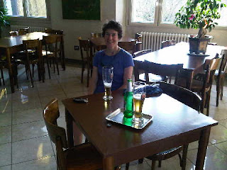
By 4pm we had reached the place known as Poggio degli Allocchi (knoll of the owls), from where we chose to descend steeply over slippery leaf litter and through prickly brambles to the small village of Casaglia, where we have the run of the Posto Tappa. Sue is pictured outside with her first pot of tea. It's much warmer outside than inside on this lovely sunny evening.

We walked 22 km in 7 hours 40 minutes today, on this leg of our journey.

We have the place to ourselves, but there is no chef tonight. I must go now and put tea on...

Sent using BlackBerry® from Orange

Saturday, 13 April 2013

Saturday 13 April 2013 - GEA - Day 6 - La Burraia (Rifugio CAI di Forli) to Passo del Muraglione

The cold Apennine wind huffed and puffed and whistled all night. Extra blankets were needed in our 8C room.

Marco and Christina gave us a good breakfast, then Marco headed downhill to reunite Olaf with his owner, whilst the four of us, me, Sue, Francois and Camille, set off across the snowfield towards Monte Falco, perhaps the highest point of this trip at 1657 metres.

We left the Samsung phone found yesterday with Christina - we couldn't get it to work.

It took the best part of an hour for Sue and me to reach the summit, as we were taking care in the soft snow to avoid painful knee jarring. Approaching the summit, we met a lone skier on his way down, and after enjoying a cuppa on top - and waiting in vain for some views - we headed down. F and C had by-passed the summit, but a couple wearing snow shoes were heading up at a good rate.

It felt as if we were in Gatineau Park, and we felt odd and out of place in walking boots, which were not ideal footwear for the conditions.

Soon some views appeared, the sun came out (top picture), and we really did feel we were back in Gatineau Park near Ottawa.

After a while we came to Passo Piancancelli, where F and C were waiting to say their goodbyes as they were descending from here to catch a bus to nearby Florence.

They missed a treat, as the rest of today's paths were wonderful.

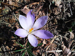
Eventually, after 6 km in soft snow, we dropped to around 1300 metres and lost the white stuff. Soon we were on a fine belvedere path, passing irresistible clumps of Hepatica, Alpine Squill, Snowdrops and Primroses. Views stretched from Monte Falco's snowy summit to beyond San Godenzo far below in the valley (pictured, below).

Lunch was taken in a sunny spot (20C here) on a knife edge, before we continued, reaching Passo del Muraglione at around 2.30pm, after 15 km and 5 hours 20 minutes on the trail.

Whilst it isn't open as a hotel at this time of year, the albergo at the pass was doing a roaring trade, with scores of motor cyclists enjoying the switchback mountain roads on a sunny Saturday.

As the hotel wasn't open, we'd booked a room at Albergo Silvano, 500 metres lower down in the village of San Godenzo. But how to get there? A two and a half hour walk, or a two hour wait for a bus? We chose a third option and ten minutes later we piled into the seatless rear of an old Fiat people carrier, lying low to dodge the eyes of the Carabinieri as we lurched down the hill on the short journey.

San Godenzo, the birthplace of Dante (The Divine Comedy), is a village with a fine Romanesque abbey, where we admired the mosaics before booking in at Albergo Silvano. We needed provisions for a couple of days (tomorrow's Posto Tappa doesn't do meals) so were relieved when the alimentari opened at 4.30. I recall the days when everything shut from noon on Saturday until Monday morning, resulting in logistical issues for backpacking trips that inevitably started with a Saturday morning flight, particularly relating to camping gas.

Our only problem now is the lack of a Sunday bus service - and we have a long enough day tomorrow without spending an extra three hours at the start lugging a load of groceries up a hill!

Sent using BlackBerry® from Orange

Friday, 12 April 2013

Friday 12 April 2013 - GEA - Day 5 - Badia Prataglia to La Burraia (Rifugio CAI di Forli)

Last night we weren't, for a change, the only guests. Despite being an 'upmarket' hotel (with no doubt much higher prices in the main season) Bosco Verde opens its doors to children during term time. So we had the company of 40 or so ten year olds and their wards. All very jolly. They did of course both eat and adjourn to their beds much later than us.

Looking out of the window at breakfast time, whilst the higher hills were cloaked in cloud the sun was trying to break through. So we were hopeful...

After re-stocking our lunch provisions at the Spar shop we set off up to Il Capanno, with views back to Badia Prataglia. Then we headed up towards Passo Fangacci. About 45 minutes into the day's walk we entered the cloud. By the time we reached Passo Fangacci (pictured, top), we were tramping through soft, knee jarring, snow.

We found our way down to the monastic retreat - Eremo di Camaldoli - which luckily was still open for visitors. It shuts between 11.30 and 15.00. The church was beautifully decorated, with a wonderfully ornate ceiling. But the whole place, at 1100 metres, was shrouded in cloud. The coffee shop provided welcome elevenses.

We spent the next 4+ hours on the trail - Sue posed at one of the few distinctive features for the second picture of the day. Much of the walk was over old but soft snow, through which it was clear that two people and a dog had passed shortly before us.

Very occasionally we glimpsed a sunlit valley to our right, but where we were the cloud was sticking to the trees like dew on a spider's web. Full waterproofs were needed.

Eventually, around 4pm, after 19 km and 7 hours on the trail, we dropped down to the welcome sight of Rifugio Forli (1350 metres), where Marco, the guardian, rushed out to greet us. There were none of the usual Rifugio formalities involving removal of boots and waterproofs - we were hastened straight in for a pot of tea in front of a fire, with two Belgians, Francois and Camille, who had arrived shortly before us with a stray dog in tow.

Marco and his wife Christina have now managed to locate the dog's owner, who has a ten mile journey up here to collect it. Luckily it was chipped and a forest ranger turned up with a chip decoding gadget.

The rooms here are more like hotel rooms than Rifugio rooms; we have a double bed in our en suite accommodation. But the extra blankets may be needed...

Goodbye for now - it's beer o'clock.

Sent using BlackBerry® from Orange

Thursday, 11 April 2013

Thursday 11 April 2013 - GEA - Day 4 - Chiusi La Verna to Badia Prataglia

Thanks for your comments, Conrad Jules and 'ipad Gibson'. Yes, it's a good time to do this trek, though we seem to be in a minority with that view. Last night we were again the only guests staying at our hotel, though an elderly couple did pop in for a meal whilst we were enjoying our feast.

It's an easy undertaking, with no technical difficulties, so don't expect anything dramatic!

Today we rose to a clear blue sky and a bevy of chatty blackbirds, who, like the jays and blackcaps we've been seeing, are busily collecting nesting material.

Swallows and martins have also arrived and are busy harvesting whatever insects they can find, but unlike on some of our summer trips we do not have a 'fly problem'.

Instead of the GEA route, we chose to start along path 51, which rose gently through groves of towering beech trees diffused with light and bird song. It was a lovely path despite the occasional wild boar scrapings that have been with us since the start of the trek.

The La Verna religious sanctuary (pictured from the outside) is a huge place. We strolled inside the walls and visited the Basilica. But we had to reluctantly move on, today being a longer day under a clear sky but with a pleasantly cooling breeze.

Snow capped peaks drew our eyes west, but they gradually slipped further into the distance today.

A lot of waiting around for Sue's flower pictures was encountered - I hope they are prize winners!

Cuckoos, willow tits, and bright yellow butterflies joined us for elevenses on a sunny corner of the path with fine views.

The path then proceeded delightfully for some way, until reaching Poggio Tre Vescovi (The Hill of Three Bishops). Here we paused for lunch and the sky began to cloud over.

Path 00, which follows the main spine of the Apennines, was rejoined here. We headed along the crest of the spine for the rest of the day, generally on a broad path with steep drops to either side. Gillian is not over enthusiastic about the views from this path, but apart from a short section of pine forest the trees - mainly beech - merely presented a 'trunk slashed' version of impressive views in all directions. When there is no foliage, it's easy to ignore the trunks and branches in the foreground of the view, though the camera is not so sure - leaving the best images arboreal ones (lower picture).

After 27 km and 7 hours 30 minutes we reached our destination after 3 km along a quiet road. In her guide book, Gillian describes Badia Prataglia's Hotel Bosco Verde as 'upmarket', but it's actually cheaper than last night's guest house (that inadvertently diddled us out of a few Euros - always check the bill!) and here we seem to be enjoying our usual exclusivity, with personal service of the highest order from Marco. The gap in our quest for accommodation has been resolved, and everything looks set fair for the rest of the trip.

I'll send this before being distracted by the menu and the decision as to what should follow my large beer.

Sent using BlackBerry® from Orange

Wednesday, 10 April 2013

Wednesday 10 April 2013 - GEA - Day 3 - Caprese Michelangelo to Chiusi La Verna

Firstly, hearty congratulations to Kate and Simon. I should be a grandad (again) in October.

This was another short but very pleasant day.

We were the only customers last night at Buca di Michelangelo. We got the sole attention from the staff. The highlight of the evening was our antipasti course - almost a meal in itself, featuring three types of bruschetta, a plate of assorted smoked meats, a bowl of mushrooms in a delicious sauce, cheese and mushrooms on fried bread, and a dish of crispy salad with crispier prosciutto.

We met just two people on the trail yesterday and none today, although we passed a few villagers. We are before the main season. The whole trip (apart from sightseeing in Rome) is an experiment. It's an attempt to start our Alpine trekking season a little earlier than usual. We therefore chose an easy route on which we didn't need to rely on mountain huts, most of which don't open until mid June. We can do half of the GEA route in this way, but will have to return in the summer to complete it, as the later stages rely on mountain huts. The plan is working. Whilst not hot, the weather is pleasant - albeit a little damp at times - and there is little evidence of the biting NE wind that was really starting to get us down in the UK.

The scenery is more Welsh than Alpine, but there's not a wind farm in sight. The trees are only just starting to come into leaf, and there isn't the usual plethora of mountain flowers. But the spring flowers are lovely, especially the Alpine Squill, Purple Crocuses and Hepatica, and the sparse foliage means the views through the trees are extensive and the birds, albeit still very shy, are more visible. For periods we are joined by cuckoos, which is about the only likeness between this walk and my next backpacking trip, the TGO Challenge walk across Scotland.

Anyway, after some overnight rain, today dawned bright and sunny. It looked like a typical 'April showers' day, but they never arrived.

After dragging Sue away from the hotel cat, a short walk down the road saw us reach the hamlet of Lama at 516 metres. It was a pull from there up to Fragaiolo and its welcoming alimentari. Coffees, and panini and fruit for lunch, were happily supplied for a modest outlay.

The tarmac continued for a while as we headed up a quiet lane past sweet chestnut trees, encountering a friendly dog called Lack. After dragging Sue away from Lack's affections we continued along a rough but motorable track (the inevitable Fiat Panda was the only car we saw) inexorably up to Eremo La Casella, at 1263 metres.

We lunched here (pictured) in warm sunshine, just as St Francis did on his return to Assisi many years ago in the 13th Century.

After inspecting the chapel and the rather smart bothy (apart from the lack of beds, no water, and blocked toilets) we continued along the Apennine sub-crest, on a delightful path with fine views across to tonight's destination, Chiusi La Verna, in an increasingly downhill direction, until we reached the bottom of a canyon.

A slow, hot, but blissfully short ascent led to the fountain used in a 1931 Campari advertising campaign (pictured), from where we headed to the 'Centro Storico' to enjoy the remainder of our tea beside Adam's rock, supposedly used by Michelangelo in the Sistine Chapel.

From there, a short stroll took us to our guest house/restaurant for the night, Da Giovanna, where we booked in around 3pm after 17 km and 6 hours on the trail. It's a lovely spot - we have a large sunlit room with fine views. Afternoon tea is currently being served.

There is no sign of any other guests, though we were greeted by the question "Are you the ones who wanted your bags carrying?" We aren't, and moreover Sue has graduated from bum bag to small rucksack, so she is able to carry her own personal items on this trip!

PS Sorry Alan, I just thought I'd make it easy for you to confirm the obvious! Alfa - no doubt about it, they all rust like that...ha! Hope your own trip went well btw.

Sent using BlackBerry® from Orange

Tuesday, 9 April 2013

Tuesday 9 April 2013 - GEA - Day 2 - Passo di Viamaggio to Caprese Michelangelo

It was to be a fairly short day, so we fancied a lie in. Unfortunately that plan was foiled last night when Maura announced (after plying us with beer, wine, and a delicious meal of pasta with ragù, followed by mixed ribs and wild boar sausage with chips, etc) that today was her day off and breakfast would be at 7am.

We could hardly complain though, when at 8am this morning we got our bill for half board, beer, wine, coffees and a flask of tea and packed lunch - €55, for the two of us.

We'd woken to find the hotel enveloped in cloud, so we set off in rain, clad in full waterproofs and feeling pleased that we had brought gaiters and boots. We had considered using trail shoes but were right to choose boots.

After yesterday's largely excellent paths it was disappointing this morning to have to share our 10km route to Pieve Santo Stefano with the tracks of trial bikes. But the scenery, insofar as we could see it, was lovely. Today we encountered more oak woods; yesterday was predominantly beech.

We diverted to Eremo di Cerbaiolo, a sanctuary founded in 722 by Benedictines, on Gillian's recommendation. Sadly, the 'custodian and her boisterous herd of acrobatic goats' were not there. The current custodian, Francesco, explained that the old lady died three years ago at the age of 85, and that her sister had then looked after the goats until she was hospitalised, when they had to go...

Coffee and cake was enjoyed with the locals in a café at Pieve. There was a double page spread in the paper about yesterday's train derailment - 'Many injured - operator accused of poor track maintenance.'

After that the rain stopped and the sun emerged. The trial bikes had not churned the paths to Caprese Michelangelo, so we enjoyed a very pleasant three hour stroll to that hilltop village.

Today's pictures are from that part of the day - lazing in the sun near the end, and one for Alan R to identify, but judging by the condition of the bodywork I would guess it's an Alfa Romeo.

We checked into Hotel Buco Michelangelo, kindly booked for us by Maura last night, soon after 3pm, our 20 km walk having taken a leisurely 7 hours 15 minutes.

That gave us plenty of time to look around the Michelangelo museum. The great man was born here in 1475.

Sent using BlackBerry® from Orange

Monday, 8 April 2013

Monday 8 April 2013 - The Grande Escursione Appenninica (GEA) - Day 1 - Bocca Traboria to Passo di Viamaggio

Happy Birthday Dot - 88 today.

Weren't we lucky! I omitted to mention yesterday the help we got from Gillian Price regarding the train line to Sansepolcro and other transport issues. Thanks Gillian. And as I start to compose this entry a comment has arrived from Gillian to indicate that this morning's train derailed.

Weren't we lucky!

[Reception is intermittent, so I'm unable to respond to comments except from within this text, which may get delayed in transit - most people know the score by now.]

We weren't so lucky with breakfast. It was to be at the café across the road (presumably part of the Guidi empire) at 8 o'clock. Every assurance was given and they knew we were catching a bus at 8.25. But there was no sign of life by 8.05, so we gave up and breakfasted at the bus station café before boarding the Baschetti minibus that services the Arezzo to Pesaro route.

[Before complaining any more about the failure of our B&B to provide breakfast, we have to hope that the person who failed in their 'breakfast duty' wasn't caught up in the derailment.]

A half hour bus ride took us to the rather desolate looking Bocca Trabaria - the start of the GEA. A sign indicated that today's walk would last 7 hours, though we later discovered the GEA adds 30 minutes to that estimate as it doesn't follow the crest of the ridge all the way.

There was a chill in the air as we set off along the wooded crest of the Apennines that we were to follow for most of the day. After a while, showers of hoar frost confirmed that last night the higher parts of the ridge had been shrouded in cloud.

We saw nobody until we reached Pian della Capanne, which was fenced off as a building site where the refuge was being refurbished. A workman with a wheelbarrow lurked outside.

By now it was mid afternoon. It had been clouding over all day and light sleet was followed by a gentle shower of rain. We met two poncho clad walkers coming the other way, the only people seen on the trail today.

The final ascent of the day took us in rather gloomy conditions to the 1147 metre summit of Monte Verde, a nice little hill with fine views, its one drawback being its apparent construction from clay.

Consequently, our boots are just inside the door of Hotel Imperatore, our lodgings for the night. Nobody will want to steal them!

Inside the hotel, whilst enjoying a pot of tea, we chatted to a group of German speaking Italians from Bolzano. [Sue: "Do you speak Italian?" Group: "We are Italian!"]. They are walking a pilgrim's route, The Path of St Francis of Assisi (Sentiero Francescano), which coincides with the GEA for short stretch. "You'll be quicker than us then" one of them remarked "- you won't need to stop so often to say your prayers!"

It's good to have them here, they've made the sun come out again.

This trail is perhaps a mini European counterpart to the Appalachian Trail. It has its quota of woodland, as demonstrated by today's picture near the start of the trail. [It was chilly - we are used to that - 'good walking weather'.]

The Garmin gadget says we've gone 21.5 km today, in 7 hours 10 minutes. I'm sure we've climbed more than Gillian's estimate of 600 metres in her guide book, but that statistic will follow when we get home and download the data that's hidden somewhere inside the Garmin gadget.

Sent using BlackBerry® from Orange

Sunday, 7 April 2013

Sansepolcro

We slept in this morning due to the room being silent and blacked out, but we still managed a leisurely breakfast and a trip to the station's Spar shop, which is open from 7.30 to 21.30 every day, so no need to bring provisions from the UK.

The timing of our start of this trip was a bit of a faux pas, as Italian transport on Sundays is sparse and erratic. The 9.30 train to Foligno left closer to ten o'clock, leaving us there at 11.30 with an hour and a half to while away in the pleasant town (coffees outside in a sunny square - bliss!) before continuing on to Perugia Ponte San Giovanni. That was just a 25 minute journey.

The Trenitalia staff in Rome had denied all knowledge of a railway station in Sansepolcro, to which town the normal route would be the Florence train to Arezzo then a bus to Sansepolcro, and onwards to the start of our walk. But the buses don't run on Sundays so we tried this alternative route via Perugia PSG.

Our downloaded timetable showed lots of trains, and we had booked a hotel, Locanda Guidi, in Sansepolcro. What could possibly go wrong?

Not a lot! On arrival at Perugia PSG the man in the Trenitalia ticket office shook his head gravely and directed us to the bar. Tickets for the hour and a quarter journey to Sansepolcro were duly produced from behind the counter in exchange for the princely sum of €4 each, bringing the cost of today's travel to around €26 each.

A bench in the sun in a wild flower meadow provided a good luncheon venue until we had to withdraw to some shade as the sun tan cream needed to cope with our sudden exposure to 24C was too deeply packed.

The hour and a half break until our train on the Umbria Mobilita line to Sansepolcro soon passed, aided by Ken Follett's 'Fall of Giants' and Graham Ratcliffe's rather contrasting 'A Day to Die For'.

The Umbria train then chugged up a picturesque valley to reach our day's destination soon after 4pm. The Locanda is in the centre of this ancient walled town, the most important (historically) in the Tuscany Upper Tiber River Valley. We wandered at length, locating tomorrow morning's bus stop and encountering a treat in the Campanile. This tower is not usually open to tourists, but on bell-ringing Sundays the ringers allow folk to sample their rickety ladders and indulge themselves in panoramic views across the rooftops. Today's image is the view towards Bocca Trabaria, from where we hope to start our GEA walk tomorrow (albeit it's a bit off our map!).

Sent using BlackBerry® from Orange

Saturday, 6 April 2013

Rome

After an energetic Parkrun, and thanks to Mike's Taxi, Jet2's Boeing 737-300 and a Terravision bus, we made it in good time to Hotel Washington, near Rome's railway terminus.

A short stroll then brought us to the church of San Giovanni in Laterano (pictured), around the corner from which a cheap pizzeria was selling large bottles of beer for €3, neither of which offers we could refuse...

Sent using BlackBerry® from Orange

The Grande Escursione Appenninica

0101Apenninemaps

Good morning.

We’ve had enough of this cold northerly wind.  A month of it is a shade excessive in our book.  It’ll probably subside now, but we don’t really care.  In a few minutes we’ll be leaving for Rome, and a ten day stroll through the woods of the Apennines, as well as a few days in Rome before we return to the nice spring weather that Timperley should by then be enjoying.

We’ll keep in touch…

Friday, 5 April 2013

Wednesday 3 April 2013 – The Thirlmere Way–Stage 1

0302HeatonParkgroup

Reg’s next ‘Plodder Project’ is a walk that traces the line of the Thirlmere water pipes all the way from Heaton Park to Thirlmere, starting with this rather urban walk from Heaton Park to Blackleach Park.

I’ve inserted Reg’s comprehensive directions at the end of this posting.

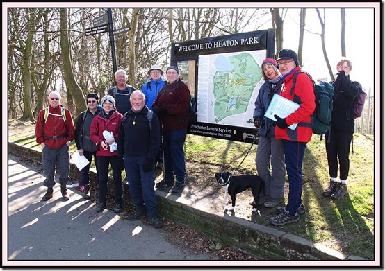
Eleven of us assembled at 10.30 not prompt, and set off in cold but sunny weather into the depths of Heaton Park, where a phantom barber awaited us.

0304HeatonParkteapotNorman

After examining Heaton Hall and the Dower House, we headed for the reservoir that holds water from Thirlmere and Haweswater before it’s distributed around Manchester via a sort of ‘ring main’.

A wall on the north side of the reservoir affords a good view across to the Peak District.

0321reservoir6

A comprehensive tour of Heaton Park, which is apparently the largest urban park in Europe, took us past the Temple (another good viewpoint) and beside the Hall, which is guarded by ornamental lions.

0328HeatonHall4

This was all pretty exhausting for the merry band of Plodders, who soon sought refuge on a ha-ha.

0329elevenses

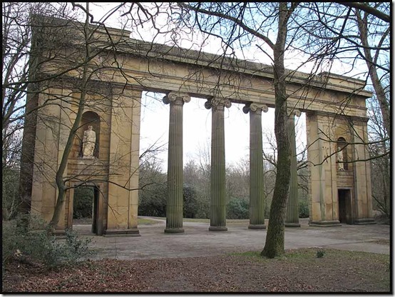
We then continued to the Colonnade, a relic from Manchester’s former Town Hall.
0336colonnade3

The exit from the Park, after five miles of walking, was through the high archway of the Grand Lodge, which can apparently be hired as a holiday home!

0340GrandLodge1

Soon we were at Agecroft, where a fine bridge carries the water pipes over the River Irwell.

0352bridge2

The pipes spend most of their time underground, but here they cross above the dilapidated remains of the Manchester to Bury Canal.

0357canalpipe2

Reg felt very at home in this part of the world.

0369Reginald

We found a couple of inspection covers – this one housed a new looking valve, but the nearby iron access gate that Reg had seen on earlier visits had gone.

0385valve

After a long and very familiar (thanks to the Bogle Stroll) section along the A6 under the M60/M61 junction, we finally left the tarmac and proceeded into Blackleach Country Park, a tranquil area that has taken the place of a chemical factory that occupied this ground for many years.
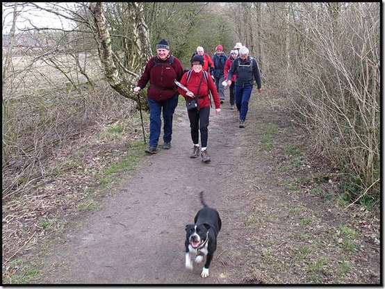
0387track

After supping the dregs of our flasks in the Visitors Centre, we departed on a variety of charabancs – the number 37 bus (every 10 minutes) proving particularly useful to those who wanted to travel to either Manchester or Bolton.

Here’s our route – 20 km, 150 metres ascent, taking a little over 5 hours.

0399route

There’s a huge and comprehensive slideshow, showing many local urban features – here.

And set down below is Reg’s diligently compiled set of directions and other information that should enable anyone with the desire to follow exactly in our footsteps.

Heaton Park Reservoir to Blackleach Country Park.

The Heaton Park Reservoir is where water from Lake Thirlmere is stored as part of Manchester’s water supply.  It makes a fitting starting place.  Heaton Park’s rolling scenery, with views of the Pennines, would be how the construction teams would have found Prestwich and the surrounding countryside.  Prestwich was a health spa at this time and noted for the purity of it’s air.  Originally it was planned to store the water in a reservoir near Bolton but the air pollution due to surrounding mills persuaded the planners to take the Aqueduct to Prestwich.

Interestingly although the Haweswater Aqueduct is acknowledged as it enters the Heaton Park Reservoir there is nothing to indicate where the Thirlmere Aqueduct enters.  As the result of a piece of detective work, namely the trained eye of Peter Smith, we think we have located where the pipes of the Thirlmere Aqueduct are situated near the side of the reservoir.  The reservoir is hidden from view in all but one place which unofficially allows you sight of the reservoir.  Your scouts have been very active!

Finally before commencing the walk description be mindful of two things - the Thirlmere Aqueduct travels beneath the road near to the western boundary of the reservoir, Bury Old Road.  Prior to this it travels under Scholes Lane and Hilton Lane on it’s way up from Agecroft.  Consequently the first sighting of the Aqueduct is the bridge across the Irwell at Agecroft.  We have made the most of our time in Heaton Park to enjoy a rural outlook prior to at times a very urban walk involving a lot of street walking.  To this end if we reach Blackleach Country Park(another haven of countryside) the majority of street walking is behind us.  It is as well to remember at the time the Aqueduct was constructed roads like the A6 would have been relatively green.

From the railway station we enter Heaton Park, immediately across the road, and head for Heaton Hall.  Heaton Park has a rich and fascinating history.  Between the mid 14th century and the beginning of the 20th century just two families owned the Heaton estate.  It passed through generations of the Holland Family until Elizabeth Holland, the last member of the family, married Sir John Egerton in 1684.  Heaton Hall was built for Sir John and over the years has been added to.  Heaton Park remained in the hands of the Egerton family until 1902 when it was sold to Manchester Corporation for £230,000.  Heaton Park is Grade 2 listed on the English Heritage Register of Parks.  More details can be found on the English Heritage website.

Near to the hall are the Orangery, Farm Centre, and play area.  We take the footpath to the car park and Dower House and it’s bees.  Here we can see and begin to follow the banks of the reservoir.  Near to the St Margaret’s Road entrance are Water Board Buildings and at the side of them are the ?Aqueduct pipes.  This position coincides with what is shown on the 1909 map as the Aqueduct entering the reservoir.  The path curving to the left away from here, leading to Bury Old Road, is shown on the 1909 map to be the way the Aqueduct reaches the reservoir from the Bury Old Road.

Turning right onto St Margaret’s Rd we reach the Reservoir banks, the Reservoir being hidden from view.  Turning right on Heywood Rd we come to the Reservoir Pump House.  This rather ordinary building is listed on account of the impressive mural that depicts the piping of water through an underground aqueduct, the Haweswater Aqueduct.  Three engineers are shown turning a huge valve.  This panel also gives important names, facts and dates in the story of the project to bring water from the Lake District to Manchester.  The panel was designed by the famous American Sculptor, Mitzi Solomon Cunliffe, and has been described as ‘a remarkable piece of public art on........a mundane industrial building’.  Until the 1950’s there were serious water shortages in Manchester.  Thanks to the two aqueducts Manchester now enjoys a plentiful supply and some of the best mains water in the country.

Just beyond the pumping station there is a wall which allows one to walk with ease up to the point where the Reservoir is visible.  It is a pity it is not possible to walk around the Reservoir, as it is a beautiful stretch of water with panoramic views of the surrounding hills.  There is considerable bird life too.

We take the bridleway which follows the Reservoir boundary and this leads to the northern perimeter wall of Heaton Park.  After half a mile there is a break in the wall allowing access back into the park.  Heading for the Transmitter Tower we climb in the direction of Heaton Hall passing Highland cattle in the nearby fields. Just beyond are public toilets and a little further on benches or a ha-ha to take a short refreshment stop.

We now head to the Lakeside cafe, temporary fun fair and onto the Grand Lodge.  A small detour takes us past the very impressive Colonnade which was formerly the front of the Manchester Town Hall.  From the Lodge we head for the road junction and cross to Scholes Lane.  Take the third road on the left, Sedgley Park Road, and walk down to the junction with the A56, the Bury New Rd.  As we walk down Sedgley Park Rd, a Jewish District, we pass on the left a most impressive building, formerly a convent training school for nuns, but now a police training centre. [Now rather unkempt.]  Turn right along the A56 and left up Chandos Road (second left).

Walk to the end of Chandos Rd and left past the red postbox onto Bland Rd and immediately right into Circular Rd.  Continue along Circular Rd until house number 41.  Turn right immediately before number 41.  Proceed down to next ginnel on the right and down to George St.  Turn right down to Fairway Lodge.  Walk in front of the hotel, through the car park, and turn left and down to a broad track at the side of the golf course.

Continue down this broad track to the T junction and turn right, uphill to the first path on your left (not onto golf course).  Follow the path to Heathlands Drive.  Left along the road to the road junction.  Turn left and then immediately right onto the Playing Area.  Follow the path immediately in front to Chapel Rd.  Turn left down Chapel Walk and onto Halliwell Rd.  Note in the distance (on a clear day!) Winter Hill and it’s masts.  Hopefully by the third section of the walk we will be very close to Winter Hill.

At the end of Halliwell Rd there is a curve.  Turn left down a passageway between houses 16 and 14.  Turn right at junction and follow the track to a derelict area (site of former public house).  Walk to main road, A6044 or Hilton Lane at Rainsough Brow, turn left and walk down to Agecroft bridge.  The ornate bridge conveys two aqueduct pipes across the River Irwell.

From the bridge continue along the road, passing the site of the former Power Station and also now the entrance to Forest Green Prison.  Stay on the left hand side of the road to reach the bridge over the former Manchester to Bury/Bolton Canal.  Walking down to the canal side allows good views of the two aqueduct pipes as they cross the canal.  Walking along a little further we see the pipes as they cross the existing Manchester to Bolton railway line.  Be mindful of walking on the road verge as this is a busy road.  Before the motorways Peter remembers lorries on their way to Liverpool Docks being nose to tail for miles along what at that time was the main route from Yorkshire to Liverpool. Continuing along the road we pass the site of Agecroft Colliery, now a retail park, forward under the railway bridge (line to Wigan) and up to the A666.

Cross road and into Ranelagh Rd.  Note inspection hatch on left on the grass verge.  The Aqueduct continues forward beneath the grass verge and on to run alongside what was Pendlebury Children’s Hospital.  From here the Aqueduct is below the A6 and continues to be so until it reaches Walkden, where it takes a right turn along the A575 (Bolton Road) and then goes cross country through some modern housing estates.  It is particularly mindful here to remember that when the Aqueduct was constructed most of these estates were green fields.

To avoid considerable road walking along the A6 we have sought to shorten and take the most direct route to Blackleach Country Park.

We continue along Ranelagh Rd to the junction with Hospital Rd, turning left then across the road to a footpath on the right.  Continue along footpath passing recreation ground on right and along to Swinton Hall Rd.  It was along this footpath on a previous expedition with East Lancs Senior Scout, ’Stormin Norman’ that like a blast from the past Norman remembered spending many ‘social hours’ in a Miner’s Recreation Centre just off the footpath, with Neil Smith.  Stopping the first member of the public, a local native woman, it was confirmed his memory was correct.  The Centre was demolished several years ago.  Be prepared for two miles of very urban road walking.  Towards the end of Swinton Hall Drive is Morrison’s and the prospect if you so wish of a cuppa in the cafe. [Or a pint in the nearby Weavers Arms.]

At the junction with Station Road turn right, over the bridge and left into Cromwell Rd.  Walk the full length of Cromwell Rd to junction with Cemetery Rd, turn left and walk down to A6.  Cross to left hand side and right up to the railway bridge.  Aqueduct pipes are visible as they cross to Moorside Station.  Continue along the A6, passing eventually under the motorway bridges.  Cross over to the right hand side of the A6, passing Linnyshaw Farm, and up to the bridge over a disused railway.  Here you will see a wealth of Aqueduct memorabilia, pipes, inspection hatches and what would have been your first gate.  Unfortunately someone very recently has removed the iron gate, the stone posts remain.  We had said to the water board after our previous explorations that they should protect (adopt was the advice we gave) this special gate as the first one people doing the walk would see!

Relief is at hand as you walk the semi rural old railway track bed for 1.5 miles to reach Blackleach Country Park.  On reaching the reservoir take the track immediately on your left which follows the side of the reservoir to reach the Information Centre, where hopefully if open there are toilets and possibly as in the past the chance of another brew.  From the Information Centre, leave the Park and via Hill Top Road cross the A575 to the bus stop for the number 37 and onto Bolton for transport to further destinations. [Or don’t cross the road if you are heading for Manchester!]

The distance is around 12-13 miles.