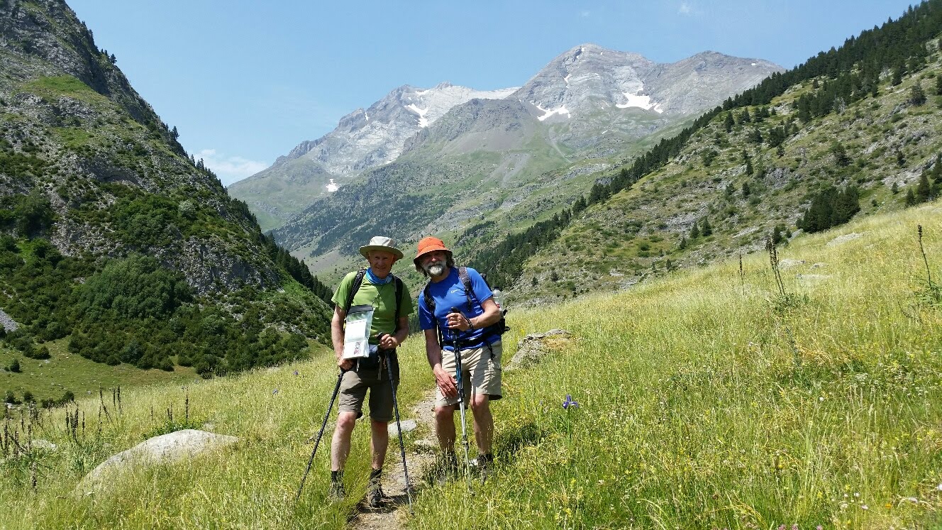
Sue and Martin in Mallorca 2019

Sue and Martin in Mallorca 2019
On the Archduke's Path in Mallorca

Friday, 3 July 2015

Friday 3 July 2015 - Pyrenees GR11 - Day 19 - Interlude 3 - A Peña Foratata Circuit


Distance: 10 km

Ascent: 900 metres

Time taken: 5.0 hrs

Weather: hot and sunny, breezy high up so much more pleasant to walk in than of late.

Today was supposed to be a complete rest day - my first since setting off. We were going to pop over to France for a gondola ride to a narrow gauge railway.

But Harry was the only taker for Clare's Peña Foratata walk from Formigal. It wouldn't 'run' with just one guest. So Sue and I came to the rescue.

It was conveniently short and gave excellent views as far back as my route into Sallent a week ago.

Lamergaiers were seen today, as well as a selection of other vultures, probably mainly Griffon and Egyptian, notably whilst Sue and Harry were at the top of the mountain, which required a scramble.

Clare and I waited a little lower, at a high col. Clare's not allowed to venture to such a scrambly place with guests for insurance reasons, but the guests are allowed into such life threatening places as long as it's of their own volition.

There were masses of flowers. The time passed quickly. As it did when we stopped for lunch in an idyllic meadow a little further down the mountain. Alpine Swifts were active here, and we could see a herd of twenty or more chamois cooling themselves on a distant snow patch.

Back in Formigal it was ice creams and cokes all round before returning to base. A short foray to Gorgol outdoor shop in Sallent resolved my sunglasses, camping gas and 'how to change an altimeter battery' problem, after which Sue went for a swim and I enjoyed another large beer. After a bit of preliminary packing...

Then we spent a lovely evening at Hotel Sabocos with friends new and old.

Transmissions may now be less reliable, as I head back into the wilds of the Pyrenees tomorrow.

Today's pictures:
Formigal and Embalse de Lanuza from the start of the walk
Peña Foratata (2295 metres) from the ascent
The view north from the slopes of Peña Foratata

Next Day - Day 20

Back to Index

Thursday, 2 July 2015

Thursday 2 July 2015 - Pyrenees GR11 - Day 18 - Torla to beyond Ordesa Canyon road terminus, via Camping Valle de Bujaruelo


Distance: 20 km (Cum: 321 km)

Ascent: 700 metres (Cum: 15100 metres)

Time taken: 5.9 hrs including 1.0 hrs stops (Cum: 115.0 hrs including 21.8 hrs stops)

Weather: very hot, with sunshine and slowly building cloud

Tim and Paula kindly offered us the lift that enabled Sue to enjoy a good walk high in the Ordesa Canyon, whilst I could make a little GR11 progress from last night's stopping point to the Ordesa road head.

Thursday is 'Ordesa Canyon Day' for Collett's, but whilst the others all hopped on a bright blue bus that took them up the valley on an otherwise closed road - a similar system to that operated in Zion National Park - I strolled through the pretty village of Torla, then up the 7 km of road that took me back to the Bujaruelo campground. Back across the sturdy beige bridge and along the lovely woodland path, past a fisherman in the river, to Puen de Santa Elena. Here the path, which doubles as the Camino de Santiago en Sobrarbe pilgrim trail, crossed the gorge and took a splendid high route involving a few cables from time to time. I met a large group of children coming the other way.

Martagon lilies and St John's Wort were among the many plant species that lined the path that was also home to some very tuneful songbirds.

At the junction at the bottom, all paths seemed to lead to either Torla or Goriz. Choosing the latter, I found myself on the other side of the gorge to the bus lane, slowly rising in the wide canyon. Lunch was taken on a balcony with a view across to the much narrower Ara gorge.

By 2.30 I'd reached the road head, so I continued for half an hour before turning round in the face of a threat of rain. That threat came to nought, but I soon met Remy, Ann and Harry, so strolled down to the bus stop with them, enjoying the views either side of the gorge as we went.

They caught the first available bus. I bought a cold drink at the café and waited.

... and waited ...

... they must be with someone from Macclesfield Squash Club!

They were, eventually turning up after 5.30 after about 17 km with 800 metres ascent. Paula, desperate, was somewhat ahead of the pack.

And another jolly good evening was had by all, including James and Alison who have just arrived.

Today's pictures:
Starting out over the beige bridge
Ordesa Canyon views

Next Day - Day 19

Back to Index

Wednesday July 2015 - Pyrenees GR11 - Day 17 - Baños de Panticosa to Camping Valle de Bujaruelo


Distance: 24 km (Cum: 301 km)

Ascent: 1000 metres (Cum: 14400 metres)

Time taken: 8.6 hrs including 1.3 hrs stops (Cum: 109.1 hrs including 20.8 hrs stops)

Weather: sunny and very hot

Another good breakfast at Hotel Sabocos set Harry and me up for a good day on GR11.

We drove up to Baños de Panticosa and recommenced my GR11 traverse with just day sacks. This made the superbly graded 900 metre ascent to Cuello de Brazato past a very depleted reservoir, Ibón dero Brazato, less than taxing despite the noises coming from a distant pipe that sounded as if someone was trying to cut it into pieces using a powerful saw.

On the 2566 metre col, about 30 children from San Sebastian were enjoying  a backpacking trip from Panticosa. Harry was delighted to be in this wonderful spot. He sent an enthusiastic message to a good friend who sadly suffers from cerebral palsy.

Here but for the grace of ...

Boulderfields featured strongly in the descent to the Ara valley, together with stupendous views towards Vignemale.

The nice people at Sabocos Hotel had provided an excellent lunch. We ate it shortly before meeting Sue, who had driven round via Torla.

A knee deep crossing of the Ara united our threesome for the fairly windy three hour walk down to the medieval bridge at San Nicolás de Bujaruelo, where Sue enjoyed a cold dip in the river before driving 3 km back along the dirt road to pick up Harry and me. We'd continued that distance into the next stage of GR11 along a lovely undulating riverside path past a few pill box like 'caves' through shady woodland - shade that was most welcome on another day of temperatures in the 30's Centigrade.

The day also featured frequent marmots, the debris caused by unseen wild boar, and the usual proliferation of flowers - notably an ascent through Alpenrose and orchids, meadows of deep blue Irises, and hillsides tinted bright yellow with broom.

There were plenty of people about in the Ara canyon, and whilst I didn't spot any GR11 walkers, Sue may have met one or two as she walked up the valley from 1400 to 2000 metres to join us.

Welcome beers after the hour long drive back to Hotel Sabocos were as necessary as ever. As on all Collett's holidays, the staff have a day off on Wednesdays, so we went with the Irish contingent (Harry and Ann) and Stephen from Melbourne, for a lavish spread at the restaurant with two cows outside.

A full day, so a brief report. Thanks also for all your comments.

Today's pictures:
The morning view back down to Baños de Panticosa and its western ramparts
Backpacking children with Vignemale
Harry and me in the Ara valley

Next Day - Day 18

Back to Index

Tuesday, 30 June 2015

Tuesday 30 June 2015 - Pyrenees GR11 - Day 16 - Interlude 2 - The Lacs d'Ayous Circuit


Distance: 17 km

Ascent: 750 metres

Time taken: 5.0 hrs

Weather: sunny and even hotter

The glorious weather continued whilst 16 guests and Clare enjoyed this easy counter-clockwise circuit from the car park below Lac de Bious-Artigues, across the French border a 50 minute drive from Panticosa over the Col du Pourtalet.

A series of lakes, and close views of Pic du Midi d'Ossau featured strongly, together with an excellent lunch break at Refuge d'Ayous.

Then a volt of at least nine vultures, probably Egyptian, flew over whilst Sue, Tim and Harry cooled off with a swim in Lac Bersau, watched over by a posse of horses.

Lower down, flying trout were trying their best to escape from another overheated lake.

Gentians and orchids accompanied us throughout.

Beers, G&Ts and lots of wine either preceded or accompanied another fine nosh at Hotel Sabocos.

An excellent day, albeit progress along GR11 seems to have slowed a bit. We did however manage to complete a section of GR10 that evaded us in 2013 due to inclement weather.

Today's pictures:
Hikers, with Pic du Midi d'Ossau
Horses and swimmers
Hikers, with Pic du Midi d'Ossau

Next Day - Day 17

Back to Index

Monday, 29 June 2015

Monday 29 June 2015 - Pyrenees GR11 - Day 15 - Interlude 1 - The Sabocos Valley - a circuit from Panticosa 


Distance: 11 km

Ascent: 500 metres

Time taken: 5.0 hrs

Weather: sunny and very hot

The hotel is great, the Collett's staff are most helpful, and the food is excellent.

Today I spent a pleasurable five hours with Remy (Collett's) and thirteen other guests, strolling on easy paths in the Sabocos valley above the village.

To all intents and purposes a well earned rest day with some of the Macclesfield Squash Club group that we encountered in Haus Valentin in Badia last July. It's a small world!

The walk featured:
 - a large lizard nearly 2 ft long
 - evidence of a wild foraging party enjoyed by some boars
 - lots of flowers, including
Queen of the Alps
Yellow Rattle
A selection of spotted Orchids
Irises
Mountain House-leek
and many more.

Back at the hotel by 2 pm for large beers and a lazy afternoon.

Sue arrived via Jet2's service from Manchester to Toulouse, and a five hour drive, at soon after 6 pm, so now we can enjoy a little holiday together.

Excellent.

Pictures comprise the view from the hotel (top), walkers in the Sabocos valley, and a view up the Sabocos valley.

(Notes from Mr Kindle: Wolf Hall is on hold at 46%, and Humphrey's recommended tale from the Pyrenees - The Invisible Guardian by Dolores Redondo has been commenced)

Next Day - Day 16

Back to Index

Sunday 28 June 2015 - Pyrenees GR11 - Day 14 - Ibón Azul Alto (2409 metres) to Panticosa  (Hotel Sabocos)


Distance: 14 km (Cum: 277 km)

Ascent: 200 metres (Cum: 13400 metres)

Time taken: 5.0 hrs including 0.8 hrs stops (Cum: 100.5 hrs including 19.5 hrs stops)

Weather: sunny and very hot

After rising at 7, I finally departed from the idyllic spot at Ibón Azul Alto at about 9. With great reluctance. I'd watched the evening turn to dusk and the sun then the alpenglow slowly fade from distant peaks to the east. Later, when the moon had shifted beyond the horizon, I savoured the deep black of a starry night unencumbered with light pollution.

Eventually, after a long sleep in the cool of the mountain meadow, I woke to the first signs of dawn, eventually leading to the slow undrawing of the shadow to reveal our home for the night in all the glory of the new day.

I didn't need to move from my bed to witness the calm waters, the glistening snow and the solid reflections.

Three others had arrived late last night, and others passed on their way up to the Cuello. It was all quite jolly.

The walk down to Baños de Panticosa started over rock scenery typical of the Central Pyrenees and concluded down a deep V-shaped valley.

I found excuses to stop whenever possible. There are lots of photos of flowers to sift through. Primroses feature strongly. Yellow Wood Violet and Alpenrose proved less photogenic.

At some point (or even last night) I put my sunglasses down and moved on.

Baños de Panticosa was reached after a very leisurely three hours. It's a landmark on my GR11 crossing as it's the point where I veer off to the village of Panticosa, some 7 km down the valley, included in today's statistics.

After a welcome cold Pepsi outside Refugio Casa de Piedra, I strolled off down the road to Panticosa, eschewing the offer of a lift from Vincent and Maria as I wanted to be able to brag about having walked all the way to Hotel Sabocos from the Atlantic.

Pride comes before a fall, or so I'm told. Having lectured myself on how now on the tarmac road to Panticosa a fall was most likely, I proceeded to trip over my own feet and spreadeagle myself headlong on that same tarmac.

So I arrived bleeding at Collett's base in the Pyrenees. I'm three days early, so I have six nights here. GR11 will have to wait, but I've now walked 13 of the 45 stages, so there are plenty more to go. Just bear with me for a few days while I chat to the amazing screeching swifts of the Sabocos Hotel.

Today's pictures show the early morning view from my tent, rock scenery on the descent, and my home for the next few days.

Next Day - Day 15

Back to Index

Sunday, 28 June 2015

Saturday 27 June 2015 - Pyrenees GR11 - Day 13 - Sallent de Gállego (Hotel El Reyno) to Ibón Azul Alto (2409 metres)


Distance: 18 km (Cum: 263 km)

Ascent: 1500 metres (Cum: 13200 metres)

Time taken: 7.1 hrs including 1.2 hrs stops (Cum: 95.5 hrs including 18.7 hrs stops)

Weather: stunning.

Days like this don't come round too often. You remember them for the rest of your life.

El Reyno provided a good breakfast. That and yesterday's good meals put me in a good position to enjoy the long ascent that occupied most of my walking day.

It was another leisurely start, as I'd agreed to wait for Tobi and start after 9.30 if he wanted to join me for the day (he needed supplies and the supermarket doesn't open until 9.30).

In the event Tobi decided to have a semi rest day and walk to Baños de Panticosa via Panticosa, as he was discouraged from the GR11 route via Cuello de Tebarrai by the perceived need for ice axe and crampons.

(Sorry Tobi, I hope you don't shed too many tears as you read on.)

My own plan was to walk beyond Rifugio de Respomuso and camp at Ibón de Llena Cantal (Gibson will be pleased he bought the guidebook). Then I would return the same way on Sunday, continuing on down to Panticosa.

I'd been sorely tempted to buy an ice axe to enable me to go over the Cuello, but in a mixture of emotions I'd been to the ice axe shop and decided to save €100 by sticking to my plan and avoiding anything terrifying.

The path up to the Rifugio follows a largely wooded gorge, past the remains of some old buildings opposite a power station, the hum from which reminded me of a sleep deprived night in Chiesa. Onwards then, up a long V-shaped valley of granite. It was cloudless and hot, but not too humid. I was going well. A runner overtook me then slowed down. Her expression of shock when she was then overtaken by an old man with a backpack was worth the extra few calories expended.

Great Yellow Gentians lined the path as it approached the Respomuso reservoir, above which the path took me to Refugio de Respomuso.

Outside were two chaps talking in English. It's funny how you can go for nearly two weeks and see just one English person (Ian at Zuriza), then you meet someone you recognise. Will had been at Haus Valentin in Badia when we visited last July.

"What are you doing here?"

"Remy and I have just cycled over the Cuello de Tebarrai. We are supposed to be on duty at Collett's in Panticosa in a few minutes, so we'd better get going."

"I didn't realise Cuello de Tebarrai was a 'road pass'!"

"Some things just have to be done..."

And off they went.

So now we have the official view on one hand, condoned by Humphrey's respected opinion, whereby ice axe and crampons are virtually essential for a successful crossing of Cuello de Tebarrai, and on the other hand we have a couple of cyclists (albeit mountain bikers) pedalling over it. Perhaps I'd better take a closer look!

I've already said the weather was stunning, so I had many hours to have a look. After a can of Pepsi at the Refugio and a half hour break I set off again in search of red and white markings. Soon they disappeared under water at the end of the reservoir, and several river crossings were needed. Will and Remy had said I'd get wet feet - I didn't, I had my trusty Saucony Hattori shoes with me.

The path gradually ascended through clumps of butterwort and past marmots covorting across snow patches, to the spot where I'd planned to camp. Someone was using it as a diving board. Further up the hill was a group who had clearly just descended from the Cuello. I went up for a chat. They had come over with no equipment other than their walking poles.

"No problem - easy" they reported.

That's about it. The snow was steep but very soft, not even warranting putting on my Grivel Spider crampons, and the final section of scree was, as predicted by my excellent guidebook, uncomfortably steep. But I was expecting that. There were wonderful views and what may be the high point of this entire trip - 2765 metres - was reached with an overwhelming sense of satisfaction.

The predicted 'short unpleasant descent' proved easy, and I was soon romping along an excellent contouring path across moraine above the picturesque Ibón de Tebarrai. 

After another Cuello my walking day concluded with a lovely half hour down a huge snow filled coire to this idyllic campsite, and it is in all respects idyllic - no hidden mosquitoes or cows here.

On the way down I encountered Maria and Vincent, a couple from Madrid doing a couple of GR11 sections over the weekend. I have the privilege of sharing this spot with them for the night. They have no tent but in this weather that's not a problem (Will and Remy may have stayed near here last night without a tent), otherwise they seem to have everything they may need.

The sun has gone now (8 pm) but it's still brightly illuminating the mountains to the east. Vincent has a fine camera and is hoping for some good pictures at dawn.

My tent will remain open all night.

Magic!

Today's pictures:
Saying goodbye to Tobi
Refugio de Respomuso and the way ahead (to the right)
Ibón de Tebarrai from the contouring moraine path
A truly idyllic campsite
Looking down on the campsite and the descent route from a nearby knoll (can you spot the tent?)

Next Day - Day 14

Back to Index

Friday, 26 June 2015

Friday 26 June 2015 - Pyrenees GR11 - Day 12 - Wild camp at Plano d'a Rinconada (1870 metres) to Sallent de Gállego (Hotel El Reyno)


Distance: 17 km (Cum: 245 km)

Ascent: 550 metres (Cum: 11700 metres)

Time taken: 5.9 hrs including 1.2 hrs stops (Cum: 88.4 hrs including 17.5 hrs stops)

Weather: sunny and hot

Before I start, Sue might recall yesterday's walk from Ibón d'Estanés to Candanchu. We did it as part of our HRP route on 8/8/2004. Our diary entry will be in the yellow diary in the Pyrenees box.

I managed to avoid the mossies this morning, albeit a leisurely start after finishing yesterday's diary - I can't write after 10 in the tent.
1. It's too dark and my Petzl e-lite doesn't exactly shed a bright beam, and
2. My eyes just shut.

So I wandered up the coire past the few remaining cows that hadn't returned past my tent, and ascended the gently graded 350 metres past meadows of Black Vanilla Orchids to the plateau in which Ibón d'Anayet (a small lake) stands picturesquely. Snap shots taken in this vicinity may have won awards.

Pic du Midi d'Ossau was larger than ever, but that was as large as I would see it on this trip, as I now appeared to have walked past it. To get a better view I couldn't resist dumping The Brick and strolling up a further two hundred metres to the ridgy but easy 2399 metre summit of Punta Espelunziecha. More stupendous views. I spent a while there. On my own as usual.

The long descent to Sallent started well, down an easy path beside Barranco Anayet.  I saw a small snake, about a foot long, perhaps a young adder. It was too quick for me to snap, unlike the ubiquitous Meadow Cranesbill.

Then the ski complex came into view, beyond which I endured the longest stretch of tarmac to date. The ski town of Formigal was by-passed and eventually the waymarks returned for the final half hour into Sallent, which turns out to be a pleasant small town. I arrived at 3 pm, so there's been plenty of R&R time today.

My lunch above the ski complex had been minimal to say the least (a walking pole was needed to gain access to it), so it was great to be able to enjoy a big plate of Aragonase salad in the shade in the centre of town.

The El Reyno hotel booked by Sue had left a key out whilst they enjoyed their siesta, so my chores were easily completed. By 6 pm the supermarket was open and I won't be going hungry in the forseeable future.

A pizza and a few beers with Tobi (Carol decided to bail out in Burguete, but was only ever going to walk part of the way) rounded off the day nicely. It's a shame that Tobi's iPhone isn't amenable to posting comments. I watched him draft one, and watched it vanish as he attempted to post anonymously because he doesn't have a Google ID.

Just like my draft emails vanish overnight!

Today's pictures:
Two views of Pic du Midi d'Ossau
Ibón d'Anayet
A tale of two lunches

Next Day - Day 13

Back to Index
 

Thursday 25 June 2015 - Pyrenees GR11 - Day 11 - Wild camp in meadow a few hundred metres beyond Achar d'Aguas Tuertas (1610 metres) to wild camp at Plano d'a Rinconada (1870 metres)


Distance: 24 km (Cum: 228 km)

Ascent: 1050 metres (Cum: 11150 metres)

Time taken: 10.1 hrs including 2.5 hrs stops (Cum: 82.5 hrs including 16.3 hrs stops)

Weather: sunny and hot

A great mountain day, if a little tiring due to heat and terrain. The stats make it look like a reasonably easy day, but imagine you are in Ardgour and the shop you expected to gain sustenance from was closed.

I'd camped in a place where the cows were distant and there was no sign of them having been there for a while. They made up for that by marching through at 6.30 this morning. No damage though, and I was away by 8 with a wet tent due to a heavy dew.

The sky had cleared overnight, leaving a red hot day, even at around 2000 metres.

It was a beautiful walk through the meadow full of cows and horses, especially now I was fresh. I saw nobody for the first few hours but then quite a few day walkers and a few backpackers, but none doing GR11.

It was relatively easy up to a col at 1909 metres, from where there was a fine view of the Ibón d'Estanés lake, with Pic du Midi d'Ossau beyond.

I paused to take in the view and take advantage of an unexpected phone signal. It was good to hear from Louise, and an honour yesterday to hear that Markus is following the 'gossip'. By that I think he means he's enjoying reading the comments more than the actual diary. So keep them coming folks, though I know you'll all break off for your own holidays at some point.

Gear interlude: Alan was curious about my choice of shoes (Keen Targhee ll). Having failed to break in some new Scarpa boots before the TGO Challenge - I just didn't get round to wearing them - I was faced with using the leaky old Scarpas I used on the Challenge, or these Keen shoes. Not wanting to have to buy a new pair of boots en route - the Scarpas won't do anything like another 800 km - I chose the Keens. The first and fourth days were a bit of a test. The shoes kept out the rain for half both those days and then held up their hands and said "I give up", as did the Sealskinz socks I wore for the same four days, drying them out overnight.

The Keens are certainly better than the trainers I once wore on a ten day trip to a central section of the HRP  (Pyrenean High Route). I had an ankle rub that made boots very uncomfortable for a year or two. Whilst I did carry boots on that trip for some of the scrambling, I do remember struggling up a steep scree slope from an insect ridden campsite at Rioumajou in the trainers. The Keens may not be good on snow, so I have some Grivel Spider crampons with me.

It was a slow job getting down to the lake, a proper mountain path jinking and weaving over and around the numerous bands of rock that barred the way.

Then an easy section with lots of tourists - there's a car park nearby, before taking a narrow path to the right and contouring on a slow but entertaining path towards the magnificent Cirque d'Aspe. The Pyrenees contain many of these huge arcs of mountains bisected by long thin waterfalls, the Cirque de Gavarnie being one of the most famous.

The water in the Gave d'Aspe was pretty low, so there were no wet feet today. I was surprised to hear French voices hereabouts. Then I realised I was in France! I wonder whether GR10 returns the compliment by visiting Spain? I think it does.

The final descent to Candanchu was marred by the sight of a beautiful alpine hillside scarred with ski debris.

Candanchu was a huge disappointment. Completely shut apart from a small café bar with blaring music that I couldn't be bothered to return to after going down to the two Refugios that claim to serve GR11 walkers, only to find 'Cerrado' signs on both doors. Earlier, I'd told Tobi I would wait for him here, but I couldn't face spending the afternoon in such a dreadful place.

So apologies were sent to Tobi and I moved on along the route to Sallent de Gállego, soon being cheered by a lovely narrow path through mixed woodland with flowery verges dominated by Yellow Rattle and contouring around 1450 metres. A tempting sign to Canfranc and it's 'all facilities' was passed. Tempting because I'd been banking on getting a good lunch in Candanchu and after taking that meal from my provisions I was left with a packet of soup and some pasta for dinner and a small packet of biscuits for breakfast. So I hope Sallent will provide tomorrow's lunch!

Before that turn, I'd passed the Anglasé Chimney, the last surviving relic of the mining industry that dates back to the 16th century. The industry now seems to be summer cows and winter tourism, the remains of old buildings used as a factory for making combs, knives and buttons, and an inn for cross-border travellers now having deteriorated into cow sheds. The chimney for some reason reminded me of the one at Jenny Brown's Point near Silverdale.

I later discovered that Tobi (and is Carol still battling on?) had succumbed to Canfranc's temptations.

It was a long, slow pull up to the point where the path finally hauls itself over a final lip onto the Plano d'a Rinconada and into the corrie from which no feasible onward route can be identified.

Having passed hundreds of cows on the way up, I was pleased to find this place free of them. A handy spring and a flat piece of ground was all I needed. I didn't mind the loudly whistling marmots, but the mosquitoes were a pain. They forced me indoors for a semi-comatose sauna until the sun finally went down at around 9 pm, after which all those cows I'd passed slowly re-passed me heading for a snooze in the corrie. At least they were quiet for a few hours before wandering back down the hill in the morning!

Dinner was extensive (it's a big bag of pasta) but exceedingly boring.

Today's pictures:
Ibón d'Estanés and Pic du Midi d'Ossau from the 1909 metre col
The Anglasé Chimney
Camp at Plano d'a Rinconada

Next Day - Day 12

Back to Index


Thursday, 25 June 2015

Wednesday 24 June 2015 - Pyrenees GR11 - Day 10 - Zuriza (campsite at 1227 metres) to wild camp in meadow a few hundred metres beyond Achar d'Aguas Tuertas (1610 metres)


Distance: 21 km (Cum: 204 km)

Ascent: 1450 metres (Cum: 10100 metres)

Time taken: 8.9 hrs including 2.0 hrs stops (Cum: 72.4 hrs including 13.8 hrs stops)

Weather: starting as a Blue Sky Day, hot, with a little cloud cover later; very comfortable at 1600 metres in the shade this evening, but hard work walking in the heat.

Perhaps Ian and Marisa skipped breakfast. They weren't there when I popped in at 8.30 to return my tent tag. They had been keen to do a longish walk to the north east and no doubt wisely started early.

Zuriza would be a good place to visit for a few days. It's a centre for lots of great walks. In a way it's a shame that I am simply scything my way through areas that really warrant more time for exploration.

Anyway, off I went on the track that soon thinned to a narrow waymarked path that wound its way inexorably up an 800 metre ascent to Cuello Petraficha. To my right (and pictured top) were magnificent views towards the Fanes like Sierra d'Alano. On the way, a spring called Fuente Fría was passed. Here the water just wells up from the ground.

I heard barking in the forest, then there were chamois dashing about in all directions. Just to join the party, a few marmots couldn't resist the temptation to make themselves known. Ring ouzels and wheatears were amongst the birds that were monitoring my progress over a lawn of rockroses, squills, spring gentians and a variety of clovers.

Up on the col, a rock like Fat Betty (on the Yorkshire Moors near Ralph's Cross) was the target to aim for - a big block of rock with a globe on top.

Then as I approached, the rock suddenly sprouted legs! It was Jerzy, a Czech living in Germany. Last year he walked from Andorra to Torla, this time he's heading from Sallent to the Atlantic. We chatted for half an hour. I was able to explain to him how not to get lost on Peña Ezkaurri, but he wasn't able to assuage my concerns about getting over Cuello de Tebarrai in a few days time.

He left for Zuriza. I decided to abandon the rucksack and visit the summit of Chipeta Alto, at 2189 metres my highest point yet. It was an easy ascent to a hill that looks impossible from the east. On the way up Orange decided it was time to let me have a phone signal and grab another £3 for a brief internet connection.

So yesterday's diary entry was duly dispatched and I discovered that Humphrey is also concerned about my attempting Cuello de Tebarrai. Thanks for your help, Humphrey.

I soon left the signal to the circling vultures at the summit, descended to the col, and then down to La Mina past a gigantic flock of sheep and goats (pictured centre).

Beyond La Mina I came up here through the Valley of the Cows. My guide book recommends a spot a bit further on, but I can see cows over there so I've stopped well before where they seem to live, in a buttercup meadow near some dolmen and cromlechs. It's a perfect shady pitch (pictured bottom) with all necessary facilities to hand.

On the way up the valley from La Mina I saw more of the black and white 'eagles' that I glimpsed yesterday. There were quite a few and I got a good look. I think they are Egyptian vultures.

Chipeta Alto was rich with bird life. Apart from the big vultures there were ravens, whose summit perch I stole, snow finches and choughs, as well as the statutory LBJs that I can't identify.

I'm now well into proper mountain country, despite all the cows.

Next Day - Day 11 
 
Back to Index
 

Wednesday, 24 June 2015

Tuesday 23 June 2015 - Pyrenees GR11 - Day 9 - Isaba (Hostal Ezkaurre) to Zuriza (campsite at 1227 metres)


Distance: 17 km (Cum: 183 km)

Ascent: 1400 metres (Cum: 8650 metres)

Time taken: 7.5 hrs including 1.3 hrs stops (Cum: 63.5 hrs including 11.8 hrs stops)

Weather: perfect for mountain walking - blue skies with occasional light cloud and a cooling breeze

I feel better. After the first true mountain day of the trip I'm outside the bar of the campground at Zuriza with a view of a fine array of mountains, one of which I've come over. There's no phone signal or wifi but I don't really care - at least I'm not aware of anything having broken.

This morning's long lie in, waiting for an 8.30 breakfast, had me wondering whether I should have just set off and skipped breakfast. But no, it was a filling meal that certainly helped me up the 1400 metre climb, and I was here at 4.30 with plenty of time before the restaurant opens at 8 pm.

Last night's minor storm had cleared the air, and the gradients were mostly gentle. Nevertheless the early shade as I exited Isaba along its narrow cobbled streets was most welcome.

Early on, I met a couple of lads coming the other way along the lovely lane lined with pinks and yellow mulleins. Towering mountains ahead to the east thankfully blocked the sun for a while.

Beyond the head of the track, the contours tightened and a steep path led through woods to eventually gain the crest of the hill. Before that, immediately after leaving the track, I'd hopped across the trickle of water that's the Barranco de Beruela. And before that the Barranco de Belabarze had passed unnoticed under a bridge. The latter had foiled my guide book writer's attempt to walk the route in June 2013, when he was unable to cross the river. Meanwhile at that time Sue and I were busy trying to make progress on GR10. This leads me to conclude that this year's conditions are comparatively benign. Mick and Gayle should have no snow problems on GR10, and the total absence of snow on today's hill gives me hope that my own route may be clear of difficulties.

It was a lovely stroll along the broad horseshoe shaped ridge. To my left, cloud was boiling over from France and a herd of sheep and goats was being led towards me by a large white sheepdog. I made my escape, shortly to encounter the shepherd, to whom I confirmed I was heading for Zuriza.

The vultures have gone, replaced briefly today by cawing crows, soon to be replaced themselves by squealing choughs (having a great time by the look of it).  

After climbing to the 1769 metre summit of Itoleta o Punta d'Otrazo for lunch, the ongoing route looked obvious. But it wasn't. Instead of heading to the easy angled nose of the whaleback hill in front of me, the path headed past a small lake and straight up the side of the mountain. It was steep. Scrambling was involved. I was all alone in the world. Then the phone bleeped. "Are you in Isaba tonight?" asked Tobi. I proffered my apologies, taking care to tell him exactly where I was (nearly stuck on a nearby hill). Then a chap with a day sack appeared out of nowhere, rushing past and leaving me for dead. He was the only other walker on Peña Ezkaurri today.

Trumpet Gentians were seen in clumps on the ascent - their first appearance on this trip, together with various other newcomers to my growing list.

The summit was crowded with numerous small cairns. At 2047 metres it was my first 2000er of the trip. Fine views, it goes without saying.

I managed to get the other chap to take a quick picture before he rushed off. I'm not sure whether he was happy to have company on the hill.

It was a long way down to the Zuriza campground. That's all there is at Zuriza, apart from a fawn and white eagle that fluttered off just as I arrived. It's a good place though, thanks partly to it being quiet tonight. Excellent facilities and a view a bit like that of the Fanes from Haus Valentin in Badia.

After a couple of beers and a bit of writing I got a big surprise. The first English voice since I started walking over a week ago. Ian and Marisa spend the summer in Bilbao and had come here some 21 years after their last visit. They were excellent company for the evening. Thanks you two for letting me join you.

Today's pictures:
Trumpet Gentians on the ascent of Peña Ezkaurri, and me on the summit.
(Any more might cause transmission problems with a weak signal - you'll just have to imagine the whaleback mountain and the steep route up it I'm afraid.)

Sent from the summit of Chipeta Alto  (2189 metres)

Next Day - Day 10

Back to Index
 

Tuesday, 23 June 2015

Monday 22 June 2015 - Pyrenees GR11 - Day 8 - Ochagavía (Hostal Orialde) to Isaba (Hostal Ezkaurre)


Distance: 22 km (Cum: 166 km)

Ascent: 950 metres (Cum: 7250 metres)

Time taken: 7.0 hrs including 0.9 hrs stops (Cum: 56.0 hrs including 10.5 hrs stops)

Weather: a blue sky day, with fluffy clouds and humidity in the afternoon

A good breakfast at the hotel set me up for what should have been an easy day. But it was Hot.

The morning was spent on a long track bordered with Yellow Rattle, Hoary Plantain, purple orchids of many persuasions, and much more, that slowly rose about 700 metres, passing at one point an ugly concrete hut that was cool inside and was quite usable as a bothy - it had bunks but no soft furniture - to Collado de Saitsederra (1363 metres).

There had been good views back to yesterday's route, and the way ahead could be seen. But this didn't stop me dumping my sack and nipping up to the 1583 metre summit of Kakueta, my highest point to date. The views from the summit were not unexpectedly extensive. Which is more than can be said for my lunch - just a few raisins as I'd eaten everything else and couldn't be bothered to wait for the supermarket to open.

The brick on my back wasn't excessively heavy anyway.

Back down from the summit, my route left the track and took nice paths all the way to sleepy Isaba. Here, the order of the day is 'Slow Motion'. Otherwise (and even so) you come out in a lather.

I found the place Sue had booked for me. The receptionist speaks some English, which is handy. They don't do food (or anything for that matter) so I must go elsewhere to find that - 8.30 was suggested! When I frowned she simply shrugged and said they eat late in Spain.

There is a supermarket. Not a very good one, but I now have a weighty food bag. I'll be slow on tomorrow's 1400 metre ascent as I also need to take water for the whole day.

My heart isn't really in this tonight, mainly because I have internet problems again and despite strong wifi I can't access emails or internet. When you read this you'll know the problem is relieved, but for how long?

Anyway, a few more random notes from the day:
 - I saw three people all day - a man in a jeep and two women in a campervan.
 - on the ascent of Kakueta - more giant puffballs and large white orchids, and a lone dead tree, stark against the verdant greenery.
 - silhouetted mountains stretching into the distance to the south east, from Kakueta.
 - on the final descent to Isaba, a chapel in a poor state of repair, Idoia Dona Marialtea, where I took a long drink from the water-point before descending a fine sunken lane past the statutory stations of the cross (plain grey wooden crosses here) to the village that was hidden from the wooded descent path until the bridge over which the village lies was reached.
 - in all the villages, the screech of swifts in the evenings. Just like home.
 - my first day without ankle gaiters; nor was there any mud...

Later:
An excellent meal at Hostal Lola, which would be a better place to stay if you don't want to get drenched in a thunderstorm on the way home...
Goats cheese salad
Lamb chops and chips
Ricotta with honey and sugar
Rosé wine (I've decided etiquette dictates that I should only drink about half the bottle)
Coffee
I also discovered the better supermarket (after 8pm so shut) that I'd not found when shopping because that section of road was blocked by a crane. Never mind, I'm stuck with biscuits for breakfast for three days after tomorrow.

Today's pictures:
A view of the track on which I spent much of the day.
Some Basque horses. Before I leave the region I thought I'd better record a sight that is commonplace on both sides of the border during the first week of any Pyrenean traverse.
The view ahead, from the summit of Kakueta

Next Day - Day 9

Back to Index
 

Sunday, 21 June 2015

Sunday 21 June 2015 - Pyrenees GR11 - Day 7 - Sierra de Abodi (1350 metres) to Ochagavía (Hostal Orialde)


Distance: 15 km (Cum: 144 km)

Ascent: 300 metres (Cum: 6300 metres)

Time taken: 5.3 hrs including 1.2 hrs stops (Cum: 49.0 hrs including 9.6 hrs stops)

Weather: hot, sunny and windless

After a perfect sleep I woke to a calm day and a burning sun. It would be a short day so I didn't need to rush off. I lay in just long enough for the condensation to evaporate without me getting fried inside.

I was soon strolling on easy turf on a broad ridge, crossing a road at its highest point before heading along a second broad ridge to the 1492 metre summit of Abodi Occidental Idorrokia. These names are nearly as difficult as some Scottish ones.

It was good to hear from my daughter, and as yesterday, the air seemed to be full of large white butterflies.

I lounged at the summit for half an hour, admiring the views. A panoramic information board at the road had indicated an array of minor summits of not much more than 2000 metres, so whilst they had the aggressive profiles of their big brothers they could only really be regarded as foothills. However, from this high point of the trip so far, something higher had come into view in the distance - Pic Anie - 2507 metres. The massive but distant views of mountains reminded me of those from the Boulevard des Pyrénées in Pau, from where I think Pic du Midi d'Ossau can be seen, but my views today were from the southern aspect and were truly panoramic, with the coastal hills also lurking in the haze on another horizon.

Having seen nobody all morning, I now encountered a gang of seventeen folk (I nearly called them Spaniards but they may deny that). One of them marched right up to me, about to complain that I'd been dazzling him with a piece of reflective metal. This turned out to be the Solarmonkey Adventurer that I'm trying out as a backup phone battery charger. I hope it absorbs energy as well as it reflects sunlight. At the head of the troupe was a strident lady who would march about 100 metres then plunge a flagpole into the ground, uttering some sort of war cry before extracting the pole and repeating the performance. Bemused, I didn't take in the colours on the flag - perhaps green, red and blue. At the back were, for want of a better description, 'Sue and Jenny'. I should have asked them what was going on, but they were preoccupied.

"Ouch!" moaned the repeatedly stabbed ground.

Continuing along the again deserted ridge, the long descent to Ochagavía began gently and gradually steepened, with the orange roofs of the village sparkling in the sunshine five miles and 700 metres down to my south.

Giant puffballs, lizards and wild thyme were all in evidence as I carefully made my way down grassy slopes. My only other encounter of the day was with a local chap out for a few days backpacking from his home. His advice - "take the old route to Zuriza" had the echo of Humphrey's voice and was always my plan.

After some welcome cool and shade from the woodland above Ochagavía, with thankfully not a horse fly in sight, I went over the small summit of Muskilda (1071 metres) on a lovely path before dropping down to some well shaded stone picnic tables. A long pause in this shade was welcome as I knew it would be hotter down at the campsite. It was only 2 pm and my day's walk was nearly over. No need for the separate rest day that I'd planned then?

A wander around the Sanctuario de Muskilda revealed a deserted site with locked buildings, so I was unable to visit the shrine of Our Lady of Muskilda in the restored Romanesque chapel. There's apparently a carved wooden image inside and a festival and pilgrimage every 8th of September to honour the patron saint of Ochagavía. Places such as this (and Gibson can read this in his guide book when it arrives) were once meeting places of covens of wizards and witches. There is evidence that the Salazarese (the local valley) coven met here in 1540, and that the mayor was a participant.

Drawing myself away from this tranquil place, I made my way down past the stations of the cross to the village. It wasn't bustling. It's Sunday. The shops are shut and everything about it points to a 'lazy day'.

I wandered around the village before heading to the campsite. One thing led to another. I stopped at a bar for a drink and inadvertently found myself at the reception desk. A conversation in 'Google translater' then ensued, in the face of considerable amusement on both sides of the counter. I went in for a drink and got a bed, but in a nicer way than when I once ordered a lager in an Austrian mountain hut near which I was camping.

It's nominally a 'hostal', but really it's a Casa Rural or small hotel. For me, it has all the facilities I'd ask of a large hotel, for the price of a B&B. Half board, including the statutory bottle of wine (I only drunk half this time) is €58.

I never did find the campsite, nor did I get more sunburnt - it's brutal out there, not that I'm complaining!

Today's pictures:
An early panorama of 2000 metre peaks to which GR11 slowly progresses
Not a flower this time
The buildings in which the shrine of Our Lady of Muskilda is housed
Ochagavía - the hotel I'm in is just out of picture to the right; the medieval bridge is misnamed 'Pentewan Romanica'

Next Day - Day 8

Back to Index
 

Fun in the Pyrenees


There I was, looking back towards yesterday's wooded, rocky, nettley, slippery ridge, wondering what to put in the foreground, when a green monster rolled into the view.

A little later, at 3.30 when I realised dinner may be 'latish' I asked for a sandwich to go with my large beer. It didn't quite fit on the dinner plate. I'm still eating it. It won't defeat me. 'Pintxos €1.50' - mine's simply from the top of the menu - 'Tortilla de patata' aka potato omelette baguette. 

What fun!

Many thanks for all your comments - I'll reply to them shortly.

Next Day - Day 7

Back to Index
 

Saturday 20 June 2015 - Pyrenees GR11 - Day 6 - Burguete (900 metres) to Sierra de Abodi (1350 metres)


Distance: 24km (Cum: 129 km)

Ascent: 1200 metres (Cum: 6000 metres)

Time taken: 8.6 hrs including 1.8 hrs stops (Cum: 43.7 hrs including 8.4 hrs stops)

Weather: perfect walking weather - sunny with a light breeze and not too hot (mostly)

I slept badly. I'm much better in a tent. Perhaps it was the bottle of wine (it came with the three course meal for €17.50, so I had to drink it) or perhaps my brain was constantly engaging and re-engaging on ways in which I could get the phone working again. I should have known it would be our provider's server that was the problem. Something of this nature seems to happen on every long trip, with problems ranging from unresponsive servers to disappearing drafts and crazy space bars.

There were a good thirty people in the hotel restaurant last night, dealt with efficiently by the boss, who sports meticulous 1/4 inch sideburns and a lower lip moustache.

From my lonesome table of:

Duck paté
Chicken and micro chips
Basque pannacotta type dessert with honey
Coffee
Wine
Sloe liqueur, on the house - surprisingly palatable

I could select my companions, and I drifted naturally to a table where Huan Jose (John Joseph) from Valencia was chatting to two motorcyclists from Stuttgart. JJ is a pilgrim. He's walking part of the Camino de Santiago. He was good company for the evening. He must have been, my interrupted sleep didn't start until after 11.30pm. That's late on this trip. He told me that if he stops for a rest on the pilgrim route he can guarantee another pilgrim will pass within a few minutes. What a contrast to GR11, on which I've seen three people in five days.

JJ is a runner. Now that he's slimmed down from twenty stone. He told me running is incredibly popular in Spain. He reckoned that any 'parkrun' initiative could really take off.

I was away before the supermarket opened - a bit of a faux pas not going last night, but I was intent on getting my washing done. Anyway I've survived on the crusts that have been loitering for nearly a week at the bottom of my food bag. The tea tastes a bit old.

Hordes of pilgrims were pouring down the street but my path was deserted apart from a lone mountain biker who stopped for a chat. It was a short chat as our languages didn't quite 'sync', but he was pleased to tell me that the weather forecast for the next week is good.

A fabulous day for walking. Just as well as I had another quite long day. They will be easier for a while after today. Sun glinted through the trees as the path undulated through woodland with occasional views. The Basque paths have impressed me - there has been virtually no tarmac. Today was no exception, though some folk would find the mud a bit wearisome. Ankle gaiters are very helpful with the trail shoes.

The phone started to work again at 9.30. That cheered me up a lot. By contrast with GR10, when we met new people at frequent intervals, my companions on this trip are mainly those with the patience to read these words and make the occasional comment. Conrad, Gibson, Alan, JJ, HMP3, Nick, Gayle, and especially Sue - you and a number of others are my companions and I do hope you are enjoying the trip.

I was really surprised not to see more people on a Saturday in mid summer. The trails are ideal for mountain biking, and where are all those people from the hotel? Driving around, I suppose.

Toby and Carol seem to have got left behind, and Mitxel is no doubt ahead, and apart from the mountain biker, I saw just seven people on today's paths - all at the end of the day, five men training for an ultra marathon and two hot walkers.

The day had a  number of highlights.

The flowers were absolutely wonderful. Limestone in the Pyrenees, early in the season, brings out the best. A plethora of orchids, including Burnt Orchid and another rare one that will have Sue drooling, and masses of bellflowers, columbines, trefoils, spring gentians, saxifrages and many more. Brilliant.

There were some great views as well today, some almost back to the coast and others ahead to the high mountains, with French clouds just lapping over slightly into Spain.

Huge birds of prey circled over the small village of Orbara, where Eskola Taberna fed me coffee, a huge bacon and cheese baguette and a cold orange juice, all for just six euros. That baguette solved any food (or lack of it) problem. There was just one other customer - an old man playing sudoku.

After Orbara, an hour along the grassy track to Hiriberri was absolutely sublime. The best of the flowers were here.

After filling up with water in the village (in the event I could have filled up 45 minutes later) I slowly rose to 1400 metres along paths that were exceedingly muddy, rocky or both - one common denominator being the need for constant vigilance to avoid being stung by tall nettles.

The Abodi ridge is laced with trees and the path is a little below the crest, so just occasional glimpses of the high mountains ahead were gained. In between those glimpses every effort was needed to avoid being stung by nettles or slipping on the limestone.

Eventually the 1400 metre summit is reached and the path drops out of the trees into a vast high meadow where cows and horses co-exist. Today there was a cool, brisk wind. I made my way over to some deep troughs in the limestone pavement near the cliffs to the south of the ridge and found a good flat spot out of sight of the livestock. In fact, it might be some time before anyone found me here.

But I'll be gone in the morning as I can't survive long on tea bags, a packet of tuna in mayo, a few cereal nuts, a bag of raisins and a litre of water. (That was written after my sumptuous feast!)

Today's pictures:
Sadly the one of distant high mountains wasn't up to scratch, so...
A typical Basque country view
A flower that isn't in Gillian's Alpine flower book (*i**** ****i*)
My campsite without an extensive view, but it's very private and is sheltered from the wind, which is quite brisk

Next - Fun in the Pyrenees

Back to Index
    

Saturday, 20 June 2015

Friday 19 June 2015 - Pyrenees GR11 - Day 5 - By Argintzo (1150 metres) to Burguete (900 metres)(Hotel Loizu - end of Stage 4)


Distance: 26 km (Cum: 105 km)

Ascent: 1100 metres (Cum: 4800 metres)

Time taken: 8 hrs including 1.2 hrs stops (Cum: 35.1 hrs including 6.6 hrs stops)

Weather: woke in a cloud, spent most of the day in a cloud, rain all day (what do you expect from a rain cloud?)

It took me an hour and a half from waking at 7.20 to leaving the campsite with a view I never saw, partly due to faffing with emails and other stuff in the confines of the tent.

I'm sure there were great views from today's high ridges, but the Basque country likes to keep its little secrets.

I made my way uneventfully over well grazed turf, following waymarks that appeared through the mist if you looked ahead with optimism, to reach the road at Puerto de Urkiago in a little over two hours. This is the end of Stage 3 in my guide book, but there are no facilities and wild camping would be difficult. There is accommodation, with free transport, at a hostel 6 km down the road.

The woodland path from there passed some impressive concrete bunkers. One of them comprised a tunnel about 10 metres into the hillside, then a right angle turn to 50 metres more tunnel, and given the presence of padlocked doors I suspect it was much more extensive than that.

Nearby, two men were chopping their way through a vast pile of logs in the rain.

The path rose to over 1200 metres again. Not a pleasant place to be today, albeit only a t-shirt was needed under the waterproof jacket. The slithery plunge through steep woodland to the Barrack Odia wasn't all that pleasant. Nor was the bridge at the bottom - shaped like the top of a small sphere, I had to hang onto slippery wooden railings to avoid sliding down from the apex.

Soon after that, Albergue Sorogain provided a hearty eggs and ham lunch, the energy from which I needed to get through the rest of the day.

First, there was a fairly brutal ascent to the top of a hill at 1181 metres. Then, and this will amuse Gibson if he turns to page 54, I mistakenly navigated from the top half of the page, not realising that was the morning's route. I even noted some 'incorrect' heightings! So I was on line 9, turning right and dropping down steeply when I should have been going straight on. I bumbled about for quite some time, gradually getting more frustrated until after half an hour I realised my error and returned to the fence with a stile. It didn't help that my GR11 strip map shows an old route that I may have been on, but even that is no excuse for heading west.

The  summit of Menditixipi, at 1213 metres, may be a good viewpoint. I was there but I wouldn't know.

Soon after the less than dramatic summit I got a shock. Having seen nobody all day, I suddenly found myself walking next to another rucksack clad hiker. This was Mitxel (Michael in Basque). He is on his first long walk at the age of 60, having got his children off his hands and sent his wife to work (the latter are not his precise words). He is ardently Basque, living in Bilbao, whose football team he admires. We walked and chatted all the way to Burguete (also known as Auritz, its Basque name). Mitxel walks a bit quicker than me and his English is good but limited, so whilst we may not walk together again we may enjoy the occasional encounter. His ardent Basque identity contrasts with my comfortably regarding myself as European.

I found the Hotel Loizu and Mitxel went off for a beer, then he may sleep under a plastic sheet in the churchyard. He says he is not strong enough to carry a tent.

Washing is done and hopefully drying, and it's now time for dinner.

I hope to be able to transmit this sometime, but my emails and Internet connection aren't currently available - it seems the server doesn't want to talk to me. 'No response from server' is the message I get. But if this does ever see the light of day I must have got a response!

Today's pictures:
A typical hunting cabin scene
Mitxel on the descent to Burguete

Next Day - Day 6

Back to Index