Sue and Martin in Mallorca 2019

Sue and Martin in Mallorca 2019
On the Archduke's Path in Mallorca

Friday, 6 July 2012

E5 in Reverse - The End of Phase One

We are now safely ensconced with the old ladies predicted by Gillian (they are delightful) in Levico Terme's Hotel Ideal, where we will enjoy a well earned rest tomorrow.

Today's entry will follow, but just to offer a clue, one of the old gents who is jealously watching me sup my Weissbeer is saying "I went to the park yesterday and the grass was brown; I went again today and it was green" (translation courtesy of Sue, our resident linguist).

The picture is one that I have saved as a challenge for Alan R to identify in between his peaty adventures...

Sent using BlackBerry® from Orange

E5 in reverse - Day 6 - Rifugio Lancia (1825m) to Rifugio Stua at Passo Coe (1610m)

Another fine day's walking in a beautiful area. Until we reached the summit of Monte Maggio, an hour before we finished, we met nobody on the trail, encountering only Karina and Rabea at our lunch stop at Malga Borcola. Mother and daughter are walking E5 from Levico Terme to Verona, which is proving to be a great contrast to the more northerly sections they have walked in the past. We discovered that we had nearly met Rabea in June in the Kinlochewe Hotel, when she was walking the Cape Wrath Trail and we were staying at the Lodge. Small world!

Hello you two, we hope that by the time you read this you will have completed a very satisfying trek.

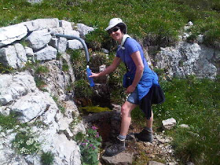
After a basic breakfast and little or no conversation with the other two couples staying at the rifugio, we set off to fill our water bottles from a nearby spring as Rif Lancia's water was allegedly undrinkable. The spring was dry. Never mind, today was a relatively temperate day - 17-24C temp range. We did have some water, and eventually came to a working spring (pictured) within three hours of setting off - at about 1740 metres as indicated in Gillian's book, overlooking an impressive limestone spire. Today's route had set off through meadows crammed full of Leopardsbane, Black Vanilla Orchids and Yellow Rattle, following what were probably military tracks, but were possibly never navigable by vehicle. At various points wartime buildings and trenches were encountered, and the terrain was sometimes vertiginous but at other times the path threaded a thin line through verdant meadows.

As usual there were some woodland phases of today's walk, and as usual these were a mixture of steep climbs and descents, and more amenably graded sections such as the final gentle descent to Passo Coe. The steep pull up from our long lunch at Malga Borcola provided the unlikely sight of an abandoned lorry on the path, next to an abandoned quarry and its offices. Alan R will no doubt be able to identify the lorry when I put up its picture.

Ravens cawed at us from heady rock spires and from the huge cross that marks the 'summit' of Monte Maggio by way of a War Memorial. Today's second picture is taken from the base of that cross, where war time trenches and gun emplacements litter the ground. There do appear to be higher parts of the mountain, but this is not a peak bagging trip, so hey!

We disturbed chamois a couple of times today. They make a noise like a scalded cat before scampering off up a precipice or away through the trees.

Some birds of prey were active on the slopes of Monte Maggio. Very angular, chestnut coloured birds a bit bigger than a cuckoo. We had no idea what these were, but the flurry of swifts over the summit a few minutes later was unmistakable.

Earlier we had come across the 'river of sheep' seen in the distance yesterday. They weren't all sheep. Goats and mules also roamed within the small temporary pen in which they had overnighted. Sue soon discovered that the pen was electrified, and we tried to rescue a lamb that had got trapped under the fence and had perhaps been receiving unwelcome pulses of power during the course of the night. When freed of the fence it perked up but remained unable or unwilling to move its legs. It was a lot healthier however than the mole or the shrew that we found at 1800 metres on the slopes of Monte Maggio!

As we left Monte Maggio's summit we encountered an elderly couple walking to the top, the only folk we'd seen on the paths all day. They didn't respond to our greeting. A few more people were on the path lower down, as was a posse of mountain bikers that tore past us on the approach to Passo Coe.

We are happily installed in Rifugio La Stua, bloated after another filling meal, and ready to flake out as soon as it goes dark. The two other residents are middle aged Italian ladies with sore muscles, and the workman engaged on constructing an extension has thankfully packed away his drill.

There's no phone signal here, so transmission may have to wait until tomorrow, when storms are forecast so the phone may be deeply stashed. And tomorrow's entry may be written later as Saturday is a rest day...

Comments:

Laura - good to hear from you - yes, it's proving to be a very amenable route, and for the moment we are missing the storms just as we did when passing through your area on our Italian Border Route.

Markus - greetings! This is a great route so far, with lots of variety. The 'Peace Route' sounds interesting. Bit I wonder whether it might get depressing at times, or would it just make us realise how fortunate we are to live in such relatively peaceful and affluent times. Today's l'Adige (our local paper) comments on how the wartime artifacts hereabouts are increasingly becoming tourist attractions.

NB It's good to receive a comment after sending a posting as I'm never quite sure whether or not the posting has 'taken'. I receive the comments as soon as I have a phone signal. I don't have internet access (until we find some WiFi - maybe Bolzano) so I can't check the postings. The Blackberry sometimes changes its mind about whether a posting has 'taken', which doesn't help, and my space on their server seems to be very limited, probably full of old stuff - but I have no idea as to how to view and delete it!

Data:
5 July 2012
16km in 7.5 hours with 1000m ascent
Other E5 walkers - Karina and Rabea
Flower of the Day - Black Vanilla Orchid - a star of the alpine limestone meadows
Rain seen since leaving Timperley - none

Itinerary - http://www.topwalks.com/E5%20Route.html

Sent using BlackBerry® from Orange

Wednesday, 4 July 2012

E5 in reverse - Day 5 - Rifugio Campogrosso (1457m) to Rifugio Lancia (1825m)

Today's route followed military roads for some way. These were built during the First World War when the area formed the boundary between Italy and the Austrian Empire.

We started by skirting around Monte Cornetto, the traverse of which would have needed Via Ferrata kit. Our mesmerisingly beautiful path led through meadows of orchids and dragonmouth into lovely beech woods and more meadows before cutting up over a shoulder and descending an amiably winding path through sunlit woods to Pian delle Fugazze.

Stage 25 in reverse, in Gillian's book, would end here. But it was only 10.30 so we considered a pause for some caffe latte to be sufficient, before proceeding to stage 24 in reverse.

A military road built by Italian General Achille Papa runs from here all the way to the high summits and passes of the Pasubio area. Built in 1916 to help counter the attempts of the Austrians to occupy this area before moving south to the Po plain, the road was never properly navigable until Mussolini came along. In the 1930's his fascist regime finished off this and other roads and, declaring the area 'sacred to the fatherland' he had a mock Roman arch built in an area where many Austrian and Italian forces had perished in the conflict.

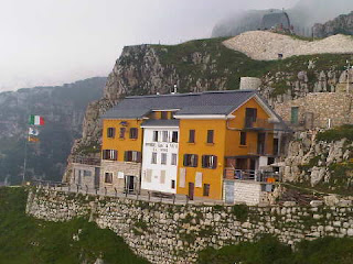
The E5 route climbs steeply out of Fugazze, ignoring the long loops of the military road and climbing for about 550 metres before rising above the tree line. We were going well. It was only around 20C, a much more acceptable temperature. Poor visibility and swirling cloud above about 2000 metres failed to dent our enjoyment. The final 250 metres of ascent to Rifugio Papa (pictured) was along the road, which sweeps around and through the mountainside in spectacular fashion.

This is superb mountain biking country - a couple rushed past - and we saw a few walkers taking advantage of the impressive footpath and Via Ferrata network around here.

By 1pm we had reached the rifugio and were tucking into our usual bowls of pasta, washed down with coke. It was a bit too cool to sit outside in a t-shirt so we stayed inside for lunch for the second day.

It's actually anything but cold - we've now spent five days walking in t-shirts and shorts.

Near the rifugio some large groups of children sat in circles receiving what may have been history lessons. They looked as if they may be equipped to venture into the nearby tunnels. These were built by the Italians during WW1 and include the impressive 'Strada delle Gallerie' - 6.5 km of roadway crafted through the mountain via 51 tunnels. We inspected the narrow entrance (it's where the picture of the rifugio was taken) but didn't explore any further.

[We've been in lots of these tunnels before, notably at Passo Falzarego.]

Alpine Choughs, noted by Gillian as 'the only form of life in the area', gave a notable aerobatic display here.

The old road then rose as gently as the lifting cloud, past Mussolini's arch (pictured) and a chapel of remembrance. E5 is well marked here and avoids a visit to Selletta Comando, which is signed as 20 minutes from the point at which path 142 turns to take the E5 walker over Selletta Domaggio. Here there are lots of WW1 tunnels, trenches and other artifacts. We explored them for a while before moving to the Austrian side of the conflict. They were within shouting distance of the Italians. Here the trenches have not been cleared of rubble and the whole mountain is disfigured by the consequences of high explosive. On one day in WW1, some 50,000kg of explosive was detonated from 200 ignition points - resulting in the largest explosion on the entire Italian front.
The Austrian flag flew forlornly over the debris of war, in remembrance of those lost in this deadlocked conflict.

Once Sella del Piccolo Roite was reached, we could divert our eyes from a huge Austrian encampment with numerous 'windows' in the rock, and enjoy the wonderful path that leads all the way to Rifugio Lancia. It's a belvedere of pure delight at around 2000 metres. Brilliant - reminiscent of the western section of the Ivano Dibona Via Ferrata near Cortina, one of my favourite walks.

Here we met two men with a nice looking border collie. Unfortunately the dog was frightened of us and refused to pass until we had scrambled some way up the steep hillside!

Later, a distant 'baa' revealed a river of sheep being herded down a distant pasture.

The rifugio has a familiar name. It was built in 1938/39 under the patronage of one Vincenzo Lancia, who also put his name to a marque of motor car.

It's a very tidy, clean place. We are installed in a large dormitory. There appear to be two other couples staying. We hope they don't snore...

The rifugio apparently has a high standard of culinary excellence to maintain, and it has done just that tonight - gnocchi with bacon and cheese, then veal cutlets with a lemon sauce, rosemary fried egg, a selection of onion and peppers, and polenta, followed by an almond slice.

Comments:

Jules - you do have a vivid imagination!

Jacqueline - I'm afraid this site doesn't support advertising of the nature you suggest.

Data:
4 July 2012
20km in 7.75 hours with 1300m ascent
Other E5 walkers - hard to identify, we think none, and certainly there are none going in our direction other than Adam and Jane, who passed through Rif Lancia on 28 June
Flower of the Day - Bluish Paederota, which dripped copiously from the limestone walls of today's military roads

Itinerary - http://www.topwalks.com/E5%20Route.html

Sent using BlackBerry® from Orange

Tuesday, 3 July 2012

E5 in reverse - Day 4 - Giazza to Rifugio Campogrosso (1467m)

After another hearty breakfast we paid up, said our goodbyes to Gabriello (to whom I apologise for mis-spelling his name yesterday) and set off up the quiet road outside the hotel. It was cooler than of late, a pleasant 20C or so for most of today, but fairly humid and with the high summits bathed in cloud.

Quiet tarmac apart from a few cyclists made for an easy ascent, as did the concreted nature trail lined with cyclamen that followed. That soon gave way to more entertaining and indeed more sporting upward progress. Rifugio Scalorbi finally came into view, at around the cloud base, after a steep and occasionally exposed section, above which cows grazed and Ring Ouzels clucked.

The rifugio offered a lunch of pasta and coke, most welcome after our 1000 metre ascent, and by the time we'd finished the cloud was fast dispersing. This must be the boundary of Franco's E5 waymarking territory, as we couldn't find the next sign! So we took path 109 up to Bocchetta dei Fondi - at 2040m our highest point so far. A wonderful old track, lined with Edelweiss, with expanding views thanks to both the added height and the clearing clouds.

Small tunnels beside the path belied the troubled history of this area, of which more tomorrow. We are well into Italy these days, but that wasn't always the case.

Following Jules's comment we tried to liken the view from Bocchetta dei Fondi (pictured) to some area of the UK. We failed.

Care was needed on the descent over loose rubble and along thin paths across steep scree. This abrupt side of the Carega mountains was in deep contrast to the gentler southern side up which we had ascended. Gillian's guide book refers to 'a hands-on clamber' when climbing what we were descending. In descent, that route was exposed and loose - we found it much easier to run down the excellent scree instead. Great, for once we beat Gillian's time!

After the scree run, during which our noise had disturbed some nearby chamois, we strolled along more level ground, past banks of Butterwort and Yellow Wood Violets, before arriving beside a rock wall. Looking up, I spotted an excellent array of Giant Knapweed. Admiring the knapweed, Sue spotted, in a rock crevice, our flower of the day (pictured). It's always a thrill to find a good specimen of Devil's Claw.

From above, it had looked like another uphill slog to reach Rifugio Campogrosso. That was an optical illusion; by the time we had passed through some delightfully sunlit woodland to reach the pass, the Rifugio was nowhere to be seen! We turned right and soon found it.

Beers on the terrace at 4pm.

We were shortly afterwards joined by nine Germans coming along E5 in the other direction, and there are at least half a dozen others staying here as well.

Almost unnoticed, a middle aged gent arrived from the Monte Cornetto (the mountain directly to our north) direction with a large rucksack which he proceeded to empty. First out was a large coil of rope and various chunks of climbing gear. Then he produced four large fire extinguishers and handed them to the rifugio's guardian. Perhaps he had just taken them for some exercise. He was sporting an 'alpine guide' t-shirt.

A mountain meal of spag bol, meltinthemouth veal with polenta and greens, and apfelstrudel has accompanied more beer.

It may be early but it seems like time for bed. Or will that be more beer?

Comments:

Jules - your point is well made, and does apply to the Lessini plateau. I was wondering whether today's transition could be likened to moving from the White Peak to some other part of Britain. But it can't. We've moved into the world beating scenery of the Dolomites.

Alan S - we are impressed that you have looked at our itinerary. You'll maybe have noticed that we are having a few days off, and you are cordially invited to join us for a couple of days in either Bolzano or Solden. We would be very impressed! (You only live once!)

Route Note:
We were tempted to take a more sporting route this morning, but with a fairly rigid timetable and no camping gear we (in retrospect correctly) considered that unwise. The E5 route runs through the countryside much in the style of the Pennine Way. It's surrounded by lesser paths. But less may be more, and a visit to any of the areas we pass through will be rich with choices for adventure. Not that there's anything wrong with E5, it seems (like the PW) to be a fine route. We are savouring every minute of it.

Data:
16km in 7 hours with 1300m ascent
Other E5 walkers - none en route, but there's a German group of 9, from Obersdorf in Bavaria, travelling south at the Rifugio - from Passo Coe to Verona, a six day trek
Flower of the Day - Devil's Claw (pictured)
Itinerary - http://www.topwalks.com/E5%20Route.html

Sent using BlackBerry® from Orange

E5 in reverse - Day 3 - Erbezzo to Giazza

We thought we may be given a shock this morning when Bruno presented his bill. A note in the apartment (you could hardly call it a room) indicated 2012 B&B tariffs from €70 to €140 for the room.

Bruno is a 'dry' character, but he clearly spotted that we had arrived from E5 rather than in a BMW, and he wants more E5 custom. €111 for B&B, dinner and beer was very reasonable. Cash only is the rule around here, so with the ATM having been confirmed this morning as a cashless resource, we are on a budget for the next few days.

A hot descent down a rough, overgrown path took us from Erbezzo into 'the gloomy Vaio dell' Anguilla'. Despite some intermittent cloud today, and lower temperatures in the 25-30C range, we were really quite 'drippy' by the time we 'bottomed out' in this very humid 'Valley of the Eels'.

No eels were found. The closest we got to that was later on when we found a couple of small grey snakes (25 cm long, 4-5mm diameter). They were 'morti'. Tonight's host, Gabrielle, thinks that they probably found nice basking rocks, went to sleep, and fried! It rather looked that way. Sue also found a mole, in perfect condition, but also 'morti'. Perhaps it died of boredom, waiting for a snake to move?

By the time we reached the small hamlet of Lesi we had given up our search for dock leaves, so enjoyed some long glugs from our water bottles, together with KitKats carried from Timperley, on a shady bench outside a weekend retreat. The water was still cool from our fridge in the B&B, and we managed to consume the chocolate shortly before it would have melted for the third day running. The bars had adopted very strange shapes!

After that break we set off with renewed purpose, only to encounter - a few minutes later - the slightly larger hamlet of Croce. Sadly, our legs failed to carry us past Albergo Croce, where cappucinos were downed whilst chatting to the elderly residents and waiting for our water bottles to be refilled.

Suitably refreshed, we enjoyed the ever changing miscellany of paths and tracks that led over to Maregge past various features described in Gillian's book. Today's terrain bore more than a little similarity to that of the White Peak back at home. At one spot the Nutcrackers we disturbed flew back to their pine woods, but the Pied Flycatchers ignored us and continued to collect food for their nearby family.

Locanda Maregge was conveniently reached at 1pm. Cokes and tagliatelle ai funghi provided a satisfying lunch under an umbrella.

No, it wasn't raining, it's just a tactic to avoid frying.

Half the afternoon was spent meandering on quiet lanes and empty footpaths to the edge of the Lessini plateau, across which the day had seen us walk almost entirely in an easterly direction from the highest village on the undulating plateau.

Sue is pictured in front of an old church that must have once been on the finely constructed main road that is now the domain of walkers and mountain bikers, not to mention cross country skiers judging by the 'MagnaLoppet' signs.

Before a final ascent, we spotted what looked like a small deer ahead of us. It bounded away as we grabbed our binoculars. They told us that it wasn't a deer at all - just the biggest hare we'd ever seen. Seconds later, the high pitched whistles of the first marmots we have seen on this trip confirmed that we weren't in the White Peak after all, though the scenery could have misled us into thinking that.

We had risen to over 1400 metres by the time we reached a sign indicating 1 hour 45 mins to Giazza. It didn't look like it at the time, but this signified the edge of the plateau, from which we descended through trees for 700 metres or so on a perfectly graded old track that reminded us of the hunting tracks in the Maritime Alps.

We paused to down our last dregs of water, before our final descent to Giazza (pictured), where we hauled ourselves up through the pretty village to Albergo Belvedere.

After handing over Bruno's presents to Gabrielle, we sat on the balcony of the bar with some cold beers and a large bowl of cherries presented to us by Gabrielle, who was then challenged by Sue to identify in Italian the various dead animals she had photographed during the day. He was very patient.

Our room is fine. "There is no key" apologised Gabrielle, adding "but there is no crime here."

There is a minor flood though, as our shower cubicle is minus a door.

It's slightly cooler here, so we enjoyed our meal - less of an endurance test than last night's. Speciality lasagne, fried trout with chips, sprouts and lettuce, and a delicious slice of apfelstrudel.

I believe it's a 'proper' mountain day tomorrow!

Comments:
Alan S - you do seem to have a rough time in Scotland in May! I have yet to encounter a 'cleg' during the TGO Challenge, and have encountered very few midges. There was quite a bit of rain last year, I recall, and one really wet day this year, but I'm sure we'll get a few days like that on this trip as well...

Patrick - all our long Alpine trips have started with unseasonably hot weather. It's a good omen! Yes, the 'fountains' are great - much better than taking water from a peaty stream...

Data:
20km in 8 hours with 950m ascent
Other walkers - none
Dead snakes - 2
Flower of the Day - Red Helleborine
(from a very long shortlist, chosen because we can't recall having seen it before - flower varieties seem to increase exponentially every day)
Itinerary - http://www.topwalks.com/E5%20Route.html

Sent using BlackBerry® from Orange

Monday, 2 July 2012

E5 in reverse - Day 2 - Montecchio to Erbezzo

Monica's idea of breakfast was to provide us with a feast that filled the table in our apartment.

Suitably refuelled we set off at 9.15 into the morning heat, retracing our steps to Montecchio for the last time. Franco was busy watering his vegetables as we passed, so we stopped to say hello. This became a feature of the day.

Rising to enjoy hazy but expansive views down to Verona and across to Lake Garda, we soon came across Tuglio, an elderly guy enjoying a Sunday stroll along E5 and the good network of public footpaths that grace this area. Stopping to chat with him was a good excuse to pause for a drink on the shady path, as today's temperatures of 30-35C in the shade made frequent drinks stops desirable, if not essential, and time pressures will be very much the exception on this trip - there were certainly none today nor will there be in the foreseeable future.

The path rose steadily, a feature of the day, in rising temperatures, another feature of the day, as we passed a small castle with lots of mewing peacocks.

The E5 route hereabouts is well waymarked with the traditional red and white Alpine markings, so the 1:50000 strip map that we have is very much just a comfort blanket and an indicator of which way to turn when the markings are obscure or unclear. However, some signs indicate that the route continues to reach the Adriatic, which was once the plan. But nowadays most folk seem content for the walk to finish (or in our case start) in Avesa.

Nestled into the hillside are numerous small communities within commuting distance of Verona. These people were out and about, as was a smattering of walkers and bikers. Our next encounter was with road bikers Lucia and Bruno, on a round from Verona, who stopped to chat in what should have been a quiet lane. It wasn't. So we accosted a man on a moped whose brother is a priest in London.

"There's a good mountain bike trail that starts from up there" he explained, before phutting off.

Eventually we dragged ourselves away, topped up our water from a nearby 'fountain' (spring water tap), and headed along a mixture of quiet tarmac lanes and stony paths towards our lunch stop at Ponte di Veja. The route featured a new town, not on our (newly purchased) map, by Ristorante Da Lara, and marble quarries of the Lessini hills lying cheek by jowl with the wealthy suburbs of Verona.

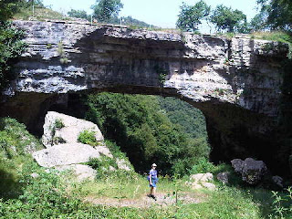
After a slight navigational mishap when we missed a sign and inadvertently transcribed a fifteen minute circle, we finally arrived at Ponte di Veja, where the large car park betrayed the presence of a huge natural arch (pictured above) to which people flock from far and wide. We lunched at a picnic bench outside the busy café, before visiting the arch and exploring its caves - used by bears in the past, then by man, now by a colony of bats.

After an hour's break for lunch, we immediately left the crowds as we spent the afternoon heading almost 600 metres in a vertical direction towards the large village of Erbezzo. The path was steep and sweaty. In the hamlet of Portello we said hello to a family group who invited us into the shade of their verandah and plied us with water for half an hour or so. Sue is pictured above with Silvano, Sonia and Elide. Thanks go to them for being so kind.

Suitably refreshed, and aided en route by a few scrumped cherries and hedgerow strawberries, both a feature of the entire day's walk, we completed the day on a pleasant, less acutely steep path to Erbezzo and the security of a comfortable room at La Stua B&B. It was 5.30 - we certainly took our time in the heat today.

After another nice meal (we are absolutely stuffed) at La Stua Ristorante (Bruno and his family seem to have quite a little empire) we sought out the ATM (empty) and wandered around the empty village before returning to our lodgings to watch the final of a European Football Contest, but we couldn't get the TV to work. Italy were in the final, but it was very quiet outside and unlike in the UK there are very few flags on display here.

I have a kit 'failure' to report - just wear and tear actually. The metal tips of both my Pacerpoles have gone. Does anyone know whether they are a universal fit, or do I need specific Pacerpole spares? At least I'm now much quieter on any tarmac!

Comments:
Thanks for your latest comment, Alan S, but it didn't make us laugh as much as the previous one!

Dot - it'll take more than us taking a break to make you 'stagnate'.

Gillian, thanks for your inspiration and encouragement. To be honest we hope it does get cooler, as the heat makes it quite tiring, but more so to justify my carrying two down jackets. Enjoy the Stelvio Alps, it's bound to be cooler up there!

Alan R - 'Greece in September' - happy dreams, Alan - Sue and I enjoyed our honeymoon there ten years ago in September.

Data:
20km in 8 hours with 1100m ascent
Other E5 walkers - none
Clouds - none
Flower of the Day - Small Yellow Foxglove
Itinerary - http://www.topwalks.com/E5%20Route.html

Sent using BlackBerry® from Orange

Sunday, 1 July 2012

E5 in reverse - Day 1 - Avesa to Montecchio

Alan S's comment arrived just as I was shouldering a 15kg rucksack, about to set off up a 500 metre climb with the thermometer reading 37C in the shade....

Does that make you any happier, Alan?

The day started with a late, leisurely breakfast. I think we may have overdone it a little, as the provisions we later bought for lunch are still languishing in my rucksack, despite the considerable motivation to lighten my load.

The number 96 bus delivered us to the centre of Verona, where we wandered from place to place for some time in search of the highly recommended Natural History Museum and its fossilised crocodiles and palm trees.

We were misled three times as to the location of the museum, which may or may not have been open, so after a grand tour of everything but the museum, we gave up. We had a pressing engagement with the E5 walking route.

Next time we'll get off the bus at the station and plan our moves from there. The NH Museum is only a few metres off the number 97 bus route to Avesa. Buses are every 30 minutes so we could easily have broken our journey to the start of the walk if we hadn't lost so much time wandering around looking for the place.

We made it to Avesa by 1pm and paused outside a bar next to the E5 start/finish line to down some cold drinks in the shade.

Stage 29 of Gillian's version of the E5 route is a short one, so it didn't worry us to be starting at 1.30. We soon found ourselves on cracked parched earth in the deep, narrow canyon of the Borago valley, trying fruitlessly to spot prehistoric-looking salamanders. It wasn't a good day for natural history - I may have glimpsed one, but it was more likely a frog.

It was, thankfully, cooler in the canyon. Just 30C. But we had to keep moving. Mozzies.

After some considerable time on a very rough path with an intermittent stream the canyon came to an end at a 30 metre head wall, down which there is no doubt a fine waterfall during less settled weather. Luckily some stairs, complete with banisters, provided an escape route into the upper section of the canyon (Sue is pictured here), where the sometimes vertiginous path took us eventually up to the small village of Montecchio, home of Franco and Helene Cuoghi, who whilst unable to accommodate us due to a family reunion had insisted on us calling by en route to Casetta Volpare, where they had kindly arranged tonight's B+B for us.

I understand that Franco was director/administrator of the E5 route from 1978 until his retirement in 2010. He is 'Mr E5'.
It was a privilege to meet him.

Water and wine were produced, and together with guests Willi and Renata we demolished a couple of bottles of Franco's "no need for the water" Rosato Garda 2012. Franco and Helene are pictured above on the left during the hour and a half we spent with them discussing the E5 and other Alpine routes. They seemed to think more English than Germans are walking E5 these days, but this wasn't borne out by their E5 visitors book, which showed about 50 people passing through last year, mostly on short sections. We duly signed the book - about the tenth to do so this year, a little below Adam Mills and Jane Heath, with whom we had been in touch before the walk. They are currently five days ahead of us, but will gain on us if they keep to their tighter schedule.

We shouldered our pack/bumbag and staggered off when F and H announced that they must change for a visit to the opera. They said it was 2km to Casetta Volpare ('small foxy house'), but within 15 minutes we were being greeted by foxy haired Monica and her troupe of dogs, and were shown to our luxury apartment in her not so little house.

A quick turnaround saw us strolling back along the well signposted alternative E5 (by-passing the equally well waymarked canyon and its ladders) to Montecchio's popular Trattoria for an alfresco meal in the relative 'cool' of a fine evening some 500 metres above the plains where the opera goers will have been sweating it out in Verona.

Data:
8km in 2.75 hours with 500m ascent
Plus 5km around Verona and 3km to and fro from Casetta Volpare
Other walkers - none
Flower of the Day - Herb Robert (in the canyon together with lots of Herb Bennet, Greater Celandine, and more)

Sent using BlackBerry® from Orange
Friday, 29 June 2012

The Hot and Dusty Road to Verona

It wasn't, I just took a fancy to that title.

What better way to start a trip than spend some time with the author of the guide book that you are taking with you? Not that we will follow it religiously, but Gillian (pictured with Sue at lunchtime in the previous posting) doesn't object to that.

Jet2 efficiently deposited us in Venice, together with a large contingent of 'Venom' Cheerleaders Association's adults and children (difficult to tell which was which - many hadn't flown before) and a jolly Australian girl with legs up to her armpits who was heading with almost every conceivable relative to a cruise ship.

After dumping our bags at Gillian's house we adjourned with her for a chatty lunch. Our itinerary was scoured for defects and just about came through unscathed, though our meticulously booked trip does lessen the options for some interesting diversions. But at least we don't need to worry about whether or not accommodation will be available.

It was hot in Venice. Easy to start dripping if you moved too fast, or even at all. Nevertheless we enjoyed a lovely stroll with Gillian under a clear blue sky. There was a light breeze to cool us beside the waterways, one of which is pictured above. Gillian writes guide books on Venice, so we enjoyed a smattering of informed comments and explanations regarding the history of the city. Apparently it was built, hundreds of years ago, on wooden pilings topped by stone blocks, with rivers running through the city. Those rivers have now been diverted in favour of the canal system, and modern day piling looks authentic but is actually coated with plastic.

Ice cream and coffee stops, a pause for thought at the Bridge of Breasts (where the ladies of the night hung out in bygone days) and a visit to a pharmacy where a room was devoted to old medicinal compound jars lined up on shelving within the wood panelled room with its locally quarried marble floor littered with ammonites (as a pharmacist Sue was granted the rare privilege of entry into this domain), punctuated our wanderings, and all too soon we were back at Gillian and Nicola's house in time to deliver a fine Turkish carpet to Lazar. "He owes me a favour" said Gillian, and bagged us a lift to the station in Lazar's little motor boat, which apparently he brought from Belgrade on a roof rack. As if there are no boats in Venice!

Anyway, our water borne journey (yes, Alan, the roads here have been flooded for so long that everyone has a boat!) back to the station was a delight. Thank you Lazar, and thanks Gillian for a lovely afternoon - as I've already said, the best way we could imagine to start this trip.

The express train to Verona would have cost €23 each. The stopping train, a well equipped double decker, cost €7.40 each. We took that. A pleasantly air conditioned two hour journey with enticing spiky Dolomitic summits on the horizon, followed by a short taxi ride to the improbably named but surprisingly smart Grotta Hotel.

We'd tried to get a room in town, but the start of the opera season seemed to have put paid to that, so we were slightly concerned to have arrived out in the sticks at 9pm (8pm UK time) without having had any supper.

"The restaurant is shut - the cook has gone home" the helpful receptionist informed us ... "But you'll be fine round the corner."

We followed his directions to an unlikely venue under an office/apartment block where you'd normally expect to find a car park. NaturaSi - 'cucina Biologica' was not a car park. It was full of people, but there was no sign of a tourist - the closest to that was a group of street artists who waltzed in after 9.30. So people come From Town to this strange restaurant in the sticks that sells food cooked with local produce that's in season!

We couldn't believe our luck. For €18 each we could eat as much as we could of their 'gourmet buffet'. What a great idea. The food was brilliant. In a way it was like last Friday's tapas meal, except that tonight we served ourselves. It was brilliant.

We were sorry to hear from JJ that it was raining in Timperley - we knew that - it started shortly after 5.30 when we startled our taxi driver by being ready and waiting for him in the street.

"I can't remember when that last happened" he had offered in a gratifyingly pleased tone.

That seems a long time ago, and my eyes are now struggling at the other end of the day. So I'll end now with thanks to Gillian, Patrick, Jules, Laura, Alan and Gibson for your comments. Gibson, you are correct, we do put ourselves through untold hardships (as anticipated by Patrick) on these trips! To be honest we only do it to give Dot (my mum) something to read - she gets bored with stories from the banks of the Bridgewater Canal!

Sent using BlackBerry® from Orange

Lunch in Venice

Let the fun begin!

Sent using BlackBerry® from Orange
Thursday, 28 June 2012

Across The Eastern Alps: E5 from Verona to Lake Constance

Our 540km section of the E5 route

The more alert amongst you may have realised that we are about to embark on the southern section of European Walking Route E5, which runs for 3200km from Pointe du Raz in France to Verona.

The map shows our own planned route, subject to a few diversions, which we are walking in the ‘wrong direction’, ie from south to north, in order to avoid the late snow in the Austrian Alps and obviate the need to carry ice axes and crampons, as they would struggle to fit into Sue’s bum bag.  We will be walking around 540 to 600 km in total, over about 37 days, including some rest days.  Sue still can’t carry a rucksack, so it’s on a B&B basis.

Gillian, you may recognise the map – it’s from your excellent guide book, which we will attempt to negotiate backwards, starting at page 152!  The book has already proved invaluable in planning our itinerary, which includes a side trip into the Lechtalalps.

This promises to be a fine trip through a wide variety of Alpine scenery and habitats.  We hope you’ll enjoy the Postcards from the comfort of your armchairs.

Wednesday, 27 June 2012

Ainsdale

Tim Wood on Ainsdale Sands - 26/6/12

Yesterday (Tuesday) I enjoyed a brief visit to Ainsdale (Southport), for a stroll in the dunes with Tim, who’s had a rather difficult and traumatic time recently.

We spotted lots of this orchid.  It looks to me a bit like a Pyramidal Orchid, or something similar.

Orchid in Ainsdale Dunes

We also spotted this plane, just beyond the Pontins Holiday Camp, where the inmates appear to be kept under armed guard!

'Escape from Pontins'

“I’d like to be up there” enthused Tim. “And me” I agreed.

‘Never mind, it’s probably full of people escaping from Pontins’, we surmised…

Tuesday, 26 June 2012

Lake Constance


Lake Constance at Lindau - March 2009


It’s over three years since we’ve been here, and the weather wasn’t so good.

Time to revisit?  Yes.  There’s a nice path from Verona, we are led to believe…

Monday, 25 June 2012

Verona

Verona - 30 June 2010

It’s nearly two years to the day since we visited Verona.

Our next ‘trip’ starts from there exactly two years after the above picture was taken.

I’m told it’ll be quite hot…

Saturday, 23 June 2012

A Mercy Mission

The Blue Limo

Readers may recall that I spent Wednesday with Gary and Andrew on their meticulously planned C2C walk from St Bees to Reeth.  They had dropped Andrew's car off at Reeth, carefully positioning it in preparation for today's drive back to St Bees to reunite Gary with his own transport.

These best laid plans were foiled when Andrew's top of the range limo (pictured above in its final resting place) expired as it entered Reeth last Saturday.  A shame, as it had 'done good'.

So after a rather slow 5km Parkrun (tired legs!) today I pottered up the A1 to the pretty village of Reeth to empty the Volvo of its dog box and other contents, deliver Neil and Liz - who had walked with A + G today - back to their car in Keld, return Gary to St Bees, and then return Andrew to Deepest Cheshire.

The weather was much better – I was only driving in rain for about 6 hours, but given that the constantly lashing driving rain where we were in Calderdale yesterday was the worst in their living memory, that doesn't mean an awful lot!  I’ve now discovered that they actually did get a month’s rain in a day, and that the puddle we left in the cafe is probably nothing compared with the river that was flowing through it later on in the day.  So we were possibly wise to beat a retreat when we did.  We did notice sandbags being put out as we drove home, not necessarily with any great effect from what we hear on the news.

Incidentally, I’ve known that car about as long as I’ve known Andrew, as it was his last company car at the time we first met, thirsty but durable, and very comfy for many journeys over the years. 

Old Blue Limo – RIP!  Thankfully its thirsty but durable owner is in better health.

Friday, 22 June 2012

A Nice Day For A Bike Ride - The Mary Towneley Loop

First, a short mention of last night's mini adventure. An evening walk had been planned from the Silverdale Hotel, so after Sue had picked me up from the station we headed off for a bite to eat at the hotel. 7.30 came and went, and nobody had turned up for our traditional mid-summer's walk. Not really surprising given the torrential rain outside.

"I've already done 30km over mainly pathless ground with a heavy pack..." I muttered.

My inferred plea to go straight home didn't work.

"I've come for a walk, so I'm going for a walk" dictated The Boss.

So we enjoyed a pleasant circuit - along the beach then across to Far Arnside to the path up Arnside Knott, which is a good viewpoint - recommended when the rest of the Lake District is engulfed in cloud. Tonight Arnside Knott was itself engulfed in cloud. We took some photos in the rain. I may get time to download them one day.

A steep descent through dark, wet woods (Jenny wouldn't have liked it) and a pleasant if rather damp stroll back via Arnside Tower, Elmslack and the Cove, ensured that we got back to the car in time to get home from this rather energetic three day trip by 11.30...

The alarm went at 6.30 today. It was still pouring down, but Mike, Robert and I had a long standing engagement with 'The Mary Towneley Loop' - a 47 mile bike ride in the South Pennines, all off road, with about 2300 metres of ascent.

A tough day out.

We met at 8.30 as planned at a picnic site in Waterfoot, despite being baulked by a closed motorway and a lack of signage to the picnic site. It was raining hard but we set off in good spirits and after quite a while we reached the plaque to Mary Towneley, pictured above with a picture of Robert and Mike at the same point. The phone with which the pictures were taken spent the rest of the day in a waterproof bag. My wet weather Ixus (once drowned) camera decided not to work - again - it was fine afterwards (again).

It was at this point that Mike started to shiver. "I may not get all the way round" he offered. I thought about this whilst cruising down the next section of 'path', or should I say 'river', as today the Pennine Bridleway that forms the basis of the Loop had acquired the persona of a river bed, with the contents in spate. Perhaps that's why we didn't see any other cyclists today...

I had a wet bottom. "Probably because your overtrousers have split" observed Mike, between shivers.

"You might have a wet bottom" chipped in Robert "but my waterproofs from Aldi have a 'fit for purpose' issue".

So I was nice and warm, if a bit tired, and therefore on the slow side, Mike was cold, and Robert was wet. We'd been going for over two hours and were less than a quarter of the way round the Loop. It was 'tipping down'. We felt as if a whole month's rain was being dumped on us in one go.

"I didn't get wet at all on the TGO Challenge" commented Mike, "but I am now!" "Same here" I muttered, from a wet bottom.

So, on reaching Long Causeway Road, a long straight road beside a windfarm, we decided that as the camera I'd brought to record our exploits had failed, there was no real reason to continue.

We left the Loop and headed down the road to Todmorden, where a café was remarkably understanding and fed us with tea and coffee and huge baked potatoes, in return for very few notes and a large puddle on their floor - "Don't worry, we have a mop" they jested.

It's quite a pull over to Bacup and Waterfoot from Tod. The wind was gusty and the rain at times torrential. Rivers were full to capacity or more. I walked on the verge for a mile or two - safer, I thought. I didn't want to be blown into the path of an HGV.

By the time we got back to the picnic spot at about 3pm we'd covered about 47km (30 miles) in about 6 hours. Had we attempted to continue around the Loop.... we may still have been there (waiting for the camera to start working, obviously). The rain didn't abate until much later.

A sort of heroic failure, can perhaps describe our day. But some might think us foolhardy to have set off in the first place with a camera that was known to be a bit dodgy.

I really rather enjoyed it. I hope Mike and Robert did.

We'll crack it one day!

Sent using BlackBerry® from Orange

Thursday 21 June 2012 - Shap to Burneside

After a still night, light rain started shortly before the tent came down. It rained all day, so the phone was stashed after snapping Obi (above - pitched better than it looks!).

Thanks for your comments, Alan and Gibson. The media card is working again - I must have knocked it when changing the battery. Good to hear from you Norma, and Gibson - you will be pleased that we've seen off some of this summer's wet weather before you venture in this direction.

After seeing a dozen or so folk on the fells on Tuesday, and a crocodile of over a hundred on the C2C path yesterday, I saw just two other walkers today, ascending steeply into the mist on my last hill of the day, Great Howe. Before that I'd spent some time extricating myself from the environs of Shap, which is a very long village surrounded by an intricate network of footpaths.

Wet Sleddale had lived up to its name as I rose up to the (sadly locked) Lunch House, where signs indicated that I was welcome so long as I used the footpaths. There were no footpaths so far as I could see. Which was only a few metres, so the footpath police would have struggled to see me breaking the rules. At least the sign wasn't as threatening as the one in Patterdale threatening to shoot dogs, and do untold damage to cyclists bold enough to venture onto a particular footpath. Not all farmers are uncaring though - on yesterday's approach to Shap we found a bucket of cold drinks and a large slab of ice, courtesy of the local friendly farmer. Good value for a pound, but where were the ice creams?

Anyway, today's soaking wet walk involved intricate navigation through deep bogs and over peat hags, eventually reaching the stupendous summit of Sleddale Pike. Well, it may have been stupendous if you could have seen much. I was soon on a roll and the mighty peaks of Wasdale Pike, Great Saddle Crag, Harrop Pike and Grey Crag all saw my soggy boot prints before the final descent from Great Howe and the long but satisfying walk along footpaths and bridleways to Burneside from Sadgill.

A quick train journey to Silverdale followed, for the next action packed episode, for which you'll have to wait as there's not time at present to do stuff and write very much.

Hiya Gayle - good to hear from you, and yes the cuckoos have been in good voice in the Lakes this week.

Sent using BlackBerry® from Orange

Wednesday, 20 June 2012

Wednesday 20 June 2012 - Patterdale to Shap

Another fine day's walk in lovely sunny weather, over Angletarn Pikes, Brock Crags, Rest Dodd, The Knott, Rampsgill Head and Kidsty Pike, some of which Andrew and Gary (aka Cramp + Blister - and that's just Andrew) also ventured up.

I rejoined their less vertiginous route after this little bout of summiteering, for lunch in the sun by Haweswater, which appeared to have been invaded by Canada geese.

A gentle walk to Shap followed. I'm camping at A+G's B+B, which happens to be at the opposite end of town to our chosen eatery, the Greyhound. There we encountered John K - a TGO Challenger who is leading a HF (Holiday Fellowship) group along the C2C route. If his better half, Norma, is watching - 'Hello, we hope you are continuing to recover from your back op'.

Sadly the phone's media card seems to have suffered a 'fatal error' so today's image is one of Brothers Water from Brock Crags, saved to the phone by some fluke this morning.
.
Sent using BlackBerry® from Orange

Tuesday 19 June 2012 - A Backpack! - Staveley to Patterdale

At last, a 'proper' backpack, but as Sue is at work I've been on my own today.

The Trans-Pennine Express and a local train delivered me efficiently to Staveley by 9.30, from where I enjoyed a delightful stroll north to Patterdale, via Sallows, Yoke, Ill Bell, Froswick, Thornthwaite Beacon, Stony Cove Pike, John Bell's Banner, and Hartsop Dodd.

A fine high level route.

I'd planned a wild camp, but the attraction of a beer in the White Lion and a flat 'pitch' on a lawn won the day.

Whilst there was evidence of showery weather as I travelled north, the sun shone as I set off from Staveley on the gentle - until the final kilometre - ascent of Sallows, the first of today's eight 'high points according to Bill' (Birkett).

My walk continued fairly joyously in lovely weather, despite a heavier pack than that to which I have softened to in recent weeks. I passed above a major traffic accident in the Kirkstone area, and heard lots of cuckoos as I wandered over the remaining lumps and bumps and down to Hartsop and the fleshpots of Patterdale, for Mike and Marian's warm welcome and freshly mown lawn.

Obi 1P was soon up - not too midgy - and after dinner a stroll to the White Lion revealed my companions for tomorrow, Andrew and Gary, who are on the 'Coast to Coast' (C2C) route.

Whilst I saw a smattering of folk, they weren't close enough to act as photographic foregrounds, so today's snaps comprise mountain scenery. Each picture is different. To the connoisseur! Those chosen for this posting are the view of Hartsop and beyond from the descent of Hartsop Dodd, and Patterdale from a bridge over the river that runs past the village.

Sent using BlackBerry® from Orange
Saturday, 16 June 2012

Saturday 16 June 2012 - Maol Chean-dearg

After last night's party, those still standing chose a relatively easy hill for today's walking exploits.

Thus it was that after waving goodbye to Steve, Jenny and Richard, who were heading off today, ten of us drove through light rain to Coulags, where it wasn't raining.

The path up to Bealach a' Choire Ghairbh, past a rather smart bothy, is a delight, from near sea level to around 600 metres without really noticing the gradient.

From the bealach the path steepens to reach the Munro summit of Maol Chean-dearg (933 metres) rather more easily than the slabby route up the neighbouring Corbett - An Ruadh-stac (892 metres). Both are fine hills, but today their summits were only intermittently revealed through the cloud. Our summit photo was, for the first time for a while, without a view, although it was warm and calm enough to enjoy our lunch around the massive summit cairn, which for many of us featured large slabs of Louise's alcoholic chocolate cake.

A pair of ptarmigan were on hand to inspect the site and join the mice in a hunt for Sue's dropped crisps.

An uneventful descent concluded our travails in this part of the world for the time being, though others in our group are continuing to other parts of Scotland in an ongoing hill climbing frenzy.

Today's 17km included about 900 metres ascent and took around 6.5 hours.

As soon as we set off from Coulags the rain started again. Sue thinks she saw an otter swimming in Loch a' Chroisg. Julie had been on a short walk slightly to the east of us; it had rained all day there. The ten of us had been very lucky.

We've also been very lucky to have Louise and Liz as our catering department. They have fed us like the Lords and Ladies who are their usual clientele, finishing tonight with Mull scallops, haggis-neeps-n-tatties, apple crumble, and the usual fine cheese board.

I'm out of time now, so you are spared more fauna, flora and geological etc stuff - until next time! We travel home tomorrow, and some 're-grouping' will be required before the next trip.

Today's photos were both taken near Bealach a' Choire Ghairbh, the first showing Meall nan Ceapairean, which I'd planned to climb but didn't, with the second picture of today's girlie contingent (Sue W, Tove, Sue B, Ruth and Carol) in front of An Ruadh-stac.

Sent using BlackBerry® from Orange

Friday, 15 June 2012

Kinlochewe Lodge

This week's venue, situated amongst some of the finest hills in Scotland, is an early C20 hunting lodge currently owned by Pat Wilson, a Perth landowner. It's rented out on a weekly basis to groups like ours, with the Wilson family using it for just 2-3 weeks a year.

The occasion, as mentioned earlier, is G+T's 100th birthday party, celebrating their passage of fifty years each.

It's a great place to stay, and quite reasonably priced if the cost is divided between 18 people plus 'staff'. There are lots of rooms. Cluedo style jokes abound - was the murderer Miss Brown in the Billiard Room with the Ice Axe, or was she in the Music Room when the gory deed took place?

I know of other groups who have used the Lodge on a self catering basis, but we have Louise and Liz, thus freeing the rest of us from any worries about where our next meal is coming from.

Although the Lodge is close to the centre of the village, we are told that pine martens can often be seen serenading on the lawns at dusk. It would be a treat to see one of these elusive animals, but we haven't seen one yet.

The Lodge is altogether a brilliant base for a trip of this nature.

Sent using BlackBerry® from Orange

Friday 15 June 2012 - Fionn Bheinn

With high cloud and a bit of a breeze drifting in with a gradual change in the weather, we chose an easy day on a Munro that Sue hadn't previously visited.

Taking a direct route from Achnasheen, beside Allt Achadh na Sine, we soon reached a pleasant spot (pictured, with Meall a' Chaorainn behind) for a cup of tea or two.

I thought the ascent would be harder, but despite an increase in the wind velocity and the absence of a clear path, the summit trig point dutifully appeared a couple of hours and 800 metres ascent after our 9.30 start.

We were just below the cloud base, in a strong breeze against which Sue braced herself for a summit photo (see lower image). Two other walkers were also enjoying a day out; otherwise we saw nobody on the walk.

It wasn't a day to linger, but the easy path down Sail an Tuim Bhain enabled us to enjoy the wide ranging views. To our south, cloud had enveloped the summits, whilst to the north everything was cloud free - including An Teallach on the horizon. So the rest of our group would have good views as they 'toured', visited gardens, or ascended a nearby hillock.

We reached the road after passing through a sequence of deer fences, with the inevitable roe deer being trapped in the forest that the fences are supposed to protect. Here we bumped into the gents we'd seen on the summit; it would have been impolite of us to refuse the lift offered back to our car.

The 11km walk, with about 800 metres ascent, had taken just 3.5 hours - leaving plenty of time for lunch at the roadside viewpoint that overlooks Kinlochewe, and a long chat with Louise before anyone else arrived back at the Lodge.

Today is GI's 50th birthday, which together with Tove's achievement in reaching the same vintage earlier in the year is the reason we are all here this week.

Happy Birthday, Graham and Tove (who don't read these pages, but I'll refrain from insulting them on this occasion).

So there will be a big party tonight ...

Sent using BlackBerry® from Orange

Thursday 14 June 2012 - Beinn Alligin

Beinn Alligin is one of my favourite hills, so it was great to be up there again today.

Unlike Monday, when both hills had several summits of similar height to visit to ensure that the tops had actually been 'bagged', Beinn Alligin sports two indisputable summits - one at each end of its easy summit ridge. The difficulties, such as they are, on Alligin involve the traverse of its three 'horns' which grace the north eastern spur of the hill. Today we chose to visit these in ascent, which perversely involves an awkward if well protected descent move on the way down from the final horn before scrambling easily up to the Munro summit of Sgurr Mòr.

Sue and I had set off with Steve, who would spend the whole day with us, and with Graham, Richard and Jenny, who chose the excellent traverse of Beinn Dearg for their outing in the continuing wonderful weather.

Initially we took the wide path up Coire Mhic Nòbuil, where Sue is seen above with Graham, with a Beinn Alligin backdrop. Then after leaving Graham to guide R+J over Beinn Dearg the three of us climbed steeply up through bands of rock, eventually gaining the summit of the first 'horn'. From the ridge we could see the others slowly rising up Beinn Dearg's airy western flank, and we enjoyed splendid views across to yesterday's summits and far beyond.

Sue is pictured in the lower image with Steve on the third and highest 'horn', with Baosbheinn behind them, before we descended more easily than I could recall, to the col leading to the summit.

We felt we had earned our lunch, which was enjoyed at leisure today, with no time pressures to hasten us along our way.

Continuing to the summit, we paused frequently to admire the dramatic outline of the 'horns' below us, and just beyond that high point we halted again at the spectacular cleft of Eag Dhubh.

Soon afterwards we met a couple of Scots on their way to explore the 'horns'. We met only six people all day, and nobody else seemed to be traversing the hill in our anti clockwise direction, though erosion on the summit ridge and on the path in Coir' nan Laogh was clear evidence of its great popularity.

A stroll along the ridge soon brought us up a band of sandstone slabs, to the southern summit of Tom na Gruagaich, where we enjoyed a final slug of tea before descending easily and quickly back to the car park on the Diabeg road.

We noticed the bright yellow flowers of Bog Asphodel on the lower slopes today, and a small yellow orchid appeared amongst the huge numbers of blue and white ones. The large single flowers of Melancholy Thistles occasionally nodded as we passed them in gullies on lower ground, and Mountain Everlasting is abundant in these parts.

On the subject of flora, we've found Ken Butler's 'Wild Flowers of the Northern Highlands of Scotland' brilliant for this trip. It deals with just 250 of the 1500 species found in the area, but of those 250 we've only spotted a small handful of plants.

Anyway, after our 12km walk, with about 1200 metres ascent, completed in less than 7 hours, we had plenty of time for the usual indulgences, including a trip to the Kinlochewe Hotel to sample their tasty draft beer.

Sent using BlackBerry® from Orange

Thursday, 14 June 2012

Wednesday 13 June 2012 - Beinn an Eoin and Baosbheinn - A Classic Round

Sue and I set out alone today; others had different agendas. We all enjoyed fine days out in perfect (sunny, clear, no wind, no midges) weather, so everyone was happy tonight.

We started at about 9am from the 'Red Barn' by Am Feur-loch on the Gairloch road. The track to Loch na h-Oidhche is a good one, with information boards and four waymarked routes designed for the more casual traveller in need of a short walk from the Red Barn.

We took that path for 6km, meeting two men on a buggy, with a couple of dogs. These were the only people we saw all day. The stepping stones over the Abhainn Loch na h-Oidhche were high and dry, evidencing the fact that since 13 May, when all May's rainfall fell in one day, there has been very little rain hereabouts.

A few hundred metres beyond the stepping stones, two massive erratics announced the need to turn left. We would now be pathless for many miles, initially over easy ground to reach the ridge by Coire Loch na Geala that rises to point 715 at the northern end of Beinn an Eoin. We were delayed by 'flower stops' after discovering sundew and orchids, and by Sue falling into a bog and covering her legs in a substance that looked like ... sick. Bogs were hard to find today, but Sue was up for that challenge.

The flattish ridge culminated in a short burst of ascent to the summit, from which the views of Torridon and far, far beyond were absolutely magnificent on this crystal clear day. It had taken a little over 3 hours to get thus far.

A pleasantly blunt knife edge ridge took us to the rocky convex nose of Beinn an Eoin, down which we picked our way slowly but entertainingly to a point a little to the left of the bothy at Poca Buidhe, which appeared to be occupied by two dogs!

Lunch was followed by the ascent of a pleasant ridge with widening views, to Ceann Beag, Baosbheinn's 705 metre outlier.

It was still some way to the summit, due to a couple of abrupt gashes in the ridge, but we got to admire those summit views, and enjoy more of our tea and a second lunch, at around 3pm, some 6 hours after setting off from the Red Barn. The upper picture shows Sue approaching the summit, with
Beinn an Eoin behind her and more distant Torridonian giants to her right.

It was a truly magnificent day for this classic round of hills.

Some more undulations delivered us to the pinhead of a further summit, from which the most precipitous descent of the day (walking poles were tossed down to make the downclimb easier) took us to a lovely broad ridge that rose gently to our final 801 metre summit. The views to the Outer Hebrides from here were wonderful, as were the views back to the central Torridon peaks. (Sue is pictured in the lower image on this broad ridge, with our steep descent in the background and Beinn Dearg to the right.)

After lingering with our last cuppa to take in these views, we embarked on a final steep 600 metre descent into the Flowerdale Forest, to reach the thin river known as Abhainn a' Garbh Choire by a small but obvious footbridge. After the first 300 metres down steep but easy grass, the gradient eased but the going became somewhat 'lumpy'. Sue was flagging, but revived when she found a spring issuing crystal clear cool water. We continued over a rocky bluff to a deer fence that was easily climbed at a well used corner, and on to the previously mentioned footbridge. Here we didn't cross the bridge, instead joining the 'yellow' trail, a path marked by posts beside the left bank of the river that took us through more stunning scenery all the way back to the Red Barn. We reached there at about 6pm, 3 hours after leaving the summit of Baosbheinn. The 26km walk (hardly a 'stroll' today) had involved about 1800 metres ascent and had taken 9 hours.

We returned to the Lodge in plenty of time for a cream tea, bath, beers and another fine dinner, after this most satisfying of mountain days.

Simply wonderful!

Sent using BlackBerry® from Orange

Wednesday, 13 June 2012

Tuesday 12 June 2012 - Beinn Eighe

Thanks for your comments on various posts, I'll respond next week when I have more than a weak phone signal.

Today Sue and I had a last minute change of plan when we woke to a gloriously sunny morning. Beinn Alligin was left for another day.

We were joined by Steve for this fine walk up one of the best hills that Scotland has to offer - Beinn Eighe. Whilst we knew from yesterday that Steve is a sound walker, we didn't know how he would cope with a long scrambly ridge. We had only met him on Sunday and he had only walked on a few Scottish mountains. So we decided against tackling the entire ridge, targeting instead the comparatively easy central section.

A car was therefore left at the Ling Hut car park, then we returned to Loch Bharranch to start walking at around 10am. It's a well made path all the way up to Spidean Coire nan Clach, our first summit and Steve's tenth Munro, mercifully clear of cloud although the day's weather had now settled into a rhythm of sunshine and showers.

We enjoyed the 2km ridge walk to A' Coinneach Mhor, from which today's image was taken - towards Torridon, with Beinns Alligin and Dearg.

Lunch had been taken en route, and we enjoyed the friendliest of several encounters on the hill today. Terry Gallaher, training for a forthcoming triathlon event, paused during his run for a chat. We wish him well, and we were pleased to note later that he did find a quick way down from Ruadh-stac Mòr, our own next objective.

By the time we got up there the cloud was down. Despite a long wait amongst strikingly pink beds of Moss Campion, we couldn't persuade it to clear, though eventually the rain eased and our waterproofs could finally be stashed for the day. That left us relatively unencumbered for the steep descent to Loch Coire Mhic Fhearchair, where we enjoyed our last sip of tea, with some CCS (shortbread), in view of the mountain's magnificent triple buttresses.

An easy amble around Sail Mhor to Coire Dubh Mhòr, all on an excellent path with fine views of Liathach's spiky ridge, brought this 18km excursion to a most satisfying conclusion by about 6.30pm. The route involving 1300 metres of ascent had taken us all of 8.5 hours, but we were back at the Lodge in time to enjoy tea and cake and a hot bath before tucking into a delicious joint of lamb.

Ten of the others arrived back at the same time as us from a successful walk up Slioch, on which the main point of interest seemed to be Richard's failed attempt at a cartwheel. He was just a little battered.

Sent using BlackBerry® from Orange

Tuesday, 12 June 2012

Monday 11 June 2012 - Sgurr nan Ceannaichean and Moruisg

Today our 18 strong party all took to the hills. The 'A' team comprised nine of us who headed off from the outskirts of Craig, in Glen Carron, before 10am.

We'd left Tom's car at the usual parking spot for Moruisg and immediately reaped the benefit of avoiding the direct route up that hill. The track beside Allt a' Chonais and subsequent stalkers path up Sgurr nan Ceannaichean were a delight in comparison with the thrutch of the former route.

The view back to Fuar Tholl and its neighbours (pictured) enthralled us through our wing mirrors as we rose gently to the former Munro's summit. The zigzag stalkers path was Alpine in nature and easy to follow. I could see Keith and Phil ahead, four more behind, with Sue and Jenny bringing up the rear, each group strolling in apparently opposite directions on the zigzags.
Then Sue and Jenny disappeared. We waited for some time at a zag, then at a zig. No sign of them. A search ensued, finally tracking them down to a cloud on the summit. Once we'd all arrived, the cloud rose and everyone was happy.

The errant duo had been distracted by the flora, which like the path they failed to follow was decidedly alpine in nature. Today we added the following to our tally:
Lousewort
Thrift (why is it just found on sea shores and on mountain tops?)
Common cowwheat
Cowberry
Starry saxifrage
Yellow mountain saxifrage
Atlantic butterwort
Wild thyme
Cotton grass, and
Water avens

Up here there were lots of wheatears, ptarmigan mothers with excitable chicks, and a baby red deer that ran off after being disturbed by Tom; we hope its mother found it again.

By the time we reached Moruisg's summit we could enjoy wide ranging views - from Glen Carron (pictured) that was in the centre of an arc of cloud laden hills to its south, with the cloud free tops of Liathach, Beinn Eighe, Slioch and the Fisherfield Forest hills amongst many lined up to its north. Whilst the Cuillin massif was in cloud, the hills of Harris were clearly visible beyond the northern tip of Skye.

The direct descent (better in descent than in ascent) to Tom's car was steep but easy, apart from a newly erected deer fence near the bottom, where the planting of a forest of 'native woodland' is imminent. We managed fine despite the absence of a stile or gate where we entered the new plantation site, where the ground had been massacred in preparation for planting.

We returned to the Lodge for 5pm, when France were seen to thrash England's footballing underdogs 1:1 in the sides' first game in the European championships.

Then Louise excelled again, with another fine meal.

Sent using BlackBerry® from Orange

Sunday, 10 June 2012

Sunday 10 June 2012 - The Sow of Atholl and Meall na Leitreach

This four and a half hour walk was really just a leg stretch on the short journey from Pitlochry to Kinlochewe.

With the cloud base at 600 metres we were never really going to see very much, but the flora and fauna kept us entertained all day.

A bleep from the phone brought sad but not unexpected news from Southport. Kate Wood's battle against cancer had finally come to an end. Our thoughts are with Tim and the family. Later we were to pass the point in Kingussie where we first met 'Little and Large', on the TGO Challenge in 2008.

The mist brought a few surprises - red deer, startled by our presence, lots of frogs and froglets, some red grouse chicks instinctively hiding from us as their mother pretended she had a broken wing.

There was lots of other bird life, in particular around Loch Garry - including oyster catchers, lapwings, ringed plovers, the usual mallards, common sandpipers, and a fly past from some greylag geese.

Flora included lots of heath spotted orchids, a profusion of common butterwort, milkwort, tormentil, cloudberry, heathers, ladies-mantles, birdsfoot trefoil, dog-violets and various Ranunculus (buttercups).

By the time we got down the rain had eased, but I'd established that my old waterproofs are now due for recycling, a bit like Mike's car (anyone wanting to get rid of a good runner for up to £1500?).

Others enjoyed longer walks, and we were first to arrive at Kinlochewe Lodge, at 5pm, apart from our catering department - Louise and Liz, who have now established themselves as an essential resource, having provided our group of eighteen with a superb meal.

Pictured: The Sow of Atholl from near Dalnaspidal Lodge (which is undergoing an impressive looking refurbishment).

Sent using BlackBerry® from Orange